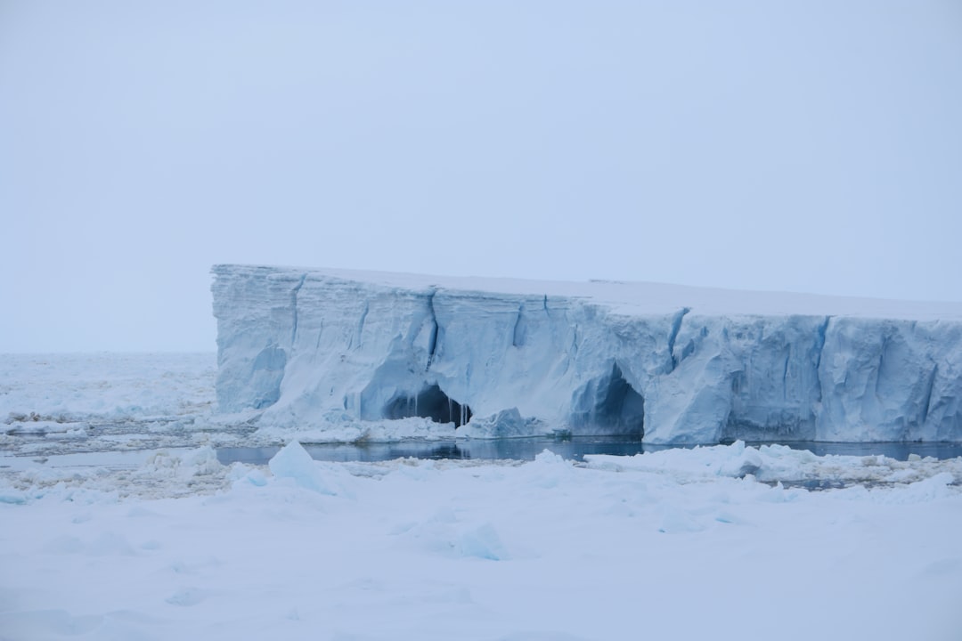
The frozen continent of Antarctica, a landmass larger than Europe and covered by an ice sheet averaging thousands of meters thick, remains one of Earth’s most enigmatic regions. Its extreme environment – characterized by perpetual cold, hurricane-force winds, and isolation – has historically limited exploration and direct observation. However, advances in remote sensing technologies and glaciological research are beginning to peel back centuries of accumulated ice, revealing a landscape far more complex and dynamic than once imagined. This article delves into the methodologies and groundbreaking discoveries associated with uncovering hidden Antarctic structures, emphasizing the scientific significance of these revelations.
Unveiling structures buried beneath miles of ice is not a simple undertaking. It requires sophisticated methods that can penetrate the opaque ice sheet without direct physical interaction. Researchers have developed and refined a suite of technologies, each offering a unique window into the subglacial realm.
Ice-Penetrating Radar (IPR)
Ice-penetrating radar, also known as ground-penetrating radar (GPR) when applied to ice, is arguably the most crucial tool in this endeavor. It operates by sending radio waves into the ice and detecting the echoes that bounce back from layers within and at the base of the ice sheet.
Principles of Operation
IPR systems typically mounted on aircraft, sleds, or even autonomous vehicles, emit pulses of electromagnetic radiation. These pulses travel through the ice, and when they encounter a change in dielectric constant – such as an interface between ice and rock, or different ice layers with varying densities or impurities – a portion of the energy is reflected back to the receiver. The time it takes for the signal to return indicates the depth of the interface, while the strength and characteristics of the reflected signal provide information about the nature of the reflector.
Data Interpretation Challenges
Interpreting IPR data is a complex science. Factors such as ice temperature, water content, and the presence of englacial debris can significantly affect signal penetration and reflection. Sophisticated algorithms and extensive validation against other datasets are required to accurately translate raw radargrams into meaningful geological and glaciological interpretations. The sheer volume of data generated by extensive surveys also necessitates advanced computational techniques for processing and analysis.
Satellite Altimetry and Gravimetry
While IPR offers high-resolution profiles, satellite-based systems provide a broader, synoptic view of the ice sheet’s surface and underlying topography.
Measuring Surface Elevation
Satellite altimetry missions, such as ICESat and ICESat-2, precisely measure the elevation of the ice surface. Changes in these elevations over time can indicate ice thickness changes, which in turn can hint at subglacial processes like basal melting or refreezing, or the presence of subglacial water bodies. By subtracting the surface topography from the ice thickness, researchers can infer the shape of the bedrock beneath.
Detecting Mass Anomalies
Gravimetry missions like GRACE (Gravity Recovery and Climate Experiment) and GRACE-FO (Follow-On) measure subtle variations in Earth’s gravitational field. These variations are directly linked to changes in mass distribution. As ice sheets grow or shrink, or as large subglacial features like mountains or deep trenches influence the mass beneath, these changes are detectable from space. This allows for mapping large-scale subglacial topography and identifying regions of significant ice mass change.
Seismic Sounding
For detailed insights into the specific rock types and structures beneath the ice, seismic sounding offers a more direct approach, albeit a more labor-intensive one.
Generating Seismic Waves
Seismic surveys involve generating artificial seismic waves, typically using explosives or specialized vibrator trucks, and then recording the reflections and refractions of these waves as they travel through the ice and underlying bedrock. Different materials transmit seismic waves at different speeds, and interfaces between layers reflect waves distinctively.
High-Resolution Subsurface Imaging
Seismic data provides high-resolution images of subglacial geology, differentiating between various rock types, identifying faults, and even characterizing the properties of subglacial sediments or water. However, the logistical challenges and costs associated with deploying seismic equipment in Antarctica mean that these surveys are typically limited to smaller, targeted areas of particular scientific interest.
If you’re intrigued by the mysteries of Antarctica and want to learn more about uncovering hidden structures beneath its icy surface, you might find this article particularly enlightening. It delves into various methods used by researchers and explorers to detect secret formations, utilizing advanced technology and satellite imagery. For further insights, check out this related article on the topic: How to Find Secret Structures in Antarctica.
Unveiling Subglacial Mountains and Basins
One of the most striking revelations from subglacial exploration is the discovery of vast, complex mountain ranges and deep basins hidden beneath the ice. These features are not merely aesthetic curiosities; they exert profound control over ice sheet dynamics.
The Gamburtsev Subglacial Mountains
Perhaps the most famous example is the Gamburtsev Subglacial Mountains, located deep within East Antarctica. This range, stretching over 1,200 km and with peaks reaching over 3,000 meters, remained completely unknown until relatively recently.
Discovery and Origin
First detected by Soviet seismic surveys in the late 1950s, the full extent and grandeur of the Gamburtsevs were only revealed through extensive international radar and seismic campaigns in the 21st century. The mountains are thought to be ancient, formed during a continental collision event hundreds of millions of years ago, and preserved by the overlying ice sheet.
Impact on Ice Sheet Stability
The Gamburtsevs play a critical role in anchoring the East Antarctic Ice Sheet (EAIS). Their height and rugged topography impede the flow of ice, effectively stabilizing a significant portion of its interior. Understanding their formation and interaction with the ice sheet provides crucial insights into the long-term history and future stability of the EAIS.
Byrd Subglacial Basin and Other Deep Troughs
In stark contrast to the mountains, deep subglacial basins and troughs represent zones of potential vulnerability for the ice sheet.
Geographical Extent
The Byrd Subglacial Basin, located in West Antarctica, is a prime example of such a feature. It is a vast depression exceeding 2,000 meters below sea level in places, stretching hundreds of kilometers beneath the ice. Numerous other troughs and canyons have been mapped, particularly in West Antarctica and along the Antarctic Peninsula.
Influence on Ice Flow
These depressions act like natural conduits, channeling fast-flowing ice streams towards the coast. The absence of bedrock pinning points in these basins allows the ice to flow more freely, and in some areas, the bedrock depth can exacerbate marine ice sheet instability, where a grounding line retreating into deeper water becomes inherently unstable.
Subglacial Lakes: Hidden Aquatic Worlds
Beneath the Antarctic ice sheet lies a vast and interconnected network of subglacial lakes, representing unique and extreme aquatic environments. Their existence was hypothesized decades ago but only confirmed with technological advancements.
Lake Vostok: The Iconic Subglacial Lake
Lake Vostok, located under four kilometers of ice near the Russian Vostok Station, is the most famous and extensively studied subglacial lake.
Discovery and Characteristics
Discovered in the 1990s using a combination of radar altimetry and seismic sounding, Lake Vostok is one of the largest subglacial lakes, approximately the size of Lake Ontario. It has been sealed off from the atmosphere for millions of years, leading to hypotheses about the presence of unique microbial life adapted to extreme cold, high pressure, and nutrient scarcity.
Scientific Significance
The drilling efforts to reach Lake Vostok have been fraught with challenges, primarily to avoid contaminating its pristine waters. The lake represents a natural laboratory for studying astrobiology, geophysics, and microbial evolution in an isolated environment. The potential discovery of novel life forms would have profound implications for our understanding of life’s adaptability and the possibility of extraterrestrial life.
Dynamic Subglacial Hydrological Systems
Lake Vostok is not an isolated phenomenon. Hundreds of other subglacial lakes have been identified, forming complex hydrological systems beneath the ice.
Interconnected Networks
Radar data and satellite altimetry reveal that many of these lakes are not static but are part of dynamic networks, periodically filling and draining. This episodic drainage can lubricate the base of the ice sheet, accelerating ice flow, and even triggering seismic events.
Impact on Ice Stability
The presence and dynamics of subglacial water play a critical role in regulating ice sheet flow. Water at the ice-bed interface reduces friction, allowing the ice to slide more rapidly. Understanding the distribution and behavior of this subglacial plumbing system is essential for accurate predictions of future ice sheet contributions to global sea level rise.
Subglacial Geology and Tectonics
Beyond topographic features and water bodies, remote sensing is also providing unprecedented insights into the fundamental geology and tectonic history of the Antarctic continent.
Ancient Cratons and Terranes
Antarctica is a patchwork of ancient continental blocks (cratons) and accreted terranes, some of which formed during the assembly of the supercontinent Gondwana.
Mapping Bedrock Composition
Magnetic and gravity anomalies, combined with targeted seismic surveys, allow geophysicists to infer variations in bedrock composition and density. These data help in delineating the boundaries of ancient continental fragments and understanding the tectonic forces that shaped the continent over geological timescales. For example, East Antarctica is largely composed of a stable craton, while West Antarctica is a mosaic of smaller, more tectonically active blocks.
Tectonic Evolution of Antarctica
Understanding the subglacial geology is paramount to reconstructing the tectonic evolution of Antarctica and its role in the fragmentation of Gondwana. This knowledge sheds light on the past connections between continents, informing models of ancient climate and biological dispersal.
Evidence of Past Glaciations and Climate
The subglacial landscape itself preserves a record of past ice sheet behavior and climatic conditions.
Interpreting Erosion Features
Subglacial valleys, striations on bedrock, and other erosional features observed beneath the ice are like fossilized footprints of past ice flow directions and magnitudes. By analyzing these features, scientists can reconstruct the extent and dynamics of ancient ice sheets, providing critical context for understanding present-day changes.
Identifying Ancient Sedimentary Basins
Sedimentary basins found beneath the ice can hold vast amounts of information about past environments, including ancient flora and fauna, and records of past atmospheric CO2 levels and temperatures. While challenging to access, these basins represent invaluable archives of Earth’s deep history.
If you’re intrigued by the mysteries of Antarctica and want to learn more about uncovering hidden structures beneath its icy surface, you might find this related article helpful. It provides insights into the techniques used by researchers and explorers to detect these secret formations. For a deeper understanding, check out the article on finding secret structures in Antarctica. This resource can enhance your knowledge and spark your curiosity about the enigmatic landscapes of this remote continent.
Broader Implications and Future Directions
| Method | Description | Tools/Technology | Effectiveness | Notes |
|---|---|---|---|---|
| Satellite Imagery Analysis | Using high-resolution satellite images to detect unusual shapes or structures beneath ice or snow. | Google Earth, NASA satellites, commercial satellite data | High | Requires expertise in image interpretation and access to updated imagery. |
| Ground Penetrating Radar (GPR) | Sending radar pulses into the ice to detect objects or cavities below the surface. | GPR equipment, ice-penetrating radar systems | High | Effective for shallow to moderate depths; requires physical presence on site. |
| Magnetometry | Measuring magnetic anomalies that could indicate metallic or artificial structures. | Magnetometers, drones equipped with sensors | Medium | Best used in combination with other methods for confirmation. |
| Thermal Imaging | Detecting heat signatures that differ from natural ice or snow formations. | Infrared cameras, thermal drones | Low to Medium | Limited by extreme cold and snow cover; better for detecting active heat sources. |
| Historical Research | Studying old maps, expedition logs, and declassified documents for clues. | Archives, libraries, online databases | Medium | Can provide leads but not direct evidence of structures. |
| Drone Surveys | Using drones to capture aerial footage and sensor data over inaccessible areas. | Unmanned aerial vehicles (UAVs), cameras, sensors | High | Allows detailed and flexible exploration without human risk. |
The ongoing effort to uncover hidden Antarctic structures is more than an academic exercise; it has far-reaching implications for global climate, sea level, and our fundamental understanding of Earth processes.
Refining Ice Sheet Models
The newly revealed subglacial topography, hydrological systems, and geological structures serve as critical inputs for improving numerical ice sheet models. These models, which simulate the flow and evolution of ice sheets, are the primary tools for projecting future sea level rise.
Enhanced Predictive Capabilities
Accurate bedrock topography is foundational for these models. Without knowing the shape of the container, one cannot accurately predict how the fluid (ice) within it will behave. The new data allows for more precise representations of basal friction, drainage pathways, and potential instability zones, leading to more robust projections of ice sheet response to climate change.
Understanding Ice-Ocean Interactions
The shape of the continental shelf and the interaction of ice sheets with the surrounding ocean are also key. Mapping subglacial canyons that extend to the ocean critically informs our understanding of where warm ocean waters can access and melt ice from below, a major driver of ice loss in West Antarctica.
Astrobiology and the Search for Life
The discovery of isolated subglacial ecosystems has transformed thinking in astrobiology, making Antarctica a terrestrial analog for extraterrestrial environments.
Analogues for Ocean Worlds
The subglacial lakes, sealed off for millennia, are considered strong analogues for potential subsurface oceans on icy moons like Europa and Enceladus. Studying the extremophiles in Antarctic subglacial environments can provide insights into how life might evolve and survive under similar conditions elsewhere in the solar system.
Future Exploration Strategies
The technologies and protocols developed for exploring and sampling Antarctic subglacial lakes will directly inform future missions to analyze subsurface environments on other planetary bodies, including the design of cryobots capable of melting through ice and exploring subglacial oceans.
Resource Potential and Environmental Stewardship
While largely unconfirmed, the possibility of subglacial mineral or hydrocarbon resources beneath Antarctica presents a complex future challenge.
Potential for Resources
The geological history of Antarctica suggests the potential for significant mineral deposits, including iron ore, coal, and hydrocarbons. While the Antarctic Treaty System currently prohibits mineral resource activities, the detailed mapping of subglacial geology provides preliminary insights into these possibilities, albeit for scientific understanding rather than exploitation.
Ethical and Environmental Considerations
Any future consideration of resource extraction would face immense ethical, environmental, and logistical hurdles. The scientific community emphasizes the paramount importance of protecting Antarctica’s pristine environment and its unique ecosystems, regardless of any potential resource discoveries.
The ongoing endeavor to uncover Antarctica’s hidden structures is a testament to human ingenuity and scientific curiosity. With each new discovery, a deeper understanding of this magnificent continent emerges, reshaping our perception of Earth’s past, present, and future. The ice, once an impenetrable veil, is slowly revealing a dramatic and dynamic landscape, a frozen archive of geological history, and a potential cradle for unique life forms. The journey into Antarctica’s subglacial realm has just begun, promising many more captivating revelations.

SHOCKING: New Radar Reveals City Under Antarctica
FAQs
What are secret structures in Antarctica?
Secret structures in Antarctica refer to hidden or lesser-known man-made installations, research stations, or historical sites that are not widely publicized or easily accessible due to the continent’s remote and harsh environment.
How can one locate secret structures in Antarctica?
Locating secret structures typically involves studying satellite imagery, analyzing historical records, consulting scientific research publications, and sometimes using specialized equipment like ground-penetrating radar during expeditions.
Are there any legal restrictions on exploring Antarctica?
Yes, Antarctica is governed by the Antarctic Treaty System, which regulates human activity to preserve the environment and scientific value. Unauthorized exploration or disturbance of sites, including secret structures, is generally prohibited.
What technologies help in discovering hidden sites in Antarctica?
Technologies such as satellite imaging, aerial drones, ground-penetrating radar, and remote sensing tools are commonly used to detect and study hidden or buried structures beneath the ice and snow.
Why are some structures in Antarctica kept secret or undisclosed?
Some structures may be undisclosed due to national security reasons, ongoing scientific research confidentiality, environmental protection policies, or simply because they are remnants of past expeditions that have not been widely documented.