Renaissance cartography marks a pivotal moment in the history of mapmaking, characterized by a profound transformation in the way the world was perceived and represented. This period, spanning roughly from the 14th to the 17th century, witnessed a revival of classical knowledge and an insatiable curiosity about the natural world. As Europe emerged from the Middle Ages, scholars and explorers began to challenge long-held beliefs about geography, leading to a surge in map production that was both artistic and scientific.
The maps created during this era were not merely tools for navigation; they were also reflections of the cultural, political, and intellectual currents of the time. The Renaissance was a time of exploration and discovery, fueled by advancements in technology and a renewed interest in the classical texts of antiquity. Cartographers began to incorporate new information gathered from explorers who ventured into uncharted territories, resulting in maps that were more accurate and detailed than ever before.
This period also saw the emergence of new cartographic techniques and tools, which would lay the groundwork for modern mapping practices. As such, Renaissance cartography serves as a crucial chapter in the story of human understanding of geography and the world at large.
Key Takeaways
- Renaissance cartography introduced advanced mapmaking techniques that significantly improved geographic knowledge.
- Cartographers of the Renaissance played a crucial role in supporting exploration, discovery, and expanding trade routes.
- The period saw the development of new tools and instruments that enhanced the precision and detail of maps.
- Renaissance maps combined artistic expression with political and cultural symbolism, reflecting power dynamics of the era.
- The legacy of Renaissance cartography continues to influence modern mapping technologies and geographic information systems.
The Evolution of Mapmaking Techniques in the Renaissance
The evolution of mapmaking techniques during the Renaissance was marked by significant advancements that transformed the discipline from a largely artistic endeavor into a more scientific practice. One of the most notable developments was the introduction of perspective in map design. Cartographers began to employ techniques such as triangulation and the use of grids, which allowed for more accurate representations of landforms and distances.
This shift towards precision was influenced by the growing emphasis on empirical observation and mathematical calculations, reflecting the broader intellectual currents of the Renaissance. Additionally, the invention of the printing press in the mid-15th century revolutionized map production. Prior to this innovation, maps were laboriously hand-drawn and often limited in circulation.
With the advent of printing, cartographers could produce multiple copies of their works, making maps more accessible to a wider audience. This democratization of knowledge not only facilitated exploration but also encouraged a culture of sharing information among scholars and navigators. As a result, maps became essential tools for navigation, education, and commerce, further solidifying their importance in society.
Exploring the Influence of Renaissance Cartography on Exploration and Discovery
Renaissance cartography played a crucial role in shaping the age of exploration, as it provided explorers with essential navigational tools that enabled them to venture into unknown territories.
The accuracy and detail of these maps were vital for navigation, as they helped sailors avoid treacherous waters and identify potential trade routes.
Moreover, the maps created during the Renaissance not only reflected existing knowledge but also inspired further exploration. As cartographers incorporated new discoveries into their works, they fueled a sense of curiosity and adventure among explorers and patrons alike. The allure of uncharted territories depicted on maps ignited imaginations and spurred individuals to embark on voyages that would ultimately reshape global trade networks and cultural exchanges.
In this way, Renaissance cartography was not merely a reflection of exploration; it actively contributed to the spirit of discovery that defined the era.
Uncovering the Role of Renaissance Cartographers in Shaping Geographic Knowledge
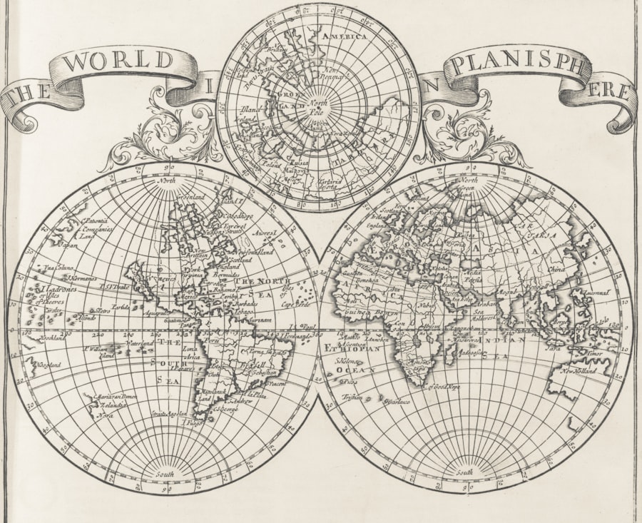
Renaissance cartographers were not just skilled artisans; they were also intellectuals who played a significant role in shaping geographic knowledge during their time. Many cartographers were well-educated individuals who drew upon classical texts, contemporary observations, and firsthand accounts from explorers to create their maps. Figures such as Gerardus Mercator and Abraham Ortelius emerged as prominent cartographers whose works synthesized vast amounts of information into coherent representations of the world.
These cartographers often collaborated with explorers, scientists, and scholars, creating a network of knowledge that transcended geographical boundaries. Their maps served as both practical tools for navigation and as educational resources that disseminated geographic knowledge to a broader audience. By incorporating new discoveries and refining existing information, Renaissance cartographers contributed to a more nuanced understanding of geography that would influence future generations of explorers and scholars.
Tracing the Development of Cartographic Tools and Instruments in the Renaissance
| Metric | Description | Example | Significance |
|---|---|---|---|
| Cartographer’s Signature Style | Unique drawing techniques and stylistic elements used by Renaissance mapmakers | Decorative compass roses, elaborate cartouches | Helps identify the creator and origin of maps |
| Use of Projection | Type of map projection employed (e.g., Ptolemaic, Mercator) | Mercator projection introduced in 1569 | Indicates technological advancement and navigational purpose |
| Material and Ink Composition | Type of paper, parchment, and ink used in map production | Handmade rag paper with iron gall ink | Assists in dating and authenticating maps |
| Geographical Accuracy | Degree of precision in representing coastlines and landmasses | Improved accuracy in Mediterranean depiction | Reflects knowledge and exploration progress |
| Iconography and Symbolism | Use of mythological figures, sea monsters, and heraldic symbols | Sea monsters in Atlantic Ocean areas | Provides cultural context and artistic value |
The Renaissance era witnessed remarkable advancements in cartographic tools and instruments that significantly enhanced mapmaking practices. One of the most important innovations was the development of more precise measuring instruments, such as the astrolabe and the sextant. These tools allowed navigators to determine their latitude with greater accuracy, enabling them to traverse vast oceans with confidence.
The refinement of these instruments was crucial for maritime exploration, as it provided sailors with reliable means to chart their courses. In addition to navigational instruments, advancements in printing technology also played a vital role in cartography during this period. The introduction of copperplate engraving allowed for finer details to be captured on maps, resulting in more visually appealing and informative representations.
As a result, Renaissance maps became not only functional tools but also works of art that reflected the creativity and ingenuity of their creators.
The Impact of Renaissance Cartography on Trade and Commerce
Renaissance cartography had a profound impact on trade and commerce, as accurate maps facilitated the establishment of new trade routes and connections between distant regions. The detailed representations of coastlines, ports, and inland routes enabled merchants to navigate unfamiliar territories with greater ease. This newfound ability to traverse oceans and continents opened up lucrative opportunities for trade, leading to an expansion of markets and an increase in economic activity.
Furthermore, maps became essential tools for merchants seeking to establish trade networks across Europe and beyond. The ability to visualize trade routes allowed merchants to strategize their operations effectively, identifying key locations for commerce and resource exchange. As trade flourished during this period, so too did the demand for accurate maps that could guide merchants through complex networks of exchange.
In this way, Renaissance cartography not only supported economic growth but also contributed to the interconnectedness of global markets.
Examining the Cultural and Artistic Aspects of Renaissance Maps
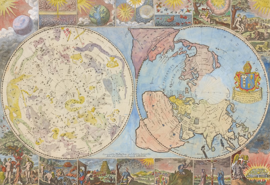
Renaissance maps are not only significant for their scientific accuracy but also for their cultural and artistic dimensions. During this period, cartographers often infused their works with elaborate illustrations that reflected contemporary beliefs, myths, and artistic styles. Maps became canvases for artistic expression, showcasing intricate designs that depicted not only geographical features but also historical events, allegorical figures, and decorative motifs.
The artistic quality of Renaissance maps can be seen in works such as those created by Ortelius or Mercator, where vibrant colors and detailed engravings brought landscapes to life. These maps served as visual narratives that conveyed cultural values and societal aspirations while simultaneously providing practical information about geography. The fusion of art and science in Renaissance cartography exemplifies how maps transcended their utilitarian purpose to become objects of beauty that captured the imagination of viewers.
Unraveling the Political and Power Dynamics Reflected in Renaissance Maps
Renaissance maps often served as instruments of power, reflecting political ambitions and territorial claims during an era marked by exploration and conquest. The creation of maps was frequently influenced by national interests, as monarchs sought to assert their dominance over newly discovered lands. Cartographers were tasked with producing maps that not only depicted geographical realities but also reinforced political narratives that justified territorial expansion.
Maps from this period often included elaborate borders, heraldic symbols, and inscriptions that conveyed messages about sovereignty and control. For instance, European powers used maps to legitimize their claims over newly discovered territories by depicting them as part of their empires. This practice highlights how cartography was intertwined with politics, serving as both a tool for navigation and a means of asserting authority over land and resources.
Analyzing the Accuracy and Inaccuracy of Renaissance Maps
While Renaissance cartography marked significant advancements in mapmaking techniques, it is essential to recognize that many maps from this period contained inaccuracies due to limited knowledge and technological constraints. Despite efforts to create precise representations based on empirical observations, many cartographers relied on outdated information or speculative accounts from explorers who had not fully explored certain regions. For example, some maps depicted fantastical elements or exaggerated features based on hearsay rather than direct observation.
The inclusion of mythical creatures or exaggerated landforms reflected both cultural beliefs and the limitations of contemporary geographic knowledge. While these inaccuracies may seem quaint by modern standards, they reveal much about how people understood their world during the Renaissance—a blend of curiosity, imagination, and emerging scientific inquiry.
The Legacy of Renaissance Cartography in Modern Mapping and Geographic Information Systems
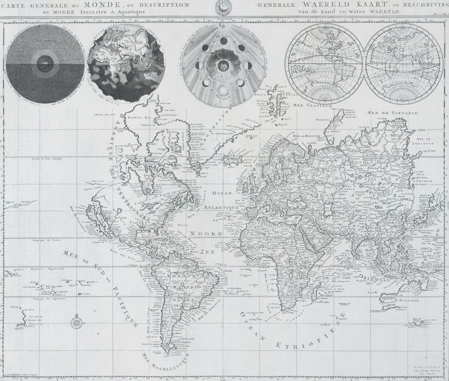
The legacy of Renaissance cartography continues to resonate in contemporary mapping practices and geographic information systems (GIS). The innovations introduced during this period laid the groundwork for modern cartography by emphasizing accuracy, detail, and artistic representation. Many principles established by Renaissance cartographers—such as scale representation, grid systems, and thematic mapping—remain integral components of modern mapmaking.
Furthermore, advancements in technology have transformed how geographic information is collected, analyzed, and visualized today. GIS has revolutionized our ability to manage spatial data, allowing for dynamic mapping that can incorporate real-time information from various sources. While modern mapping techniques have evolved significantly since the Renaissance era, they owe much to the foundational work laid by early cartographers who sought to understand and represent their world.
The Enduring Influence of Renaissance Cartography on Our Understanding of the World
In conclusion, Renaissance cartography represents a transformative period in human history that reshaped our understanding of geography through innovative techniques, artistic expression, and intellectual collaboration. The maps produced during this era not only facilitated exploration but also reflected cultural values, political ambitions, and emerging scientific inquiry. As we navigate our increasingly interconnected world today, it is essential to recognize the enduring influence of Renaissance cartography on modern mapping practices.
The legacy left by Renaissance cartographers continues to inform our understanding of geography while inspiring curiosity about our planet’s complexities. Their contributions laid the foundation for future generations to explore new frontiers—both literally and metaphorically—fostering a spirit of inquiry that remains vital in our quest for knowledge about the world around us.
Renaissance cartography was a pivotal moment in the history of map-making, characterized by the emergence of new techniques and a deeper understanding of geography. The intricate details and artistic flair of maps from this period often reveal the cultural and scientific advancements of the time. For a deeper exploration of how these maps influenced navigation and exploration, you can read more in this related article on Renaissance Cartography.
WATCH THIS! 🗺️ The Map That Proves Humans Explored Earth 5,000 Years Too Early
FAQs
What is Renaissance cartography?
Renaissance cartography refers to the map-making practices and developments that occurred during the Renaissance period, roughly from the 14th to the 17th century. This era saw significant advancements in geographic knowledge, navigation, and artistic representation on maps.
What are “fingerprints” in the context of Renaissance cartography?
In Renaissance cartography, “fingerprints” typically refer to unique stylistic features, techniques, or marks left by individual mapmakers or workshops. These can include specific drawing styles, symbols, annotations, or printing methods that help identify the origin or creator of a map.
Why are fingerprints important in studying Renaissance maps?
Fingerprints help historians and researchers attribute maps to specific cartographers or regions, understand the transmission of geographic knowledge, and trace the evolution of cartographic techniques. They also assist in authenticating maps and uncovering historical connections between mapmakers.
What materials and techniques were commonly used in Renaissance cartography?
Renaissance cartographers commonly used parchment or paper as their base material. Techniques included hand-drawing with ink and pigments, woodcut or copperplate engraving for printing, and the use of compasses and astrolabes for accurate measurements.
How did Renaissance cartography influence modern map-making?
Renaissance cartography laid the foundation for modern cartography by introducing more accurate geographic data, improved projection methods, and standardized symbols. The period’s emphasis on exploration and scientific inquiry helped shape contemporary mapping principles.
Who were some notable Renaissance cartographers?
Notable Renaissance cartographers include Gerardus Mercator, Abraham Ortelius, Martin Waldseemüller, and Ptolemy (whose works were rediscovered and influential during the Renaissance). Their contributions significantly advanced geographic knowledge and map-making techniques.
Can fingerprints help detect forgeries in Renaissance maps?
Yes, analyzing fingerprints such as stylistic details, printing techniques, and material composition can help experts identify forgeries or later reproductions by comparing them with known authentic works from the period.
Where can one find collections of Renaissance maps?
Renaissance maps are housed in many libraries, museums, and archives worldwide, including the British Library, the Library of Congress, the Vatican Library, and specialized institutions like the Huntington Library and the Bibliothèque nationale de France. Many collections are also digitized and accessible online.