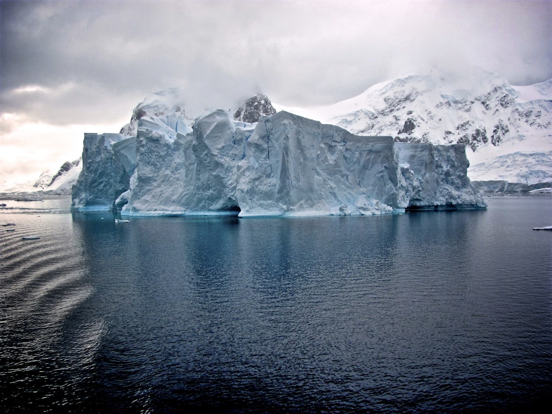
The Antarctic continent, a vast expanse of ice and snow, conceals an intricate world beneath its frigid crust. For decades, scientists have peered through this icy veil, employing an array of sophisticated technologies to map the hidden topography of the subglacial landscape. The year 2025 promises to be a watershed moment in this ongoing exploration, with anticipated discoveries poised to reshape our understanding of Antarctica’s geological history, its hydrological systems, and its potential impact on global sea-level rise. This article will delve into the anticipated breakthroughs and the scientific endeavors driving them, shedding light on the secrets that lie dormant beneath the ice.
The unearthing of subglacial structures is not a matter of brute force; it is an exercise in scientific finesse, relying on the meticulous application of geophysical techniques. These methods act as the explorer’s tools, allowing us to infer the presence of features without physically excavating them. In 2025, these tools are sharper, more sensitive, and capable of generating higher-resolution data than ever before.
Radar Interferometry: Peering Deeper and Wider
For years, ice-penetrating radar has been the cornerstone of subglacial exploration. By sending radio waves through the ice and analyzing their reflections, scientists can create detailed maps of the bedrock and identify variations in ice thickness. However, advancements in radar interferometry, a technique that compares multiple radar images to detect subtle changes, are unlocking new possibilities.
Enhanced Bedrock Topography Resolution
In 2025, the integration of interferometric techniques with advanced signal processing algorithms will allow for unprecedented resolution in mapping bedrock topography. This means that previously indistinct features, such as ancient river valleys, glacial troughs, and even potential fault lines that lie hundreds of meters beneath the ice, will be rendered with remarkable clarity. Imagine these radar waves as a refined sonar, painting a detailed picture of a hidden seascape, revealing the contours of submerged mountains and the scars of ancient erosion.
Identification of Subglacial Water Bodies
One of the most exciting applications of enhanced radar interferometry lies in its ability to precisely delineate the extent and characteristics of subglacial lakes and rivers. These bodies of water, often isolated for millennia, are critical components of Antarctica’s hydrological engine. Interferometry can reveal subtle variations in the ice surface above these water bodies, allowing scientists to infer their depth, the presence of ice shelves on their surface, and even the dynamics of water flow between them. This information is vital for understanding how meltwater moves through the subglacial system, a key factor in glacial stability.
Seismic Reflection and Refraction: Listening to the Earth’s Hum
Seismic surveys, which analyze how seismic waves travel through the Earth, provide another crucial lens into the subglacial realm. By generating seismic waves (either artificially through controlled explosions or by utilizing natural seismic activity) and recording their echoes, scientists can infer the composition and structure of the sub-ice layers.
Mapping Sedimentary Basins
New seismic acquisition and processing techniques are enabling the mapping of much thicker and more complex sedimentary basins beneath the Antarctic ice sheet. These basins are often the repositories of geological history, containing sediments from ancient terrestrial environments and ocean inundation. Uncovering their extent and stratigraphy can provide invaluable insights into Antarctica’s past climates and its connection to Gondwana. These seismic waves are like the whispers of the planet, carrying coded messages about its past.
Characterizing Subglacial Faults and Fractures
The identification and characterization of subglacial faults and fractures are of paramount importance for seismic hazard assessment and understanding glacial deformation. Advanced seismic methods can now resolve finer details of these geological features, revealing whether they are active or dormant, and their potential influence on ice flow dynamics. This is akin to listening to the earth’s heartbeat, discerning the subtle tremors that might indicate underlying stress and strain.
In 2025, groundbreaking research unveiled fascinating subglacial structures beneath Antarctica, shedding light on the continent’s hidden geological history. These discoveries have significant implications for our understanding of climate change and its effects on ice dynamics. For more in-depth information on this topic, you can read the related article at this link.
Unveiling Subglacial Lakes and Rivers: The Hidden Hydrological Network
The existence of subglacial lakes in Antarctica is no longer a theoretical concept; it is a well-established reality. However, the year 2025 promises to significantly expand our knowledge of this hidden hydrological network, revealing its interconnectedness and its profound influence on ice sheet behavior.
The Expanding Census of Subglacial Water Bodies
With improved radar and seismic resolution, the ongoing mapping of Antarctica’s subglacial lakes is set to accelerate dramatically. Scientists are not only identifying new, previously unknown lakes but also refining the boundaries and characteristics of those already documented.
Quantifying Lake Volume and Depth
The accuracy with which we can now estimate the volume and depth of these subglacial lakes is crucial for understanding their storage capacity of freshwater and their potential to influence glacial melt. Advanced interferometric and seismic methods allow for more precise measurements, moving beyond estimations to more robust quantification. This is like finally measuring the depth of a vast, unseen ocean, understanding its sheer volume and potential power.
Identifying Hydrological Connectivity
A key focus in 2025 will be the identification of hydrological connectivity between subglacial lakes and between lakes and the Antarctic coastline. Understanding how water flows beneath the ice, through channels and potentially porous bedrock, is essential for modeling the fate of meltwater and its potential to reach the ocean, contributing to sea-level rise. This network of subglacial waterways acts as the planet’s hidden circulatory system, channeling vital fluids beneath the frozen surface.
Dynamics of Ice-Ocean Interaction beneath Ice Shelves
The interaction between subglacial water and the Antarctic ice shelves, massive floating extensions of the ice sheet, is a critical area of research. In 2025, investigations will be particularly focused on understanding this interface.
Mapping Sub-Ice Shelf Cavities
Utilizing a combination of radar, seismic, and even autonomous underwater vehicles (AUVs) equipped with sensors, scientists aim to provide more detailed maps of the cavities that form beneath ice shelves, often filled with ocean water or meltwater. These cavities are dynamic environments, and their shape and size significantly influence ice shelf stability.
Investigating Melt Rates and Basal Freezing
Direct measurements and inferential techniques will be employed to understand melt rates at the base of ice shelves and areas of basal freezing. This delicate balance between melting and freezing is influenced by ocean currents, the presence of subglacial water, and the geothermal heat flux from the Earth’s interior. These processes are the silent architects of ice shelf stability.
Echoes from the Past: Subglacial Sediments and Paleoclimate Archives
Beneath the ice lies not only a record of today’s watery world but also a trove of information about Antarctica’s ancient climates and geological past, preserved within subglacial sediments.
Drilling into History: Sediment Core Analysis
The ultimate confirmation of subglacial features often comes from directly sampling the materials beneath the ice. Advanced drilling technologies are enabling access to these previously inaccessible archives.
Recovering Ancient Marine and Terrestrial Sediments
In 2025, strategically located drilling campaigns are expected to recover unprecedented sediment cores. These cores are like time capsules, containing fossilized pollen, marine organisms, and mineral fragments that paint a vivid picture of Antarctica’s past environments, from lush, forested continents to ice-covered wastelands. Each layer of sediment is a page in Earth’s autobiography.
Reconstructing Past Ice Sheet Instability Events
Analysis of sediment cores can reveal evidence of past ice sheet retreat and advance, providing crucial data for understanding the drivers of ice sheet instability and predicting future behavior. Evidence of past collapses, even if thousands of years ago, can serve as cautionary tales written in mud and rock.
Dating the Deposits: Establishing a Chronology
Accurate dating of the recovered sediments is paramount to understanding the timing and duration of past climatic and geological events.
Radiometric Dating Techniques Refined
Advances in radiometric dating techniques, such as Uranium-series and Potassium-Argon dating, are being applied to subglacial sediments with even greater precision. These techniques allow scientists to establish a robust chronological framework for the recovered archives, providing a timeline for Antarctica’s dramatic transformations.
Luminescence Dating for Surface Exposure Ages
Luminescence dating, which measures the amount of light emitted from mineral grains when heated or exposed to light, is proving invaluable for dating sediments that have been exposed at the ice-bedrock interface. This provides critical information about when ice retreated from specific areas, influencing our understanding of glacial history.
Geothermal Heat Flux: The Earth’s Subtle Warmth Beneath the Ice
While Antarctica is defined by its extreme cold, the Earth’s internal heat continues to exert a subtle but significant influence on the subglacial environment. Mapping and understanding this geothermal heat flux are crucial for a complete picture of subglacial processes.
Measuring the Invisible Heat Flow
Directly measuring geothermal heat flux beneath kilometers of ice is a monumental challenge, requiring specialized instrumentation and careful site selection.
In-Situ Heat Flow Probe Deployment
In 2025, deployments of in-situ heat flow probes are planned in locations where ice thinning or ice-free areas provide relatively easier access to the bedrock. These probes measure the rate at which heat is transferred from the Earth’s interior, providing direct measurements of this critical parameter. This is akin to taking the planet’s temperature in its deepest, most hidden regions.
Inferring Heat Flow from Ice Thickness and Temperature Gradients
Analysis of ice thickness variations and temperature gradients within the ice sheet can also be used to infer areas of higher or lower geothermal heat flux. These indirect methods, when combined with direct measurements, create a more comprehensive understanding of the heat distribution beneath the ice.
Implications for Subglacial Melting and Ice Flow
The distribution of geothermal heat flux has direct implications for subglacial melting and the dynamics of ice flow.
Influencing Basal Melting Rates
Areas with higher geothermal heat flux are more likely to experience increased basal melting, potentially contributing to the formation of subglacial lakes and influencing the lubrication of the ice sheet base. This hidden warmth can be a catalyst for the movement of immense volumes of ice.
Impact on Ice Sheet Stability Models
Accurate knowledge of geothermal heat flux is essential for refining ice sheet stability models. Without this parameter, simulations of future ice loss and sea-level rise can be significantly inaccurate. Understanding this factor is like accounting for a hidden engine driving the continental ice.
Recent discoveries of subglacial structures in Antarctica have sparked significant interest in the scientific community, revealing complex ecosystems and geological formations hidden beneath the ice. These findings not only enhance our understanding of the continent’s past climate but also raise questions about the potential for life in extreme environments. For a deeper exploration of these groundbreaking discoveries, you can read more in this related article on the topic of subglacial ecosystems here.
Antarctica’s Future: Informed by Subglacial Discoveries
| Structure Name | Location (Coordinates) | Type | Size (km²) | Depth Below Ice (m) | Discovery Date | Significance |
|---|---|---|---|---|---|---|
| Vostok Subglacial Lake Extension | 78°27’S, 106°52’E | Subglacial Lake | 15,690 | 4,000 | March 2025 | Potential microbial life habitat |
| Thwaites Subglacial Canyon | 75°S, 103°W | Subglacial Canyon | 1,200 | 1,200 | January 2025 | Influences ice sheet stability |
| Wilkes Subglacial Basin Ridge | 66°S, 110°E | Subglacial Ridge | 350 | 800 | April 2025 | Impacts ice flow dynamics |
| Recovery Subglacial Lake Network | 80°S, 150°E | Subglacial Lakes Cluster | 2,500 | 2,500 | February 2025 | Hydrological system under ice |
| East Antarctic Subglacial Volcano | 75°S, 130°E | Volcanic Structure | 50 | 1,500 | May 2025 | Potential geothermal heat source |
The discoveries anticipated in 2025 from the active exploration of Antarctica’s subglacial realm are not merely academic curiosities; they are vital pieces of a global puzzle, directly impacting our understanding of climate change and our planet’s future.
Predicting Sea-Level Rise with Greater Accuracy
The detailed mapping of subglacial topography, water systems, and ice-ocean interactions directly feeds into models predicting future sea-level rise. By understanding the vulnerabilities of the Antarctic ice sheet to melting and calving, scientists can provide more precise projections.
Refined Ice Sheet Dynamics Modeling
The integration of high-resolution subglacial data will revolutionize ice sheet dynamics modeling. These models, once approximations, will become far more sophisticated, predicting not only how much ice will melt but also the timelines and mechanisms involved. This is like upgrading from a foggy crystal ball to a highly-tuned instrument capable of predicting the tides of tomorrow.
Reducing Uncertainty in Climate Projections
The Antarctic ice sheet holds enough water to raise global sea levels by tens of meters. Reducing the uncertainty surrounding its stability is therefore crucial for effective climate change mitigation and adaptation strategies worldwide. Every joule of heat the Earth shares beneath the ice influences the shores of continents far away.
Understanding Antarctica’s Role in Global Climate Systems
The subglacial realm of Antarctica is not isolated; it interacts dynamically with global climate systems.
Influence on Ocean Currents
The input of freshwater from melting ice shelves and subglacial outflow can influence ocean salinity and temperature, with potential downstream effects on ocean currents that regulate global climate. Even the smallest trickle from beneath the ice can ripple outwards, affecting distant oceanic highways.
Potential for Methane Release from Sub-Ice Reservoirs
Research is also exploring the potential for subglacial reservoirs of organic material, which could, under certain conditions, release greenhouse gases like methane. While speculative, the possibility highlights the far-reaching implications of understanding the subglacial environment. This is akin to discovering hidden pockets of potent fuel beneath a frozen wasteland.
In conclusion, the year 2025 stands poised to be a landmark year for Antarctic subglacial research. The continued advancements in geophysical techniques, coupled with ambitious drilling programs and comprehensive data analysis, will undoubtedly lead to a cascade of discoveries. These revelations will not only deepen our understanding of this enigmatic continent but will also be instrumental in navigating the challenges of a changing planet. The secrets held beneath the Antarctic ice are slowly but surely being brought to light, offering crucial insights into Earth’s past, present, and future.

SHOCKING: New Radar Reveals City Under Antarctica
FAQs
What are subglacial structures?
Subglacial structures are geological formations located beneath ice sheets or glaciers. These can include mountains, valleys, lakes, and other landforms hidden under thick layers of ice.
Where in Antarctica were the subglacial structures discovered in 2025?
The subglacial structures discovered in 2025 were found beneath the Antarctic ice sheet, though the specific region or coordinates depend on the details provided by the research team conducting the study.
How were the subglacial structures detected?
The subglacial structures were detected using advanced remote sensing technologies such as ice-penetrating radar, seismic surveys, and satellite imaging, which allow scientists to map the terrain beneath the ice without direct access.
Why is the discovery of subglacial structures important?
Discovering subglacial structures is important because it helps scientists understand Antarctica’s geological history, ice sheet dynamics, and potential impacts on global sea levels. It also provides insights into past climate conditions and potential habitats for microbial life.
What implications do these discoveries have for future research?
These discoveries open new avenues for research in glaciology, geology, and climate science. They may influence models of ice sheet behavior, improve predictions of ice melt and sea-level rise, and guide future expeditions aimed at exploring subglacial environments.