
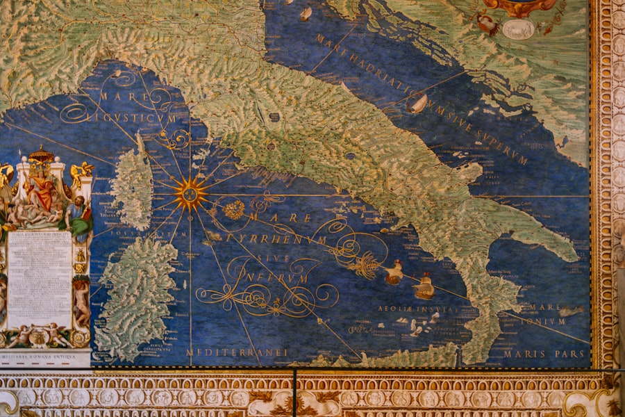
The Piri Reis Map, a remarkable artifact from the early 16th century, has captivated historians, cartographers, and enthusiasts alike since its discovery. Created by the Ottoman admiral and cartographer Piri Reis in 1513, this map is notable not only for its artistic quality but also for its geographical significance. It is one of the oldest surviving maps that depict parts of the Americas, particularly the coastlines of South America and the Caribbean.
The map serves as a window into the navigational knowledge of the time, revealing how explorers perceived the world and their place within it. What makes the Piri Reis Map particularly intriguing is its blend of ancient and contemporary knowledge. It incorporates information from various sources, including earlier maps and accounts from explorers who ventured into uncharted territories.
This synthesis of knowledge raises questions about the extent of maritime exploration during the Age of Discovery and the transmission of geographical information across cultures. As scholars continue to study this map, it becomes increasingly clear that it is not merely a navigational tool but a complex document that reflects the interplay of science, art, and history.
Key Takeaways
- The Piri Reis Map is a famous world map created by Ottoman admiral and cartographer Piri Reis in 1513.
- The map is known for its controversial and mysterious features, including its supposed depiction of Antarctica and advanced cartographic techniques.
- Scholars have debated the accuracy and origins of the map, with some suggesting it may have been based on ancient sources or even extraterrestrial knowledge.
- Despite its inaccuracies, the Piri Reis Map is considered an important artifact in the history of cartography and has influenced modern understanding of early navigation and exploration.
- Ongoing research and analysis continue to uncover new insights into the map’s creation, its connections to ancient civilizations, and its impact on the development of cartography.
The History of the Piri Reis Map
The origins of the Piri Reis Map can be traced back to 1513 when Piri Reis, an accomplished navigator and cartographer in the Ottoman Empire, created it. The map was drawn on a piece of worn parchment and is believed to have been part of a larger collection of maps that Piri Reis compiled over his lifetime. His work was influenced by various sources, including ancient Greek and Roman texts, as well as firsthand accounts from explorers like Christopher Columbus.
The map itself was rediscovered in 1929 in the Topkapi Palace in Istanbul, Turkey, where it had been stored for centuries. Its unveiling sparked significant interest among historians and cartographers, leading to extensive research into its origins and implications.
The map’s depiction of the New World was groundbreaking for its time, as it provided a glimpse into territories that were still largely unknown to many Europeans. The historical context surrounding its creation adds layers of complexity to its interpretation, as it reflects not only Piri Reis’s skills as a cartographer but also the broader geopolitical dynamics of the early 16th century.
Controversies Surrounding the Piri Reis Map
The Piri Reis Map has not been without its share of controversies, particularly regarding its accuracy and the sources from which it was derived. Some scholars argue that the map contains inaccuracies that challenge its credibility as a reliable navigational tool. For instance, certain geographical features are depicted in ways that do not align with modern understandings of cartography.
Critics have pointed out that these discrepancies raise questions about Piri Reis’s methods and the reliability of his sources. Moreover, there are debates surrounding the potential influence of lost ancient civilizations on the map’s creation. Some theorists suggest that Piri Reis may have had access to knowledge from civilizations such as the Phoenicians or even earlier cultures that possessed advanced navigational skills.
This notion has led to speculation about the extent of ancient maritime exploration and whether there were connections between disparate cultures long before the Age of Discovery. Such theories have fueled discussions about the map’s significance beyond mere geography, positioning it as a key to understanding historical interactions between civilizations.
The Accuracy of the Piri Reis Map
| Aspect | Details |
|---|---|
| Map Creator | Piri Reis |
| Creation Date | 1513-1520 |
| Accuracy | Debate over accuracy due to inclusion of Antarctica |
| Features | Coastlines of Europe, Africa, and South America |
| Historical Significance | Early example of world map with America |
When examining the accuracy of the Piri Reis Map, it becomes evident that it is a product of its time, reflecting both remarkable insights and notable limitations. The map accurately depicts certain coastal outlines and geographical features, particularly those of South America and parts of Africa. For instance, the representation of Brazil’s coastline is relatively precise compared to contemporary maps from the same era.
This accuracy suggests that Piri Reis had access to reliable information from explorers who had recently navigated these waters. However, there are also significant inaccuracies present in the map that cannot be overlooked. Some landmasses are distorted or misrepresented, leading to confusion about their actual locations.
Additionally, certain regions are depicted with anachronistic features that did not exist at the time. These inconsistencies have led some scholars to question whether Piri Reis relied on outdated or erroneous sources when compiling his map. Despite these flaws, the Piri Reis Map remains an invaluable artifact for understanding early cartography and navigation.
Uncovering the Cartographic Techniques Used in the Piri Reis Map
The cartographic techniques employed by Piri Reis in creating his map reveal much about the practices and knowledge available during the early 16th century. One notable aspect is his use of projection methods that allowed him to represent three-dimensional landforms on a two-dimensional surface. This technique was essential for accurately depicting coastlines and other geographical features, demonstrating an understanding of spatial relationships that was advanced for its time.
Additionally, Piri Reis utilized a combination of artistic skill and scientific observation in his work. The map is adorned with intricate illustrations, including depictions of animals, ships, and even mythical creatures. These embellishments not only enhance its aesthetic appeal but also serve as a testament to the cultural context in which it was created.
By blending artistry with cartographic precision, Piri Reis produced a map that was both functional and visually striking, reflecting the dual nature of cartography as both science and art.
The Piri Reis Map and its Connection to Ancient Civilizations
The connection between the Piri Reis Map and ancient civilizations is a topic that has intrigued researchers for decades. Some scholars posit that Piri Reis may have drawn upon knowledge from earlier cultures that possessed advanced navigational skills long before European exploration began. This theory suggests that there may have been exchanges of information between civilizations such as the Phoenicians or even ancient Egyptians, who were known for their maritime prowess.
The implications of this connection are profound, as they challenge conventional narratives about exploration during the Age of Discovery. If ancient civilizations did indeed possess knowledge of distant lands and navigational techniques, it raises questions about how this information was transmitted across time and space. The Piri Reis Map could serve as a crucial link in understanding these historical interactions, providing insights into how knowledge was shared and adapted over centuries.
The Mysteries and Unanswered Questions of the Piri Reis Map
Despite extensive research into the Piri Reis Map, many mysteries remain unresolved. One of the most pressing questions pertains to the sources used by Piri Reis in creating his map. While some sources are known, such as earlier European maps and accounts from explorers, there are gaps in understanding how he synthesized this information into a cohesive representation of the world.
The absence of detailed records regarding his sources leaves room for speculation about what other knowledge may have influenced his work. Another enigma lies in certain features depicted on the map that do not correspond with known geographical locations. For instance, some theorists have pointed to what appears to be an accurate representation of Antarctica long before it was officially discovered.
This has led to various interpretations regarding whether Piri Reis had access to lost maps or knowledge from ancient civilizations that possessed advanced geographical understanding. These unanswered questions continue to fuel debates among historians and cartographers, highlighting the enduring allure of this remarkable artifact.
The Influence of the Piri Reis Map on Cartography and Exploration
The impact of the Piri Reis Map on cartography and exploration cannot be overstated. As one of the earliest maps to depict parts of the Americas with such detail, it served as a reference point for subsequent explorers and cartographers seeking to navigate uncharted waters. Its unique blend of artistic representation and geographical accuracy set a precedent for future mapping endeavors, influencing how subsequent generations approached cartography.
Moreover, the map’s existence challenged prevailing notions about exploration during its time. It demonstrated that knowledge about distant lands was not solely confined to European explorers but was shared across cultures through various means.
Modern Day Analysis and Interpretation of the Piri Reis Map
In contemporary times, advancements in technology have allowed researchers to analyze the Piri Reis Map with greater precision than ever before. High-resolution imaging techniques enable scholars to examine details that were previously obscured by wear and tear over centuries. This modern analysis has led to new insights regarding its construction and potential sources, shedding light on aspects that remained elusive in earlier studies.
Additionally, interdisciplinary approaches involving historians, geographers, and archaeologists have enriched interpretations of the map’s significance. By examining it through various lenses—cultural, scientific, and historical—scholars are beginning to piece together a more comprehensive understanding of its context within early modern navigation and exploration. This collaborative effort underscores how modern scholarship continues to evolve in response to new discoveries related to this fascinating artifact.
The Piri Reis Map’s Role in Understanding Early Navigation and Exploration
The Piri Reis Map plays a crucial role in understanding early navigation and exploration practices during a transformative period in history. It serves as a testament to human curiosity and ingenuity in seeking out new frontiers despite limited technological resources. By analyzing this map alongside other contemporary works, researchers can gain insights into how navigators approached their journeys and what challenges they faced along the way.
Furthermore, studying the Piri Reis Map allows historians to explore broader themes related to globalization and cultural exchange during this era. As explorers ventured into unknown territories, they brought back not only geographical knowledge but also cultural artifacts and ideas that would shape societies for generations to come. The map stands as a symbol of this interconnectedness—a reminder that exploration is not merely about discovering new lands but also about forging connections between diverse cultures.
Conclusion and Future Discoveries Related to the Piri Reis Map
In conclusion, the Piri Reis Map remains an enduring subject of fascination for scholars and enthusiasts alike due to its rich historical context and complex implications for our understanding of early navigation and exploration. As research continues into this remarkable artifact, new discoveries may yet emerge that further illuminate its significance within both cartographic history and broader cultural narratives. Future explorations into the mysteries surrounding the Piri Reis Map hold promise for uncovering additional layers of meaning within this intricate document.
As technology advances and interdisciplinary collaboration flourishes among researchers from various fields, there is hope that answers will be found regarding its origins, sources, and potential connections to ancient civilizations. Ultimately, the legacy of the Piri Reis Map serves as a reminder that history is an ever-evolving narrative—one shaped by curiosity, exploration, and our relentless pursuit of knowledge about our world.
The Piri Reis map, a fascinating artifact from the early 16th century, is renowned for its detailed depiction of the known world at the time, including parts of Europe, Africa, and the Americas. This map has intrigued historians and cartographers alike due to its advanced geographical knowledge and the mysterious inclusion of regions that were supposedly undiscovered at the time. For those interested in exploring more about ancient maps and their historical significance, a related article can be found on Real Lore and Order, which delves into the mysteries and legends surrounding ancient cartography and its impact on our understanding of history.
WATCH THIS 🧊The US Military Confirmed It: What’s REALLY Under the Antarctic Ice?
FAQs
What is the Piri Reis map?
The Piri Reis map is a world map created by Ottoman admiral and cartographer Piri Reis in 1513. It is one of the oldest surviving maps to show the Americas.
What does the Piri Reis map show?
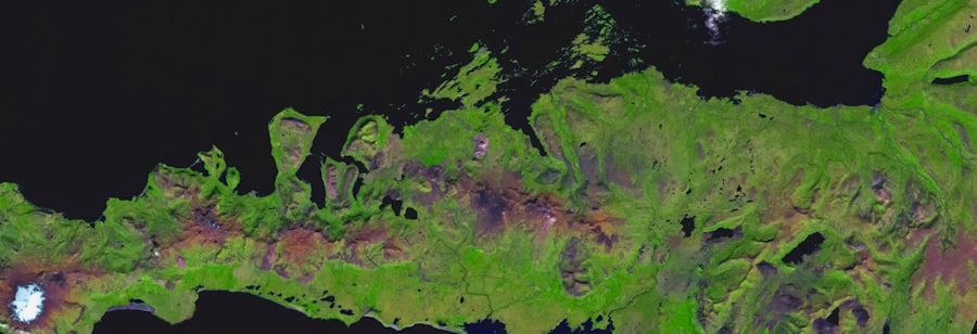
The Piri Reis map shows the coastlines of Europe, Africa, and the Americas, as well as various islands and geographical features. It is particularly notable for its depiction of the coast of South America and the coastline of Antarctica.
What is significant about the Piri Reis map?
The Piri Reis map is significant because it shows a portion of the coastline of Antarctica, which was not officially discovered until the early 19th century. This has led to speculation and debate about how the map could have been created with such accuracy.
What are some theories about the Piri Reis map?
There are various theories about the Piri Reis map, including the possibility that it was based on ancient sources or that it may indicate prehistoric or extraterrestrial knowledge of the Earth’s geography. However, these theories are not widely accepted by mainstream historians and scholars.
Where is the Piri Reis map located today?
The original Piri Reis map is no longer intact, but a portion of it is housed in the Topkapi Palace Museum in Istanbul, Turkey. Copies and reproductions of the map can be found in various museums and collections around the world.