
Ancient navigation represents a remarkable chapter in human history, showcasing the ingenuity and resourcefulness of early civilizations. Long before the advent of modern technology, seafarers relied on their understanding of the natural world to traverse vast oceans and navigate treacherous waters. This ancient art was not merely a means of transportation; it was a vital component of trade, exploration, and cultural exchange.
The methods employed by these early navigators laid the groundwork for the sophisticated navigational systems that would follow, influencing generations of explorers and shaping the course of human history. The significance of ancient navigation extends beyond mere survival at sea. It reflects the deep connection between humanity and the environment, as navigators learned to read the signs provided by nature.
From the stars that twinkled above to the currents that flowed beneath, every element played a crucial role in guiding these early mariners. As they ventured into the unknown, they not only expanded their horizons but also forged links between distant lands, fostering a sense of global interconnectedness that resonates even today.
Key Takeaways
- Ancient navigation relied heavily on the stars for direction and location.
- Landmarks and natural phenomena, such as ocean currents and bird migrations, were crucial for ancient navigation.
- Nautical charts and maps were developed to aid in navigation, marking important landmarks and routes.
- Ancient cultures, such as the Phoenicians and Polynesians, made significant contributions to navigation techniques.
- Navigational tools and instruments evolved over time, improving accuracy and efficiency in ancient navigation.
The Role of the Stars in Ancient Navigation
Stars served as celestial beacons for ancient navigators, illuminating the night sky and providing essential guidance for those who dared to venture into the open sea. The constellations were not merely decorative patterns; they were vital tools for orientation and navigation. Cultures around the world developed intricate systems to interpret the movements of celestial bodies, allowing them to determine their position relative to the Earth.
For instance, sailors in the Northern Hemisphere often relied on Polaris, the North Star, which remained relatively fixed in the sky, serving as a reliable point of reference. In addition to Polaris, various cultures identified other significant stars and constellations that played crucial roles in navigation. The Polynesians, for example, utilized a sophisticated understanding of the stars, employing them to navigate vast distances across the Pacific Ocean.
They recognized patterns in the night sky and correlated them with specific islands and ocean currents, enabling them to travel with remarkable precision. This deep knowledge of celestial navigation exemplifies how ancient mariners harnessed the cosmos to guide their journeys.
The Use of Landmarks and Natural Phenomena in Ancient Navigation

While celestial navigation was essential for open-sea voyages, ancient navigators also relied heavily on terrestrial landmarks and natural phenomena to guide their paths. Coastal navigation often involved identifying prominent features such as cliffs, mountains, or distinctive rock formations that could be seen from afar. These landmarks served as visual cues, helping sailors maintain their bearings as they approached shorelines or navigated through narrow straits.
Natural phenomena also played a significant role in ancient navigation. The behavior of ocean currents, wind patterns, and even animal migrations provided valuable information about the surrounding environment. For instance, experienced sailors could interpret changes in water color or temperature as indicators of nearby land or shifting currents.
This keen observation of nature allowed ancient navigators to make informed decisions about their routes and avoid potential hazards.
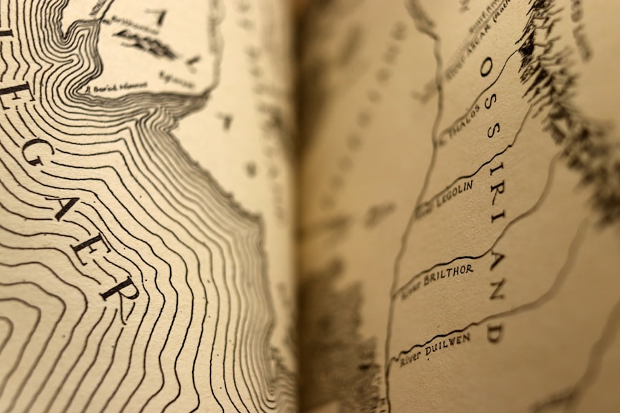
The Development of Nautical Charts and Maps
| Time Period | Development |
|---|---|
| Ancient Times | Early maps and charts were simple and often inaccurate, based on limited knowledge and exploration. |
| Medieval Period | Portolan charts and compass roses were developed, improving navigation and accuracy. |
| Age of Exploration | Nautical charts became more detailed and accurate as explorers discovered new lands and sea routes. |
| 18th-19th Century | Advancements in surveying and cartography led to more precise nautical charts for navigation. |
| Modern Era | Digital mapping and satellite technology have revolutionized the creation and use of nautical charts. |
As civilizations advanced, so too did their navigational techniques, leading to the development of nautical charts and maps. These early representations of maritime routes were crucial for improving navigation accuracy and efficiency. Ancient mariners began to document their journeys, recording key landmarks, currents, and prevailing winds on rudimentary maps.
These charts not only served as practical tools for navigation but also reflected the growing understanding of geography and cartography.
The Greeks and Romans made notable contributions to this field, producing maps that depicted coastlines and major ports with increasing detail.
The Ptolemaic maps of the second century AD exemplified this trend, incorporating both astronomical observations and geographical knowledge. Such advancements laid the foundation for future explorers who would rely on these charts to navigate uncharted waters.
The Influence of Ancient Cultures on Navigation Techniques
The art of navigation was not confined to a single culture; rather, it evolved through a rich tapestry of influences from various ancient civilizations. The Phoenicians, known for their seafaring prowess, played a pivotal role in advancing navigational techniques in the Mediterranean. Their extensive trade networks facilitated cultural exchange, allowing them to share knowledge about celestial navigation and maritime routes with neighboring societies.
Similarly, the ancient Egyptians contributed significantly to navigation through their understanding of the Nile River’s seasonal flooding patterns. This knowledge enabled them to develop effective trade routes along the river and beyond. As different cultures interacted through trade and exploration, they exchanged ideas and techniques that enriched their navigational practices.
This cross-pollination of knowledge ultimately led to more sophisticated methods that would shape future generations of navigators.
The Evolution of Navigational Tools and Instruments
The evolution of navigational tools and instruments marked a significant advancement in ancient navigation techniques. Early mariners relied on simple devices such as sticks or ropes to measure distances or determine direction. However, as knowledge expanded, so did the complexity of navigational instruments.
The astrolabe, for instance, emerged as a crucial tool for measuring celestial angles and determining latitude at sea. The development of the compass further revolutionized navigation by providing sailors with a reliable means of determining direction regardless of visibility conditions. This invention allowed navigators to venture into uncharted waters with greater confidence, as they could now orient themselves even when celestial bodies were obscured by clouds or fog.
The refinement of these tools over time exemplifies humanity’s relentless pursuit of accuracy and precision in navigation.
The Importance of Currents and Tides in Ancient Navigation
Understanding ocean currents and tides was paramount for ancient navigators seeking to optimize their journeys across vast bodies of water. These natural phenomena could significantly impact travel times and safety at sea. Experienced sailors learned to read the rhythms of the ocean, recognizing how currents flowed in different seasons or times of day.
This knowledge allowed them to plan their voyages strategically, taking advantage of favorable conditions while avoiding treacherous waters. Tides also played a crucial role in coastal navigation. Ancient mariners had to be acutely aware of tidal patterns when approaching shorelines or navigating through estuaries.
They understood that tides could affect water depth and alter coastal features, making certain routes more hazardous during specific times.
The Impact of Trade and Exploration on Ancient Navigation
Trade and exploration were driving forces behind advancements in ancient navigation techniques. As civilizations expanded their reach through commerce, they sought efficient routes to transport goods across vast distances. This demand for trade led to increased exploration as merchants ventured into uncharted territories in search of new markets and resources.
The exchange of goods facilitated cultural interactions that enriched navigational knowledge across regions. For example, the Silk Road not only connected East and West through land routes but also inspired maritime trade networks that spanned oceans. As traders shared their experiences and insights about navigation with one another, they contributed to a collective body of knowledge that would benefit future generations of explorers.
The Mystery of Polynesian Navigation Techniques
Polynesian navigation techniques remain one of the most fascinating aspects of ancient navigation history. The Polynesians mastered long-distance voyaging across the vast Pacific Ocean using an intricate system that combined celestial navigation with an intimate understanding of oceanic patterns. They relied on a unique set of skills that included reading wave patterns, observing bird behavior, and recognizing subtle changes in water color.
What sets Polynesian navigation apart is its reliance on oral tradition rather than written records. Navigators passed down their knowledge through generations via storytelling and mentorship, ensuring that essential skills were preserved despite the absence of written documentation. This oral tradition created a rich tapestry of cultural heritage that continues to inspire modern navigators and researchers alike.
The Legacy of Ancient Navigation on Modern Navigation
The legacy of ancient navigation is deeply woven into the fabric of modern maritime practices. Many contemporary navigational techniques can trace their roots back to the methods employed by early seafarers. The principles of celestial navigation remain relevant today, particularly for long-distance voyages where GPS technology may be unavailable or unreliable.
Moreover, ancient navigational tools have evolved into sophisticated instruments used by modern sailors and aviators alike. The compass has undergone significant advancements but still serves as a fundamental tool for orientation at sea or in the air. Additionally, nautical charts have become highly detailed representations that incorporate satellite imagery and advanced cartographic techniques while retaining the essence of their ancient predecessors.
Unraveling the Secrets of Ancient Navigation
The exploration of ancient navigation reveals a rich tapestry woven from human ingenuity, cultural exchange, and an intimate connection with nature. From celestial bodies guiding mariners across vast oceans to intricate maps charting trade routes, each aspect reflects humanity’s relentless quest for discovery and understanding. As modern navigators continue to build upon these foundational techniques, they honor the legacy left by those who dared to venture into uncharted waters.
In unraveling the secrets of ancient navigation, one gains insight not only into historical practices but also into the enduring spirit of exploration that defines humanity’s journey through time. The lessons learned from these early navigators continue to resonate today as individuals seek new horizons—whether across oceans or within themselves—driven by an innate desire to explore the unknown.
The mystery of ancient navigation has long fascinated historians and archaeologists, as they seek to understand how early mariners traversed vast oceans without the modern tools we rely on today. An intriguing article that delves into this topic can be found on Real Lore and Order, where the author explores the ingenious methods used by ancient sailors, such as celestial navigation and the use of primitive compasses. For a deeper dive into these ancient techniques and their historical significance, you can read more in the article available at Real Lore and Order.
WATCH THIS 🤯Ancient Tech That Should Not Exist
FAQs
What is ancient navigation?
Ancient navigation refers to the methods and techniques used by early civilizations to navigate and explore the seas and oceans. This includes the use of stars, landmarks, and natural phenomena to determine direction and location.
What are some examples of ancient navigation techniques?
Some examples of ancient navigation techniques include celestial navigation using stars and constellations, coastal navigation using landmarks and natural features, and dead reckoning which involves estimating current position based on a previously determined position.
What are some of the mysteries surrounding ancient navigation?
One of the mysteries surrounding ancient navigation is how early civilizations were able to accurately navigate vast distances across open seas without the use of modern technology such as GPS or compasses. Another mystery is the extent of ancient seafaring and the routes taken by early explorers.
What evidence do we have of ancient navigation techniques?
Evidence of ancient navigation techniques includes navigational tools such as the astrolabe and the sextant, as well as historical accounts of voyages and explorations. Additionally, archaeological discoveries of ancient shipwrecks and navigation charts provide further evidence of early navigation methods.
How did ancient civilizations navigate without modern technology?
Ancient civilizations navigated using a combination of observational techniques, such as studying the positions of stars and the movement of celestial bodies, as well as knowledge of natural phenomena such as currents and winds. They also relied on experience and oral traditions passed down through generations.
What impact did ancient navigation have on the world?
Ancient navigation had a significant impact on the world by facilitating trade, exploration, and the exchange of ideas and cultures between different civilizations. It also led to the discovery and colonization of new lands, ultimately shaping the course of human history.