The vast, ochre expanse of the Nefud Desert, a seemingly unforgiving sea of sand in northern Saudi Arabia, holds secrets far older and more profound than its arid reputation suggests. For millennia, the image of the Nefud has been one of relentless sun, searing winds, and an absolute dearth of life-sustaining water. Yet, beneath this sun-baked crust, a hidden history of abundance lies buried, a testament to a dramatically different climate that once sculpted this now-desiccated landscape. Scientists, geologists, and archaeologists are increasingly turning their attention to this seemingly barren region, drawn by the tantalizing evidence of ancient lakes, ephemeral waterways, and the possibility that these long-vanished water worlds played a crucial role in the migration and settlement patterns of early humans. Unveiling these hidden water sources is akin to unearthing lost oases, revealing not just geological formations but also the stories of life that once thrived in their shadow.
The Echoes of a Wetter Past: Climatic Shifts and Paleo-Lakes
The Nefud Desert, as it exists today, is a product of a relatively recent climatic shift. While the Arabian Peninsula has always experienced periods of aridity, the deep past tells a different story. During the Pleistocene epoch, particularly during glacial periods known as “pluvial phases,” atmospheric moisture patterns shifted, bringing significantly more rainfall to regions that are now desert. These wetter intervals, interspersed with drier interglacial periods, created a dynamic environment where temporary lakes, rivers, and even grasslands flourished across the Arabian Peninsula.
Revealing the Evidence: Geomorphological Signatures of Ancient Water Bodies
The geological landscape of the Nefud bears indelible marks of this forgotten hydrological past. Geomorphologists meticulously study the landforms left behind by these ancient water bodies. Features such as ancient shorelines, characterized by distinct terraces and sedimentary layers, are prime indicators of former lake extents. These shorelines often contain accumulations of gravel, sand, and mud, deposited by wave action and water flow at the lake’s edge. The presence of specific types of sediment, such as lacustrine clays and silts, further confirms the existence of standing bodies of water.
Furthermore, the erosion patterns observed in the Nefud can also be attributed to past water activity. Dry riverbeds, known as wadis, snake across the landscape, remnants of ephemeral rivers that once channeled water during rainy seasons. The scale and complexity of some of these wadi systems suggest that they once carried substantial volumes of water, originating from a broader and wetter catchment area than is conceivable today. The very shape of the dunes, while predominantly shaped by prevailing winds, can also hold clues, with ancient water bodies sometimes influencing the initial topography upon which the sands were deposited.
Dating the Water: Paleoclimate Proxies and Chronological Frameworks
Establishing a timeline for these ancient lakes is a critical aspect of understanding the Nefud’s climatic history. Scientists employ various paleoclimate proxies to reconstruct past environmental conditions and date the sediments associated with these ancient water bodies. Radiocarbon dating, for instance, is a widely used technique to determine the age of organic materials, such as plant fragments or charcoal, found within lake sediments. This provides a direct measure of when the organic matter was deposited and, by extension, when the lake existed.
Beyond radiocarbon dating, other methods offer insights into longer timescales. Optically Stimulated Luminescence (OSL) dating, for example, can determine the last time quartz grains within sediments were exposed to sunlight. This allows researchers to date sedimentary layers from millennia ago, extending the chronological framework beyond the reach of radiocarbon dating. Analyzing the isotopic composition of minerals, such as carbonates, can also provide information about past precipitation patterns and water sources. By combining data from multiple dating techniques and various sedimentary layers, a comprehensive chronological framework for the Nefud’s wet periods can be constructed, revealing cycles of lake formation and desiccation over tens of thousands of years.
Recent studies have shed light on the fascinating ancient lakes in the Nefud Desert, revealing their significance in understanding past climatic conditions and human habitation in arid regions. For a broader perspective on ancient water bodies and their historical implications, you may find the article on ancient mariners’ maps in Antarctica particularly intriguing. It explores how ancient navigators charted their courses based on the geography of water sources, much like the ancient lakes of the Nefud Desert influenced the movement of early civilizations. You can read more about it here: Exploring Antarctica: Ancient Mariners’ Maps.
Traces of Life: Human Encounters with Ancient Water Worlds

The existence of substantial ancient lakes and a more hospitable climate in the Nefud Desert during certain periods directly impacts our understanding of early human migration and settlement in the Arabian Peninsula. These water sources would have been vital attractors for early hominins and later Homo sapiens, providing essential resources for survival and acting as crucial stepping stones for movement across the landscape. The discovery of archaeological sites in proximity to evidence of ancient lakes offers compelling insights into these early human-Nephud interactions.
Early Human Migrations: Following the Waterways
The prevailing theory regarding the spread of Homo sapiens out of Africa posits that they followed a “green corridor” route, utilizing areas with greater water availability and vegetation. The Nefud, during its pluvial phases, would have represented such a corridor. Ancient lakes, rivers, and the associated flora and fauna would have provided sustenance and facilitated movement across the vast distances of the Arabian interior. Archaeological evidence, such as stone tool assemblages and fossilized hominin remains, found in locations that were once shores of these ancient lakes, strongly supports this hypothesis.
Researchers are investigating how early humans navigated this dynamic landscape. Did they follow perennial rivers, or did they rely on ephemeral water sources that appeared seasonally? The presence of sophisticated hunting and gathering strategies, evidenced by the types of animal bones found at archaeological sites, suggests that these ancient populations were adept at exploiting the resources offered by these wetter environments. The ability to locate and utilize these temporary water bodies would have been a critical survival skill.
Paleolithic Settlements: Oases of Activity
The discovery of Paleolithic sites, particularly those dating back to the Middle and Upper Paleolithic periods, within the Nefud Desert has been transformative. These sites are not scattered randomly but often cluster around areas where geological evidence points to the existence of ancient lakes or substantial wadi systems. This spatial correlation is highly significant, suggesting that these water bodies were not merely transient resources but attracted sustained human activity.
Archaeological excavations have unearthed a wealth of artifacts at these sites, including stone tools such as handaxes, scrapers, and projectile points, as well as evidence of hearths and butchered animal remains. The presence of such artifacts in abundance indicates that these ancient lake shores served as important settlement areas, where early humans lived, hunted, processed food, and manufactured tools. The diversity of tool types suggests a range of activities, from hunting large game to processing plant materials. The preservation of these sites, often buried beneath sand and sediment, has protected them from erosion and modern development, offering a unique window into the lives of our ancestors.
The “Green Arabia” Hypothesis: Connecting Continents
The Nefud’s ancient water worlds are integral to the broader “Green Arabia” hypothesis, which proposes that periods of increased rainfall in the Arabian Peninsula created a more interconnected landscape, facilitating the dispersal of both humans and animals between Africa and Eurasia. During these wetter intervals, the Sahara and the Arabian Desert would have been less of a barrier and more of a bridging landscape.
The ancient lakes of the Nefud, acting as freshwater reservoirs, would have been vital nodes within this interconnected system. They provided reliable water sources for migrating populations and supported the diverse ecosystems that fueled these movements. The study of these ancient lakes, therefore, contributes not only to our understanding of regional prehistory but also to the global narrative of human evolution and migration. The Nefud, once considered an impassable barrier, is now understood as a critical pathway, a testament to the profound impact of climatic change on the course of human history.
The Hidden Hydrology: Unveiling Subterranean Secrets
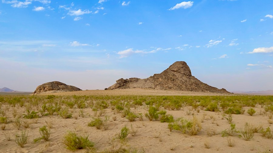
While the focus has often been on surface-level ancient lakes, the Nefud Desert’s hydrology is also shaped by significant subterranean water systems. These underground reserves, often replenished by past rainfall events and recharged by the limited precipitation that does occur today, play a crucial role in sustaining the sparse modern vegetation and can hold further clues to the region’s wetter past. Unveiling these hidden water worlds requires sophisticated exploration techniques.
Groundwater Reservoirs: The Unseen Oasis
The Nefud Desert, despite its arid surface, sits atop considerable groundwater reservoirs. These aquifers, formed from porous rock formations that have captured and stored water over millennia, are a vital resource for the few settlements and agricultural endeavors that exist in the region today. The extent and depth of these groundwater systems are being mapped through extensive hydrogeological surveys.
Understanding the origin and recharge rates of these aquifers is a key area of research. While modern rainfall contributes minimally, geological evidence suggests that many of these reservoirs were significantly replenished during the pluvial periods when the Nefud was dotted with lakes and rivers. The water stored in these ancient aquifers is essentially a legacy of a wetter past, a subterranean echo of the surface water bodies that once dominated the landscape.
Modern Wells and Traditional Knowledge: Sustaining Life in Aridity
Modern drilling techniques have tapped into these groundwater reserves, providing essential water for human consumption and limited agriculture. However, the sustainability of these resources is a growing concern. Traditional knowledge, passed down through generations of Bedouin communities, often holds invaluable insights into the location of natural springs and seepages, areas where groundwater is close to the surface. This traditional wisdom, when combined with modern scientific methods, offers a more holistic approach to understanding and managing the Nefud’s water resources.
The practice of well digging in the Nefud is often a delicate balance between technological advancement and ancient understanding. While modern drilling rigs can access deeper reserves, the knowledge of where to drill, based on geological indicators and the distribution of certain plants that signal the presence of water, remains crucial. The study of these wells and the communities that rely on them offers a direct link between the desert’s hydrological present and its ancient, wetter past, demonstrating how life has adapted to and persisted within this challenging environment.
Archaeological Discoveries: Artifacts from the Water’s Edge
The archaeological record of the Nefud Desert is intrinsically linked to the presence of ancient water sources. Sites unearthed near evidence of former lakes and riverbeds have yielded a wealth of artifacts that paint a vivid picture of human life in these now-arid lands. These discoveries are not just relics of the past; they are a testament to the critical role water played in shaping human settlement patterns and cultural development.
Stone Tools and Technology: Adapting to the Environment
The tools unearthed at archaeological sites in the Nefud, particularly those found in association with ancient lake shorelines, speak volumes about the ingenuity of early inhabitants. The prevalence of lithic industries, the study of stone tools, reveals how these ancient populations adapted their technologies to the available resources and the demands of their environment.
Sophisticated projectile points, used for hunting animals that would have been attracted to water sources, are common finds. Scrapers and knives, essential for processing animal hides and plant materials, demonstrate the multifaceted nature of their survival strategies. The types of stone used and the techniques employed in their manufacture provide insights into trade networks and the movement of people across the landscape. For example, finding a specific type of chert miles from its origin suggests migration or established exchange routes that likely followed the ancient watercourses.
Faunal Remains: A Diet Shaped by Water
The study of animal bones found at Nefud archaeological sites provides crucial evidence of the diet of its ancient inhabitants and the ecosystems that once thrived there. During wetter periods, the Nefud would have supported a far richer and more diverse array of fauna than is present today.
Excavations have revealed the remains of large mammals such as gazelles, wild asses, and even wild cattle, animals that are dependent on consistent access to water and vegetation. The butchery marks on these bones indicate that these animals were hunted and consumed by early humans. The presence of these faunal remains, concentrated in areas that were once lake shores or along ancient wadi systems, directly links the human past to the presence of water. This faunal evidence serves as a paleo-ecological indicator, helping scientists reconstruct the ancient environment and understand the resources available to early populations.
Ancient Habitation Sites: Tracing the Footprints of Ancestors
The discovery of entire habitation sites, often preserved beneath layers of sand and sediment, offers a more comprehensive glimpse into the lives of those who lived by the Nefud’s ancient lakes. These sites can include evidence of temporary camps, more permanent settlements, and even ritualistic spaces.
Features such as hearths, indicated by concentrations of ash and charcoal, reveal where fires were built for warmth, cooking, and social gathering. The arrangement of artifacts within a site can suggest patterns of daily life, such as areas dedicated to tool making, food preparation, or sleeping. The careful excavation and analysis of these habitation sites are crucial for understanding how early humans organized their lives, interacted with their environment, and adapted to the cycles of abundance and scarcity that characterized the Nefud’s climatic history. These discoveries transform the seemingly barren desert into a vibrant historical landscape, teeming with the stories of our distant ancestors.
Ancient lakes in the Nefud Desert have long fascinated researchers due to their unique geological formations and the insights they provide into past climatic conditions. A related article discusses how environmental changes have shaped various landscapes around the world, including the impact of human activity on natural resources. For more information on this topic, you can read the article on China’s investment in Mexican factories, which highlights the broader implications of environmental changes and resource management in different regions. To explore this further, visit this link.
The Future of Exploration: Technologies and Conservation
| Lake Name | Location | Approximate Age (years) | Maximum Area (km²) | Water Source | Significance |
|---|---|---|---|---|---|
| Lake Nefud | Nefud Desert, Saudi Arabia | ~120,000 | 1,200 | Rainfall and groundwater recharge | Evidence of prehistoric human settlements and climate change |
| Lake Jubbah | Northwest Nefud Desert | ~100,000 | 800 | Seasonal rainfall and runoff | Archaeological site with ancient rock art |
| Lake Al-Hasa | Southern edge of Nefud Desert | ~90,000 | 600 | Groundwater springs | Important for understanding desertification processes |
The ongoing exploration of the Nefud Desert’s ancient lakes is a dynamic field, continually evolving with the development of new technologies and an increasing focus on the responsible conservation of these invaluable resources. The insights gained from these ancient water worlds are not only enriching our understanding of the past but also informing strategies for the future.
Advanced Imaging and Remote Sensing: Seeing Through the Sands
Modern technological advancements are revolutionizing the way scientists explore the Nefud. Remote sensing technologies, such as satellite imagery and aerial photography, allow for the broad-scale identification of potential ancient lake features that might be obscured from ground level or by recent dune activity. These technologies can detect subtle variations in topography and vegetation that might indicate buried shorelines or ancient hydrological systems.
Ground-penetrating radar (GPR) is another invaluable tool, allowing researchers to peer beneath the surface without the need for extensive excavation. GPR can detect changes in sediment layers, buried structures, and even the presence of subterranean water. This non-invasive approach is crucial for identifying promising areas for more targeted excavation and for mapping the extent of ancient lake beds and associated deposits. Combining these advanced imaging techniques with traditional geological and archaeological fieldwork provides a powerful synergy for uncovering the secrets of the Nefud’s lost water worlds.
Paleoclimatic Modeling: Reconstructing Past Environments
The wealth of data gathered from the Nefud’s ancient lake sediments and archaeological sites is increasingly being used to refine paleoclimatic models. These sophisticated computer simulations aim to reconstruct past climate conditions, including temperature, precipitation patterns, and atmospheric circulation. By feeding the empirical data from the Nefud into these models, scientists can gain a more accurate understanding of the regional and global climate dynamics that led to the formation and subsequent desiccation of these ancient lakes.
These models not only help to explain how these wet periods occurred but also offer insights into the duration and intensity of these climatic shifts. Understanding the frequency and magnitude of past pluvial events is crucial for predicting future climate scenarios and for assessing the vulnerability of arid regions to climate change. The Nefud’s ancient lakes, therefore, serve as natural laboratories for understanding long-term climate variability.
Conservation and Sustainable Management: Preserving a Legacy
As the importance of the Nefud’s ancient water worlds becomes increasingly apparent, so too does the need for their careful conservation. Archaeological sites, geological formations, and the delicate ecosystems that still persist in the region are vulnerable to damage from both natural processes and human activity.
Efforts are underway to document and protect these sites. This includes establishing protected areas, developing responsible tourism guidelines, and engaging local communities in conservation efforts. The sustainable management of groundwater resources, which are a direct link to the past hydrological regime, is also a critical concern. Balancing the needs of modern populations with the imperative to preserve this irreplaceable natural and cultural heritage is a significant challenge but one that is essential for safeguarding the legacy of the Nefud’s hidden water worlds for future generations. The lessons learned from these ancient lakes offer valuable insights into the resilience of life and the profound impact of climate on the landscapes we inhabit, both past and present.

Why Were Giant Camels Carved Above the Desert?
FAQs
What are ancient lakes in the Nefud Desert?
Ancient lakes in the Nefud Desert are bodies of water that existed thousands of years ago but have since dried up, leaving behind evidence of their former presence.
How were ancient lakes formed in the Nefud Desert?
Ancient lakes in the Nefud Desert were formed through various geological processes such as tectonic activity, climate changes, and the shifting of water sources over time.
What evidence of ancient lakes can be found in the Nefud Desert?
Evidence of ancient lakes in the Nefud Desert includes dried-up lake beds, sediment deposits, fossilized remains of aquatic life, and unique geological formations that indicate the past presence of water.
Why are ancient lakes in the Nefud Desert important to study?
Ancient lakes in the Nefud Desert provide valuable insights into past climates, environmental changes, and the evolution of landscapes. Studying these ancient lakes can help scientists better understand the region’s history and geology.
What is the significance of ancient lakes in the Nefud Desert for researchers?
Ancient lakes in the Nefud Desert serve as natural archives that hold clues about the region’s past hydrology, biodiversity, and human occupation. Researchers study these ancient lakes to reconstruct the area’s environmental history and cultural development.