The wind whispered secrets across the vast, untamed landscapes that our prehistoric ancestors called home. To survive, to thrive, they needed an intimate understanding of their world, an intimate knowledge etched not in written words but in the very fabric of their being. Navigating these wild terrains was not a matter of chance, but a testament to their keen observation, their deep connection to the natural world, and a sophisticated system of spatial awareness that allowed them to traverse immense distances, locate vital resources, and return to safety. These ancient landmarks, both natural and subtly modified, served as their maps, their guides, their silent companions in a world that offered both bounty and peril.
Whispers of the Land: Natural Signposts in the Prehistoric World
For early humans, the land itself was a living document, a constantly unfolding narrative of direction and opportunity. They didn’t rely on compasses or satellite imagery; their navigation was an intuitive, deeply learned skill, honed through generations of observation and experience. The very contours of the earth, the behavior of its inhabitants, and the rhythm of celestial bodies provided an intricate web of information.
The Sentinel Peaks and the Flow of Water
The most imposing and enduring features of any landscape were the first and most obvious landmarks. Towering mountains, distinctive rock formations, and even unusually shaped hills served as visual anchors, visible for miles across open plains or through dense forests. A hunter, having traversed a particular route, would remember the sequence of these massive forms, using them to orient themselves as they moved. A specific peak might mark the edge of a hunting territory, or a prominent ridge could delineate a valley where prey was known to congregate.
Equally crucial was the network of waterways. Rivers, streams, and even seasonal springs acted as arteries of the land, guiding animals and, consequently, the humans who followed them. A hunter would learn the course of a river, understanding how it meandered, where it narrowed or widened, and where it might offer access to fertile hunting grounds or reliable sources of water and fish. Following a river downstream often led to larger bodies of water or more open country, while heading upstream could indicate a route towards higher ground or the source of a particular resource. The sound of flowing water, even when out of sight, could also be a directional cue, a comforting indicator of proximity to a life-sustaining element.
The Living Compass: Flora and Fauna as Navigational Aids
Beyond the static geological features, the dynamic elements of the environment played a vital role. The distribution of plants and animals was not random; it followed predictable patterns dictated by climate, soil, and water availability. Prehistoric hunters possessed an encyclopedic knowledge of these patterns. They knew which trees grew in particular soils, which berry bushes fruited in specific microclimates, and where certain herds were likely to graze at different times of the year.
The presence of specific plant communities could signal proximity to water sources or indicate the type of terrain ahead. For instance, a dense stand of willows might suggest a nearby stream, while a sparser, more open woodland could indicate drier conditions. Similarly, the tracks and droppings of animals, their migratory routes, and their preferred habitats provided invaluable directional information. A skilled hunter could read the age of a track, estimate the size of a herd, and deduce their likely direction of travel, thereby guiding their own movements. The migratory paths of birds, the seasonal habits of insects, and even the behavior of small mammals could all contribute to a complex understanding of the surrounding environment and its potential for resources.
The Celestial Dial: Sun, Moon, and Stars as Cosmic Guides
When the sun dipped below the horizon, or when the landscape was obscured by fog or snow, the celestial bodies became indispensable guides. Our ancestors were intimately familiar with the movements of the sun and moon, and likely possessed an early understanding of stellar constellations. The sun’s path across the sky provided a fundamental daily directional marker, allowing for general orientation even in unfamiliar territory. Sunrise and sunset offered consistent points of reference, enabling them to maintain a sense of east and west.
As their knowledge deepened, the moon, with its predictable phases, would have offered further navigational clues. However, it is the stars that likely offered the most consistent and enduring celestial navigation. The observation of Polaris, the North Star, would have been particularly significant for cultures in the Northern Hemisphere, providing a fixed point around which the other stars appeared to rotate. This allowed for a remarkably precise sense of direction during nighttime journeys or when establishing long-term camp locations. Patterns of constellations would have become familiar landmarks in the night sky, recognized and used to mark progress or to navigate between distant points.
Prehistoric hunters often relied on natural landmarks for navigation, using prominent features of the landscape to guide their movements across vast terrains. These landmarks, such as distinctive rock formations or large trees, served as crucial reference points in an era when maps and compasses were nonexistent. Interestingly, the concept of using identifiable features for navigation can be seen in modern contexts as well, such as in the strategic planning for lunar bases. For more insights into how navigation principles are applied in contemporary scenarios, you can read about it in this article on lunar base defense strategies: Securing the Moon: Lunar Base Defense Strategies and Systems.
The Sculpted Landscape: Human Imprints on Ancient Paths

While natural landmarks provided the foundational framework for prehistoric navigation, evidence suggests that early humans also actively modified their environment to enhance and standardize these routes. These alterations, though often subtle, demonstrate a sophisticated understanding of landscape engineering and a desire to create more predictable and efficient travel corridors.
Trail Blazing: Fashioning Pathways Through the Wilderness
The most direct form of landscape modification for navigation was the creation of trails. Through repeated use, game trails would have been widened and deepened by human passage. However, it is likely that early humans also deliberately widened certain game trails or even carved new pathways through dense vegetation. These trails would have served multiple purposes: facilitating movement for individuals and groups, guiding them towards important resources like water or hunting grounds, and establishing reliable routes for returning to settlements.
These trails were not necessarily paved or extensively engineered in the modern sense. They might have been marked by the repeated removal of undergrowth, the creation of slight depressions in the ground, or the occasional placement of stones or branches. The key was consistency and recognizability. A familiar path, even a faint one, offered a sense of security and a guarantee of reaching a known destination, reducing the cognitive load of navigating unfamiliar terrain. The knowledge of these established trails would have been passed down through oral tradition, becoming an integral part of a group’s cultural landscape.
Cairns and Markers: Stones That Speak of Direction
The deliberate placement of stones, known as cairns, served as potent navigational markers across diverse landscapes. These carefully constructed piles of rocks acted as highly visible signposts, often placed at crucial junctures, along ridgelines, or in open areas where natural landmarks were scarce. A cairn might indicate a turn in a trail, mark the entrance to a hidden cave, or denote a significant meeting point.
The construction of cairns was not arbitrary. Their size, shape, and placement would have held specific meaning within the group. A large, prominent cairn could signal a major directional change or the presence of an important site, while smaller, less conspicuous markers might indicate a subtle fork in a trail or the proximity of a water source. The practice of leaving offerings or tokens at certain cairns also suggests a spiritual or ritualistic dimension to these navigational aids, underscoring the deep connection between the physical act of travel and the belief systems of prehistoric peoples.
Modifications to Natural Features: Enhancing Recognizability
Beyond trails and cairns, prehistoric peoples likely made subtle modifications to existing natural features to enhance their recognizability. This could have involved clearing brush around a distinctive rock formation to make it more visible from a distance, or creating a small embankment near a particular tree to draw attention to its presence. The goal was to imbue natural landmarks with a human-defined significance, making them more reliable and less prone to being overlooked.
These modifications were an extension of their observational skills. They understood which features were already prominent and sought to amplify their signaling capacity. Imagine a hunter noticing that a particular gnarled tree, due to its unique shape, is easily spotted from a specific direction. They might then clear away surrounding vegetation, ensuring that this natural landmark remains a clear indicator for anyone following their route. Such actions demonstrate an active engagement with the landscape, a desire to shape it for their own needs and to leave a discernible, albeit often ephemeral, mark.
The Internal Compass: Cognitive Maps and Memory in Navigation

The ability to navigate complex environments was not solely reliant on external cues. Prehistoric hunters possessed highly developed cognitive abilities, including sophisticated mental mapping skills and exceptional long-term memory, which allowed them to retain and recall vast amounts of spatial information.
The Architecture of the Mind: Building Mental Maps
The human brain is remarkably adept at creating and storing spatial information. For prehistoric hunters, this ability was crucial for survival. They would have constructed intricate mental maps of their territories, internalizing the relationships between landmarks, the distances between them, and the terrain features that lay in between. These mental maps were not static; they were constantly updated and refined as new information was gathered through exploration and observation.
These cognitive maps would have encompassed not only the physical layout of the land but also the seasonal availability of resources, the migratory patterns of animals, and the locations of potential dangers. A hunter could visualize a route, mentally tracing the path from their camp to a distant hunting ground, picturing the sequence of rivers to cross, hills to ascend, and forests to traverse. This internal navigation allowed them to make informed decisions about travel, optimize their routes, and ensure that they could always find their way back to familiar territory.
The Power of Place: Memory and the Sensory Experience
Memory played a paramount role in prehistoric navigation. The recall of specific routes, the remembering of landmark sequences, and the recollection of the sensory experiences associated with particular locations were all vital components of their navigational prowess. This was not just abstract recall; it was a deeply embedded, multi-sensory memory.
The smell of a particular pine forest, the sound of a specific waterfall, the feel of the ground underfoot in a certain type of terrain – all these sensory details would have been encoded in their memories and linked to specific locations. This rich tapestry of sensory information served as a powerful mnemonic device, reinforcing their mental maps and providing additional cues for orientation. The recollection of a particular scent might trigger the memory of a nearby water source, or the sound of wind rustling through a certain type of vegetation could signal their proximity to a known hunting area. This holistic approach to memory made their navigational abilities robust and adaptable.
Navigating the Unseen: Abstract Concepts and Directional Awareness
Beyond the immediate visual and sensory cues, prehistoric hunters likely developed an understanding of more abstract directional concepts. This might include an awareness of prevailing winds, the direction of snowdrift accumulation, or even a general sense of the sun’s arc throughout the day. These less tangible cues, when combined with more concrete landmarks, provided a comprehensive framework for spatial orientation.
For example, a hunter might learn that in a particular region, snow consistently drifts from the west in winter. This knowledge, combined with their understanding of the terrain, could help them identify north-facing slopes where prey might seek shelter. Similarly, understanding the prevailing wind patterns could assist in predicting animal movements or even in judging distances by observing how sounds travel. These abstract navigational skills highlight the cognitive sophistication of our ancestors, demonstrating their ability to interpret subtle environmental indicators and integrate them into a functional understanding of their world.
The Social Fabric of Exploration: Shared Knowledge and Generational Transmission
Navigation was not solely an individual pursuit. The transmission of knowledge, the shared experiences of exploration, and the collective memory of a community were fundamental to the success of prehistoric groups in navigating their vast and often challenging environments.
The Elders’ Wisdom: Oral Traditions and Learned Routes
The accumulated knowledge of generations was a precious resource, meticulously preserved and passed down through oral traditions. Elders, with their extensive life experience, served as living libraries of navigational information. They would share stories of journeys taken, routes explored, and the locations of vital resources with younger generations, often through narrative, song, or demonstration.
These oral traditions were more than just directions; they were imbued with cultural significance, detailing the history of their people’s relationship with the land, the spirits that inhabited it, and the ancestral routes that connected them to their past. The learning process was often experiential, with younger individuals accompanying experienced hunters and trackers on expeditions, observing their techniques, and gradually internalizing the complex web of navigational cues. This apprenticeship model ensured the continuity of essential survival skills.
Mapping the Collective Territory: Shared Mental Landscapes
While individuals would develop detailed personal mental maps, these were often integrated into a broader, collective understanding of the group’s territory. Different individuals might specialize in navigating different areas, and this knowledge would be shared and consolidated through communal activities, such as joint hunts or seasonal migrations. This collective mapping created a robust and resilient navigational network for the entire community.
Imagine a scenario where a group moves seasonally between summer and winter grounds. Knowledge of the routes between these locations would be held by multiple individuals, ensuring that the path remained known even if some individuals were absent. This shared mental landscape fostered a sense of collective ownership and responsibility for the territory, reinforcing their ability to thrive within it. The success of the group was directly linked to the collective mastery of their environment.
The Language of Landmarks: Communal Significance and Naming Conventions
The naming of prominent landmarks would have been a common practice, imbuing these natural features with communal significance and facilitating their recall. A distinctive rock formation might be known by a name that evokes its shape, a past event that occurred there, or a resource found nearby. This shared nomenclature created a common language for discussing and navigating the landscape.
These names were not merely labels; they carried embedded information. A name might suggest the presence of game animals, the safety or danger of a particular area, or its spiritual importance. For instance, a name translating to “Eagle’s Perch” for a high cliff would immediately suggest its prominence and potentially its suitability for observation. The act of naming and remembering these names reinforced the collective memory of the landscape and strengthened the social bonds of the community through shared understanding.
Prehistoric hunters often relied on natural landmarks for navigation, using distinctive features of the landscape to guide their journeys. This practice is reminiscent of how early cartographers, such as Piri Reis, mapped the world by incorporating recognizable geographical elements into their maps. For a deeper understanding of this fascinating intersection between navigation and cartography, you can read more about it in this article on Piri Reis and Ottoman Cartography.
The Enduring Legacy: Echoes of Ancient Navigation in the Modern World
| Landmark Type | Example | Purpose | Estimated Age | Region |
|---|---|---|---|---|
| Mountain Peaks | Mount Ararat | Directional reference for migration and hunting routes | Up to 40,000 years ago | Near East |
| River Confluences | Confluence of the Nile and Blue Nile | Water source and navigation point | Over 30,000 years ago | Africa |
| Rock Formations | Uluru (Ayers Rock) | Visual landmark for orientation and spiritual significance | Approximately 20,000 years ago | Australia |
| Coastal Cliffs | White Cliffs of Dover | Navigation along coastlines for hunting and gathering | Up to 15,000 years ago | Europe |
| Large Trees or Groves | Ancient Baobab Trees | Markers for water sources and resting points | Over 10,000 years ago | Africa |
The sophisticated navigational skills of our prehistoric ancestors, honed over millennia in the crucible of survival, have left an indelible mark on human history. While modern technology has revolutionized the way we traverse the globe, the fundamental principles of observation, spatial awareness, and deep environmental understanding that guided those early hunters still resonate.
The Innate Human Drive to Explore and Understand
The very act of human migration and exploration across continents speaks to an inherent drive to understand and navigate our surroundings. The ability to move from Africa to populate every habitable continent is a testament to the effectiveness of these ancient navigational strategies, passed down and adapted through countless generations. This innate curiosity and capacity for spatial reasoning are cornerstones of our species’ success.
The exploration of new territories, the charting of coastlines, and the development of early seafaring traditions all built upon the foundational skills of our hunter-gatherer ancestors. They laid the groundwork for all subsequent human endeavors in understanding and interacting with the Earth’s diverse landscapes.
The Roots of Modern Cartography and Wayfinding
While the maps of prehistoric peoples were etched in their minds and on the land itself, they represent the nascent stages of cartography. The deliberate marking of routes, the creation of symbolic representations of the landscape, and the establishment of navigational aids like cairns are the ancestors of modern mapmaking and surveying.
The human desire to represent the world spatially, to create comprehensible diagrams of terrain, is a legacy that stretches back to those earliest days. Similarly, the intuitive understanding of direction, the ability to orient oneself based on subtle cues, and the reliance on familiar landmarks are still the bedrock of basic wayfinding, even in an age of GPS. Our brains are still wired to process spatial information in ways that echo the cognitive processes of our ancient forebears.
A Renewed Appreciation for the Natural World
In a world increasingly dominated by screens and synthetic environments, the study of ancient navigation offers a profound reminder of our deep and essential connection to the natural world. It highlights the power of observation, the importance of environmental literacy, and the profound knowledge that can be gained by living in harmony with the rhythms of nature.
Understanding how prehistoric hunters navigated encourages a renewed appreciation for the subtle signposts and intricate systems that the natural world provides. It calls us to look beyond our immediate surroundings, to attune ourselves to the whispers of the land, and to recognize the enduring wisdom embedded in the landscapes that have shaped us for millennia. The ancient landmarks still stand, silent witnesses to a remarkable human capacity for exploration and survival.
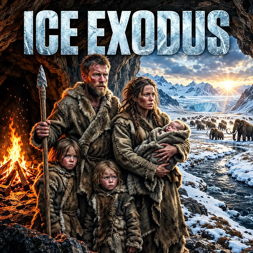
Life 20,000 Years Ago: The Ultimate Ice Age Fight to Survive
FAQs
What are some examples of landmarks used by prehistoric hunters for navigation?
Examples of landmarks used by prehistoric hunters for navigation include mountains, rivers, rock formations, and distinctive trees.
How did prehistoric hunters use landmarks for navigation?
Prehistoric hunters used landmarks as reference points to orient themselves and navigate through their surroundings. By recognizing and memorizing these natural features, they could create mental maps of the area.
Were landmarks used by prehistoric hunters for navigation still visible today?
Some landmarks used by prehistoric hunters for navigation are still visible today, while others may have eroded or changed over time due to natural processes or human activities.
Did prehistoric hunters use landmarks for navigation in all types of environments?
Prehistoric hunters used landmarks for navigation in various environments, including forests, plains, mountains, and coastlines. The types of landmarks they relied on could vary depending on the specific terrain.
How did the use of landmarks for navigation by prehistoric hunters contribute to their survival?
The use of landmarks for navigation by prehistoric hunters helped them navigate unfamiliar territories, locate valuable resources such as water and food sources, and avoid getting lost. This skill was crucial for their survival and successful hunting expeditions.