
The sands of North Africa whisper tales of empires long past, and among the most enduring legacies of Roman rule are its vast and remarkably sophisticated highway networks. These arteries of stone and packed earth, stretching across what is now Algeria, Tunisia, Libya, and Morocco, were far more than mere pathways; they were the sinews of Roman power, facilitating trade, troop movement, administration, and the dissemination of Roman culture across a diverse and often challenging landscape. To understand the Roman presence in North Africa is to trace these ancient routes, to marvel at their engineering prowess, and to appreciate their profound and lasting impact.
The Foundation of Roman Infrastructure: Engineering and Purpose
The Romans were masters of engineering, and their approach to road construction was characterized by meticulous planning, robust materials, and a deep understanding of the terrain. The construction of these North African highways was a monumental undertaking, requiring vast labor forces, often comprised of legions themselves, local levies, and skilled engineers. The primary purpose was strategic: to connect the vital coastal cities, rich in agricultural output and trade, with the interior and to secure the empire’s vast frontier.
Strategic Placement and Design Principles
The placement of Roman roads was dictated by military necessity and economic opportunity. Roads were designed to be direct, minimizing travel time for legions and couriers. Curves were often gentle, and gradients were carefully managed to allow for the efficient movement of heavy carts and military equipment. The standard Roman road construction involved several layers. The foundation, or statumen, consisted of large stones to provide a solid base. This was followed by the rudus, a layer of smaller stones and gravel, and then the nucleus, a finer layer of gravel and sand. The crowning layer, the summum dorsum, was typically paved with carefully fitted flagstones or compacted gravel, often slightly convex to allow for water drainage. In particularly marshy or sandy areas, more elaborate foundations might be employed, including the use of wooden piles. The dedication of these roads, often marked by milestones, underscored their importance and the pride the Romans took in their construction. These milestones, bearing the names of emperors and distances, served as tangible proof of Roman dominion and efficiency.
The Role of the Military in Road Construction
The Roman army was not just an instrument of conquest but also a formidable construction force. The construction and maintenance of roads were integral to military operations. Soldiers were trained in surveying, excavation, and masonry, skills that were applied to building fortifications, aqueducts, and, crucially, the extensive road network. The ability to quickly build and repair roads allowed for rapid troop deployment, facilitating the suppression of revolts, the defense of the frontier against nomadic tribes, and the projection of Roman authority across the vast expanse of North Africa. The military presence ensured the security of the roads, making them reliable conduits for communication and commerce, thereby integrating the region more firmly into the Roman Empire.
The intricate network of Roman highways across North Africa played a crucial role in the expansion and administration of the Roman Empire, facilitating trade, military movement, and cultural exchange. For a contemporary perspective on how transportation networks can influence development, you might find the article on cislunar space traffic management interesting. It explores the future of navigation and logistics beyond Earth, drawing parallels to historical networks like those of the Romans. You can read more about it here: Navigating the Future: Cislunar Space Traffic Management.
Key North African Roman Highway Networks: Tracing the Routes
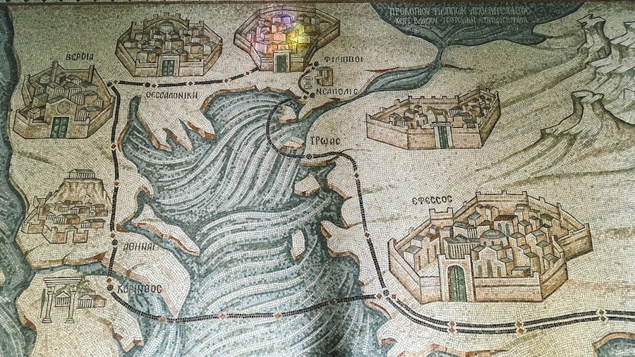
The Roman highway system in North Africa was not a single, monolithic entity but rather a complex web of interconnected routes that served different purposes and connected various regions. These roads facilitated the movement of goods, people, and ideas, transforming the economic and social landscape of the province.
The Limes Africanus: Securing the Southern Frontier
Perhaps the most famous and strategically significant of the Roman routes in North Africa was the Limes Africanus. This was not a single road but a series of fortified lines, roads, and outposts that marked the southern and eastern boundaries of Roman territory in North Africa, particularly in what is now southern Tunisia and western Libya. The Limes was designed to control the movement of nomadic tribes from the Sahara and to protect the fertile agricultural lands and settled populations within the Roman provinces. The roads associated with the Limes were crucial for troop patrols, supply lines, and rapid response to incursions. They connected forts, watchtowers, and defensive walls, creating a formidable barrier that asserted Roman control and defined the limits of their imperial ambition in the desert fringes. Traveling along the Limes provided access to strategically important oases and allowed for the monitoring of trade routes emanating from sub-Saharan Africa.
Coastal Routes: Arteries of Commerce and Administration
Stretching along the Mediterranean coast, a series of well-maintained Roman roads connected the major cities of Roman North Africa: Carthage, Utica, Hippos Regius (modern Bône, Algeria), Caesarea (modern Cherchell, Algeria), Leptis Magna, and Cyrene. These coastal routes were the lifeblood of the region’s economy, facilitating the export of grain, olive oil, wine, and other agricultural products to Rome and other parts of the empire, and the import of manufactured goods and luxury items. They also served as vital administrative arteries, enabling efficient communication between provincial capitals and the imperial bureaucracy. The presence of these well-traveled roads fostered the growth of prosperous cities and towns along the coastline, making North Africa a breadbasket of the Roman Empire. The infrastructure also supported the development of local markets and regional trade networks that extended beyond the immediate coastal strip.
Inland Connections: Linking Cities and Hinterlands
Beyond the coastal and frontier routes, a network of inland roads connected the major cities to their hinterlands and to each other. These roads were essential for surveying and controlling agricultural lands, accessing natural resources, and integrating the diverse populations of North Africa into the Roman sphere. For instance, roads extended from coastal cities like Carthage into the fertile agricultural plains of what is now Tunisia, reaching important inland centers. Similarly, routes connected the Roman settlements in Algeria to the interior, facilitating the exploitation of resources and the administration of a vast territory. These inland routes, while perhaps less grand than some of the coastal thoroughfares, were equally vital in knitting together the fragmented landscape and ensuring the effective governance and economic exploitation of Roman North Africa. The presence of these routes allowed for the movement of raw materials to processing centers and the distribution of finished goods to more remote settlements, fostering a more integrated provincial economy.
The Legacy of Roman Roads: Enduring Impact and Modern Relevance
The impact of Roman highway networks in North Africa extends far beyond the period of Roman rule. Their enduring physical remnants and the lasting influence they had on subsequent development continue to shape the region today.
Physical Remnants and Archaeological Evidence
Despite centuries of neglect, erosion, and the repurposing of materials, significant physical remnants of Roman roads can still be found across North Africa. Sections of paved roadways, bridge abutments, milestones, and the remains of roadside settlements offer tangible evidence of this once-extensive infrastructure. Archaeological excavations continually uncover new insights into their construction, usage, and the lives of those who traveled and maintained them. These physical remains are invaluable for historians and archaeologists seeking to reconstruct the Roman world and understand the logistical feats achieved by the empire. The sheer scale of some of these surviving sections, often remarkably well-preserved by the dry climate, allows for a visceral connection to the past and a tangible appreciation of Roman engineering.
Influence on Subsequent Infrastructure and Settlement Patterns
The routes established by the Romans often determined the locations of later roads and settlements. When subsequent rulers or colonial powers sought to develop infrastructure or establish new centers of population, they frequently followed the lines of least resistance, which had already been cleared and graded by the Romans. This is particularly evident in the persistent tendency for modern road networks to align with ancient Roman routes, especially along the coast and in strategically important inland valleys. The Roman presence and its associated infrastructure profoundly influenced settlement patterns, with many modern cities and towns in North Africa owing their origins to Roman road junctions, forts, or administrative centers. The legacy of these roads is embedded in the very geography of the region.
The Economic and Cultural Diffusion Facilitated by the Network
The Roman road network was a powerful engine for economic and cultural diffusion. By facilitating the rapid and secure movement of goods, people, and ideas, these highways helped to integrate North Africa into the wider Roman world. Roman laws, administration, language, and architectural styles spread along these routes, profoundly shaping the cultural identity of the region. The economic prosperity generated by trade along these roads supported the growth of urban centers and the development of a sophisticated agricultural economy. The constant flow of people, from soldiers and merchants to administrators and scholars, ensured the exchange of knowledge and the dissemination of Roman customs, contributing to a shared Romanitas that transcended local differences. This cultural exchange was not one-sided; Roman culture was also influenced by the diverse populations and traditions of North Africa, creating a unique synthesis.
Challenges and Innovations in North African Road Construction
Building and maintaining roads in North Africa presented unique challenges due to the region’s diverse and often harsh environment. The Romans responded to these challenges with ingenuity and adaptation, employing innovative construction techniques and materials.
Adapting to Arid and Desert Environments
The vast desert and semi-arid regions of North Africa posed significant obstacles to road construction. Maintaining a stable road surface in sandy soil, managing flash floods in wadis, and providing water sources for travelers and construction crews were critical issues. Roman engineers likely employed techniques such as the use of permeable materials in sandy areas to prevent subsidence, the construction of elevated causeways in flood-prone regions, and the establishment of water cisterns and wells along important routes. The careful selection of routes often took advantage of natural contours and existing drainage patterns to minimize the need for extensive earthmoving and to manage water effectively. The construction of well-engineered drainage channels and culverts was crucial to prevent the roads from being washed away during infrequent but intense rainfall.
Engineering Solutions for Diverse Topography
North Africa’s topography ranges from coastal plains and fertile valleys to rugged mountain ranges and rolling hills. Roman engineers had to adapt their construction methods to suit these varied landscapes. In mountainous regions, roads were often carved into hillsides, with retaining walls and bridges constructed to overcome steep gradients and span gorges. In flatter areas, the standard layered construction was employed. The construction of bridges, often using arches, was a testament to their mastery of engineering, allowing for the crossing of rivers and streams that would otherwise impede travel. The strategic placement of these bridges was critical for maintaining the continuity and efficiency of the network, ensuring that watercourses did not become insurmountable barriers to troop movements or trade.
The Importance of Maintenance and Repair
The longevity of the Roman road network was not solely due to its initial construction but also to a systematic approach to maintenance and repair. The Roman military and civilian authorities understood that a well-maintained road was essential for its intended purpose. Local garrisons and assigned civilian workforces were responsible for repairing potholes, clearing debris, and reinforcing damaged sections. The dedication of roads and the presence of milestones also served as reminders of the ongoing commitment to their upkeep, signifying the importance of this infrastructure to the imperial administration and the local economy. The system of curatores viarum (road overseers) ensured that funds and labor were allocated for repairs, preventing minor damage from escalating into major structural failures.
The intricate network of Roman highways across North Africa not only facilitated trade and military movements but also played a significant role in shaping the region’s socio-economic landscape. These ancient routes are a testament to the engineering prowess of the Romans and their ability to connect diverse cultures. For a deeper understanding of how environmental factors have influenced migration patterns in regions like North Africa, you can explore this insightful article on the impact of environmental migration on communities. The article provides valuable context on how historical infrastructure can affect modern societal changes, highlighting the lasting legacy of the Roman highway system. You can read more about it here.
The Enduring Significance of Roman North African Highways
| Highway Name | Region | Length (km) | Primary Cities Connected | Construction Period | Purpose |
|---|---|---|---|---|---|
| Via Augusta | North Africa (modern Tunisia and Algeria) | 350 | Hippo Regius, Carthage, Hippo Diarrhytus | 1st Century BC | Military and trade route |
| Via Hadriana | Libya | 400 | Leptis Magna, Cyrene, Sabratha | 2nd Century AD | Connecting major coastal cities |
| Via Nova Traiana | Egypt (Western Desert) | 250 | Qift, Berenice Troglodytica | 2nd Century AD | Trade and military access to Red Sea ports |
| Via Domitia | Morocco (Mauretania Tingitana) | 300 | Tingis, Volubilis, Lixus | 1st Century AD | Linking Roman settlements and military outposts |
| Via Militaris | North Africa (general) | Varied | Multiple military forts and cities | 1st-3rd Century AD | Military logistics and troop movement |
The Roman highway networks across North Africa represent a remarkable achievement of ancient engineering and a profound testament to the organizational capacity of the Roman Empire. These roads were more than just conduits for physical movement; they were instruments of conquest, tools of administration, and powerful agents of cultural and economic integration.
Facilitating Romanization and Imperial Control
The roads were instrumental in the Romanization of North Africa. By enabling the efficient movement of legions, officials, and settlers, they facilitated the dissemination of Roman culture, language, and legal systems. The security and reliability of the road network allowed for the effective administration of the provinces, the collection of taxes, and the projection of imperial authority over vast distances. This infrastructure was the backbone of Roman power, allowing the empire to exert control and extract resources from this strategically important region. The interconnectedness fostered by the road network allowed for a more unified provincial administration and the suppression of localized resistance, consolidating Roman rule.
The Economic Engine of Roman North Africa
The economic prosperity of Roman North Africa, particularly its role as a major grain producer and exporter, was heavily reliant on its robust road network. These highways enabled the efficient transport of agricultural produce from the fertile hinterlands to the coastal ports for export to Rome and other parts of the empire. They also facilitated trade within the region, fostering the growth of local markets and industries. The movement of goods and services along these routes stimulated economic activity and contributed to the wealth and development of the province, making it a vital component of the Roman imperial economy. The ease of transport lowered the cost of goods and encouraged specialization in agricultural production, further enhancing the economic output of the region.
A Lasting Monument to Roman Ingenuity
The enduring legacy of Roman roads in North Africa is a powerful reminder of the ingenuity and ambition of the Roman civilization. These ancient highways, some of which still exist as functional routes or visible archaeological features, stand as silent witnesses to the Roman Empire’s ability to overcome formidable geographical challenges and to build infrastructure that could endure for millennia. Their study continues to inform our understanding of Roman history, engineering, and the complex relationship between infrastructure and imperial power. The Romans built not just roads, but the very sinews of their empire, and in North Africa, those sinews still speak of a power that once spanned continents. The continued study and preservation of these routes are vital for understanding not only Roman history but also the long and complex development of North African societies.

The 2.7% Statistic That Terrifies Roman Historians
FAQs
1. How extensive was the Roman highway network in North Africa?
The Roman highway network in North Africa was extensive, covering thousands of miles and connecting major cities and settlements across the region.
2. What was the purpose of the Roman highways in North Africa?
The Roman highways in North Africa served multiple purposes, including facilitating trade, enabling efficient movement of troops, and promoting Roman cultural and political influence in the region.
3. How were the Roman highways in North Africa constructed?
The Roman highways in North Africa were typically built using a combination of techniques such as cutting through hills, bridging valleys, and paving with stones or gravel to ensure durability and usability in all weather conditions.
4. What were some of the key cities connected by the Roman highway network in North Africa?
Major cities such as Carthage, Leptis Magna, and Alexandria were connected by the Roman highway network in North Africa, facilitating communication and trade between these urban centers.
5. How did the Roman highway network impact the development of North Africa?
The Roman highway network played a significant role in the development of North Africa by promoting economic growth, cultural exchange, and administrative efficiency throughout the region, leaving a lasting legacy on the landscape and infrastructure of the area.