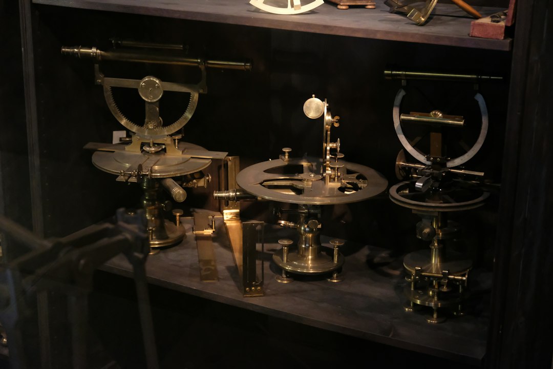
The rhythmic tap of a plumb bob against a stone, the careful stride of a surveyor, the glint of sunlight off a stretched cord – these were the hallmarks of ancient land measurement. In a world devoid of GPS satellites, laser levels, and sophisticated computation software, our ancestors possessed an ingenuity that allowed them to delineate boundaries, plan cities, construct monumental architecture, and manage agricultural lands with remarkable accuracy. These ancient surveying techniques, honed over millennia, reveal a profound understanding of geometry, astronomy, and the natural world. They were not merely rudimentary approximations; rather, they were sophisticated systems that laid the groundwork for modern surveying practices and continue to inspire awe at their effectiveness. The necessity of understanding and measuring land was paramount for early civilizations, driving the development of tools and methods that could withstand the test of time, both literally and figuratively.
The Foundation of Measurement: Simple Tools and Observational Skills
The cornerstone of any surveying endeavor, ancient or modern, lies in the fundamental act of measurement. Without the benefit of electronic devices, ancient surveyors relied on simple, yet effective, tools that were readily available or could be crafted with relative ease. These tools, combined with keen observational skills and a deep understanding of basic geometric principles, enabled them to tackle complex land management tasks.
Measuring Length and Distance: The Power of the Human Form and Natural Materials
The most basic unit of measurement in ancient societies was often derived from the human body. Hand spans, forearm lengths (the cubit), and foot lengths were common, though they introduced inherent variability. To overcome this, standardized units were developed, often tied to physical objects or manufactured lengths. For instance, ropes, meticulously knotted at regular intervals, served as early measuring tapes. These ropes, often made of natural fibers like flax or hemp, could be stretched taut to ensure consistent lengths. The Egyptians, for example, are known to have used knotted ropes to measure out fields, particularly after the annual flooding of the Nile. The length of these ropes would have been standardized and likely calibrated against known lengths, such as the royal cubit.
In addition to ropes, wooden rods and poles of specific lengths were also employed. These were more rigid and less prone to stretching, offering a degree of consistency. For longer distances, surveyors would employ a technique known as “chaining,” where a series of measured rods or ropes were laid end-to-end. This process required meticulous attention to detail, ensuring no gaps or overlaps between measurements. The concept of pacing, where a surveyor would count their steps, was also a fundamental method for estimating distances, with trained individuals developing a consistent stride length. Over time, these simple methods, when applied with diligence and standardized units, provided a surprisingly reliable means of quantifying the land. The challenge, of course, was maintaining uniformity and accuracy across different individuals and different stretches of land, requiring rigorous training and consistent application of established standards.
Establishing Right Angles: The Pythagorean Principle in Action
The ability to create a perfect right angle, or 90-degree corner, is crucial for defining rectangular plots of land, laying out building foundations, and constructing straight lines. Ancient surveyors developed ingenious methods to achieve this without protractors or compasses. The most famous and widely adopted technique utilized the principles of the Pythagorean theorem, even before its formal mathematical articulation. This involved using ropes with specific knot arrangements.
The 3-4-5 rope triangle is a classic example. A rope is knotted at points dividing it into three sections with lengths of 3, 4, and 5 units (e.g., 3 cubits, 4 cubits, 5 cubits). When the knot representing the junction of the 3-unit and 4-unit sections is placed at a point, and the ends of the rope are brought together to form a triangle, the angle opposite the 5-unit side will always be a perfect right angle. This method was incredibly versatile, allowing surveyors to establish the corners of fields, align walls, and create perpendicular lines with remarkable precision. Evidence of this technique has been found in various ancient civilizations, including Egypt, Mesopotamia, and Greece, suggesting its widespread recognition and application. The beauty of this method lies in its simplicity and its reliance on fundamental geometric relationships, making it accessible and effective for numerous surveying tasks.
Leveling and Elevation: Understanding the Horizontal Plane
Measuring the elevation of land and establishing a level plane was essential for irrigation, drainage, and constructing stable structures. Ancient surveyors developed several ingenious methods for this purpose. The plumb bob, a weight suspended from a string, was a fundamental tool for determining verticality. When the weight settles, the string hangs precisely perpendicular to the Earth’s gravitational pull, indicating the vertical line.
For establishing horizontal lines, the A-frame level was a common device. This consisted of an inverted V-shaped wooden frame, with a plumb bob suspended from the apex. When the bubble (or the plumb bob string) settled perfectly in the middle of the frame, the base of the A-frame was perfectly horizontal. Surveyors could then use this as a reference to transfer horizontal lines. Another technique involved using a water level. A long trough or channel filled with water would naturally establish a level surface. By observing the water’s surface at different points, surveyors could determine relative elevations. For more complex engineering projects, like aqueducts, surveyors would often work with a series of interconnected water levels or use sighting devices that allowed them to maintain a consistent gradient over long distances. The principle of water always finding its own level was a profound insight that greatly aided ancient engineers and surveyors in their quest for precise vertical control.
Ancient surveying techniques have long fascinated historians and archaeologists, revealing how early civilizations managed to create precise measurements without the benefit of modern tools. For instance, the use of simple instruments like the groma and the chorobates allowed the Romans to construct their impressive aqueducts and roads with remarkable accuracy. This topic is explored in depth in a related article that discusses the challenges and innovations in human exploration, including the potential for long-term habitation on the Moon. You can read more about this intriguing subject in the article found here: Securing Long-Term Human Presence on the Moon.
Celestial Navigation and Astronomical Alignment
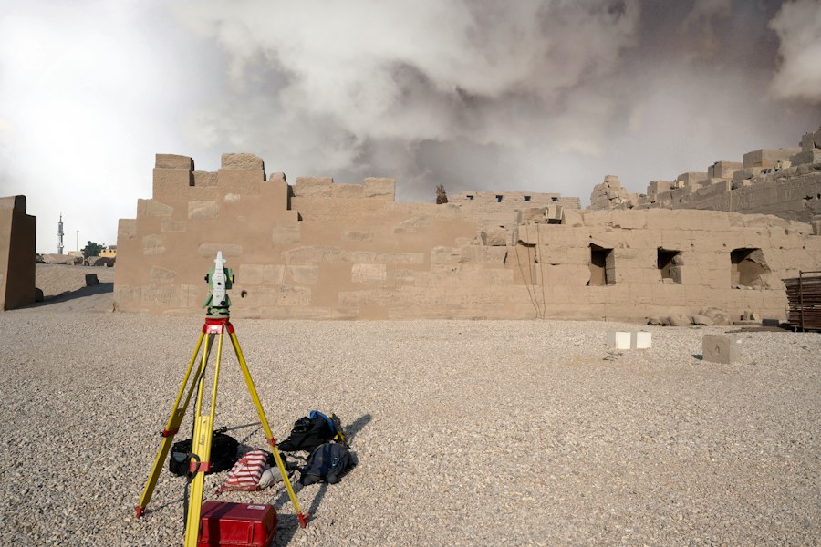
Beyond terrestrial measurements, ancient surveyors also looked to the heavens for guidance. The predictable movements of celestial bodies provided an invaluable framework for orientation, establishing cardinal directions, and even aligning monumental structures with astronomical events. This integration of astronomy into surveying demonstrated a sophisticated understanding of the cosmos and its relationship to the terrestrial world.
Determining North: The Pole Star and Solar Observations
Establishing the direction of North was a fundamental requirement for orientation and mapping. In the Northern Hemisphere, the Pole Star (Polaris) offered a constant and reliable marker. Due to its proximity to the celestial north pole, Polaris appears to remain almost stationary in the night sky, while other stars appear to revolve around it. Ancient surveyors would observe the position of Polaris to determine true North. This often involved setting up sighting devices or marking reference points aligned with the star.
During daylight hours, solar observations were employed. The sun rises in the east and sets in the west, reaching its highest point in the sky at solar noon, which is due South (in the Northern Hemisphere). By observing the shadow cast by a vertical object (a gnomon), surveyors could determine the direction of North. At solar noon, the shadow would be at its shortest and point directly North. Alternatively, they could use the sun’s position at sunrise and sunset, though this required more complex calculations or careful observation of a full diurnal cycle. The accuracy of these methods depended on the observer’s skill, the clarity of the sky, and the precision of their sighting instruments. The use of the sun’s position was particularly important for establishing East-West lines and for setting out buildings or land divisions that needed to align with the cardinal directions.
Aligning Structures with Celestial Events: Temples and Megaliths
A striking testament to the advanced surveying skills of ancient civilizations is the precise alignment of their monumental structures with astronomical phenomena. Many ancient temples, pyramids, and megalithic sites are oriented to coincide with solstices, equinoxes, or the rising and setting of specific stars. The Egyptians, for instance, meticulously aligned the Great Pyramid of Giza with the cardinal directions, demonstrating an understanding of true North with remarkable accuracy. The Great Pyramid’s sides are aligned to within a tiny fraction of a degree of true North, South, East, and West, a feat that continues to baffle modern engineers.
The builders likely used a combination of Polaris observations and solar methods to achieve this precision. Similarly, Stonehenge in England is famously aligned with the sunrise on the summer solstice. This alignment suggests that the builders understood the cyclical nature of the sun and incorporated this knowledge into their sacred architecture. These alignments were not merely decorative; they likely held deep religious and calendrical significance, allowing communities to track the seasons, plan agricultural cycles, and mark important religious festivals. The effort and precision involved in these celestial alignments underscore the integral role of astronomy in ancient surveying and construction practices. They reveal a worldview where the heavens were not distant, but intimately connected to the earthly realm and its organization.
The Art of Mapping: Representing the Earth’s Surface
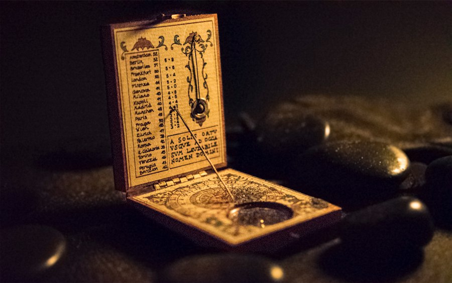
Translating the measured land onto a flat surface for record-keeping, planning, and communication was a critical aspect of ancient surveying. The development of maps, even in their most rudimentary forms, allowed for a spatial understanding of territories, resource management, and military strategy. These early maps, while lacking the detail and accuracy of modern cartography, were nonetheless powerful tools.
Early Forms of Cartography: From Symbolic Representations to Geometric Grids
The earliest forms of maps were often symbolic or schematic, depicting important landmarks, routes, and settlements rather than precise geographical features. Cave paintings and ancient pottery fragments sometimes contain rudimentary depictions of landscapes, which can be interpreted as early attempts at spatial representation. As societies became more complex, so too did their mapping needs.
The Babylonians created clay tablets with geographical information, often related to land ownership and irrigation systems. These maps might show the layout of fields, canals, and property boundaries. The Egyptians, with their need to re-establish boundaries after the annual Nile floods, developed sophisticated cadastral maps that detailed land ownership and divisions. These maps were often drawn on papyrus and showed considerable detail for their time.
The Greeks, particularly with the work of Anaximander and later Ptolemy, began to develop more systematic approaches to cartography, incorporating concepts of latitude and longitude. While they lacked the precise astronomical and surveying tools to implement these ideas perfectly, their theoretical contributions laid the groundwork for future mapmaking. The development of geometric grids and the use of scale, even if approximated, were significant steps towards creating more accurate and standardized representations of the Earth’s surface. These early maps served a vital purpose in organizing and understanding the world, paving the way for more advanced cartographic endeavors.
The Role of Plans and Layouts in Construction and Urban Planning
Beyond regional maps, ancient surveyors were also instrumental in creating detailed plans and layouts for construction projects and urban development. The construction of cities, temples, and fortifications required precise planning to ensure efficient use of space, defensibility, and functionality.
The Romans, renowned for their engineering prowess, excelled at urban planning. They created detailed plans for their cities, including grids of streets, the placement of public buildings, aqueducts, and defensive walls. Surveyors would use their tools to lay out these plans on the ground, marking out streets, foundations, and boundaries. This meticulous planning allowed for the creation of well-organized and durable urban environments that often served as models for centuries to come. The intricate layouts of Roman cities, with their regular street grids and centrally located forums, are a testament to the importance of surveying in their urban design. Similarly, the construction of large-scale agricultural estates, with their irrigation systems and field divisions, also relied heavily on detailed surveying plans to maximize efficiency and productivity. These plans were not merely drawings; they were blueprints for transforming raw land into functional and organized spaces.
Advanced Techniques and Specialized Instruments
As ancient civilizations progressed, so did their surveying techniques and the sophistication of their instruments. While still rooted in fundamental principles, these advancements allowed for greater accuracy and the ability to tackle more ambitious projects, from monumental architecture to intricate canal systems.
The Groma and Dioptra: Tools for Precision Sighting and Angle Measurement
Two particularly important instruments that emerged in the ancient world were the Groma and the Dioptra. The Groma, primarily used by Roman surveyors (agrimensores), was a T-shaped instrument with a vertical staff. From the ends of the horizontal bar, plumb bobs hung down. When the plumb bobs all hung at rest, the horizontal bar was perfectly level, and the staff was perfectly vertical. This allowed surveyors to establish perpendicular lines and right angles with considerable accuracy. By rotating the Groma, they could lay out squares, rectangles, and straight lines across the landscape. It was a crucial tool for dividing land, marking out building foundations, and creating the precise grids that characterized Roman urban planning.
The Dioptra, attributed to Heron of Alexandria, was a more complex and versatile instrument. It could be used for measuring angles, leveling, and determining distances. It typically consisted of a bronze disc with a rotating alidade (a sighting arm) and plumb bobs. The disc could be marked with degrees, allowing for the measurement of horizontal and vertical angles. By sighting along the alidade and reading the angle on the disc, surveyors could determine the relative positions of objects and the slopes of terrain. The Dioptra represented a significant leap forward in surveying technology, enabling more precise measurements and complex calculations. These instruments, while seemingly simple by modern standards, were cutting-edge technology in their time and were instrumental in the construction of many of the ancient world’s most impressive feats of engineering.
The Importance of Standardization and Training in Maintaining Accuracy
Even with sophisticated tools, the accuracy of ancient surveying was heavily reliant on the standardization of units and the rigorous training of surveyors. Inconsistent units of measurement would render even the most precise techniques unreliable. This is why the development and enforcement of standardized units, such as the royal cubit in Egypt or the foot in Roman practice, were so crucial. These units were often defined by official standards and meticulously reproduced.
Furthermore, surveyors underwent extensive training to ensure they understood the principles of geometry, astronomy, and the proper use of their instruments. In Roman society, for example, surveyors were a respected profession, and there were established schools and treatises on surveying practice. This formal training ensured that the knowledge and techniques were passed down accurately and consistently through generations. The meticulous nature of this training and the emphasis on standardization were vital for maintaining the integrity of land records, the stability of buildings, and the equitable distribution of resources across vast territories. Without these foundational elements, the impressive achievements of ancient surveying would have been impossible.
Ancient surveying techniques, which were employed long before the advent of modern tools, reveal a fascinating aspect of human ingenuity and adaptation. For instance, the Egyptians used simple tools like ropes and plumb bobs to create precise measurements for their monumental structures. This practice not only demonstrates their advanced understanding of geometry but also highlights the importance of accurate land measurement in ancient civilizations. If you’re interested in exploring how ancient methods can inform contemporary practices, you might find this article on commercial lunar payload services particularly insightful, as it discusses the implications of precision in modern contexts.
Legacy and Lasting Influence
| Ancient Civilization | Surveying Tools Used | Techniques | Accuracy | Purpose |
|---|---|---|---|---|
| Ancient Egypt | Rope stretchers, plumb bobs, leveling instruments | Use of knotted ropes for measuring distances; sighting with plumb bobs for vertical alignment | Within a few centimeters over short distances | Construction of pyramids, land division after Nile floods |
| Mesopotamia | Measuring rods, cords, leveling tools | Use of standardized rods for length; basic geometry for land measurement | Moderate accuracy for agricultural plots | Land ownership demarcation, irrigation planning |
| Ancient Greece | Dioptra, groma | Angular measurements using dioptra; right angles with groma | High accuracy for the time, angular measurements within 1° | Mapping, construction, astronomy |
| Roman Empire | Groma, chorobates, measuring chains | Use of groma for right angles; chorobates for leveling; chains for distance | Accuracy within a few centimeters over hundreds of meters | Road building, land division, aqueduct construction |
| Ancient China | Gnomon, measuring rods, sighting tubes | Shadow measurement for angles; use of rods for distance; sighting tubes for alignment | Good accuracy for astronomical and land surveying | Astronomy, calendar making, land measurement |
The ancient surveying techniques, born out of necessity and refined through centuries of practice, have left an indelible mark on the world. Their ingenuity and effectiveness continue to resonate, providing a historical context for modern practices and inspiring an appreciation for the fundamental principles that underpin land measurement.
The Foundation of Modern Surveying Principles
The core principles employed by ancient surveyors – the use of triangulation, the establishment of baseline measurements, the understanding of angles and parallel lines, and the reliance on fundamental geometric theorems – remain the bedrock of modern surveying. While the tools have evolved dramatically, the underlying logic and mathematical relationships are remarkably similar. The ancient development of methods for establishing right angles, for instance, is a direct precursor to the use of transit instruments and electronic distance measurement (EDM) devices today. Similarly, the concept of using celestial bodies for orientation has evolved into the sophisticated techniques of astronomical positioning and the use of global navigation satellite systems (GNSS). Ancient surveyors were, in essence, the pioneers of a discipline that continues to shape our built environment and our understanding of the planet.
Enduring Examples of Precision and Ingenuity
The enduring legacy of ancient surveying can be seen in the remarkable precision of structures that have stood for millennia. The alignment of the pyramids, the intricate layout of Roman cities, and the sophisticated irrigation systems of ancient civilizations all stand as testaments to the skill and dedication of their surveyors. These achievements were not accidental; they were the direct result of meticulous planning, careful measurement, and a deep understanding of the physical world.
These ancient techniques also demonstrate the power of problem-solving with limited resources. Faced with challenges, ancient peoples found innovative solutions using readily available materials and fundamental scientific principles. This spirit of ingenuity serves as a valuable lesson, reminding us that technology, while powerful, is often an extension of fundamental knowledge and a creative application of observable phenomena. The methods developed by these ancient practitioners, in their elegance and effectiveness, continue to inspire awe and serve as a reminder of humanity’s enduring quest to understand and shape the world around us.
They Dug Water Tunnels Under the Desert… And They Still Flow
FAQs
What tools did ancient surveyors use before modern technology?
Ancient surveyors used simple tools such as ropes, plumb bobs, sighting poles, and measuring rods to measure distances and angles.
How did ancient surveyors determine direction without a compass?
Ancient surveyors often used the sun, stars, and landmarks to determine direction. They could also use a groma, a simple instrument that helped establish right angles.
What methods did ancient surveyors use to measure land area?
Ancient surveyors used a method called triangulation, where they would measure the sides of a triangle and calculate the area based on those measurements. They also used the chain method, where distances were measured using a chain made of metal links.
How accurate were ancient surveying techniques compared to modern methods?
Ancient surveying techniques were surprisingly accurate, with some structures built thousands of years ago aligning almost perfectly with cardinal directions. However, modern technology has significantly improved accuracy and efficiency in surveying.
Were ancient surveyors able to create detailed maps without modern tools?
Ancient surveyors were able to create detailed maps by carefully recording measurements, landmarks, and natural features. While these maps may not have been as precise as modern maps, they provided valuable information for navigation and land management.