The Whispers of the Desert: Ground-Truthing AI’s Desert Discoveries
For decades, the enigmatic geoglyphs of the Nazca Lines in Peru have captivated archaeologists and the public alike. Etched into the arid plains of the Nazca Desert, these colossal figures – animals, plants, and geometric shapes – have defied easy explanation, sparking theories ranging from astronomical calendars to extraterrestrial interventions. While traditional methods of observation and excavation have yielded significant insights, the sheer scale of the Nazca region and the subtlety of some of its less prominent features have presented persistent challenges. Enter artificial intelligence. In recent years, AI algorithms, particularly those trained on vast datasets of satellite imagery, have demonstrated an uncanny ability to identify potential new geoglyphs, often detecting patterns invisible to the human eye. However, the promise of AI-driven discovery necessitates a rigorous counterpart: the meticulous work of ground-truthing. This article delves into the critical process of archaeologists physically examining the sites flagged by AI, transforming digital hypotheses into tangible archaeological evidence.
The integration of AI into archaeological research represents a significant technological leap, offering the potential to accelerate discovery and refine our understanding of ancient landscapes. AI’s capacity to analyze patterns across massive geographical areas, identify subtle variations in terrain, and even differentiate between natural geological formations and human-made features is revolutionary. Yet, the digital realm, however sophisticated, cannot wholly replace the tactile and contextual understanding that seasoned archaeologists bring to a site. Ground-truthing is the bridge between the abstract world of algorithms and the concrete reality of the past, ensuring that AI’s pronouncements are not merely digital phantoms but genuine remnants of human endeavor. This process is not a simple verification exercise; it is a complex, multi-faceted investigation that involves careful planning, sophisticated surveying techniques, and a deep understanding of the Nazca culture and its environment.
The application of AI in this context is not a single monolithic technology but rather a suite of tools. Machine learning algorithms are trained on existing known geoglyphs, learning to recognize their characteristic shapes, sizes, and contexts within the desert landscape. These algorithms can then scan new imagery, highlighting areas that exhibit similar statistical properties. The challenge then becomes discerning which of these AI-flagged anomalies are truly ancient human creations and which are natural phenomena, such as erosion patterns, mineral deposits, or even modern agricultural features. This is where the expertise of archaeologists becomes indispensable. Their ability to interpret subtle topographical changes, understand soil composition, and recognize the specific techniques used by ancient peoples to create the Nazca Lines is crucial for accurate identification and preservation.
In a fascinating intersection of technology and archaeology, researchers are utilizing advanced AI tools to analyze the enigmatic Nazca Lines in Peru, which have puzzled scholars for decades. An article discussing the implications of such technological advancements can be found here: Securing the Moon: Lunar Base Defense Strategies and Systems. This exploration not only sheds light on the ancient geoglyphs but also highlights the innovative methods archaeologists are employing to ground-check these massive designs, ensuring that the preservation of cultural heritage is maintained while leveraging modern science.
The Analytical Eye: How AI Scans the Desert Floor

The initial stage of AI’s involvement in Nazca geoglyph discovery relies on sophisticated image analysis. Satellite imagery, often captured at high resolutions and from various angles, forms the bedrock of these AI models. These datasets provide an unparalleled overview of the vast Nazca desert. The AI algorithms are trained to identify telltale signs of geoglyph creation, which often involve the removal of darker, iron-oxide-rich desert varnish from the surface to expose lighter soil underneath. Subtle differences in elevation, changes in vegetation patterns that might be influenced by ancient soil disturbance, and even variations in thermal signatures can be indicators that an AI can detect.
The process typically begins with a large-scale digital scan of the Nazca region. The AI software, programmed with specific parameters derived from known geoglyphs, sifts through millions of pixels, looking for patterns that match its learned features. This might involve identifying straight lines of a certain length and orientation, curves that form recognizable shapes, or clusters of linear features that suggest a deliberate design. The algorithms are designed to be sensitive to even minor topographical disturbances, which can be incredibly subtle in a landscape shaped by wind and erosion. For instance, a faint ridge or a slight depression that would be easily overlooked by a casual observer might be flagged by the AI as a potential anomaly.
Training the Digital Archaeologist: The Importance of Data
The efficacy of any AI system hinges on the quality and quantity of the data it is trained on. In the case of Nazca geoglyph identification, this means feeding the AI with extensive datasets of already documented geoglyphs. These documented examples serve as the “ground truth” for the AI, allowing it to learn the visual characteristics and contextual features that define a geoglyph. This includes not only the outline of the figures but also their scale, their relationship to the surrounding terrain, and the typical types of geological formations they are found within. The more diverse and representative the training data, the more accurate the AI’s predictions will be.
This training process involves meticulous cataloging of existing geoglyphs, including their precise coordinates, dimensions, and visual attributes. Researchers might also include data on geological context, such as soil type and topography, to help the AI understand the environmental factors that influenced the creation and preservation of these ancient art forms. Challenges in this stage include the fact that many geoglyphs are partially eroded or have been subject to natural processes for centuries, meaning the AI needs to be trained to recognize both clear and degraded examples. Furthermore, the AI must learn to differentiate between human-made lines and natural geological features that might coincidentally resemble them.
Identifying the Anomalies: From Pixels to Potential Discoveries
Once trained, the AI system is deployed to analyze new, unseen satellite imagery of the Nazca region. The software systematically scans the landscape, comparing observed patterns with its learned models of geoglyph characteristics. Areas that exhibit a high degree of similarity to known geoglyphs, or that present novel but statistically significant patterns, are flagged as potential discoveries. These flags are not definitive pronouncements of a new geoglyph but rather alerts to areas that warrant further investigation. The output of the AI is typically a set of coordinates or highlighted regions on a map, indicating where potential geoglyphs might be located.
The AI’s identification process can be refined through various parameters. Researchers can adjust the sensitivity of the algorithm to focus on specific types of figures (e.g., zoom in on animal shapes) or to look for features of a certain minimum size. The AI might also be programmed to consider the proximity of flagged anomalies to known archaeological sites or other cultural features, further increasing the likelihood of a genuine discovery. The sheer volume of data processed by the AI means it can identify potential geoglyphs that might have been missed by human observers relying on manual visual inspection of the same imagery, especially those that are faint, partially obscured, or located in remote areas.
The Archaeologist’s Footprint: Navigating the Desert for Verification

The true test of an AI’s discovery begins when archaeologists physically venture into the desert to examine the flagged locations. This “ground-truthing” phase is labor-intensive, requiring meticulous fieldwork and a deep understanding of archaeological principles. It involves navigating the challenging desert terrain, often under harsh environmental conditions, to reach the precise coordinates identified by the AI. The goal is to determine if the flagged anomaly is indeed a geoglyph, and if so, to document its characteristics and context.
This phase is not about confirming a pre-determined finding but rather about an open-ended investigation. Archaeologists approach each flagged site with a critical and inquisitive mindset. They are not merely looking for what the AI predicted but are also open to discovering other archaeological features or understanding the geological processes that might have created the observed anomaly. The physical presence on the ground allows for a level of detail and interpretation that is simply not possible from satellite imagery alone.
Planning the Expedition: Precision and Preparedness
Before setting foot in the desert, extensive planning is undertaken. This involves detailed review of the AI-generated maps, cross-referencing flagged locations with existing topographical data and known archaeological sites. Archaeologists consider the most efficient routes for accessing these remote areas, often requiring off-road vehicles or even hiking. Essential equipment includes GPS devices for precise navigation, surveying tools like total stations or even simple measuring tapes and stakes for detailed mapping of any discovered features, cameras for comprehensive photographic documentation, and soil sampling kits for analysis.
The team’s composition is also crucial. It typically includes experienced archaeologists with expertise in the Nazca culture, geologists to help differentiate between natural and anthropogenic formations, and skilled surveyors to accurately map any findings. Safety is paramount in the harsh desert environment, so plans also include provisions for water, communication, and emergency procedures. The team must be prepared for unexpected challenges, such as sandstorms or difficult terrain, and possess the flexibility to adapt their plans accordingly.
On the Ground: Walking the Lines
Upon reaching a flagged location, the archaeologists begin a systematic examination. This involves carefully walking the area, visually inspecting the ground for any signs of human activity. They are looking for disruptions in the natural landscape that are consistent with geoglyph creation techniques – the removal of the dark desert varnish to expose lighter soil, the creation of shallow trenches, or the arrangement of stones. The scale of the geoglyphs means that even if the AI has flagged a general area, archaeologists will meticulously survey a wider perimeter to ensure no part of the feature is missed.
The process of ground-truthing often involves a combination of visual observation and tactile investigation. Archaeologists might kneel to examine the soil composition, looking for evidence of disturbance or the distinctive patina that forms on exposed soil over time. They will pay close attention to the edges of any potential lines or shapes, noting their clarity and consistency. The presence of any associated artifacts, such as pottery sherds or stone tools, can also provide crucial context and further support the identification of a geoglyph. The trained eye of an archaeologist can often detect subtle clues that a machine might miss, such as the characteristic way ancient people would have cleared debris or smoothed surfaces.
Documenting the Evidence: From Field Notes to Digital Archives
Once a potential geoglyph is identified on the ground, the process of meticulous documentation begins. This is a critical step that transforms a fleeting observation into enduring archaeological data. The information gathered here will be used to refine AI models, inform future research, and contribute to the broader understanding of the Nazca culture. This documentation goes beyond simple photographs; it involves detailed recording of spatial data, environmental context, and the characteristics of the geoglyph itself.
The thoroughness of this documentation is essential for ensuring the longevity and accessibility of the findings. The harsh desert environment poses a constant threat to the preservation of these ancient features, making accurate and comprehensive records even more vital. The collected data forms the foundation for future analyses and serves as a permanent record of the discoveries made.
Mapping and Measurement: Precision in the Field
Accurate spatial data is paramount. Archaeologists use GPS devices to record the precise geographical coordinates of the identified geoglyph. For more detailed analysis and mapping, they may employ surveying equipment like total stations, which allow for the precise measurement of distances, angles, and elevations. This data is used to create detailed maps of the geoglyph, showing its exact dimensions, orientation, and relationship to the surrounding landscape. This includes mapping the width and depth of any lines or trenches, the overall dimensions of figures, and the spatial distribution of associated features.
The level of detail in this mapping is crucial for understanding the construction techniques and the intended design of the geoglyph. For example, precise measurements can reveal whether lines are perfectly straight or intentionally curved, and the dimensions of figures can be compared to known iconography. This spatial data is also invaluable for integrating the new discovery with existing GIS (Geographic Information System) databases, allowing for complex spatial analyses and comparisons with other archaeological features.
Photographic and Descriptive Records: Capturing the Details
Comprehensive photographic documentation is undertaken from multiple angles and at various scales. This includes overview shots that capture the geoglyph within its landscape context, as well as close-up images that highlight specific details of its construction and condition. Photogrammetry techniques may also be employed, where multiple overlapping photographs are used to create detailed 3D models of the geoglyph. This provides a highly accurate and interactive representation of the feature, allowing for virtual exploration and analysis long after the fieldwork is complete.
In addition to photographs, detailed written descriptions are essential. Archaeologists record their observations on the condition of the geoglyph (e.g., degree of erosion, presence of damage), the type of soil exposed, the nature of the surrounding topography, and any evidence of associated artifacts. This descriptive information adds a crucial layer of qualitative data that complements the quantitative measurements and photographic records, providing a holistic understanding of the discovery. This might include notes on the clarity of the lines, the presence of any subtle variations in the soil, or the visual impact of the figure within the landscape.
Recently, archaeologists have been conducting ground checks on the Nazca AI flags, which have sparked considerable interest in the archaeological community. These flags, believed to be linked to the ancient Nazca civilization, have raised questions about their purpose and significance. For those interested in exploring how technology intersects with archaeology, a related article discusses the advancements in electronics manufacturing in Mexico and how these innovations can aid in archaeological research. You can read more about this fascinating topic in the article here.
Interpreting the Findings: Context and Cultural Significance
| Metric | Value | Description |
|---|---|---|
| Number of AI-Flagged Sites | 15 | Number of potential archaeological sites identified by AI in the Nazca region |
| Sites Ground-Checked | 12 | Number of AI-flagged sites physically inspected by archaeologists |
| Confirmed Archaeological Features | 9 | Sites where ground checks verified the presence of archaeological features |
| False Positives | 3 | AI-flagged sites that did not show archaeological significance upon ground check |
| Accuracy Rate | 75% | Percentage of AI-flagged sites confirmed by ground inspection |
| Average Time per Ground Check | 4 hours | Average duration spent by archaeologists inspecting each flagged site |
| Area Covered per Site | 2 hectares | Average size of the area examined during ground checks |
The process of ground-truthing doesn’t end with the physical verification and documentation of a potential geoglyph. The collected data then feeds into a broader analytical phase, where archaeologists interpret the findings within their cultural and environmental context. This interpretation is crucial for understanding not just what was found, but why it was created and what it tells us about the Nazca people. The integration of AI-flagged discoveries with existing knowledge allows for a more nuanced and comprehensive understanding of this ancient civilization.
This interpretative stage is where the collaboration between AI and human expertise truly shines. While AI can identify patterns and anomalies, it is the human archaeologist who can weave these findings into the larger narrative of the Nazca culture, drawing upon decades of research and understanding. This iterative process of discovery, verification, and interpretation is what drives archaeological progress forward.
Comparing with Known Patterns: The AI’s Refined Vision
The data collected from ground-truthing is fed back into the AI models. This feedback loop is vital for improving the accuracy and efficiency of future AI-driven discoveries. If a flagged anomaly turns out to be a genuine geoglyph, the detailed information about its characteristics (size, shape, orientation, context) can be used to refine the AI’s learning parameters. This allows the AI to become more adept at distinguishing true geoglyphs from natural formations in the future. Conversely, if a flagged anomaly is determined to be a natural feature, this information also helps the AI learn to avoid such misidentifications.
This iterative refinement is key to the long-term success of using AI in archaeology. It allows the technology to evolve alongside our understanding of the Nazca Lines. The AI becomes a more sophisticated tool, capable of identifying even fainter or more complex patterns, and better equipped to avoid false positives. This constant learning process ensures that the AI remains a valuable asset rather than a static technological solution.
Unraveling the Purpose: Connecting the Dots
The ultimate goal of archaeological research is to understand the purpose and meaning behind the artifacts and features we discover. For the Nazca Lines, this remains a subject of ongoing debate, with theories ranging from agricultural rituals and astronomical observatories to water cults and shamanic practices. New geoglyphs identified through AI and subsequently ground-truthed can provide fresh data points that challenge or support existing hypotheses.
For instance, the discovery of a new geoglyph in proximity to a known ceremonial site might strengthen theories linking the lines to ritualistic activities. The shape and orientation of a newly found figure could offer clues about astronomical alignments. The presence of associated artifacts could shed light on the specific practices or beliefs of the people who created and utilized these vast designs. By integrating these new discoveries into the existing body of knowledge, archaeologists can gradually build a more comprehensive picture of the Nazca culture and their motivations for creating these extraordinary desert art forms. The ground-truthing of AI flags is not just about finding new lines; it’s about adding new chapters to the ancient story of the Nazca people.
Recently, archaeologists have been conducting ground checks on the Nazca AI flags, which has sparked significant interest in the intersection of technology and archaeology. This innovative approach aims to verify the findings of artificial intelligence in identifying ancient geoglyphs. For those intrigued by the complexities of historical maps and their interpretations, a related article explores the Piri Reis map controversy, shedding light on how ancient cartography continues to captivate researchers. You can read more about it in this insightful piece here.
The Future of Discovery: A Symbiotic Relationship
The synergy between artificial intelligence and human archaeological expertise represents a transformative approach to uncovering the past. The Nazca Lines, with their immense scale and subtle details, are a prime example of how AI can amplify human capabilities. AI’s ability to process vast amounts of data and identify patterns invisible to the naked eye opens up new frontiers for discovery, while the meticulous work of archaeologists on the ground ensures that these digital whispers are translated into tangible archaeological evidence.
This partnership is not a case of technology replacing human intuition and knowledge, but rather augmenting it. AI provides a powerful lens through which to survey the landscape, highlighting areas of interest. Archaeologists, with their deep understanding of culture, context, and the physical environment, provide the critical interpretative and verification layer. This symbiotic relationship is crucial for ensuring that discoveries are not only made but are also accurately understood and preserved for future generations.
The ongoing refinement of AI algorithms, coupled with continued fieldwork, promises to reveal even more about the Nazca culture. As AI becomes more sophisticated and archaeologists become more adept at collaborating with these digital tools, the potential for new discoveries is immense. The Nazca desert, a canvas of ancient artistry, continues to yield its secrets, with the digital eye and the human foot working in tandem to decipher its timeless messages. This fusion of cutting-edge technology and traditional archaeological practice is not merely an advancement; it is a redefinition of how we explore and understand our shared human heritage.
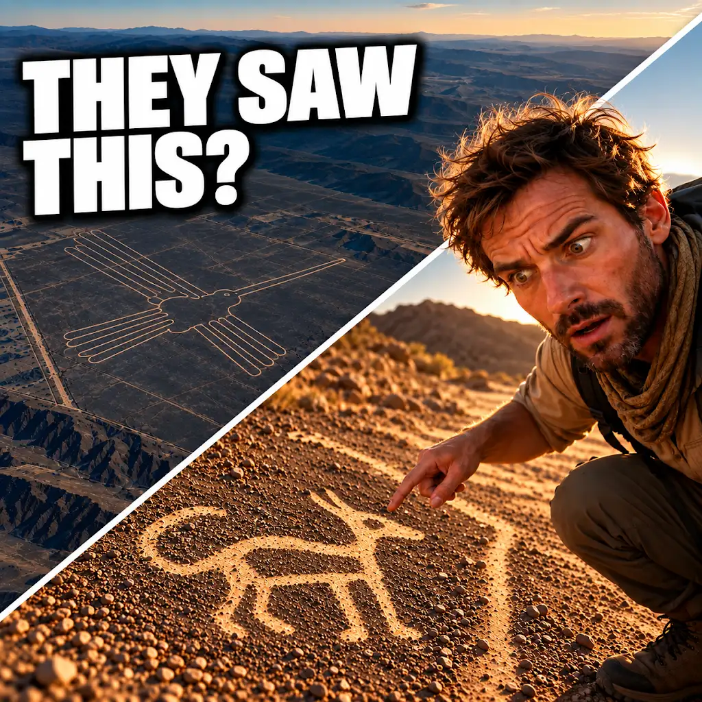
AI Found New Nazca Drawings—Could People See Them from the Ground?
FAQs
What is the purpose of the article “Archaeologists ground check Nazca AI flags”?
The purpose of the article is to discuss how archaeologists are using artificial intelligence (AI) technology to study and analyze the Nazca Lines in Peru.
What are the Nazca Lines?
The Nazca Lines are a series of ancient geoglyphs located in the Nazca Desert in southern Peru. They are large designs created in the ground by removing rocks and earth to reveal the lighter-colored soil underneath.
How are archaeologists using AI technology to study the Nazca Lines?
Archaeologists are using AI technology to analyze high-resolution satellite images of the Nazca Lines. The AI algorithms can detect subtle differences in the landscape that may indicate the presence of previously undiscovered geoglyphs.
What have archaeologists discovered through the use of AI technology in studying the Nazca Lines?
Archaeologists have discovered new geoglyphs and other ancient structures that were previously unknown. The AI technology has helped researchers identify these features more efficiently and accurately than traditional methods.
Why are the Nazca Lines significant to archaeologists and historians?
The Nazca Lines are significant because they provide valuable insights into the culture and beliefs of the ancient Nazca people. The designs are thought to have had ceremonial or religious significance, and studying them can help researchers better understand the history of the region.