
The thawing Arctic presents a landscape of both opportunity and tension, a stark reality that has compelled five nations to reassess and, in some cases, practically redraw their territorial claims. The ephemeral nature of ice, once a steadfast boundary, has exposed the seabed and resources previously locked away, prompting a flurry of activity from the nations bordering this rapidly changing region. This is not a matter of sudden revelation, but rather the culmination of years of scientific inquiry, evolving geopolitical considerations, and a pragmatic response to shifting environmental conditions. The title, “Arctic Maps Erased: 5 Nations Take Action,” encapsulates this period of re-evaluation and the concrete steps being taken by these key players.
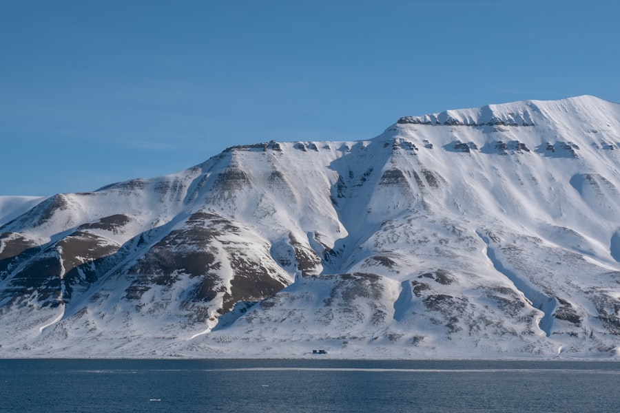
The Arctic, a region historically defined by its frozen expansity, is undergoing a profound transformation. This transformation is not solely atmospheric; it has direct implications for the territorial claims and resource access of the five nations with Arctic coastlines: Russia, Canada, Denmark (via Greenland), Norway, and the United States. The retreat of sea ice, a phenomenon directly linked to anthropogenic climate change, has unveiled new avenues for navigation, resource extraction, and strategic positioning. Consequently, the established cartographic representations of Arctic sovereignty, particularly concerning extended continental shelves, are being rigorously examined and, in some instances, actively contested or redefined.
The Science of Submerged Frontiers
The scientific impetus behind these revisions lies in the UN Convention on the Law of the Sea (UNCLOS). Article 76 of UNCLOS allows coastal states to extend their continental shelf beyond the 200-nautical-mile limit if they can prove that the geological features of the seabed are a natural prolongation of their landmass. This has led to extensive bathymetric surveys, seismic research, and geological analyses undertaken by these nations.
Unveiling the Lomonosov Ridge and its Implications
One of the most prominent areas of scientific investigation has been the Lomonosov Ridge, a submarine mountain range that traverses a significant portion of the Arctic Ocean. Russia, in particular, has focused considerable resources on demonstrating that this ridge is geologically connected to its continental shelf. Their submissions, supported by substantial scientific data, aim to assert sovereign rights over hydrocarbon and mineral resources present in this extended zone.
The Data Collection Challenge
The sheer scale and harsh environment of the Arctic present immense logistical and financial challenges to data collection. Specialized icebreaker vessels, advanced sonar and seismic equipment, and highly trained scientific personnel are required to conduct these surveys effectively. Despite these difficulties, the potential economic and strategic rewards have fueled sustained research efforts.
Beyond the Ridge: Other Submerged Extensions
While the Lomonosov Ridge has garnered significant attention, scientific efforts extend to other potential seabed extensions. Canada, Denmark, and Norway are also actively engaged in similar research to delineate and claim their respective extended continental shelves. These claims, while geographically distinct, are all driven by the same fundamental principle of UNCLOS: the right to exploit the natural resources of the seabed beyond the 200-nautical-mile exclusive economic zone.
The Interplay of Geology and Geopolitics
The scientific data collected directly informs geopolitical maneuvering. A strong geological case for an extended continental shelf strengthens a nation’s claim and provides a basis for challenging the claims of others. This has created a dynamic where scientific endeavor is inextricably linked to strategic national interests.
The Legal Framework: UNCLOS as the Arbiter
The United Nations Convention on the Law of the Sea (UNCLOS) is the primary legal framework governing maritime claims in the Arctic. While all five nations are signatories, the interpretation and application of its provisions, particularly Article 76, remain central to the current discourse.
The Commission on the Limits of the Continental Shelf (CLCS)
The CLCS is the UN body responsible for examining the submissions made by coastal states regarding their extended continental shelves. Its recommendations are scientific and technical, but they carry significant weight in the international legal arena.
Navigating the CLCS Process
The submission process to the CLCS is complex and lengthy. Nations must meticulously compile vast amounts of data and present a coherent geological argument. The CLCS then reviews these submissions, often requesting further information or clarification. This deliberative process can take years, contributing to the protracted nature of Arctic territorial adjustments.
Reservations and Interpretations
While UNCLOS provides a framework, certain nuances and interpretations can lead to disagreements. The definition of “natural prolongation” and the assessment of geological continuity are areas where differing perspectives can emerge, particularly when claims overlap or are in close proximity.
The Shadow of Non-Ratification
The United States, despite actively participating in Arctic governance and upholding many UNCLOS principles, has not ratified the convention. This unique position can, in some legal interpretations, complicate its ability to formally submit claims for an extended continental shelf under the UNCLOS framework, although it still asserts its rights based on customary international law and other legal principles.
In light of the recent decision by five nations to erase Arctic maps, it is crucial to understand the broader implications of such actions on global geopolitics and environmental policies. This move has sparked discussions about territorial claims and resource management in the rapidly changing Arctic region. For those interested in how national emergencies and preparedness play a role in these geopolitical shifts, a related article offers essential insights on the topic. You can read more about it in this article on preparing your home for national emergencies: Preparing Your Home for National Emergencies: Essential Tips.
Russia’s Assertive Arctic Presence: From Scientific Expeditions to Strategic Posts
Russia, with its vast Arctic coastline and long history of Arctic exploration and resource development, has been particularly proactive in asserting its claims. The nation has not only undertaken extensive scientific expeditions to bolster its legal arguments but has also demonstrably increased its military and economic presence in the region.
The Polar 2007 and 2008 Expeditions: Laying the Scientific Groundwork
Two landmark expeditions, “Polar 2007” and “Polar 2008,” were crucial for Russia’s efforts to establish its geological connection to the Lomonosov Ridge. These expeditions involved deploying submersibles to the seabed at the North Pole, collecting rock samples, and conducting seismic surveys.
The Significance of Geological Sampling
The rock samples collected from the seabed were analyzed to determine their origin and geological composition. Russia’s scientific findings aimed to demonstrate that the Lomonosov Ridge is a continental fragment that broke off from the Eurasian landmass, thus forming a natural prolongation of its continental shelf.
International Scrutiny of the Data
While Russia presented its findings as conclusive, they have faced scrutiny from the international scientific community and other Arctic nations. Questions have been raised regarding the interpretation of the data and the methodologies employed.
Re-establishing Northern Sea Route Infrastructure
Beyond territorial claims, Russia has been investing heavily in the Northern Sea Route (NSR), a crucial shipping lane that could become increasingly viable as Arctic sea ice recedes. This initiative involves modernizing ports, expanding icebreaker fleets, and developing infrastructure along the coast.
The Economic Imperative of the NSR
The NSR offers a significantly shorter transit route between Europe and Asia compared to traditional routes via the Suez Canal. Russia envisions it as a major global shipping artery, generating substantial economic benefits.
Challenges and Opportunities for Global Shipping
While the potential is clear, the NSR still faces challenges including extreme weather, limited infrastructure beyond Russian waters, and the need for specialized ice-capable vessels. However, for nations seeking to reduce transit times, it presents a growing opportunity.
Military Modernization and Strategic Positioning
Russia has also been actively modernizing its military infrastructure in the Arctic, reopening Soviet-era bases and establishing new military installations. This includes the deployment of advanced weaponry and naval assets.
The Dual Nature of Military Presence
These military deployments are framed by Russia as necessary for defending its Arctic territories and ensuring the security of its economic activities. However, they are also viewed with concern by other Arctic nations as a potential destabilizing factor in the region.
Balancing Security and Cooperation
The increasing military footprint in the Arctic highlights the delicate balance between national security interests and the need for regional cooperation in an environmentally sensitive area.
Canada’s Arctic Ocean Defense: Asserting Sovereignty in a Changing North
Canada’s response to the evolving Arctic landscape has been characterized by a strong emphasis on asserting its sovereignty, particularly in the waters of the Canadian Arctic Archipelago. The nation has focused on increasing its presence, modernizing its military capabilities, and engaging in scientific research to support its claims.
The Arctic Patrol Vessel Program: A Visible Presence
A key component of Canada’s strategy has been the development and deployment of a new fleet of Arctic Offshore Patrol Vessels (AOPVs). These vessels are designed to operate in Arctic conditions and provide a visible Canadian presence throughout the region.
Enhancing Maritime Domain Awareness
The AOPVs are intended to enhance Canada’s ability to monitor its maritime domain, conduct search and rescue operations, and enforce its sovereignty in the Arctic.
The Importance of Indigenous Consultation
Canada’s approach to Arctic sovereignty often includes consultation with Indigenous communities, recognizing their historical presence and rights in the region. This collaborative element is seen as crucial for building sustainable and legitimate claims.
Resource Exploration and Environmental Protection
Canada has also been active in exploring for potential hydrocarbon and mineral resources within its Arctic territories and adjacent waters. This is conducted alongside a commitment to environmental protection and sustainable development.
Navigating the Economic Potential
The economic potential of Arctic resources is a significant factor driving Canadian policy. However, this must be balanced with the need to protect the fragile Arctic environment.
The Role of Environmental Impact Assessments
Rigorous environmental impact assessments are a critical part of any resource development project in the Canadian Arctic, aiming to mitigate potential harm to ecosystems and wildlife.
Scientific Research and Data Collection for Claims
Canada has invested in scientific research programs to gather data that supports its claims to an extended continental shelf under UNCLOS. This includes geological surveys and bathymetric mapping.
Collaboration with International Partners
Canada often collaborates with other nations and international scientific bodies to conduct research in the Arctic, fostering a spirit of shared scientific endeavor.
The Long-Term Nature of Scientific Endeavor
The scientific demonstration of an extended continental shelf is a long-term undertaking, requiring sustained investment in research and requiring patience as data is collected and analyzed.
Denmark’s Greenlandic Frontier: Charting New Territories from Ice to Seabed
Denmark, through its self-governing territory of Greenland, is a significant player in the Arctic. The nation has been actively engaged in scientific research to delineate extended continental shelf claims, particularly in the waters surrounding Greenland.
The Danish Continental Shelf Submission: A Comprehensive Effort
Denmark has submitted a comprehensive claim to the UN Commission on the Limits of the Continental Shelf (CLCS) for an extended continental shelf in the Arctic Ocean, encompassing areas north and northwest of Greenland. This submission is supported by extensive geological and geophysical data.
The Role of the Geological Survey of Denmark and Greenland (GEUS)
GEUS has been at the forefront of Denmark’s scientific efforts, conducting numerous expeditions and analyses to gather the necessary data for their submission.
The Geopolitical Significance of Greenland
Greenland’s strategic location and potential resource wealth make it a focal point of Arctic geopolitical interest. Denmark’s assertive approach to its continental shelf claims reflects this significance.
Resource Potential and Sustainable Development Aspirations
Greenland, with its untapped mineral and hydrocarbon resources, holds considerable economic potential. Denmark, in coordination with Greenlandic authorities, is exploring these possibilities while emphasizing sustainable development practices.
The Balancing Act of Resource Extraction
The pursuit of economic prosperity through resource extraction in the Arctic presents a complex balancing act, requiring careful consideration of environmental impacts and Indigenous rights.
The Future of Greenlandic Economy
The development of Arctic resources is seen by many as a potential pathway to economic independence and a diversified economy for Greenland.
Climate Change Impacts and Adaptation Strategies
Denmark, like other Arctic nations, is acutely aware of the impacts of climate change on Greenland. This includes the melting of the Greenland ice sheet and its implications for sea-level rise and coastal communities.
The Global Implications of Greenland’s Ice Melt
The accelerating melt of the Greenland ice sheet has global implications, contributing significantly to rising sea levels worldwide.
Adaptation and Resilience in Arctic Communities
Adapting to these changes and building resilience in Arctic communities is a critical challenge that requires ongoing research and policy development.
In a surprising turn of events, five nations have decided to erase certain Arctic maps, a move that has sparked significant debate regarding territorial claims and environmental concerns. This decision aligns with ongoing discussions about the future of Arctic resources and the geopolitical implications of climate change. For further insights into the broader context of resource management in extreme environments, you can read about NASA’s plans for controlling the moon’s water ice in this related article. The complexities surrounding Arctic navigation and resource allocation continue to evolve, making it essential for nations to navigate these challenges carefully. To learn more, visit this article.
Norway’s Northern Waters: From Fishing Grounds to Resource Zones
| Nation | Reason for Erasing Arctic Maps |
|---|---|
| Canada | Dispute over sovereignty and resources |
| Denmark | Claiming rights over the North Pole |
| Norway | Asserting control over Arctic waters |
| Russia | Staking claim to the Arctic region |
| United States | Concerns over access to natural resources |
Norway, with its extensive coastline along the Barents Sea and Arctic Ocean, has long been involved in Arctic exploration and resource management. The nation maintains a strong focus on its continental shelf claims and the management of its rich marine resources.
The Continental Shelf Beyond the 200-Nautical-Mile Limit
Norway has also made significant submissions to the CLCS regarding its extended continental shelf, primarily in the Barents Sea and the Arctic Ocean. These claims aim to secure access to potential hydrocarbon and mineral resources.
The Jan Mayen Ridge and its Scientific Underpinnings
Norway’s submissions often focus on the geological continuity of features like the Jan Mayen Ridge as evidence for its extended continental shelf.
International Cooperation in Scientific Research
Norway actively participates in international scientific collaborations, sharing data and expertise to advance understanding of the Arctic.
The Barents Sea: A Region of Economic and Environmental Significance
The Barents Sea is a region of immense economic importance, hosting rich fishing grounds and significant hydrocarbon reserves. Norway plays a crucial role in managing these resources.
Sustainable Fisheries Management
Norway has a long-standing commitment to sustainable fisheries management in the Barents Sea, aiming to ensure the long-term health of fish stocks.
The Joint Fisheries Management with Russia
The joint management of fisheries in the Barents Sea between Norway and Russia is a notable example of international cooperation in resource management.
Energy Exploration and Production
Norway is a major producer of oil and gas, with a significant portion of its offshore production occurring in the Barents Sea. The nation adheres to strict environmental regulations for its energy sector.
Advanced Technologies for Arctic Offshore Operations
Norway has developed and employs advanced technologies for offshore oil and gas exploration and production that are designed to mitigate environmental risks in challenging Arctic conditions.
Balancing Energy Needs and Environmental Protection
The nation faces the ongoing challenge of balancing its energy production needs with the imperative of protecting the pristine Arctic environment.
Recently, the decision by five nations to erase Arctic maps has sparked significant debate regarding territorial claims and environmental concerns in the region. This move has been linked to ongoing geopolitical tensions and the quest for resources as climate change alters the landscape of the Arctic. For a deeper understanding of how historical contexts influence modern territorial disputes, you can explore this insightful article on ancient debt peonage systems and their implications in contemporary society. The article can be found here: uncovering ancient debt peonage systems.
United States’ Arctic Engagement: From Alaskan Shores to Global Interests
The United States, with its Alaskan coastline, has a significant Arctic presence. While not having ratified UNCLOS, the U.S. asserts its rights and interests in the region through other legal frameworks and active engagement in Arctic diplomacy and scientific research.
U.S. Arctic Continental Shelf Claims: A Different Legal Basis
While the U.S. has not formally submitted claims for an extended continental shelf under UNCLOS due to its non-ratification, it asserts sovereign rights over its seabed beyond the 200-nautical-mile EEZ based on customary international law and other legal principles.
The Alaskan Landmass as the Basis of Claims
The U.S. claims are based on the natural prolongation of the Alaskan landmass, consistent with extended continental shelf principles.
Arctic Research and Scientific Diplomacy
The U.S. invests heavily in Arctic research, seeking to understand the environmental changes and their implications for the region and the globe. This research also informs its diplomatic engagement.
Economic Development and Resource Potential in Alaska
Alaska holds considerable potential for resource development, including oil, gas, and minerals. The U.S. is exploring these possibilities while adhering to environmental regulations.
The Economic Engine of Alaskan Resources
Resources extracted from Alaska contribute significantly to the U.S. economy, and their responsible management is a key focus.
The Challenges of Arctic Development
Developing resources in the Arctic presents unique challenges related to harsh environmental conditions, remoteness, and the need to protect the fragile ecosystem.
Strategic Importance and National Security Interests
The growing strategic importance of the Arctic, driven by emerging shipping routes and resource accessibility, also involves U.S. national security considerations.
Increased Naval Presence and Arctic Patrols
The U.S. Navy has been increasing its presence and operational tempo in the Arctic to ensure freedom of navigation and to monitor activities in the region.
Collaboration with Allies in Arctic Security
The U.S. collaborates with its allies in addressing Arctic security challenges, emphasizing cooperation and de-escalation.
Environmental Stewardship and Climate Change Research
The U.S. is deeply invested in understanding and addressing the impacts of climate change in the Arctic, conducting extensive research on melting ice, permafrost thaw, and ecosystem changes.
The Global Implications of Arctic Melt
Research conducted by U.S. scientists contributes vital data to the global understanding of climate change impacts, particularly those stemming from Arctic ice melt.
Indigenous Communities and Climate Adaptation
The U.S. works with Indigenous communities in Alaska to support their adaptation strategies in the face of climate change impacts.
In conclusion, the “Arctic Maps Erased: 5 Nations Take Action” narrative is not about the literal disappearance of terrestrial maps, but rather the dynamic and ongoing recalibration of maritime boundaries and assertions of sovereignty. The retreat of ice has opened not only new passages and resource prospects but also a period of intensified international attention and deliberate action by the five Arctic coastal states. Their efforts, driven by scientific inquiry, legal frameworks, and strategic considerations, are collectively reshaping the geopolitical and cartographic understanding of this critical region. The future of the Arctic will undoubtedly be shaped by how these nations, and the international community, navigate the complexities of resource management, environmental protection, and the enduring pursuit of national interests in a rapidly transforming environment.
FAQs
1. Why did 5 nations erase the Arctic maps?
The 5 nations – Canada, Denmark, Norway, Russia, and the United States – erased the Arctic maps to update the boundaries of their continental shelves in the region, as part of their efforts to claim rights to the seabed and its resources.
2. What are the implications of erasing the Arctic maps?
Erasing the Arctic maps signifies the ongoing territorial disputes and competition for resources in the region. It also reflects the increasing importance of the Arctic due to climate change and the potential for accessing new shipping routes and natural resources.
3. How does erasing the Arctic maps affect international relations?
The erasure of Arctic maps can lead to heightened tensions and competition among the 5 nations and other countries with interests in the region. It may also impact diplomatic negotiations and cooperation on Arctic governance and resource management.
4. What are the potential environmental impacts of the Arctic map erasure?
The erasure of Arctic maps could lead to increased exploitation of natural resources in the region, potentially leading to environmental degradation and impacts on Arctic ecosystems. It may also affect indigenous communities and wildlife that rely on the Arctic environment.
5. What are the next steps following the erasure of the Arctic maps?
Following the erasure of the Arctic maps, the 5 nations will continue to engage in negotiations and scientific research to support their claims to the Arctic seabed. This process will involve submitting evidence to the United Nations Commission on the Limits of the Continental Shelf (CLCS) for review and potential approval of extended continental shelf claims.