Satellite imagery, once a tool confined to government intelligence agencies and select scientific organizations, has rapidly transitioned into a readily accessible resource for a diverse range of users. This democratization of data presents both unprecedented opportunities and complex challenges. The delicate act of balancing public access to this powerful information with the strategic needs of national security and economic competitiveness is critical for harnessing its full potential while mitigating risks. Navigating this landscape requires a nuanced understanding of the underlying technologies, the evolving user base, and the inherent tensions between transparency and secrecy.
From Classified Rosters to the Open Skies
For decades, the acquisition and utilization of satellite imagery were shrouded in secrecy. Earth observation satellites were primarily developed and operated by national governments for military reconnaissance and intelligence gathering. The data they produced was highly classified, a guarded treasure trove of information. Access was strictly controlled, available only to a select few individuals with the appropriate security clearances. This era was characterized by a scarcity of imagery, high costs associated with its acquisition, and a limited understanding of its broader applications. The very notion of public access was largely absent.
The Dawn of Commercialization and the Rise of the Data Flood
The emergence of commercial satellite imagery providers in the late 20th and early 21st centuries marked a profound shift. The development of more sophisticated and cost-effective launch technologies, coupled with advancements in sensor technology, paved the way for private companies to operate their own constellations of Earth observation satellites. This commercialization significantly broadened the availability of imagery. Suddenly, the once-scarce resource became more abundant and accessible. Businesses, researchers, non-governmental organizations, and even individuals could, for a fee, obtain high-resolution imagery of nearly any point on Earth. This influx of data has been likened to turning on a firehose of information, unleashing a torrent of insights waiting to be discovered. The key challenge became not finding imagery, but effectively filtering, processing, and interpreting this vast ocean of data.
The Public as a Stakeholder: Citizen Science and Broader Applications
As access expanded, so too did the understanding of satellite imagery’s potential beyond traditional applications. Citizen scientists have become invaluable partners in analyzing vast datasets. From tracking deforestation in the Amazon to monitoring glacial melt in the Arctic, ordinary individuals armed with accessible tools and an urge to contribute can now play a vital role in scientific discovery. Disaster relief organizations leverage imagery to assess damage and coordinate aid efforts in real-time. Agricultural companies use it for precision farming, optimizing crop yields and resource management. Urban planners utilize it for infrastructure development and environmental monitoring. This democratization allows the public to transform from passive observers to active participants in understanding and shaping our planet. The public, once on the outside looking in, has become an integral part of the satellite imagery ecosystem.
The debate surrounding public versus strategic satellite imagery access has gained significant attention in recent years, particularly as nations grapple with issues of transparency and security. A related article that delves into the complexities of this topic is available at Fragile States: A Global Challenge. This piece explores how satellite imagery can be utilized to monitor fragile states and the implications of accessibility for both humanitarian efforts and national security.
The Strategic Imperative: Protecting National Interests
National Security and the Pillars of Intelligence
The foundational purpose of many Earth observation programs remains rooted in national security. Governments utilize satellite imagery for a multitude of strategic purposes, including:
Military Reconnaissance and Situational Awareness
Satellite imagery provides an unparalleled vantage point for monitoring military activities, assessing the disposition of forces, and understanding the operational environment. This intelligence is crucial for deterrence, threat assessment, and the planning of defensive and offensive operations. The ability to observe and verify movements, infrastructure development, and potential weapons proliferation is a cornerstone of modern defense strategies. Without timely and accurate imagery, understanding the global security landscape becomes significantly more challenging, akin to navigating a battlefield blindfolded.
Border Security and Illicit Activity Monitoring
Securing national borders is a complex undertaking, and satellite imagery offers a persistent and comprehensive monitoring capability. It can be used to detect unauthorized crossings, track the movement of contraband, and identify clandestine operations. This applies not only to physical borders but also to maritime boundaries, where it aids in combating illegal fishing, smuggling, and other illicit maritime activities.
Infrastructure Protection and Critical Asset Monitoring
Protecting vital national infrastructure, such as power grids, transportation networks, and communication hubs, is paramount. Satellite imagery allows for the monitoring of these critical assets for potential threats, environmental hazards, or signs of deterioration. Early detection of potential vulnerabilities can prevent catastrophic failures and ensure the continuity of essential services.
Economic Competitiveness and the Global Marketplace
Beyond defense, satellite imagery plays a significant role in fostering economic competitiveness on a global scale.
Resource Management and Exploration
Industries reliant on natural resources, such as mining, oil and gas, and forestry, utilize satellite imagery for exploration, resource assessment, and operational planning. Identifying promising geological formations, mapping forest density, and monitoring the impact of extraction activities are all facilitated by this technology. The ability to accurately map and assess resources provides a significant advantage in a competitive global market.
Commercial Planning and Investment Decisions
Businesses across various sectors use satellite imagery to inform investment decisions, assess market trends, and monitor project development. For instance, retail companies might use it to analyze traffic patterns and population density to determine optimal store locations. Real estate developers can assess land use changes and environmental factors impacting their projects. This data-driven approach to decision-making can lead to increased efficiency and profitability.
International Trade and Supply Chain Optimization
Satellite imagery can provide insights into global trade flows and supply chain dynamics. Monitoring port activity, tracking cargo movements, and assessing infrastructure development along trade routes can help optimize logistics and identify potential bottlenecks. This global perspective is invaluable for businesses operating in an interconnected world.
The Delicate Equilibrium: Balancing Transparency and Secrecy

The Trade-offs Between Openness and Security
The fundamental tension in balancing public and strategic access lies in the inherent trade-offs between transparency and security. As outlined, governments have legitimate national security interests that necessitate a degree of control over certain types of information. However, an overzealous approach to secrecy can stifle innovation, hinder scientific progress, and limit the public’s ability to engage with crucial environmental and societal issues. Conversely, unfettered public access to highly sensitive strategic imagery could, in theory, provide adversaries with valuable intelligence. This is akin to a homeowner deciding how much to reveal about their home’s security systems. Sharing too much could leave them vulnerable, while sharing too little might prevent neighbors from assisting in case of trouble.
Selective Disclosure and Data Redaction
One of the primary mechanisms for navigating this balance is through selective disclosure and data redaction. Governments may choose to release certain types of imagery for public consumption while retaining more sensitive data. This can involve:
Resolution and Temporal Limitations
The resolution of satellite imagery refers to the level of detail it can capture. Lower-resolution imagery, while still useful for broad assessments, may not reveal specific details of sensitive facilities. Similarly, temporal limitations, such as delaying the release of imagery for a period, can reduce its immediate strategic value to potential adversaries. This is akin to redacting sensitive passages in a document, allowing the general gist to be understood without revealing classified details.
Classification Levels and Access Controls
Different datasets are assigned various classification levels, dictating who can access them. Strategic imagery related to military installations or sensitive government operations will remain under strict classification. Publicly available imagery, on the other hand, is typically unclassified and accessible to a wider audience. This tiered access system attempts to create a carefully constructed labyrinth of information access.
Public-Private Partnerships and Data Sharing Agreements
Collaboration between government agencies and commercial satellite imagery providers is increasingly common. These partnerships can facilitate the sharing of data for specific governmental needs while ensuring that commercially obtained imagery is managed responsibly regarding public release. Data sharing agreements can outline the terms and conditions under which certain information can be accessed and utilized, aiming to strike a mutually beneficial arrangement.
The Role of International Cooperation
The global nature of satellite technology necessitates international cooperation in managing access. Different nations have varying perspectives on what constitutes sensitive information and what level of public access is appropriate.
Data Sharing Treaties and Protocols
Establishing international treaties and protocols for data sharing can help standardize practices and foster trust among nations. These agreements can address issues such as the sharing of disaster response imagery, the monitoring of environmental treaties, and the prevention of dual-use technologies falling into the wrong hands. This creates a common language for navigating the shared skies.
Addressing Dual-Use Technologies
Many satellite technologies have dual-use applications, meaning they can be used for both civilian and military purposes. International cooperation is crucial for developing norms and regulations around the development and export of these technologies to prevent their misuse. This requires a constant vigilance against the potential for innovation to be weaponized.
Technological Advancements and Their Implications

The Power of High-Resolution and Multispectral Imaging
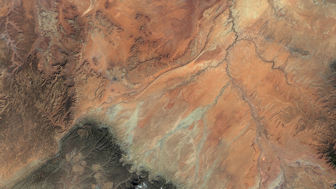
The continuous improvement in satellite sensor technology has led to an explosion in the capabilities of Earth observation.
Enhanced Detail and Feature Identification
Modern satellites can capture imagery with resolutions measured in centimeters, allowing for the identification of very small objects and intricate details. This has profound implications for everything from urban planning to environmental monitoring, enabling the detection of subtle changes that were previously imperceptible.
Capturing Beyond the Visible Spectrum
Multispectral and hyperspectral sensors allow satellites to capture light across a much broader range of the electromagnetic spectrum than human eyes can perceive. This “invisible light” reveals critical information about the composition of materials, the health of vegetation, and the presence of specific pollutants. This is akin to having eyes that can see not just colors, but the very chemical fingerprints of the Earth.
Artificial Intelligence and the Interpretation of Data
The sheer volume of satellite imagery being generated necessitates advanced tools for analysis. Artificial intelligence (AI) and machine learning (ML) are transforming how this data is processed and understood.
Automated Feature Extraction and Change Detection
AI algorithms can be trained to automatically identify and classify features within imagery, such as buildings, roads, or agricultural fields. They can also detect subtle changes over time, such as urban expansion, deforestation, or shifts in land use. This automates labor-intensive tasks, freeing up human analysts for more complex interpretation.
Predictive Analytics and Trend Forecasting
By analyzing historical and current satellite data in conjunction with other datasets, AI can be used to develop predictive models. This is valuable for forecasting weather patterns, predicting crop yields, or anticipating the impact of natural disasters. This allows for a more proactive approach to managing potential challenges.
The Decentralization of Data Processing
Historically, processing satellite imagery required specialized, high-powered computing resources. The advent of cloud computing and more accessible analytical software is democratizing this capability.
Cloud-Based Platforms and Accessibility
Cloud platforms offer scalable computing power and storage, making it easier for a wider range of users to access and process large satellite imagery datasets without significant upfront infrastructure investment. This lowers the barrier to entry for researchers, startups, and smaller organizations.
Open-Source Software and Tools
The development and proliferation of open-source software libraries and tools for geospatial analysis are further empowering users. These resources provide the building blocks for sophisticated data processing and visualization, fostering a collaborative environment for innovation. This has created a vibrant ecosystem of shared tools and knowledge.
The ongoing debate between public and strategic satellite imagery access has sparked significant interest in various sectors, including environmental monitoring and national security. A related article that delves into the implications of satellite technology and its hidden potentials can be found at Unearthed: The Lost Tech They Hid. This piece explores how advancements in satellite imagery can reshape our understanding of both global issues and local developments, highlighting the importance of balancing accessibility with security concerns.
Challenges and Considerations for the Future
| Aspect | Public Satellite Imagery Access | Strategic Satellite Imagery Access |
|---|---|---|
| Resolution | Typically 1-10 meters per pixel | Sub-meter to centimeter level |
| Availability | Open access, often delayed by hours to days | Restricted, real-time or near real-time access |
| Data Sources | Commercial satellites, government open data (e.g., Landsat, Sentinel) | Military and intelligence satellites, classified sources |
| Cost | Free to low cost | High cost, often classified |
| Use Cases | Environmental monitoring, disaster response, agriculture, education | National security, military operations, intelligence gathering |
| Data Volume | Large volumes, publicly archived | Highly controlled, selective distribution |
| Legal Restrictions | Minimal, governed by open data policies | Strict, governed by national security laws |
| Update Frequency | Days to weeks | Minutes to hours |
The Digital Divide and Equitable Access
While satellite imagery is becoming more accessible, a significant digital divide persists. Developing nations and underserved communities often lack the infrastructure, technical expertise, and financial resources to fully benefit from this technology. Ensuring equitable access and capacity building is crucial for truly global utilization. This is akin to providing a library card but leaving the reader without the ability to read the books.
Data Security and Privacy Concerns
The increasing ubiquity of satellite imagery raises important questions about data security and privacy. While strategic information needs protection, so too does the privacy of individuals and communities. Striking a balance between transparency and the right to privacy in the age of pervasive surveillance is a growing ethical and legal challenge. The constant gaze from above demands careful consideration of its implications for personal autonomy.
The Need for Clear Governance and Ethical Frameworks
As the applications of satellite imagery continue to expand, there is a growing need for clear governance structures and ethical frameworks. These frameworks should guide the responsible development, acquisition, and utilization of imagery, addressing issues such as data ownership, intellectual property, and the potential for misuse. Establishing these guidelines is akin to drawing the boundaries of a newly discovered territory.
Fostering Collaboration and Interdisciplinary Approaches
Addressing the complex challenges of balancing public and strategic access requires a collaborative and interdisciplinary approach. Scientists, policymakers, industry leaders, and civil society must work together to develop innovative solutions that maximize the benefits of satellite imagery while mitigating its risks. This requires open dialogue and a willingness to find common ground to build a future where this powerful technology serves the broadest possible good.
FAQs
What is the difference between public and strategic satellite imagery?
Public satellite imagery is openly available to the general public and often used for educational, environmental, and commercial purposes. Strategic satellite imagery, on the other hand, is typically classified or restricted and used by governments or military organizations for national security and defense.
Who provides public satellite imagery?
Public satellite imagery is provided by various government agencies such as NASA, the European Space Agency (ESA), and commercial companies like Planet Labs. These images are often accessible through online platforms and databases.
Why is strategic satellite imagery restricted?
Strategic satellite imagery is restricted to protect national security interests, prevent sensitive information from being accessed by adversaries, and maintain an advantage in military and intelligence operations.
Can individuals access strategic satellite imagery?
Generally, individuals cannot access strategic satellite imagery due to its classified nature. Access is usually limited to authorized government personnel and agencies with appropriate security clearances.
How is public satellite imagery used in everyday applications?
Public satellite imagery is used in various fields including agriculture monitoring, disaster management, urban planning, environmental research, and navigation services, providing valuable data for decision-making and analysis.