
The Enduring Legacy of Roman Roads
For centuries, the Roman Empire’s mastery of engineering and logistics was epitomized by its vast network of roads. These meticulously constructed thoroughfares were not merely conduits for troop movement and trade; they were arteries that connected a sprawling empire, facilitating the dissemination of culture, ideas, and governance. From the rugged terrain of Britannia to the sun-baked plains of North Africa, Roman roads carved a path through diverse landscapes, leaving an indelible mark on the historical and geographical tapestry of Europe, North Africa, and the Middle East. Their construction, often using sophisticated techniques and durable materials, ensured their longevity, with many segments still visible or traceable today. These roads were a testament to Roman ingenuity, their strategic planning, and their enduring vision of a unified and connected world. Understanding these routes is paramount to comprehending the empire’s reach, its administrative capabilities, and the economic and social interactions that defined its existence. The physical remnants of these roads – the stones, the embankments, the routes themselves – are invaluable historical artifacts, whispering tales of ancient marches, bustling caravans, and the daily lives of those who traversed them.
The digitization of historical artifacts, such as the Roman road atlas, plays a crucial role in preserving and understanding ancient civilizations. By creating digital records, researchers can analyze and share information about these significant historical routes, enhancing our knowledge of trade, travel, and cultural exchange in the Roman Empire. For further insights into the impact of ancient technology and its relevance today, you can read a related article titled “The Lost Power of Ancient Technology” available at this link.
The Imperative of Digital Preservation
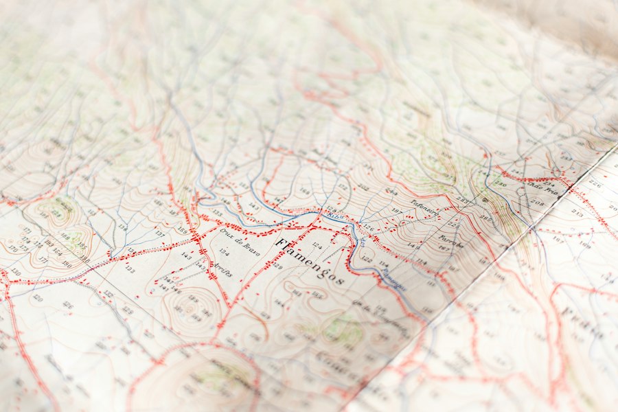
The passage of time, coupled with the relentless forces of nature and human development, poses a significant threat to the remaining fragments of Roman roads. Erosion, agricultural expansion, urban sprawl, and the repurposing of ancient materials have contributed to the gradual disappearance of these historical arteries. Without deliberate intervention, the tangible evidence of this remarkable feat of engineering risks being lost forever, taking with it crucial insights into Roman society, technology, and urban planning. The need for a comprehensive and accessible record of these historical pathways has never been more acute. Digitizing Roman road atlases presents a vital solution, offering a way to preserve, analyze, and share this invaluable heritage for future generations. This digital approach transcends the limitations of physical preservation, allowing for wider access and deeper scholarly investigation. It is a proactive measure, a digital ark carrying the essence of a vanished infrastructure into the future.
Challenges in Physical Preservation
The physical remnants of Roman roads face a multitude of threats. Natural elements like wind, rain, and frost can cause erosion and gradual decay of exposed surfaces. In areas where roads are still in use or have been partially incorporated into modern infrastructure, traffic and construction can cause irreparable damage. Agricultural practices, such as plowing and land leveling, can obliterate subtle but significant features of ancient roadbeds. Furthermore, the sheer scale and widespread distribution of the Roman road network make continuous physical preservation an almost insurmountable task for any single entity. Protecting every mile, every junction, and every surviving paving stone is an endeavor that strains resources and faces constant opposition from ongoing land use.
The Promise of Digital Solutions
In contrast to the costly and often ephemeral nature of physical preservation, digital technologies offer a scalable and enduring solution. By creating digital replicas and comprehensive databases of Roman roads, historians, archaeologists, and the public can access and study this heritage without directly impacting the fragile physical sites. This digital approach allows for the aggregation of information from various sources, including historical texts, archaeological surveys, aerial photography, and satellite imagery. The potential for interactive maps, 3D reconstructions, and data analysis opens up new avenues for research and understanding, transforming how we engage with this ancient infrastructure. It is a democratizing force, making the wonders of Roman engineering accessible to anyone with an internet connection.
Methodologies for Digital Archiving
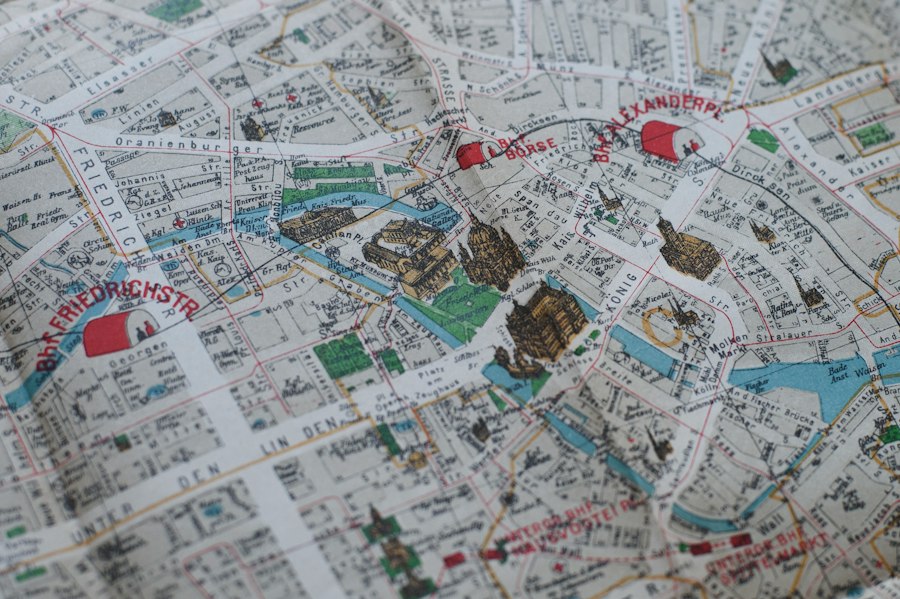
The process of digitizing Roman road atlases is a multifaceted undertaking, requiring a systematic approach to data acquisition, processing, and storage. It involves integrating various digital tools and techniques to capture the spatial and contextual information of these ancient routes. From the initial identification of road segments to the creation of detailed digital models, each step is crucial in building a robust and informative digital archive. The success of such a project hinges on the careful selection and application of appropriate methodologies, ensuring the accuracy, completeness, and long-term accessibility of the digitized data.
Geolocation and Spatial Data Acquisition
The foundation of any digital road atlas lies in accurate geolocation. This involves precisely mapping the course of Roman roads using a combination of historical cartography, archaeological fieldwork, and advanced remote sensing technologies. Traditional maps, some dating back centuries, provide initial clues to road alignments. However, these often lack the precision required for modern digital mapping. Archaeological surveys, involving ground-penetrating radar and metal detectors, can uncover buried road features and construction details.
Aerial and satellite imagery offers a broader perspective, allowing researchers to identify subtle traces of Roman roads that may be invisible from the ground, such as crop marks or earthwork patterns. Modern Geographic Information Systems (GIS) are indispensable tools in this phase, enabling the integration of various spatial data layers. Drones equipped with high-resolution cameras can capture detailed imagery of road remnants, providing close-up views of paving stones, ditches, and embankments. LiDAR (Light Detection and Ranging) technology is particularly effective, as it can penetrate vegetation and provide highly accurate topographic data, revealing the underlying landforms shaped by Roman engineering. By meticulously compiling and georeferencing this diverse range of spatial data, researchers can create a precise digital representation of the Roman road network.
Data Integration and Database Development
Once spatial data is acquired, the next critical step is to integrate it into a structured and queryable database. This involves organizing information about each road segment, including its location, construction type, estimated date of construction, condition, and any associated archaeological findings. Metadata – data about the data – is essential for ensuring that the archive is understandable and usable by researchers and the public alike. This metadata can include information about the source of the data, the methodology used for its acquisition, and any scholarly interpretations or hypotheses related to the road segment.
GIS software plays a pivotal role in this integration process, allowing for the creation of thematic maps and the analysis of spatial relationships between different road segments, settlements, and other historical features. Database management systems are then employed to store and manage this integrated information, enabling efficient searching, filtering, and retrieval of data. For instance, a researcher might query the database to identify all paved sections of Roman roads in a particular province, or to find roads leading to a specific Roman city. The development of a standardized data schema is crucial for ensuring interoperability and allowing for future expansion and collaboration. This might involve adopting established archaeological data standards or developing new ones tailored to the specific needs of Roman road research. The goal is to create a living archive that can be continuously updated and enriched with new discoveries.
3D Modeling and Virtual Reconstruction
Beyond simple mapping, advanced digital techniques allow for the creation of three-dimensional models and virtual reconstructions of Roman roads and their surrounding environments. This adds a layer of immersion and understanding that is difficult to achieve with 2D representations alone. Photogrammetry, a technique that uses overlapping photographs to create 3D models, can be applied to surviving road sections or individual paving stones, capturing their form and texture in exquisite detail.
LiDAR data can also be used to generate highly accurate digital elevation models, upon which virtual reconstructions can be built. These models can recreate the visual appearance of Roman roads as they might have looked in antiquity, complete with reconstructed bridges, milestones, and roadside structures. This offers a powerful tool for public engagement, allowing people to virtually “walk” along these ancient routes and experience them in a way that was previously impossible. Furthermore, 3D models can aid in archaeological interpretation by allowing researchers to visualize different construction phases or hypothesize about the original appearance of damaged or incomplete sections. This virtual exploration bridges the gap between abstract data and tangible experience, bringing the Roman world to life.
Enhancing Research and Accessibility
The digitization of Roman road atlases offers transformative potential for historical and archaeological research, democratizing access to information and fostering new avenues of inquiry. By making this wealth of data readily available, the project empowers scholars, students, and the public to engage with Roman history in unprecedented ways. The digital format transcends geographical barriers and the limitations of physical access to archives, creating a truly global resource.
Scholarly Analysis and Interdisciplinary Studies
A comprehensive digital atlas of Roman roads provides a powerful platform for advanced scholarly analysis. Researchers can conduct large-scale spatial analyses to identify patterns in road construction, their relationship to terrain, and their strategic importance. For example, one could analyze the density of roads around major cities to understand the extent of their economic influence, or examine the gradient of roads in mountainous regions to gauge the engineering challenges faced by the Romans.
The integration of road data with other historical datasets – such as archaeological sites, demographic information, and textual sources – opens up exciting possibilities for interdisciplinary studies. Historians can cross-reference road networks with the movement of legions and trade routes to better understand military logistics and economic development. Archaeologists can use the atlas to identify potential new excavation sites by looking for areas where road remnants might be present but have not yet been thoroughly investigated. Geographers can study the long-term impact of Roman roads on landscape modification and settlement patterns. This cross-pollination of disciplines, facilitated by the digital atlas, promises to yield deeper and more nuanced understandings of the Roman world.
Public Engagement and Education
The digitized Roman road atlas is not solely for academic pursuits; it is also a powerful tool for public engagement and education. Interactive online maps allow individuals to explore the vast Roman road network from their own homes, tracing the routes of famous legions or discovering how ancient roads shaped the landscapes they inhabit today. Engaging visualisations, such as animated historical maps showing the expansion of the road network over time, can make the information more accessible and captivating for a general audience.
Educational institutions can leverage the atlas to create dynamic lesson plans, allowing students to virtually explore Roman Britain or the Via Appia. The 3D reconstructions can be particularly impactful, enabling students to “visit” ancient Roman towns and see how the road network connected them. This digital resource can foster a greater appreciation for Roman engineering prowess and the enduring legacy of their infrastructure. It transforms history from a static subject into an interactive journey, sparking curiosity and inspiring the next generation of historians and archaeologists. Furthermore, citizen science initiatives could be integrated, allowing the public to contribute observations and data, further enriching the atlas and fostering a sense of collective ownership of this shared heritage.
Collaborative Research and Data Sharing
A core strength of a digitized Roman road atlas is its potential to foster collaborative research on a global scale. By providing a standardized and accessible platform, the project encourages researchers from different institutions and countries to share their data, findings, and expertise. This can lead to more comprehensive and robust research outcomes, as disparate pieces of knowledge are brought together to form a more complete picture.
A central, well-maintained digital archive acts as a hub for this collaboration. Researchers can contribute their own digitized data, ensuring that the atlas remains a dynamic and ever-expanding resource. This collaborative model also helps to avoid duplication of effort and ensures that research is built upon the most up-to-date and comprehensive information available. The open sharing of data, where appropriate, can accelerate discoveries and lead to breakthroughs that might not be possible through individual efforts. The digital atlas becomes a shared intellectual commons, a testament to the power of collective endeavor in preserving and understanding our past.
The digitization of historical artifacts, such as the Roman road atlas, plays a crucial role in preserving our understanding of ancient civilizations. By transforming these invaluable resources into accessible digital formats, researchers can analyze and share insights that were previously confined to physical archives. For those interested in exploring more about the secrets of ancient technology and the knowledge unearthed from our past, a fascinating article can be found here: forbidden ancient technology. This connection between digital preservation and the study of ancient innovations highlights the importance of modern technology in uncovering the mysteries of history.
The Future of Digital Roman Road Atlases
| Metric | Description | Value | Unit |
|---|---|---|---|
| Number of Roman Roads Digitized | Total count of distinct Roman roads mapped and digitized | 120 | roads |
| Artifacts Cataloged | Number of historical artifacts linked to the Roman roads in the atlas | 3500 | items |
| GIS Layers Created | Geospatial data layers developed for roads, settlements, and landmarks | 15 | layers |
| Digitization Accuracy | Average spatial accuracy of digitized road paths compared to historical maps | 95 | percent |
| Historical Map Sources | Number of different historical maps and manuscripts used for digitization | 25 | sources |
| Time to Digitize One Road | Average time required to digitize and verify one Roman road segment | 8 | hours |
| Public Access Platform Users | Number of users accessing the digital Roman road atlas online | 15000 | users/month |
The digitization of Roman road atlases is not a static endpoint but an evolving process. As technology advances and our understanding of the Roman world deepens, these digital archives will continue to grow and adapt, offering even greater insights and accessibility. The future promises more sophisticated analytical tools, enhanced virtual experiences, and broader participation from communities worldwide.
Technological Advancements and Future Applications
The rapid pace of technological innovation will undoubtedly shape the future of digital Roman road atlases. Advancements in AI and machine learning could be used to automatically identify potential road segments from satellite imagery or to analyze textual descriptions of roads for geographical clues. Improved imaging technologies, such as hyperspectral imaging, might reveal details about the materials used in Roman road construction that are not visible to the naked eye.
The integration of virtual reality (VR) and augmented reality (AR) will offer even more immersive experiences. Imagine walking through a reconstructed Roman city and seeing the actual routes of the roads overlayed onto your view, or using AR on a hike to see virtual reconstructions of ancient road features appearing in the landscape around you. These technologies will not only enhance public engagement but also provide new tools for archaeologists and historians to visualize and interact with the data. Furthermore, the development of more sophisticated analytical tools will allow for increasingly complex queries and the discovery of previously hidden patterns and relationships within the vast dataset.
Community Involvement and Citizen Science
The future success of digital Roman road atlases will likely depend on increased community involvement and the integration of citizen science initiatives. Empowering the public to contribute to the project can significantly expand the scope and accuracy of the data. This could involve developing user-friendly interfaces for reporting sightings of potential Roman road remnants, uploading geotagged photographs, or transcribing historical documents that mention roads.
Online platforms can be designed to facilitate these contributions, with moderating systems to ensure data quality. Educational programs can be developed to train volunteers in identifying Roman road features, turning local exploration into valuable data collection. This collaborative approach not only enriches the atlas but also fosters a sense of stewardship and personal connection to this shared historical heritage. By engaging a wider audience, these projects can transform passive observers into active participants in the preservation and study of Roman roads.
Long-Term Sustainability and Archiving
Ensuring the long-term sustainability of digital Roman road atlases is a critical consideration. Digital data is not immune to obsolescence; file formats can become outdated, software can cease to be supported, and storage media can degrade. Therefore, robust digital archiving strategies are essential. This involves regularly migrating data to new storage formats, ensuring that the underlying infrastructure is maintained, and actively managing the intellectual property and access rights.
Establishing partnerships with established digital archives and libraries can provide a framework for long-term preservation. These institutions have the expertise and resources to manage vast digital collections and ensure their accessibility for future generations. Furthermore, the development of open-source software for managing and visualizing the data can reduce reliance on proprietary systems and enhance long-term accessibility. The goal is to create a digital legacy that will endure, continuing to inform and inspire for centuries to come, much like the enduring legacy of the Roman roads themselves.

The 2.7% Statistic That Terrifies Roman Historians
FAQs
What is the Roman Road Atlas project?
The Roman Road Atlas project is an initiative to digitize historical artifacts related to ancient Roman roads, including maps, inscriptions, and other relevant materials.
How will digitizing historical artifacts benefit researchers and historians?
Digitizing historical artifacts will make them more accessible to researchers and historians around the world, allowing for easier analysis, comparison, and preservation of valuable information about ancient Roman roads.
What types of artifacts are included in the Roman Road Atlas digitization project?
The project includes a wide range of artifacts such as ancient maps, inscriptions, milestones, and other archaeological findings related to Roman roads, providing a comprehensive view of the road network in the Roman Empire.
Who is involved in the digitization of the Roman Road Atlas artifacts?
The digitization project involves collaboration between archaeologists, historians, technology experts, and cultural institutions to ensure the accurate preservation and dissemination of information about Roman roads.
How can the public access the digitized artifacts from the Roman Road Atlas project?
Once digitized, the artifacts will be made available through online platforms and databases, allowing the public to explore and learn about the ancient Roman road network from anywhere in the world.