The intricate dance between human civilization and water resources has, for millennia, been characterized by innovation and adaptation. Among the most remarkable and enduring of these innovations is the qanat system, an ancient underground aqueduct designed to tap into subterranean water sources and transport them over long distances to arid lands. The efficiency of a qanat, however, is not an inherent quality but rather a product of meticulous planning and execution, particularly in its route. This article delves into the principles and practices of efficient qanat tunnel route planning, underscoring its critical role in sustainable water management.
The Historical Context of Qanat Construction
The genesis of the qanat system is deeply rooted in the need to overcome water scarcity in regions with limited surface water availability. Its origins are widely attributed to ancient Persia, with evidence suggesting its development as early as the 7th millennium BCE. From Persia, the qanat technology spread across the Middle East, North Africa, and as far as Spain and India, demonstrating its universal applicability and effectiveness. The ingenuity of the qanat lies in its ability to circumvent the challenges posed by evaporation and contamination, which plague open canals and surface reservoirs. By channeling water underground, qanats provide a reliable and clean water supply, thereby enabling the sustenance of agriculture and urban settlements in otherwise inhospitable environments. The very existence of ancient cities in desert regions is a testament to the profound impact of well-planned qanat systems. Understanding this historical evolution is crucial for appreciating the long-term vision and technical sophistication inherent in traditional qanat route selection.
Ancient Engineering Prowess and Water Discovery
The early pioneers of qanat construction possessed an uncanny understanding of hydrogeology, even without modern scientific instruments. Their ability to locate groundwater sources relied on keen observation of natural indicators. Changes in vegetation patterns, the presence of specific plant species, and even subtle variations in soil moisture were vital clues. They understood that water table depth and aquifer characteristics were paramount for the success of their endeavor. The construction process itself was a monumental undertaking, involving manual excavation of long, sloping tunnels that followed the natural gradient of the land to ensure gravity-driven water flow. Vertical shafts, known as “wells” or “access shafts,” were dug at regular intervals to facilitate excavation, ventilation, and maintenance. The alignment of these tunnels was not arbitrary; it was a carefully calculated path designed to maximize water yield while minimizing excavation effort and geological challenges. This ancient engineering prowess, honed over centuries, laid the foundation for the sophisticated route planning that defines efficient qanat systems.
Societal Impact and Water Security
The societal impact of functional qanat systems cannot be overstated. They transformed arid and semi-arid landscapes into arable land, fostering agricultural productivity and supporting burgeoning populations. Beyond sustenance, qanats provided a crucial element of water security, buffering communities against droughts and ensuring a consistent supply for domestic use, irrigation, and even artisanal activities. This reliability fostered stability and facilitated the development of complex social structures and economies. The shared responsibility for maintaining these vital water arteries also fostered a sense of community and cooperation. Villages and cities were built around qanats, their very existence intrinsically linked to the continued operation of these underground lifelines. The planning of qanat routes was therefore not merely a technical exercise but a strategic decision with profound social and economic implications, ensuring the long-term viability and prosperity of communities.
In the context of qanat tunnel route planning, understanding the broader implications of infrastructure development is crucial. A related article that explores the importance of secure communication lines in infrastructure projects is available at this link: Securing Cislunar Communication Lines: Best Practices. This article discusses best practices for ensuring reliable communication in complex projects, which can be beneficial for the effective planning and execution of qanat tunnels.
Geomorphological and Hydrological Considerations in Route Planning
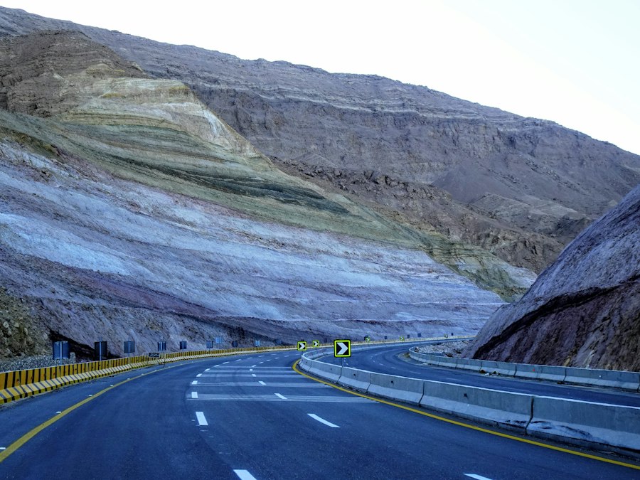
The efficiency of a qanat tunnel is fundamentally dictated by its alignment with the natural landscape and its ability to tap into and convey groundwater effectively. This requires a deep understanding of geomorphology and hydrology, the scientific disciplines that govern landforms and water systems, respectively. Traditional qanat planners, through generations of experience, developed an intuitive grasp of these principles, which are now being formalized and enhanced by modern scientific methods.
Understanding Groundwater Flow and Aquifer Dynamics
The primary objective of qanat route planning is to intercept groundwater flowing within an aquifer and guide it towards its destination. This necessitates a thorough understanding of aquifer properties, including permeability, transmissivity, and storage capacity. Planners must identify areas where the water table is sufficiently high to be tapped by the qanat’s starting point, often situated at the foothills of mountains or higher elevations where precipitation infiltrates the ground. The route must then be carefully contoured to maintain a consistent, gentle gradient, ensuring that gravity propels the water without excessive flow velocity that could lead to erosion or loss of hydraulic head. The presence and nature of impermeable layers (aquitards) are also critical, as they can influence the direction and pressure of groundwater flow. Identifying these geological structures is essential for predicting water availability and optimizing the tunnel’s path to maximize interception and minimize costly excavation through resistant rock.
Terrain Analysis and Gradient Determination
The selection of the qanat tunnel’s route is inextricably linked to the topography of the land. The tunnel must descend from the groundwater source to the point of use, typically a village or agricultural area, with a consistent and gentle slope. This gradient is crucial for efficient water flow. Too steep a gradient can cause increased water velocity, leading to tunnel erosion and potential collapse, as well as significant loss of hydraulic pressure. Conversely, too shallow a gradient will result in sluggish flow, sedimentation, and potential water stagnation. Traditional planners relied on simple tools and keen observation to establish this gradient, often using water levels in pits dug along the proposed route. Modern techniques, such as Geographic Information Systems (GIS) and digital elevation models (DEMs), provide far more precise and comprehensive terrain analysis. These tools allow for the identification of optimal paths that balance the need for a consistent gradient with the avoidance of challenging geological formations and excessively deep excavations. The meticulous analysis of terrain is a cornerstone of efficient qanat route planning, ensuring both the feasibility of construction and the long-term functionality of the water system.
Geological Suitability and Construction Feasibility
The geological composition of the ground through which the qanat tunnel will be excavated is a critical determinant of its route. Different rock types and soil formations present varying degrees of difficulty and cost for excavation. Soft soils might require extensive support structures to prevent collapse, while hard rock can necessitate specialized and labor-intensive drilling and blasting techniques. Unstable geological formations, such as fault lines or areas prone to landslides, must be carefully avoided to ensure the structural integrity of the tunnel and the safety of those who maintain it. Route planning must therefore incorporate detailed geological surveys to identify the most amenable strata for excavation. This involves understanding rock strength, the presence of groundwater within the rock mass (which can increase excavation risks), and the potential for seismic activity. By selecting routes that traverse stable, easily workable geological materials, planners can significantly reduce construction time, cost, and the likelihood of future structural failures, thereby enhancing the overall efficiency and sustainability of the qanat system.
Modern Technologies for Enhanced Qanat Route Planning
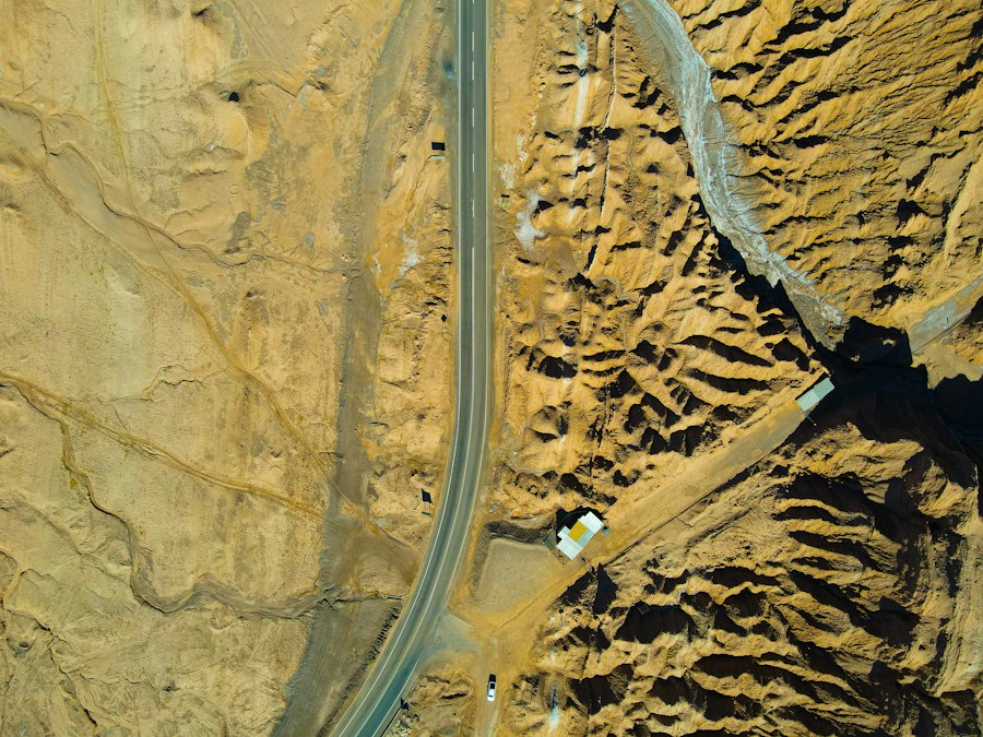
While ancient qanat builders relied on empirical knowledge and observation, contemporary planning leverages advanced technologies to refine and optimize route selection, leading to greater efficiency and sustainability. The integration of modern geospatial, hydrological, and geological tools offers unparalleled precision and predictive power.
Geospatial Analysis and GIS Applications
Geographic Information Systems (GIS) have revolutionized the way routes are planned and analyzed. By integrating various datasets – including topographic maps, satellite imagery, geological surveys, and hydrological data – GIS software can create detailed digital models of the terrain and subsurface conditions. Planners can use these models to visualize potential routes, calculate precise gradients, estimate excavation volumes, and identify potential geological hazards. Advanced spatial analysis techniques within GIS can also be used to model groundwater flow patterns and predict the optimal interception points for the qanat. Furthermore, GIS facilitates collaboration among different stakeholders, allowing for the visualization and evaluation of multiple route options and their associated environmental and economic impacts. This data-driven approach moves beyond traditional intuition, enabling more informed and robust decision-making in qanat route planning.
Remote Sensing and Subsurface Investigation Techniques
Remote sensing technologies, such as satellite imagery and aerial photography, provide valuable insights into surface water patterns, vegetation health, and landforms, which can indirectly indicate the presence of groundwater. More directly, advanced subsurface investigation techniques complement these surface observations. Ground-penetrating radar (GPR) and electrical resistivity tomography (ERT) can provide non-invasive profiles of the subsurface, revealing variations in soil and rock layers, the presence of water-bearing zones, and potential geological anomalies. These methods allow planners to map out underground conditions with greater accuracy than ever before, identifying the most promising locations for groundwater interception and selecting tunnel routes that avoid problematic geological features. The combination of remote sensing and direct subsurface investigation significantly reduces the uncertainty associated with traditional methods, leading to more efficient and cost-effective qanat construction and operation.
Hydrogeological Modeling and Simulation
Sophisticated hydrogeological models are essential for understanding and predicting groundwater behavior. These models simulate the flow of water within aquifers, taking into account factors such as rainfall recharge, geological formations, and existing water extraction. By inputting data from site investigations and geospatial analysis, planners can simulate the performance of different qanat route designs. They can predict the volume of water that a proposed route is likely to intercept, assess the impact of the qanat on the surrounding groundwater regime, and identify potential risks such as aquifer depletion or saline intrusion. These simulations allow for the iterative refinement of route plans, ensuring that the final design maximizes water yield while minimizing negative environmental impacts and ensuring the long-term sustainability of the water resource.
Sustainable Water Management Through Efficient Qanat Design
The inherent efficiency of a well-planned qanat system makes it a cornerstone of sustainable water management, particularly in arid and semi-arid regions. Its ability to deliver water with minimal loss and reliance on renewable energy sources aligns perfectly with the principles of environmental stewardship and resource conservation.
Minimizing Water Loss and Evaporation
One of the most significant advantages of qanats over surface irrigation systems is their inherent ability to minimize water loss. By transporting water underground, they completely eliminate evaporation, which can account for substantial water losses in open canals and reservoirs, especially in hot, dry climates. This direct delivery of water to the point of use ensures that the maximum possible volume of extracted groundwater reaches the intended beneficiaries. Furthermore, the controlled flow within the qanat reduces seepage losses compared to unlined open channels. This conservation of precious water resources is paramount for ensuring long-term water security and supporting agricultural productivity in water-scarce regions. The efficient route planning directly contributes to this water-saving aspect by ensuring optimal gradient and minimizing any potential breaches or leaks along the tunnel.
Energy Independence and Reduced Carbon Footprint
Qanat systems are inherently gravity-driven, meaning they do not require external energy sources like pumps to move water. This reliance on natural gravitational forces makes them an exceptionally sustainable and environmentally friendly water management solution. The absence of energy consumption translates to a significantly reduced carbon footprint compared to modern pumped water systems. This energy independence also enhances the resilience of water supply systems, as they are not susceptible to power outages or fluctuations in energy prices. In an era where reducing greenhouse gas emissions and transitioning to renewable energy sources are critical global imperatives, the energy-efficient nature of qanat systems offers a valuable and time-tested model for sustainable water provision. The route planning ensures that the gravitational potential is maximized, making the system function effectively without any artificial energy input.
Long-Term Water Security and Resilience
The meticulous planning and construction of efficient qanat tunnels contribute directly to long-term water security and the resilience of communities. By tapping into deep groundwater sources, qanats provide a reliable water supply that is less susceptible to short-term climatic variations like droughts, which can severely impact surface water availability. The underground nature of the system also protects water quality from surface contamination, ensuring a healthier and more consistent supply. Furthermore, the distributed nature of many qanat systems, with multiple tunnels serving different areas, can enhance overall system resilience. If one tunnel requires maintenance or experiences a localized issue, others can continue to supply water, mitigating the impact of disruptions. This inherent robustness makes qanats a vital tool for adapting to changing environmental conditions and ensuring the sustained well-being of populations in vulnerable regions.
In the context of qanat tunnel route planning, understanding the geopolitical implications of water resources is crucial. An insightful article that explores the broader dynamics of global power struggles and their impact on resource management can be found here: the rise of proxy wars. This piece delves into how conflicts over essential resources like water can influence infrastructure projects, including qanat systems, which are vital for sustainable water supply in arid regions.
Challenges and Future Directions in Qanat Route Optimization
| Metric | Description | Typical Values / Range | Importance in Qanat Tunnel Route Planning |
|---|---|---|---|
| Tunnel Gradient | The slope of the qanat tunnel to ensure water flow by gravity | 0.5% to 2% | Critical for maintaining steady water flow without causing erosion or stagnation |
| Tunnel Length | Total horizontal distance from water source to outlet | Several hundred meters to several kilometers | Determines water delivery capacity and construction effort |
| Depth of Mother Well | Vertical depth of the main well accessing the water table | 10 to 50 meters or more depending on water table | Ensures access to reliable groundwater source |
| Spacing Between Vertical Shafts | Distance between vertical access shafts along the tunnel | 20 to 35 meters | Facilitates ventilation, excavation, and maintenance |
| Water Table Depth | Depth at which groundwater is found | Varies widely by region, typically 5 to 50 meters | Determines feasibility and depth of qanat construction |
| Soil and Rock Type | Geological composition along the tunnel route | Sandy, clay, limestone, volcanic rock, etc. | Affects tunnel stability, excavation method, and lining requirements |
| Water Discharge Rate | Volume of water delivered per unit time | 0.5 to 10 liters per second | Determines irrigation capacity and sustainability |
| Surface Topography | Elevation profile of the land surface above the tunnel | Varies by location | Influences tunnel gradient and shaft placement |
| Environmental Impact | Potential effects on local ecosystems and water resources | Qualitative assessment | Ensures sustainable water use and minimal ecological disruption |
Despite their proven efficacy, the continued relevance and optimization of qanat systems face several contemporary challenges. Addressing these will be crucial for their sustained contribution to sustainable water management.
Balancing Traditional Knowledge with Modern Techniques
A key challenge lies in effectively integrating traditional, locally developed knowledge with modern scientific and technological approaches. While modern tools offer precision and predictive power, they can sometimes overlook nuanced site-specific conditions that experienced local planners intuitively understand. The ideal scenario involves a synergistic approach where modern technologies validate and enhance traditional methods, rather than entirely replacing them. Training programs that bridge this knowledge gap, fostering collaboration between experienced qanat operators and modern engineers and hydrologists, are essential. This ensures that qanat route planning benefits from both historical wisdom and cutting-edge scientific understanding, leading to more robust and culturally appropriate solutions. The future of efficient qanat planning lies in this respectful and effective fusion of past and present expertise.
Addressing Modern Environmental and Socio-Economic Factors
Contemporary qanat route planning must also contend with a range of modern environmental and socio-economic factors. These include climate change impacts, such as altered precipitation patterns and increased evaporation rates, which can affect groundwater recharge and availability. Urbanization and agricultural intensification can lead to increased water demand and potential over-extraction from aquifers, necessitating careful hydrological impact assessments during route selection. Furthermore, land ownership patterns, infrastructure development, and socio-political considerations can influence the feasibility and acceptance of proposed qanat routes. Planners must now adopt a holistic approach, considering not only the technical aspects of water conveyance but also the broader ecological, economic, and social context to ensure the long-term viability and equitable distribution of water resources.
The Role of Qanats in Contemporary Water Resource Management
The future role of qanats in contemporary water resource management is significant and multifaceted. As climate change intensifies water scarcity in many parts of the world, traditional qanat systems, with their inherent efficiency and sustainability, offer a valuable, low-tech, and environmentally sound alternative to more complex and energy-intensive modern infrastructure. There is a growing recognition of their potential, leading to renewed interest in their rehabilitation, maintenance, and even the construction of new qanat-like systems in suitable regions. Research and development are focusing on improving existing systems, optimizing their performance through modern monitoring techniques, and exploring their integration with other water management strategies. The efficient planning of qanat tunnels, leveraging both historical wisdom and modern technology, will be central to unlocking their full potential and ensuring their continued contribution to resilient and sustainable water futures.
In the context of qanat tunnel route planning, understanding the implications of resource management and governance can be crucial. A related article discusses the complexities of governance in outer space, which can draw parallels to the management of subterranean water systems. For more insights on governance issues, you can read about it in this thought-provoking piece on space control found here: space governance. This exploration highlights how effective management strategies can influence both terrestrial and extraterrestrial resource allocation.
Conclusion: The Enduring Legacy of Intelligent Route Planning
The efficient planning of qanat tunnel routes stands as a testament to human ingenuity and foresight in the face of environmental challenges. From the intuitive understanding of hydrogeology by ancient builders to the sophisticated geospatial and hydrological modeling of today, the core principle remains: to harness groundwater sustainably for the benefit of communities. The meticulous selection of terrain, gradient, and geological suitability, now augmented by modern technologies, ensures minimal water loss, energy independence, and long-term water security. As the world grapples with increasing water stress, the lessons learned from efficient qanat route planning offer invaluable insights into resilient and sustainable water management practices, underscoring the enduring legacy of intelligent design in safeguarding this most precious resource. The continued exploration and application of these principles hold the key to a more water-secure future for generations to come.
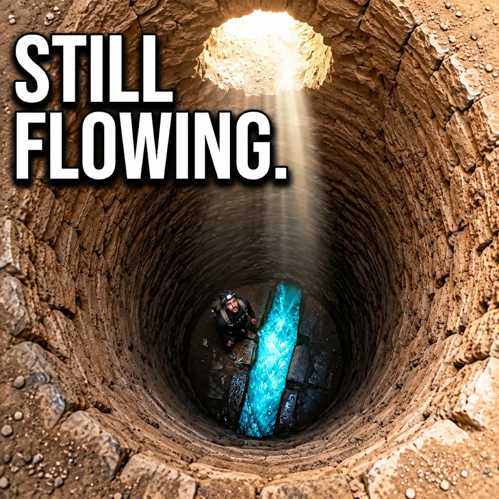
They Dug Water Tunnels Under the Desert… And They Still Flow
FAQs
What is a qanat tunnel route?
A qanat tunnel route is an underground water management system used to transport water from a source to a destination through a series of tunnels, shafts, and channels.
How are qanat tunnel routes planned?
Qanat tunnel routes are planned by conducting geological surveys to determine the best path for the tunnels, considering factors such as topography, soil composition, and water source location.
What are the benefits of using qanat tunnel routes for water transportation?
Qanat tunnel routes are beneficial for water transportation as they reduce water loss due to evaporation and seepage, provide a reliable water supply, and require minimal maintenance once constructed.
What challenges are faced during the planning of qanat tunnel routes?
Challenges faced during the planning of qanat tunnel routes include identifying suitable water sources, dealing with geological obstacles such as rock formations, and ensuring the sustainability of the water supply over time.
Are qanat tunnel routes still used today?
While qanat tunnel routes have been used for centuries in various parts of the world, they are still used today in regions where water scarcity is a concern and traditional water management systems are valued for their efficiency and sustainability.