The frozen expanse of Greenland, a land sculpted by millennia of ice and wind, harbors secrets long buried beneath its glacial mantle. Among these is the ghostly legacy of Camp Century, a once-vibrant U.S. Army research base built in the late 1950s under the guise of scientific endeavor, but with a clandestine ulterior motive – the potential staging ground for nuclear missile deployment during the Cold War. For decades, this forgotten city, entombed by encroaching ice, remained an enigmatic footnote in history. However, modern radar mapping technology has breathed new life into its study, allowing researchers to peer through the ice and reconstruct the story of this remarkable, and ultimately doomed, undertaking.
Camp Century was an audacious project, born from the unique challenges and strategic imperatives of the Cold War. The United States, seeking a strategic advantage in the Arctic, conceived of a base that would be hidden from Soviet observation, yet poised to launch intercontinental ballistic missiles (ICBMs). The choice of Greenland, a territory under Danish sovereignty but heavily influenced by American strategic interests, was no accident. The sheer thickness of the ice sheet offered a natural camouflage, making it seemingly impervious to discovery and attack.
Project Iceworm: The Military Imperative
The overarching military project that spawned Camp Century was codenamed “Project Iceworm.” While publicly presented as a scientific exploration of the Arctic environment and the potential for living and working beneath the ice, its true objective was far more sinister. The strategic location of Greenland, its proximity to both North America and the Soviet Union, made it an ideal launchpad for nuclear missiles. The ambition was to establish a network of hidden missile silos, capable of striking targets deep within Soviet territory.
Engineering Marvels in an Extreme Environment
The construction of Camp Century was a testament to human ingenuity and the relentless pursuit of Cold War objectives. The base was not carved directly into the ice, which would have been highly unstable, but rather built within a vast network of tunnels excavated by the Mobile, Construction, and Engineering (MCE) battalion. These tunnels, some spanning miles, were covered with a layer of snow and ice, creating a seemingly natural, yet ingeniously concealed, environment. The base itself was comprised of prefabricated modules, brought to the site and assembled within these excavated tunnels. These modules housed everything from living quarters and a hospital to a nuclear reactor – the first of its kind to operate in the Arctic – and even a greenhouse, demonstrating a remarkable ability to sustain a community in one of Earth’s most unforgiving landscapes. The scale of the operation was immense, requiring the transport of thousands of tons of material and the labor of hundreds of personnel. The ambition was to create a self-sufficient, permanent installation, a testament to American technological prowess and Cold War resolve.
The Illusions of Permanence: A Fragile Foundation
Despite the monumental effort and advanced engineering, the very foundation of Camp Century was inherently unstable. The Arctic environment, characterized by extreme temperatures, powerful winds, and the ever-present threat of glacial movement, proved to be a formidable adversary. The ice sheet, which was initially perceived as a stable platform, was in reality a dynamic and constantly shifting entity. This inherent fragility, combined with the ever-increasing snow accumulation and the subtle creep of the ice, would ultimately seal the fate of this subglacial city. The dream of a permanent, hidden military outpost was destined to be slowly, inexorably, reclaimed by nature.
Modern radar mapping techniques have significantly advanced our understanding of historical sites, such as Camp Century in Greenland, where researchers are uncovering the impacts of climate change on ice and permafrost. This innovative technology allows scientists to visualize subsurface structures and assess the effects of melting ice on ancient artifacts. For a deeper exploration of how climate has influenced historical events, you can read a related article on the role of climate in the Bronze Age collapse at this link.
The Ghostly Echoes Beneath the Ice: Unveiling Camp Century with Radar
For decades, the remnants of Camp Century lay dormant, entombed beneath an ever-thickening layer of ice. The knowledge of its existence persisted through declassified documents and the fading memories of those who served there, but the physical reality remained elusive. The advent of sophisticated radar mapping technology, however, has provided an unprecedented window into this lost world. This non-invasive technique allows researchers to penetrate the ice and reveal the buried structures and infrastructure of the former base, painting a vivid picture of its past glory and eventual demise.
Ground-Penetrating Radar (GPR): A Glimpse Below the Surface
Ground-Penetrating Radar (GPR) has become an indispensable tool in exploring Camp Century. This technique utilizes radio waves to create an image of the subsurface. A transmitter emits radio pulses into the ground, and a receiver detects the reflected signals. Variations in the reflected signals, caused by differences in the electrical properties of the materials beneath the surface, allow for the creation of detailed subsurface profiles. In the context of Camp Century, GPR can effectively differentiate between the ice, the buried structures of the base, and even potential artifacts left behind.
Interpreting the Radar Signatures: From Pixels to Palaces
The interpretation of GPR data requires expertise and a deep understanding of the geological and structural characteristics of the site. Researchers analyze the patterns of reflected signals, identifying anomalies that correspond to the buried tunnels, buildings, and other infrastructure of Camp Century. These radar signatures, when meticulously processed and visualized, can reveal the layout of the base, the dimensions of its structures, and even the presence of specific components like the nuclear reactor or the vehicles that once plied its icy corridors. The seemingly abstract pixels on a screen transform into a tangible representation of a bygone era, a ghostly blueprint of a forgotten city.
Limitations and Challenges of GPR Exploration
While GPR is a powerful tool, its effectiveness can be influenced by several factors. The depth of penetration is limited by the electrical conductivity of the ice, which can vary depending on its composition and temperature. In some instances, the extreme depth of the buried structures can pose a challenge for current GPR technology. Furthermore, the dynamic nature of the ice sheet can distort radar signals, making interpretation more complex. Despite these limitations, GPR remains the primary method for non-invasively mapping the subglacial remains of Camp Century, offering invaluable insights that would be impossible to obtain through traditional excavation.
Recent advancements in radar mapping technology have shed new light on Camp Century in Greenland, revealing the intricate layers of ice and the historical significance of this once-secret military base. For those interested in similar explorations of ice-covered regions, an insightful article discusses seismic profiling of the Antarctic ice cap, which can be found here. This research not only enhances our understanding of polar environments but also contributes to the broader conversation about climate change and its impact on these fragile ecosystems.
Airborne Radar Surveys: Broad-Scale Reconnaissance
Beyond ground-based GPR, airborne radar surveys have also played a crucial role in mapping Camp Century. Aircraft equipped with specialized radar systems can cover vast areas of the ice sheet, providing a broader overview of the site and its surroundings. These surveys can help identify larger features and patterns that might be missed by ground-based efforts, contributing to a more comprehensive understanding of the base’s footprint and its integration with the surrounding glacial landscape.
Synthetic Aperture Radar (SAR): High-Resolution Imaging
Synthetic Aperture Radar (SAR) is a particularly effective airborne radar technique. SAR systems use the motion of the aircraft to create a synthesized antenna, achieving very high-resolution images of the surface and subsurface. For Camp Century, SAR can provide detailed maps of the ice surface, revealing subtle changes and features that might indicate buried structures or areas of significant ice deformation. This allows researchers to identify potential areas of interest for more detailed ground-based investigations.
Ice-Penetrating Radar (IPR): Deeper Insights into Glacial Stratigraphy
Complementing GPR and SAR, Ice-Penetrating Radar (IPR) systems are designed to penetrate much deeper into the ice sheet. These systems can provide information about the stratigraphy of the ice, revealing layers that represent past snowfall and volcanic eruptions. While not primarily focused on mapping buried structures, IPR can provide valuable context for understanding the glacial environment in which Camp Century was built and how it has evolved over time, offering insights into the forces that ultimately led to the base’s demise.
Reconstructing the Daily Life and Demise of Camp Century
The radar maps generated by these advanced technologies are not merely abstract diagrams; they are the keys to unlocking the stories of the people who lived and worked at Camp Century, and the processes that led to its abandonment and eventual burial. By meticulously analyzing the revealed structures, researchers can reconstruct the layout of the base, infer the functions of different modules, and even imagine the daily routines of its inhabitants.
The Layout of the Subglacial City: A Grid Beneath the Snow
The radar data reveals a surprisingly organized and deliberate layout for Camp Century. The excavated tunnels formed a network, connecting various prefabricated modules. These modules were arranged in a manner that facilitated efficient movement and access between different areas of the base. Researchers can identify what are believed to be living quarters, mess halls, medical facilities, workshops, and even recreational areas, painting a picture of a functioning, albeit isolated, community. The sheer scale of the excavated tunnels and the spatial arrangement of the modules speak to the ambitious nature of the project.
Identifying Key Infrastructure: The Nuclear Heart and Vital Arteries
Among the most significant discoveries made through radar mapping are the locations of key infrastructure. The nuclear reactor, the power source for the base, has been identified, its distinctive radar signature a testament to its central role. Similarly, the radar reveals the network of pipes and cables that formed the lifeblood of the base, supplying power, water, and communication. Tracing these “vital arteries” helps researchers understand the logistical challenges and solutions employed to maintain the base in such an extreme environment.
The “Library” and Other Surprising Amenities
One of the most poignant discoveries from the radar data is the identification of what is believed to be the base’s library. This unexpected amenity, a space dedicated to knowledge and reflection in the heart of a military installation, offers a glimpse into the human element of Camp Century. The presence of such facilities suggests a conscious effort to foster a sense of community and normalcy for the personnel stationed there. Other identified areas might represent workshops, storage facilities, or even spaces for scientific research, adding further layers to our understanding of the base’s multifaceted purpose.
The Inevitable March of the Ice: A Slow and Steady Collapse
The radar mapping has also provided crucial evidence regarding the ultimate fate of Camp Century. The encroaching ice and the increasing snow accumulation, which were initially thought to be manageable challenges, proved to be insurmountable. The radar images reveal subtle but significant deformations in the ice around the buried structures, indicating the immense pressures exerted by the glacier. Over time, these pressures caused the tunnels to collapse and the modules to buckle.
Evidence of Structural Deformation: The Ice’s Grasp Tightens
The radar signatures show clear evidence of structural deformation. Tunnels that were once straight and uniform begin to appear contorted and compressed. The prefabricated modules, designed to withstand certain pressures, show signs of buckling and warping as the ice continues to assert its dominance. These visual cues, translated from the radar data, provide a stark and tangible demonstration of the relentless power of nature and the inherent vulnerability of even the most ambitious human endeavors in such an environment.
The Gradual Abandonment: A Retreat from the Frozen Frontier
The analysis of radar data, combined with historical records, suggests that Camp Century was not abandoned in a sudden catastrophe, but rather through a gradual process of retreat. As the ice encroached and maintenance became increasingly difficult and costly, the decision was made to dismantle and evacuate the base. The radar reveals that some components may have been salvaged, while others were left behind to be consumed by the ice. The site was eventually decommissioned and left to the mercy of the glacier, a stark reminder of the ephemeral nature of even the most technologically advanced installations in the face of geological forces.
The Legacy of Camp Century: More Than Just a Military Relic
The exploration of Camp Century through modern radar mapping extends beyond mere archaeological curiosity. The findings offer invaluable insights into the history of the Cold War, the challenges of Arctic engineering, and the profound impact of climate change on our planet. The ghostly city beneath the ice serves as a potent symbol of ambition, ingenuity, and ultimately, the humbling power of nature.
A Cold War Archetype: The Illusion of Arctic Invincibility
Camp Century stands as a potent archetype of Cold War military ambition, representing a bold attempt to leverage the Arctic environment for strategic advantage. The project was built on the assumption of a controlled and predictable environment, an illusion of Arctic invincibility that was ultimately shattered by the realities of glacial dynamics. The insights gained from studying its rise and fall challenge the notion that human ingenuity can entirely conquer nature, particularly in such extreme and dynamic settings.
Lessons in Arctic Engineering: Adapting to a Dynamic Environment
The engineering challenges faced by the builders of Camp Century were immense. Their efforts, while ultimately unsuccessful in their long-term goal, provided valuable lessons in building and operating infrastructure in extreme cold and dynamic glacial environments. Radar mapping allows us to analyze the successes and failures of their designs, offering data that can inform future Arctic development projects, emphasizing the need for adaptability and a deep understanding of glacial processes.
The Role of Climate Change: A Modern Relevance
The story of Camp Century has gained a new and urgent relevance in the era of climate change. The very forces that led to the base’s demise – ice movement and accumulation – are being amplified by rising global temperatures. As glaciers melt and shift at accelerated rates, the potential for buried infrastructure, including potentially hazardous materials from former military bases like Camp Century, to be exposed is becoming a growing concern. Radar mapping techniques used to explore Camp Century are now being employed to monitor these changes and assess potential risks associated with thawing permafrost and melting ice sheets.
Preserving the Past, Informing the Future: The Ongoing Study of Camp Century
The exploration of Camp Century is an ongoing endeavor. Each new radar survey and each refined interpretation of the data adds another layer to our understanding of this fascinating historical site. The goal is not only to document the physical remains of the base but also to learn from its history, to understand the interplay between human ambition and natural forces, and to use these lessons to inform our approach to the challenges of the future, particularly in the rapidly changing Arctic landscape. The ghostly city, once a symbol of Cold War power, now serves as a poignant reminder of our interconnectedness with the environment and the enduring power of ice.
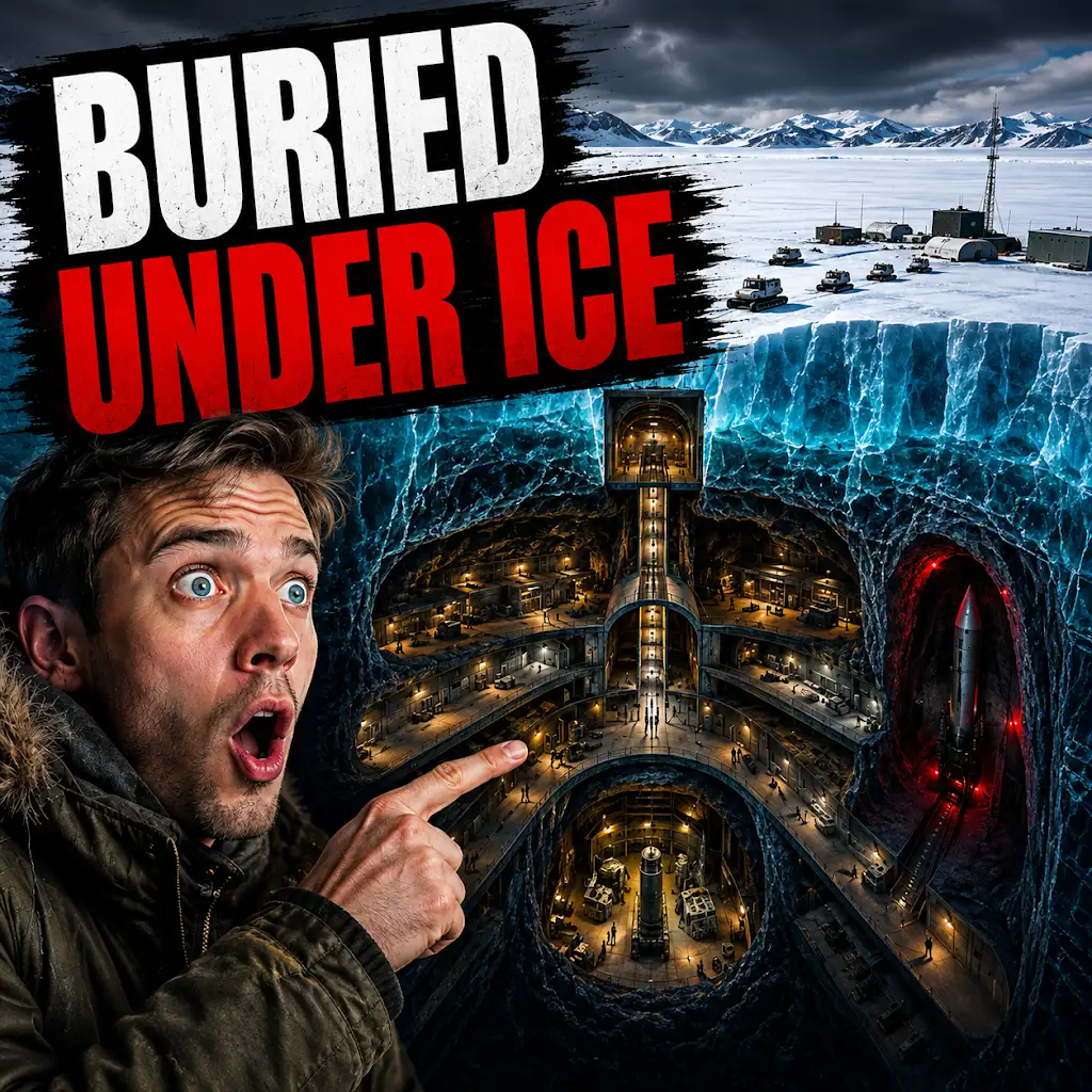
The U.S. Built a Nuclear City Under Greenland. The Ice Won.
FAQs
What is Camp Century in Greenland?
Camp Century was a United States military base located in Greenland, built in 1959 as part of a secret Cold War project known as Project Iceworm. It was primarily used for scientific research and as a cover for the deployment of nuclear missiles.
What is modern radar mapping?
Modern radar mapping uses advanced radar technology to create detailed maps of the Earth’s surface. It can penetrate through ice and snow, allowing for the mapping of areas that are difficult to access or survey using traditional methods.
How is modern radar mapping being used at Camp Century in Greenland?
Modern radar mapping is being used at Camp Century in Greenland to study the ice sheet and the underlying bedrock. This technology helps scientists understand the dynamics of the ice sheet and how it is changing over time.
What are the potential benefits of modern radar mapping at Camp Century in Greenland?
The potential benefits of modern radar mapping at Camp Century in Greenland include gaining a better understanding of the ice sheet’s behavior, which can help in predicting sea level rise and understanding the impacts of climate change.
What are the challenges of modern radar mapping at Camp Century in Greenland?
Challenges of modern radar mapping at Camp Century in Greenland include the harsh Arctic environment, logistical difficulties, and the need for specialized equipment and expertise. Additionally, interpreting and analyzing the large amounts of data collected can also be a challenge.