
The arid landscape of Rapa Nui, commonly known as Easter Island, presents a paradox. While surrounded by the vast Pacific Ocean, the island’s terrestrial freshwater resources are notoriously scarce. This scarcity has long been a critical factor shaping its history and ecology. Recent cartographic investigations have begun to illuminate the distribution and characteristics of freshwater seeps, offering a more nuanced understanding of this vital but often hidden resource. The exploration of these seeps on the map is not merely an academic exercise; it holds implications for archaeology, conservation, and future water management strategies.
The island’s geological formation, primarily volcanic, contributes to its hydrological challenges. Much of the rainfall infiltrates the porous volcanic rock, replenishing underground aquifers. However, accessing this water on the surface is a different matter. Traditional sources have often been limited to ephemeral streams following intense rainfall and a few brackish coastal springs. The subtle emergence of freshwater from the ground, often near the coast or in elevated inland areas, represents a critical ecological niche and a crucial resource for both past and present inhabitants. Mapping these seeps provides a spatial framework for understanding where and how these limited water sources have been utilized and preserved.
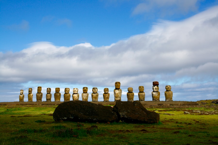
The history of Rapa Nui is inextricably linked to its struggle for sustenance, a struggle intensely influenced by the availability of freshwater. Archaeological evidence suggests that early Polynesian settlers arrived on an island with a more favorable climate and presumably more abundant water. However, as the population grew and the famed moai statues were erected, the island’s environment underwent significant transformation, exacerbated by deforestation and soil erosion. This environmental degradation likely placed immense pressure on freshwater resources, potentially contributing to societal shifts and conflicts observed in the archaeological record.
Evidence from Oral Traditions
While direct written accounts are absent, oral traditions, meticulously documented by early European visitors and later by Rapa Nui descendants, frequently allude to the importance of water. These narratives often describe journeys to find reliable water sources, the reverence associated with particular springs, and the consequences of their depletion. While these traditions are not always precise in their geographical references, they underscore the central role water played in daily life and decision-making. Mapping the seeps provides a tangible anchor for interpreting these historical narratives, allowing researchers to correlate oral accounts with physical locations.
Archaeological Indicators of Water Use
Archaeological sites often reveal the patterns of human settlement and resource exploitation. On Rapa Nui, the proximity of settlements to known or inferred water sources is a consistent observation. Features such as stone structures near springs, evidence of water catchment systems, and the distribution of agricultural terraces can all indicate reliance on localized water. The identification of freshwater seeps on maps allows for a re-evaluation of settlement patterns and the potential intensity of water use in different areas throughout the island’s history. It offers a more granular understanding of how communities adapted to and managed their limited water supply across chronologies.
Freshwater seeps on Easter Island are a crucial resource for the island’s inhabitants, providing essential water for drinking and agriculture in an otherwise arid environment. Understanding the distribution and management of these freshwater sources is vital for sustainable development on the island. For further insights into the implications of resource management and legal frameworks, you can refer to a related article that discusses asset freezing powers and their relevance in environmental contexts. For more information, visit this article.
Methodologies for Seep Identification and Mapping
The identification and mapping of freshwater seeps on Rapa Nui require a multidisciplinary approach, integrating geological surveys, hydrological studies, remote sensing techniques, and on-the-ground fieldwork. The subtle nature of these seeps, often characterized by damp soil, localized vegetation changes, or minor water outflow, makes their detection a complex undertaking.
Ground-Based Surveys and Reconnaissance
The most direct method for identifying freshwater seeps involves systematic ground-based surveys. This entails physically traversing the island, paying close attention to variations in vegetation, soil moisture, and geological features that might indicate subsurface water emergence. Local knowledge, passed down through generations, is invaluable in this process, guiding surveyors to areas historically known for water. Researchers often conduct transect surveys, moving across the landscape in established patterns to ensure comprehensive coverage, and employing simple tools to measure soil moisture and pH.
Vegetation Indicators
Certain plant species are more tolerant of moist soil conditions than others. Identifying patches of vegetation that appear unusually lush or consist of water-loving species can be a strong indicator of a nearby seep. This requires botanical expertise and an understanding of the typical flora of Rapa Nui. Unusual concentrations of particular grasses or ferns can signal a subterranean water source not immediately apparent.
Geological Observations
The underlying geology of Rapa Nui plays a crucial role in the formation and location of freshwater seeps. Observing changes in rock formations, the presence of specific soil types, and evidence of fault lines or other geological structures can help predict where water might emerge. Volcanic rock porosity also dictates infiltration rates, influencing where perched water tables might occur and subsequently manifest as seeps.
Remote Sensing and GIS Applications
Remote sensing technologies, such as satellite imagery and aerial photography, offer a broader perspective for identifying potential seep locations. Multispectral and thermal imaging can detect subtle variations in surface temperature and vegetation health that may be associated with freshwater discharge. Geographic Information Systems (GIS) are essential for integrating various data layers – including topography, geology, land cover, and identified seep locations – to create detailed maps and analyze spatial relationships.
Satellite Imagery Analysis
Analyzing satellite imagery, particularly during different seasons or after rainfall events, can reveal changes in surface moisture. Areas that remain damp or show more vibrant vegetation in otherwise dry conditions may warrant further investigation on the ground. Hyperspectral imaging can be particularly useful in detecting biochemical indicators of water stress or abundance in vegetation.
Aerial Photography and Drone Surveys
Aerial photography provides higher resolution imagery than satellite data and can be used for detailed mapping of specific areas of interest. Drone technology has become increasingly valuable, allowing for cost-effective, high-resolution imaging and even direct sensor deployment for localized hydrological measurements. Drones can quickly survey difficult terrain and capture detailed views of potential seep areas.
Hydrological Modeling and Groundwater Studies
While direct observation is key, hydrological modeling can help predict areas where groundwater might be close to the surface, thus increasing the probability of seeps. Studies on groundwater flow, aquifer characteristics, and recharge zones contribute to a more comprehensive understanding of the island’s water systems and inform the search for seeps.
Aquifer Characterization
Understanding the depth, extent, and connectivity of Rapa Nui’s aquifers is fundamental. Geoelectric surveys and well data can provide insights into the subsurface water-bearing formations and their potential for discharging water at the surface.
Rainfall-Runoff Models
Developing models that simulate rainfall infiltration and surface runoff can help identify areas where water is most likely to emerge as seeps, especially in relation to topography and soil permeability. These models can predict the temporal and spatial variability of seep activity.
Documented Freshwater Seep Locations and Characteristics

The mapping of freshwater seeps on Rapa Nui has led to the identification of several key areas where this vital resource emerges. These locations are not uniform; they vary in size, flow rate, and water quality, reflecting the complex interplay of geological, topographical, and climatic factors. Understanding these variations is crucial for assessing their ecological and historical significance.
Coastal Seeps and Their Significance
A notable concentration of freshwater seeps occurs along Rapa Nui’s coastline, often manifesting as areas where freshwater mingles with seawater. These coastal springs, or ‘ana kōre, have historically provided a critical source of potable water, particularly in areas where inland sources were less accessible or unreliable. Their proximity to the sea also presents unique challenges, as salinity levels can fluctuate.
Influence of Tidal Cycles
Coastal seeps are significantly influenced by tidal cycles. During low tide, freshwater outflow may be more pronounced, while at high tide, the influx of seawater can reduce or even temporarily eliminate the observable freshwater discharge. This dynamic nature requires careful consideration when assessing the reliability of these sources.
Water Quality and Salinity
The water quality of coastal seeps can vary considerably. While some may provide relatively fresh water, others can be brackish due to the mixing of groundwater with seawater. Regular monitoring of salinity and other water quality parameters is essential for understanding their suitability for human consumption and for supporting specific flora and fauna.
Inland Seeps and Their Ecological Niches
Beyond the coastline, freshwater seeps are also found in elevated inland areas. These seeps often emerge in ravines, depressions, or at the base of hills, creating localized microhabitats that support unique vegetation and provide water for terrestrial fauna. Their isolation can make them particularly vulnerable to environmental changes.
High Elevation Springs
Seeps found at higher elevations can be indicative of perched water tables, where a layer of impermeable rock traps water above the main water table. These springs are often crucial for supporting life in otherwise arid upland environments.
Ravine and Depression Seeps
The collection of surface runoff in natural depressions and ravines can lead to the saturation of soil and the emergence of seeps. These areas often become oases supporting distinct plant communities that are adapted to consistent moisture.
Perennial vs. Ephemeral Seeps
The distinction between perennial and ephemeral seeps is critical for understanding their long-term reliability. Perennial seeps flow consistently throughout the year, offering a stable water source, while ephemeral seeps may only appear after significant rainfall events and dry up during periods of drought.
Factors Affecting Flow Persistence
The persistence of seep flow is influenced by a number of factors, including the size of the contributing aquifer, the rate of groundwater recharge, and the geological conditions at the point of emergence. Understanding these factors helps predict the reliability of different seep locations.
Impact of Climate Variability
Climate variability, particularly prolonged drought periods, can severely impact both perennial and ephemeral seeps. Reduced rainfall leads to lower groundwater recharge, potentially causing perennial seeps to diminish or cease flowing, and rendering ephemeral seeps even less predictable.
Archaeological Interpretations and Cultural Significance
The documented freshwater seeps on Rapa Nui are not merely hydrological features; they are deeply interwoven with the island’s archaeological record and cultural history. Their locations and characteristics offer significant insights into how past populations utilized and perceived these vital, yet limited, resources.
Water Sources and Settlement Patterns
The presence of freshwater seeps likely played a decisive role in the initial settlement patterns of Rapa Nui. Early inhabitants would have gravitated towards areas with reliable water access. Archaeological sites tend to be found in proximity to identified seeps, suggesting that these water sources were central to the establishment and growth of communities. Mapping allows for a spatial correlation between known archaeological sites and seep locations, reinforcing this connection.
Correlation with Village Sites
Many known village sites on Rapa Nui are located within a reasonable walking distance of a freshwater seep or spring. This proximity would have been essential for daily life, including drinking water, agriculture, and sanitation. Investigating the precise distances and accessibility of these resources can provide a more detailed understanding of settlement strategies.
Evidence of Water Management Structures
In areas with significant seeps, evidence of rudimentary water management structures, such as stone borders to channel water, small catchments, or even simple wells, may be present. The identification of such features in conjunction with mapped seeps provides strong support for the active utilization and management of these water sources by past inhabitants.
Ritual and Symbolic Importance
Water sources on Rapa Nui, like in many cultures, likely held significant ritual and symbolic importance. Springs and seeps could have been viewed as sacred sites, places of spiritual connection, or locations for important ceremonies. Oral traditions often imbue such places with cultural meaning.
Sacred Springs and Legends
While specific legends directly tied to every mapped seep are not always clear, the general reverence for water sources in Rapa Nui’s oral traditions suggests a deep cultural connection. In a land of scarcity, reliable water would have been a profound gift, fostering a sense of gratitude and spiritual respect. Mapping these sites allows for a tangible link to these historical beliefs.
Comparative Ethnographic Data
Examining ethnographic data from other Polynesian islands concerning the cultural significance of water sources can provide a comparative framework for interpreting Rapa Nui’s traditions. The shared cultural heritage of Polynesian peoples often includes a deep respect for natural resources, particularly water.
Resource Competition and Societal Change
The limited nature of freshwater resources on Rapa Nui may have contributed to periods of resource competition and societal change. Archaeological evidence suggesting periods of conflict or population stress could, in part, be linked to the struggle for access to dwindling water supplies. Analyzing the distribution and potential carrying capacity of mapped seeps in relation to population estimates can offer a more nuanced perspective on these historical dynamics.
Stress on Limited Resources
As the population of Rapa Nui grew, the demand on its limited freshwater resources would have intensified. This could have led to increased competition among different groups or settlements for access to reliable water sources.
Potential for Depletion and Conflict
The overexploitation or natural depletion of a key seep could have created significant social disruption, potentially leading to migrations, conflict, or drastic societal adaptations. The spatial analysis of seep distribution and historical population movements can help investigate these possibilities.
Freshwater seeps on Easter Island have long been a subject of interest for researchers studying the island’s ecology and historical human activity. These vital water sources played a crucial role in sustaining the island’s population, particularly during times of environmental stress. An insightful article that delves into the broader implications of resource management and societal dynamics during crises can be found here, where it discusses elite control and the impact of famine on ancient civilizations. Understanding the significance of freshwater seeps in this context can shed light on how the inhabitants of Easter Island navigated their challenges. For more information, you can read the article at this link.
Conservation and Water Management Strategies
| Location | Latitude | Longitude | Depth |
|---|---|---|---|
| Site 1 | -27.1213 | -109.3667 | 10 meters |
| Site 2 | -27.1355 | -109.4278 | 8 meters |
| Site 3 | -27.1122 | -109.3821 | 12 meters |
The ongoing identification and mapping of freshwater seeps on Rapa Nui are not solely for historical or archaeological purposes. This knowledge is increasingly vital for contemporary conservation efforts and the development of sustainable water management strategies for the island. Given the inherent scarcity and Rapa Nui’s unique environmental context, protecting these fragile ecosystems is paramount.
Protecting Vulnerable Seep Ecosystems
Freshwater seeps create unique microclimates that support specialized flora and fauna. These ecosystems are often highly vulnerable to human impact, habitat alteration, and changes in water availability. Conservation efforts must focus on identifying and safeguarding these sensitive areas.
Habitat Restoration and Management
Where past human activity or natural phenomena have degraded seep ecosystems, restoration efforts may be necessary. This could involve reintroducing native vegetation, managing invasive species, and implementing measures to prevent soil erosion that could impact water flow.
Impact of Tourism and Development
The growing tourism sector on Rapa Nui presents both opportunities and challenges for water management. Increased demand for water from hotels and infrastructure projects, coupled with potential pollution from development, requires careful planning to ensure that seep resources are not adversely affected.
Sustainable Water Resource Development
Understanding the precise location, flow rate, and recharge potential of freshwater seeps is fundamental for planning any future water infrastructure or resource development. Sustainable practices must prioritize the long-term health of these sources.
Monitoring and Data Collection
Continuous monitoring of seep flow rates, water quality, and the surrounding environmental conditions is essential. This data provides the basis for informed decision-making regarding water allocation, conservation measures, and the assessment of the impact of climate change.
Integrating Traditional Knowledge with Modern Science
The integration of traditional Rapa Nui knowledge about water sources with modern scientific techniques offers the most effective approach to water management. Local understanding of seasonal variations, historical usage patterns, and the ecological significance of specific locations can significantly enhance the accuracy and relevance of scientific studies.
Addressing Future Water Security
As Rapa Nui navigates the challenges of climate change and potential population shifts, securing reliable freshwater resources will remain a critical priority. The detailed mapping and ongoing study of freshwater seeps are cornerstones of any strategy aimed at ensuring the island’s future water security.
Climate Change Adaptation
Rising global temperatures and changing rainfall patterns pose a significant threat to Rapa Nui’s water resources. Understanding how seeps respond to drought and increased evaporation is vital for developing adaptation strategies that can mitigate these impacts.
Community Engagement and Education
Effective water management requires the active participation and understanding of the local community. Educating residents about the importance of freshwater seeps, the challenges they face, and the role they can play in conservation efforts is crucial for long-term success.
Future Directions in Seep Exploration
The exploration of freshwater seeps on the map of Rapa Nui is an ongoing endeavor. While significant progress has been made, numerous avenues for future research and exploration remain open, promising to deepen our understanding of this critical resource and its historical significance.
Advanced Remote Sensing and GIS Techniques
Continued advancements in remote sensing technologies and GIS processing offer exciting possibilities for more precise and comprehensive seep identification and mapping. High-resolution satellite data, coupled with sophisticated analytical algorithms, can reveal subtle indicators of water emergence previously undetectable.
Machine Learning for Anomaly Detection
The application of machine learning algorithms to analyze large datasets of satellite imagery and environmental data can help identify patterns indicative of freshwater seeps more efficiently and accurately. This can accelerate the discovery of previously unknown locations.
3D Modeling and Spatial Analysis
Creating detailed 3D models of the island’s terrain, incorporating geological data and identified seep locations, will allow for more sophisticated hydrological modeling and spatial analysis. This can help understand subsurface flow paths and the potential connectivity of different seep systems.
Interdisciplinary Research Collaborations
Fostering stronger collaborations between geologists, hydrologists, archaeologists, botanists, and local community members will be essential for a holistic understanding of Rapa Nui’s freshwater seeps. Each discipline brings a unique perspective that can enrich the research.
Integrating Paleoenvironmental Data
Incorporating paleoenvironmental data, such as pollen analysis from lake sediments or ice core records (if available), can provide a longer-term perspective on past water availability and the historical dynamics of seep activity. This can help contextualize current patterns.
Understanding Microbial Communities
Investigating the microbial communities associated with freshwater seeps can provide insights into water quality and the specific ecological conditions of these environments. These microorganisms can act as sensitive indicators of environmental change.
Predictive Modeling and Water Resource Planning
Developing more robust predictive models for seep behavior under various climate change scenarios will be crucial for future water resource planning on Rapa Nui. This will enable proactive measures to be taken to ensure water security.
Real-time Monitoring Networks
The establishment of real-time monitoring networks at key seep locations, utilizing automated sensors for flow rate, temperature, and water quality, can provide immediate data for adaptive management strategies. This allows for rapid response to changes in seep behavior.
Community-Based Monitoring Programs
Empowering local communities to participate in water monitoring programs can foster a sense of ownership and responsibility for freshwater resources. This can involve training residents in data collection and providing them with the tools to observe and report on the condition of local seeps. The exploration of freshwater seeps on Rapa Nui is far from complete. Each new discovery, each refined map, and each deepened understanding contributes to the intricate tapestry of the island’s past, present, and future, underscoring the enduring importance of even the most seemingly modest sources of life.
FAQs
What are fresh water seeps on Easter Island?
Fresh water seeps on Easter Island are natural sources of fresh water that emerge from the ground, providing essential drinking water for the island’s inhabitants and wildlife.
Where are the fresh water seeps located on Easter Island?
Fresh water seeps can be found in various locations across Easter Island, including along the coastline and inland areas. They are often marked by lush vegetation and are important for sustaining life on the island.
How do fresh water seeps impact the environment on Easter Island?
Fresh water seeps play a crucial role in supporting the island’s ecosystem by providing water for plants, animals, and humans. They contribute to the overall biodiversity and sustainability of the island’s natural environment.
What is the significance of fresh water seeps for the inhabitants of Easter Island?
Fresh water seeps are vital for the survival of the island’s inhabitants, as they provide a reliable source of drinking water. Historically, these seeps have been essential for sustaining human settlement on the island.
Are there any conservation efforts in place to protect the fresh water seeps on Easter Island?
Conservation efforts are in place to protect the fresh water seeps on Easter Island, including measures to preserve the surrounding vegetation and prevent contamination of the water sources. These efforts are important for maintaining the island’s natural resources for future generations.