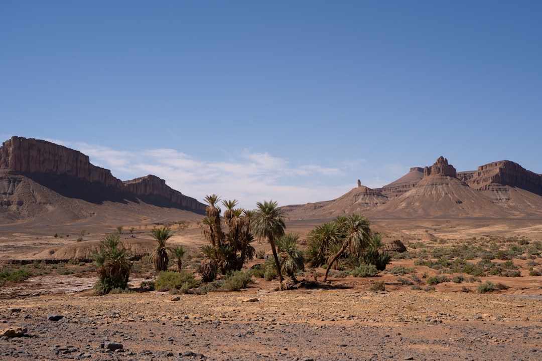
The Sahara Desert, a vast and iconic expanse of sand, rock, and extreme temperatures, holds within its seemingly barren landscapes a profound geological story. This colossal desert, the largest hot desert in the world, stretches across much of North Africa, a testament to immense geological forces that have shaped its surface over millennia. To truly appreciate the Sahara is to delve into its ancient foundations, understanding the processes that have sculpted its dunes, carved its canyons, and preserved its secrets within its arid embrace.
Beneath the shifting sands and weathered rock formations of the Sahara lies an unimaginably ancient geological skeleton, forged during the Precambrian Eon. This era, predating the Cambrian explosion of life, witnessed the formation of the Earth’s earliest continents and the initial stages of plate tectonics. The Sahara’s Precambrian basement rocks are the silent witnesses to these formative periods, providing a fundamental framework upon which all subsequent geological events have unfolded.
Archean and Proterozoic Accretion: The Birth of a Continent
The oldest rocks in the Sahara, dating back to the Archean Eon (4.0 to 2.5 billion years ago), are primarily crystalline igneous and metamorphic rocks. These are the building blocks of the very crust that would eventually coalesce into the African continent. Evidence of these ancient volcanic activities and early mountain-building events can be found in scattered outcrops and sub-surface formations. These rocks often exhibit a high degree of metamorphism, indicating they have been subjected to immense heat and pressure deep within the Earth’s crust.
Following the Archean, the Proterozoic Eon (2.5 billion to 541 million years ago) saw further continental growth through a process known as accretion. This involved the merging of smaller continental fragments and volcanic island arcs. The Sahara’s geological record from this period includes extensive sedimentary sequences deposited in ancient marine basins, interspersed with igneous intrusions and volcanic layers. These ancient sedimentary rocks can sometimes reveal clues about the early atmosphere and oceans, as well as the geological environments present billions of years ago. Understanding these ancient Precambrian foundations is crucial, as they dictate the structural integrity and the fundamental geological properties of the entire region. The presence of ancient cratons – stable, older parts of continents – within the Sahara underscores its deep geological history.
The Pan-African Orogeny: A Defining Moment
A key geological event that significantly impacted the Sahara’s Precambrian basement was the Pan-African Orogeny, a period of intense mountain-building and continental collision that occurred roughly between 600 and 500 million years ago. This orogenic event was responsible for stitching together many of the ancient cratonic blocks, forming larger landmasses. In the Sahara, this resulted in the formation of extensive mountain ranges, now heavily eroded but leaving their imprint in the folding and faulting of the Precambrian rocks. The geological structures created during the Pan-African Orogeny, such as major fault zones and thrust belts, continue to influence the subsurface geology and groundwater systems of the Sahara today. These ancient mountain belts, though long worn down by erosion, provide a structural template that guides later geological processes.
The geology of the Sahara Desert is a fascinating subject that reveals the complex history of one of the world’s largest deserts. For those interested in exploring the connections between ancient civilizations and geological formations, a related article titled “Uncovering Lost Maps: Library of Alexandria’s Legacy” provides intriguing insights into how geographic knowledge influenced historical navigation and exploration. You can read more about it by following this link: Uncovering Lost Maps: Library of Alexandria’s Legacy.
The Paleozoic and Mesozoic Seas: A Time of Ancient Oceans
While the Precambrian laid the groundwork, the subsequent Paleozoic and Mesozoic Eras brought dramatic changes to the Sahara, transforming parts of it from continental landmasses into vast shallow seas. These periods of marine inundation left behind a rich tapestry of sedimentary rocks, holding fossils that offer glimpses into ancient marine life and the environmental conditions of the time.
The Paleozoic: Cycles of Sedimentation and Glaciation
During the Paleozoic Era, particularly the Ordovician, Silurian, Devonian, and Carboniferous periods, parts of the Sahara were submerged beneath warm, shallow seas. Thick sequences of sandstone, shale, and limestone were deposited, preserving a wealth of marine fossils, including trilobites, brachiopods, and early fish. These sedimentary rocks offer invaluable insights into the marine ecosystems that thrived in these ancient waters. Furthermore, evidence from the Late Ordovician and early Silurian periods points to a significant glacial event, known as the Sahara Glaciation. Large ice sheets covered parts of Gondwana, including what is now the Sahara. Deposits from this period, such as tillites (rock formed from glacial debris), can be found in specific regions, providing stark evidence of a dramatically cooler past.
The Carboniferous period, a time of vast coal swamps on other continents, also saw depositional environments within the Sahara that could support plant life. While not as extensive as the coal deposits of Europe or North America, periods of swampy conditions and the deposition of organic-rich sediments occurred in some areas. These rocks can sometimes hold fossilized plant matter, offering further clues about the past climate and vegetation. Understanding these Paleozoic deposits is not only scientifically fascinating but also economically significant, as some formations are potential sources of hydrocarbons.
The Mesozoic: The Age of Dinosaurs and Tropical Seas
The Mesozoic Era, often referred to as the “Age of Dinosaurs,” also left its mark on the Sahara. During the Triassic, Jurassic, and Cretaceous periods, climatic shifts and changing sea levels led to further marine transgressions and regressions across the region. Much of the Sahara was periodically covered by warm, shallow seas, similar to the Paleozoic, but with different dominant life forms.
Jurassic Marine Life and Sediments
The Jurassic period, in particular, saw extensive marine deposition in parts of North Africa. Thick layers of limestone and marl were laid down, rich in fossils of ammonites, belemnites, marine reptiles, and bivalves. These fossils are crucial for reconstructing the paleogeography and environmental conditions of the Jurassic Sahara, which was then part of a much larger ocean system. The geological formations from this era are often characterized by fine-grained sedimentary rocks that were deposited in calm marine environments.
Cretaceous Seas and Dinosaur Tracks
The Cretaceous period witnessed further marine incursions and, in some areas, fluvial (river) and deltaic deposition. The presence of dinosaur fossils and, even more strikingly, dinosaur footprints in Cretaceous sedimentary rocks across the Sahara provide direct evidence of these ancient terrestrial ecosystems. These footprints, preserved in sandstones and mudstones, offer a unique window into the movement and behavior of dinosaurs that roamed these landscapes millions of years ago. The geological conditions during the Cretaceous sometimes allowed for the rapid burial of these tracks, preserving them from erosion. The diversity of these fossil findings underscores the dynamic nature of the Sahara’s past, which was far from the arid desert we know today.
Cenozoic Sculpting: The Rise of the Modern Desert
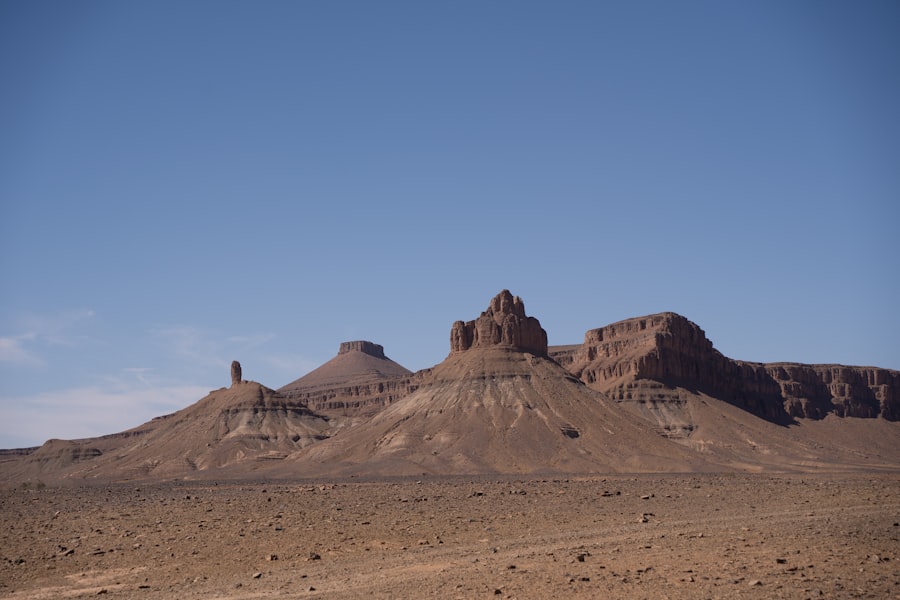
The Cenozoic Era, the most recent geological period spanning the last 66 million years, has been the primary architect of the Sahara’s modern desert landscape. This era witnessed significant tectonic activity, dramatic climatic fluctuations, and the relentless forces of erosion and deposition that have sculpted the iconic features of the Sahara.
Tectonic Uplift and Basin Formation
The Cenozoic was a period of continued tectonic activity, including significant uplift in North Africa. The collision between the African and Eurasian plates, a process that continues today, led to the formation and reactivation of fault systems and the creation of large-scale basins. These tectonic processes influenced drainage patterns, led to the deposition of thick sedimentary sequences in subsiding areas, and contributed to the overall elevation of the landmass. The formation of major mountain ranges, such as the Atlas Mountains to the northwest, played a role in regional climate patterns, influencing rainfall and creating rain shadow effects that contributed to aridification.
Climatic Oscillations: The Sahara’s Wet and Dry Cycles
Perhaps the most defining geological processes of the Cenozoic in the Sahara have been the dramatic climatic oscillations. Far from being a static environment, the Sahara has experienced numerous cycles of aridity and humidity, largely driven by variations in Earth’s orbit (Milankovitch cycles) and atmospheric circulation patterns.
The “Green Sahara” Periods
During interglacial periods, particularly over the last few hundred thousand years, the Sahara has experienced periods of significantly increased rainfall, creating what is known as the “Green Sahara.” During these times, lakes, rivers, and grasslands flourished across the region. Archaeological and geological evidence, including ancient lake sediments, fossilized flora and fauna, and rock art depicting animals that are no longer found in the desert, attests to these wetter intervals. The geological formations from these “Green Sahara” periods often include lacustrine deposits (formed in lakes) and fluvial sediments, clearly distinguishable from the arid-phase deposits.
Aridification and Desertification
Conversely, during glacial periods and periods of reduced monsoon intensity, the Sahara has become progressively drier, leading to the desertification we observe today. These arid phases have been responsible for the vast dune fields, wind-eroded landscapes, and the widespread deposition of fine sands and silts. The geological record of these arid phases is dominated by aeolian (wind-formed) deposits, such as sand seas (ergs) and loess (wind-blown silt). The movement of sand by wind is a continuous process, constantly reshaping the desert’s surface.
The Sculpting Power of Water and Wind: Shaping Today’s Sahara

While the Sahara is synonymous with aridity, the forces of water and wind, albeit acting differently than in more humid regions, are the principal sculptors of its present-day landscape. The geological formations bear the distinct signatures of these powerful, albeit often infrequent, agents of change.
Aeolian Landscapes: The Reign of the Wind
Wind is undoubtedly the dominant geological agent in the modern Sahara. Its ceaseless action has shaped vast landscapes of sand dunes, known as ergs. These ergs can cover thousands of square kilometers, displaying a remarkable diversity of forms, from simple crescent-shaped barchans to complex star dunes. The sand itself is derived from the erosion of older rocks, gradually broken down into smaller grains over millennia. The constant movement of sand by wind creates dynamic landscapes that are ever-changing.
Beyond the iconic sand dunes, wind erosion (aeolian erosion) has also sculpted rocky areas, creating features like yardangs (streamlined rock formations shaped by wind-blown sediment) and ventifacts (rocks that have been abraded by wind-blown sand). The fine, powdery dust that is often lifted by winds can be transported vast distances, even contributing to soil fertility in other parts of the world, a process known as dust storms, which are significant geological events in themselves. The deposition of this wind-blown dust, especially during past wetter periods, has also contributed to the formation of loess deposits, which can be fertile soils.
The Legacy of Ancient Rivers and Rare Fluvial Activity
Despite its current aridity, the Sahara bears the indelible marks of past fluvial systems. Ancient riverbeds, known as wadis, crisscross the landscape. These dry river channels are testament to periods when water flowed more freely across the region. During the “Green Sahara” phases, these wadis would have been active rivers, carving out canyons and valleys. Today, they serve as markers of past hydrological regimes and are often sites where ephemeral rainfall can collect, supporting localized vegetation.
Even in the present day, rare and infrequent rainfall events can lead to flash floods within these wadis. These powerful torrents, though short-lived, can rework sediments, carve new channels, and transport debris, demonstrating the lingering power of water in shaping the desert terrain. The erosion and deposition associated with these rare fluvial events contribute to the ongoing geological evolution of the Sahara. The study of these fluvial landscapes is also crucial for understanding water resources, as underground aquifers can be replenished by water percolating through the wadi systems.
The geology of the Sahara Desert is a fascinating subject that reveals much about the Earth’s history and climatic changes over millions of years. Researchers have studied the ancient rock formations and sediment layers to understand how this vast desert evolved from a once lush landscape to its current arid state. For those interested in exploring related topics, you might find insights in an article discussing the implications of technological advancements on society, which can be found here. This connection highlights how both natural and artificial changes can shape our world in profound ways.
The Sahara’s Geological Riches: Resources and Scientific Treasures
| Geological Feature | Description |
|---|---|
| Rock Formations | The Sahara Desert is characterized by various rock formations including sandstone, limestone, and granite. |
| Fossils | The desert contains important fossil sites, including dinosaur fossils and ancient human remains. |
| Mineral Resources | The Sahara is rich in mineral resources such as iron ore, uranium, and phosphate deposits. |
| Wind Erosion | Wind erosion has shaped the landscape, creating vast sand dunes and rocky plateaus. |
| Water Sources | Despite its arid nature, the Sahara contains underground water sources and occasional oases. |
The geological history of the Sahara has endowed it with significant natural resources and has made it a treasure trove for scientific discovery. From vital energy sources to invaluable insights into Earth’s past, the desert’s geology plays a critical role in both human endeavors and scientific understanding.
Hydrocarbons: Fueling the Modern World
One of the most economically significant geological aspects of the Sahara is its vast reserves of hydrocarbons, particularly oil and natural gas. These fossil fuels were formed from the organic matter accumulated in ancient marine basins during the Paleozoic and Mesozoic Eras, when parts of the Sahara were covered by seas teeming with life. Over millions of years, heat and pressure transformed this organic-rich sediment into oil and gas, which became trapped in porous rock formations known as reservoirs, often sealed by impermeable layers of rock.
Geological exploration and drilling have revealed substantial oil and gas fields across various North African countries that encompass the Sahara. The extraction and transportation of these resources have played a significant role in the economies of the region. Understanding the subsurface geology, including the stratigraphy, structural traps, and reservoir properties, is paramount for the successful exploration and production of these vital energy sources.
Groundwater: A Hidden Lifeline
Beneath the seemingly parched surface of the Sahara lies a vast, hidden reservoir of groundwater, a critical resource for life in this hyper-arid environment. These vast underground water systems, known as aquifers, are often remnants of past wetter periods or are replenished by very limited surface infiltration. Several major aquifers exist beneath the Sahara, including the vast Nubian Sandstone Aquifer System, which underlies parts of Egypt, Libya, Sudan, and Chad.
These aquifers contain water that can be tens of thousands, or even hundreds of thousands, of years old, having accumulated during the “Green Sahara” periods. The geological formations that host these aquifers are typically porous and permeable sedimentary rocks, such as sandstones and limestones, which allow water to be stored and flow. The sustainable management and exploitation of these precious groundwater resources are crucial for the survival and development of communities within and around the Sahara, presenting complex geological and hydrological challenges.
Paleontological and Archaeogical Discoveries
The Sahara’s arid climate and limited human activity have, in many areas, preserved an extraordinary record of both paleontological and archaeological significance. The ancient rock formations have yielded a wealth of fossils, providing invaluable information about the evolution of life on Earth. From the marine invertebrates of the Paleozoic and Mesozoic seas to the dinosaur footprints and remains of the Mesozoic, and the megafauna of the “Green Sahara” periods, these discoveries paint a detailed picture of past ecosystems.
Furthermore, the arid conditions have also helped preserve evidence of early human activity. Rock art sites, dotted across the Sahara, depict ancient animals, hunting scenes, and abstract symbols, offering insights into the lives and beliefs of past human populations. The geological context of these archaeological sites is crucial for dating and understanding human settlement patterns and migrations. The Sahara, therefore, stands as a vital repository of Earth’s history, both biological and human.
In conclusion, the Sahara Desert is far more than just an expanse of sand. It is a dynamic geological tapestry, woven from billions of years of tectonic activity, oceanic cycles, dramatic climatic shifts, and the persistent sculpting power of wind and water. Its ancient Precambrian foundations, Paleozoic and Mesozoic marine eras, and the continuous reshaping of its Cenozoic landscape all contribute to a complex and fascinating geological narrative. The Sahara’s geology not only shapes its present-day environment but also holds significant resources and provides invaluable insights into the planet’s deep history, making it a truly remarkable geological frontier.

The Ancient World Buried Beneath the Sahara
FAQs
What is the geology of the Sahara Desert?
The Sahara Desert is primarily composed of sand dunes, rocky plateaus, and gravel plains. It also contains various geological formations such as mountains, valleys, and ancient riverbeds.
How was the Sahara Desert formed?
The formation of the Sahara Desert is attributed to a combination of factors including tectonic activity, climate change, and the movement of the Earth’s crust. Over millions of years, these factors have contributed to the desert’s unique geological features.
What types of rocks are found in the Sahara Desert?
The Sahara Desert contains a variety of rocks including sandstone, limestone, granite, and volcanic rocks. These rocks have been shaped by erosion and weathering processes over time, contributing to the desert’s diverse geological landscape.
Are there any significant geological landmarks in the Sahara Desert?
Yes, the Sahara Desert is home to several notable geological landmarks such as the Tassili n’Ajjer plateau, the Ahaggar Mountains, and the Ennedi Plateau. These landmarks showcase the diverse geological formations found within the desert.
How does the geology of the Sahara Desert impact the region?
The geology of the Sahara Desert influences various aspects of the region including its climate, water resources, and natural resources. Understanding the desert’s geology is important for studying its environmental changes and potential for geological resources.