The Earth’s crust, a thin, brittle shell compared to the immense volumes of its interior, has always held a profound allure for humanity. For centuries, scientists and adventurers alike have dreamed of peering beneath this veneer, of understanding the processes that shape our planet from its very core. Among the most ambitious endeavors to achieve this understanding was the Kola Superdeep Borehole, a project that pushed the boundaries of human ingenuity and scientific inquiry. Nestled on the Kola Peninsula in Russia, this remarkable feat of engineering offered an unprecedented glimpse into the deep continental crust, revealing secrets that challenged existing geological models and prompting new questions about the Earth’s inner workings. Alongside the direct observations from the borehole, a parallel pursuit in geophysics, the identification and characterization of the Conrad Discontinuity, has further enriched our comprehension of the crust’s stratified nature and its complex history.
The Kola Superdeep Borehole was not a sudden impulse but the culmination of decades of scientific ambition and geopolitical rivalry. The quest to understand the Earth’s interior has a long history, with early attempts at deep drilling often driven by the search for resources. However, the Kola project was conceived with purely scientific objectives: to study the structure, composition, and physical properties of the continental crust at depths never before reached. The choice of the Kola Peninsula was strategic, selected for its ancient Precambrian rocks, believed to be representative of the stable continental crust. The project, initiated in 1970 by the Soviet Union, was a testament to their commitment to scientific exploration and their desire to be at the forefront of geological research. The sheer scale of the undertaking, involving thousands of scientists and engineers, underscored the monumental nature of the endeavor. It was a national undertaking, a symbol of Soviet scientific prowess, and a bold step into the unknown. The initial goal was to reach a depth of 15 kilometers, a seemingly insurmountable task with the technology of the time.
The Race to the Deep: Early Drilling Efforts and Technological Hurdles
The history of deep drilling is punctuated by a series of ambitious, though often less successful, attempts. Prior to Kola, projects in the United States and Germany had reached significant depths, but none approached the ultimate objectives set for the Soviet endeavor. These earlier efforts were crucial in developing the drilling technologies and techniques that would later be refined and employed at Kola. The challenges were immense: the extreme pressures and temperatures encountered at depth, the difficulty of maintaining borehole stability, and the slow rate of progress all presented formidable obstacles. Each meter drilled was a victory, a testament to the perseverance of the engineers and geologists involved. The need for specialized drilling equipment, robust casing, and sophisticated logging tools became apparent through these pioneering efforts, laying the groundwork for the more advanced techniques that would define the Kola project. The very act of drilling deeper demanded innovation, pushing the boundaries of metallurgy, fluid dynamics, and sensor technology.
Strategic Location: Why the Kola Peninsula?
The selection of the Kola Peninsula was not arbitrary. This region of northwestern Russia is characterized by the Baltic Shield, an ancient and stable geological formation. The Precambrian rocks found here, dating back billions of years, offer a window into the Earth’s earliest geological history. Unlike younger, more tectonically active regions where crustal processes are more dynamic and complex, the Kola Peninsula provided a relatively stable and well-preserved section of continental crust. This made it an ideal location for studying the fundamental architecture and composition of the continental lithosphere. Scientists hoped that by drilling into these ancient rocks, they could gain insights into the processes of crustal formation and evolution that occurred early in Earth’s history, providing a baseline for understanding later geological events. The geological uniformity of the region also simplified the interpretation of the data gathered, allowing for a more focused study of depth-related changes.
The Kola Borehole, the deepest man-made hole on Earth, has provided invaluable insights into the Earth’s crust and the mysterious Conrad discontinuity, which marks a transition between different geological layers. For those interested in understanding the broader implications of geological studies, including how ancient climate crises have shaped our planet, a related article can be found at Lessons from Ancient Climate Crisis: A Historical Perspective. This article explores the historical context of climate changes and their geological impacts, offering a fascinating backdrop to the findings from the Kola Borehole.
Unveiling the Earth’s Inner Sanctum: The Kola Superdeep Borehole
The Kola Superdeep Borehole stands as a monumental achievement in scientific exploration. For over two decades, drilling continued, slowly but surely descending into the Earth’s crust. The project’s ultimate depth of 12,262 meters (approximately 7.6 miles) remains the deepest artificial point on Earth. This incredible depth allowed scientists to sample rocks and fluids from a geological environment that had previously only been theorized about. The data collected from Kola provided a wealth of information, challenging long-held assumptions about the composition and structure of the continental crust and revealing unexpected geological phenomena. The immense effort and resources invested in this project yielded a scientific treasure trove, fundamentally altering our understanding of the planet beneath our feet.
Drilling Through the Layers: Lithology and Stratigraphy
As the drill bit descended, it passed through distinct geological layers, each revealing a different chapter in the Earth’s history. The upper portions of the borehole penetrated sedimentary rocks, which gave way to metamorphic and igneous rocks of the Archean and Proterozoic eras. The rocks encountered were often highly deformed and altered, reflecting billions of years of tectonic activity, heat, and pressure. The detailed logging of the rock strata, coupled with core samples, allowed geologists to construct a remarkably detailed cross-section of the upper continental crust. This revealed intricate folding, faulting, and metamorphism, painting a picture of a dynamic and ever-changing geological environment. The sheer variety of rock types encountered underscored the complex processes of magmatism, sedimentation, and metamorphism that have shaped the Earth’s crust over eons.
The Unexpected Discoveries: Fluids, Gases, and Microbes
Perhaps the most surprising revelations from the Kola Borehole came from the unexpected presence of fluids and gases at extreme depths, and the discovery of ancient microorganisms. Water, trapped within the pore spaces and fractures of the deep crust, was found to contain dissolved minerals and gases, including methane and hydrogen. This indicated that hydrological processes extend far deeper into the Earth than previously thought. Even more astonishing was the discovery of microfossils and intact microbial cells in rock samples from depths exceeding 9 kilometers. These extremophiles, thriving in conditions of high pressure, temperature, and scarcity of nutrients, demonstrated the remarkable adaptability of life and suggested that the deep biosphere could be a significant and previously unrecognized component of Earth’s ecosystems. These findings fundamentally altered our understanding of habitability and the potential for life in extreme environments, both on Earth and potentially on other planets.
Challenging Established Models: The Granitic Layer Debate
One of the most significant impacts of the Kola Borehole was its contribution to the debate surrounding the composition of the Earth’s crust. For decades, the prevailing geological model proposed a two-layer structure for the continental crust: an upper granitic layer and a lower basaltic layer. However, the rocks encountered in the Kola Borehole, particularly in the deeper sections, were predominantly metamorphic and igneous, with a significant presence of amphibolites and granulites, which are denser and more mafic (basaltic) in composition than granite. This suggested that the transition from the upper to the lower crust might not be as sharp as previously thought, and that the granitic layer, as envisioned in some models, might be more heterogeneous or even absent in certain regions. The data from Kola indicated a gradual increase in density and a change in seismic velocity with depth, supporting a more complex and layered structure than the simplistic granite-basalt dichotomy.
The Conrad Discontinuity: A Geophysical Marker of Crustal Transition
While the Kola Borehole provided direct physical samples from the Earth’s depths, the identification and study of the Conrad Discontinuity represent a significant achievement in geophysical exploration. This discontinuity is a subsurface boundary within the continental crust, characterized by a distinct change in seismic wave velocities. It is observed globally and is thought to mark a transition between the upper, more felsic (granite-rich) crust and the lower, more mafic (basalt-rich) crust. The Conrad Discontinuity is not a physical boundary in the sense of a distinct geological layer but rather a zone where the seismic properties of the rock change significantly. Its identification has been crucial for understanding the overall architecture and evolution of the continental crust, providing a large-scale perspective that complements the detailed, localized data from boreholes.
Seismic Waves: Unraveling Earth’s Interior
The study of seismic waves, generated by earthquakes or artificial sources, is the primary tool for investigating the Earth’s interior. When seismic waves travel through different rock layers, their speed and direction change depending on the density, composition, and temperature of the material. By analyzing the travel times and patterns of these waves recorded at seismological stations around the world, geophysicists can infer the structure of the Earth’s interior, including the boundaries between different layers. The Conrad Discontinuity was first identified through such seismic studies, revealing a systematic increase in seismic wave velocity at a particular depth. This indicated a significant change in the physical properties of the rocks below this depth, suggesting a transition in composition or lithology.
Characteristics of the Conrad Discontinuity: Velocity and Depth
The Conrad Discontinuity is typically characterized by an increase in compressional (P) wave velocity from around 6.0-6.5 km/s in the upper crust to 6.5-7.0 km/s in the lower crust. The depth at which this discontinuity occurs varies considerably across different geological provinces, generally ranging from 10 to 20 kilometers beneath the surface. In more stable, older continental areas, it tends to be shallower, while in younger, more tectonically active regions, it can be deeper. The presence and depth of the Conrad Discontinuity have been correlated with various geological factors, including crustal thickness, tectonic history, and magmatic activity. Its consistent observation across vast continental areas highlights its significance as a fundamental feature of the Earth’s crustal structure.
Interpretations and Debates: What Lies Beneath?
The exact nature of the Conrad Discontinuity has been a subject of ongoing debate and research. While it is widely accepted as a marker of a transition from the upper to the lower crust, the specific lithological changes responsible for this seismic signature are still being investigated. Some interpretations suggest a transition from granitic to more dioritic or gabbroic rocks, reflecting an increase in mafic mineral content. Other theories propose that the discontinuity may be related to changes in temperature, pressure, or the degree of metamorphism. The Kola Borehole’s findings, with its emphasis on metamorphic rocks at depth, have provided valuable insights that can help refine these interpretations. The increasing evidence suggests that the Conrad Discontinuity is not a single, uniform boundary but rather a complex zone that can vary in its characteristics and the geological processes that define it.
Connecting the Borehole and the Discontinuity: A Synergistic Understanding
The Kola Superdeep Borehole and the study of the Conrad Discontinuity, while employing different methodologies, have provided complementary insights into the structure and composition of the Earth’s continental crust. The borehole offered direct, in-situ sampling, allowing for detailed mineralogical and geochemical analysis of the rocks at specific depths. This provided ground truth for the interpretations made from geophysical data. Conversely, the widespread observations of the Conrad Discontinuity offer a broader, regional perspective, revealing large-scale patterns of crustal stratification that the borehole, being a single point, could not fully capture. Together, they have enabled a more comprehensive and nuanced understanding of the Earth’s crustal architecture.
Bridging the Gap: From Core Samples to Seismic Models
The data from the Kola Borehole played a crucial role in validating and refining seismic models of the Earth’s crust. For instance, the lithological information obtained from the borehole’s cores, which indicated a prevalence of metamorphic rocks with increasing mafic content at depth, helped geophysicists better interpret the seismic velocity changes associated with the Conrad Discontinuity. If seismic data suggested a gradual increase in density, and core samples revealed a transition from felsic to more mafic metamorphic rocks, this provided a strong link between the geophysical observation and the physical reality of the subsurface. This synergistic approach allows for a more confident interpretation of seismic data, moving beyond abstract velocity changes to a more concrete understanding of the underlying geological materials.
Heterogeneity and Complexity: Beyond Simple Layering
Both the Kola Borehole and the research on the Conrad Discontinuity have underscored the complexity and heterogeneity of the Earth’s continental crust. Instead of a simple, uniform layering, the crust is now understood to be a dynamic system characterized by intricate structures, variations in composition, and the presence of fluids and life at unexpected depths. The Kola Borehole revealed significant variations within supposedly uniform rock units and evidence of complex deformation. Similarly, studies of the Conrad Discontinuity have shown that its depth and characteristics can vary significantly, suggesting that the transition from the upper to the lower crust is not always a smooth, continuous process but can be influenced by local geological history. This realization has moved the field away from simplistic, idealized models towards more sophisticated representations of the Earth’s crust.
The Deep Biosphere and its Implications
The discovery of viable microbial life at extreme depths within the Kola Borehole has profound implications for our understanding of the Earth’s biosphere and the potential for life elsewhere. This “deep biosphere” represents a vast, largely unexplored realm of life that exists independent of surface sunlight. The presence of these extremophiles challenges our assumptions about the conditions necessary for life and suggests that life may be far more widespread and resilient than previously imagined. This has significant implications for astrobiology, as it expands the range of planetary environments that could potentially harbor life. The Kola findings have opened up new avenues of research into microbial metabolism, survival strategies in extreme environments, and the role of the deep biosphere in global biogeochemical cycles.
The Kola Borehole, known for its remarkable depth, has provided valuable insights into the Earth’s crust and the enigmatic Conrad discontinuity. Researchers have explored various geological phenomena, and understanding these layers is crucial for advancements in geosciences. For those interested in the broader implications of geological studies on global dynamics, a related article discusses key strategies for success in navigating international relations, which can be found here. This connection highlights how geological research can influence not only scientific fields but also geopolitical strategies.
Legacy and Future Prospects: Continuing the Exploration
| Metric | Value | Unit | Description |
|---|---|---|---|
| Depth of Conrad Discontinuity | 15-20 | km | Depth range at which the Conrad discontinuity was observed in the Kola Superdeep Borehole |
| Depth of Kola Borehole | 12,262 | m | Maximum depth reached by the Kola Superdeep Borehole |
| Seismic Velocity Contrast | ~0.3 | km/s | Approximate difference in seismic P-wave velocity across the Conrad discontinuity |
| Rock Type Above Discontinuity | Granite | – | Dominant rock type in the upper crust above the Conrad discontinuity |
| Rock Type Below Discontinuity | Gabbroic Rocks | – | Dominant rock type in the lower crust below the Conrad discontinuity |
| Temperature at Depth | 180-200 | °C | Estimated temperature range at the depth of the Conrad discontinuity in the borehole |
| Pressure at Depth | 0.3-0.4 | GPa | Estimated lithostatic pressure at the depth of the Conrad discontinuity |
The Kola Superdeep Borehole, though drilling operations ceased in the early 2000s, continues to be a focal point of scientific research. The vast archives of core samples and data remain a rich resource for geologists, geochemists, geophysicists, and biologists. The project’s legacy extends beyond its direct scientific contributions, inspiring future generations of researchers and driving innovation in drilling and subsurface exploration technologies. The lessons learned from Kola and the ongoing study of features like the Conrad Discontinuity are paving the way for new, even more ambitious endeavors to probe the Earth’s mysteries.
The Enduring Value of Kola’s Archives
The core samples retrieved from the Kola Superdeep Borehole are invaluable. Stored and meticulously cataloged, they represent a unique physical record of the Earth’s deep crust. Researchers continue to analyze these samples using advanced techniques, uncovering new details about mineralogy, geochemistry, and paleontology. Each new analysis can shed light on previously unresolved questions or raise entirely new ones, demonstrating the enduring scientific yield of this monumental project. The digital data from the borehole’s logging operations also provides a wealth of information for numerical modeling and comparative studies with other geological regions. The archives are a testament to the foresight of the project’s initiators and a lasting gift to the scientific community.
New Frontiers in Subsurface Exploration
The success and challenges of the Kola Superdeep Borehole have spurred the development of new technologies and methodologies for deep subsurface exploration. Advancements in drilling techniques, including directional drilling and improved drill bit technology, are enabling access to previously unreachable depths and geological formations. Geophysical methods are also becoming more sophisticated, with improved seismic imaging and the development of new techniques for characterizing subsurface properties. The search for resources, geothermal energy, and understanding of subsurface processes like carbon sequestration are all driving innovation in this field. The quest to understand the Earth’s interior is far from over; it is an ongoing journey of discovery, fueled by curiosity and technological advancement.
The Ongoing Quest: Deeper and Beyond
The ultimate goal of understanding the Earth’s interior remains a powerful driving force. While the Kola Superdeep Borehole provided an unprecedented look into the continental crust, the mantle and core still remain largely enigmatic. Future projects may aim to drill even deeper, or to explore different geological settings, such as oceanic crust, which has a different structure and evolution. The integration of data from various sources – boreholes, seismic surveys, laboratory experiments, and theoretical modeling – will be crucial in piecing together the complex puzzle of our planet’s interior. The insights gained from the Kola Borehole and the study of the Conrad Discontinuity serve as vital stepping stones in this grand scientific endeavor, reminding us that the Earth holds countless secrets yet to be unveiled. The continued exploration of our planet’s depths is not merely an academic pursuit but a fundamental aspect of understanding our place in the cosmos and ensuring a sustainable future.
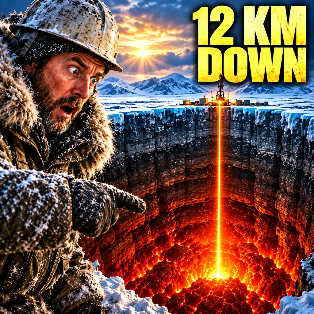
They Drilled 12 KM Into Earth — Then Everything Changed
FAQs
What is the Kola Borehole Conrad discontinuity?
The Kola Borehole Conrad discontinuity is a seismic boundary discovered during the drilling of the Kola Superdeep Borehole in Russia. It marks a significant change in seismic wave velocities at a depth of around 8-10 kilometers.
How deep is the Kola Borehole Conrad discontinuity located?
The Kola Borehole Conrad discontinuity is located at a depth of approximately 8-10 kilometers below the Earth’s surface. This boundary was identified during the drilling of the Kola Superdeep Borehole.
What does the discovery of the Kola Borehole Conrad discontinuity reveal about the Earth’s structure?
The discovery of the Kola Borehole Conrad discontinuity provides valuable insights into the Earth’s structure and composition. It indicates a change in seismic wave velocities, suggesting a transition between different layers or materials within the Earth’s crust.
Why is the Kola Borehole Conrad discontinuity significant?
The Kola Borehole Conrad discontinuity is significant because it offers scientists a rare opportunity to study the Earth’s deep structure. By analyzing the seismic data collected from this boundary, researchers can gain a better understanding of the Earth’s composition and geological processes.
What are some implications of the Kola Borehole Conrad discontinuity for geology and geophysics?
The discovery of the Kola Borehole Conrad discontinuity has important implications for the fields of geology and geophysics. It can help scientists refine their models of the Earth’s interior and improve their understanding of tectonic processes, seismic activity, and the formation of geological features.