A frozen legacy, etched into the very fabric of our planet, tells a silent yet powerful story of Earth’s dramatic past. This is the story of glaciers, immense rivers of ice that have shaped landscapes, dictated climates, and influenced the course of evolution for millennia. Their evidence is not confined to the remote polar regions; it is demonstrably present across continents, a testament to their profound impact. Understanding glacial evidence allows us to peer through time, unraveling the complex tapestry of Earth’s climatic history and anticipating future environmental shifts. The immense power of ice, a force that can sculpt mountains and carve valleys, leaves behind an indelible mark on the geological record.
Glaciers are not merely static bodies of ice; they are dynamic agents of erosion and deposition, relentlessly shaping the terrain beneath them. Their immense weight and persistent movement exert a transformative force, leaving behind a unique suite of landforms that serve as undeniable markers of past glaciation. These sculpted landscapes are a chronicle of ice’s passage, a geological diary written in rock and sediment.
Erosional Features: The Scars of Ice
The abrasive action of glaciers, as vast quantities of ice scrape and grind against the underlying bedrock, is responsible for the creation of some of the most dramatic landforms on Earth. This process, known as glacial erosion, involves two primary mechanisms: abrasion and plucking. Abrasion occurs as rocks and debris embedded in the ice act like sandpaper, scraping and polishing the bedrock. Plucking, on the other hand, involves the ice freezing onto irregularities in the rock, lifting and breaking off chunks of material as the glacier moves forward.
Cirques: Amphitheaters of Ice
One of the most distinctive erosional features is the cirque. These are bowl-shaped or amphitheater-like depressions, typically found at the head of a valley, where a glacier originated. Ice accumulates in sheltered hollows, often on the shaded side of mountains, where snowfall exceeds melting. Over time, the ice begins to move downhill, plucking rock and abrading the bedrock, gradually enlarging the hollow. The steep, back wall of the cirque is often marked by a small tarn, or mountain lake, that forms once the ice has retreated. The sheer, imposing walls of cirques are a powerful visual reminder of the relentless erosive force that once resided there.
U-Shaped Valleys: The Signature of Glacial Flow
In contrast to the V-shaped valleys carved by rivers, glaciated valleys are characteristically U-shaped. As a glacier flows down a pre-existing river valley, its immense weight and broad base widen and deepen the valley. The plucking and abrasion processes at the valley floor and sides smooth out the irregularities, transforming a sharp, V-shaped channel into a broad, gently sloping U-shape. These valleys often have steep, often sheer, sidewalls and flat floors. Fjords, deep, narrow inlets of the sea that flood glacially-carved valleys, are a spectacular example of U-shaped valleys that extend to the coast.
Arêtes and Horns: The Peaks of Resilience
Where glaciers erode from multiple sides, they can sculpt sharp, narrow ridges known as arêtes. These are essentially the remnants of the original mountain ridges that have been steepened and sharpened by glacial ice. When three or more cirques converge on a single mountain peak, they can carve out a pyramid-shaped summit known as a horn or an الإنل (in English: pyramidal peak). The Matterhorn in Switzerland is a globally recognized example of a glacial horn. The jagged, imposing silhouettes of these features stand as testament to the differential erosion by multiple glacial lobes.
Roche Moutonnées: The Polished Boulders
Roche moutonnées, French for “sheepback rocks,” are distinctively shaped bedrock outcrops that have been sculpted by glacial ice. The upstream side, exposed to the advancing ice, is typically smoothed and gently sloped due to abrasion. The downstream side, however, is often steeper and rougher, characterized by plucked rock fragments. This asymmetry in the shaping reflects the dominant processes of ice movement and erosion. They appear as rounded, polished hummocks of rock, aligned in the direction of ice flow, often found in glaciated valleys.
Depositional Features: The Legacy of Meltwater and Ice Retreat
As glaciers melt and retreat, they release the vast quantities of rock and sediment they have transported. This material, collectively known as glacial till, is deposited in a variety of forms, creating distinct depositional landforms. These features are crucial for understanding the extent of past ice cover and the dynamics of glacial retreat.
Moraines: The Piles of Debris
Moraines are ridges or mounds of unsorted glacial till deposited by a moving glacier. They are a direct consequence of the glacier’s debris-carrying capacity and its tendency to deposit this material at its edges and beneath its base.
Terminal Moraines: The Forefront of Advance
A terminal moraine marks the furthest extent of a glacier’s advance. As the glacier melts at its snout, it deposits its load of rock and sediment, forming a ridge that marks the ice margin at its maximum reach. These features can be substantial, often forming arcs that curve across the landscape and acting as natural dams for meltwater, creating proglacial lakes.
Lateral and Medial Moraines: The Sides of the Flow
Lateral moraines are deposited along the sides of a valley glacier, marking the ice margin between the glacier and the valley walls. Medial moraines are formed when two glaciers merge, their lateral moraines coalescing to form a ridge running down the center of the combined ice flow. These features are crucial for reconstructing the pathways and confluence of ancient ice streams.
Drumlins: Streamlined Hills of Till
Drumlins are streamlined, oval-shaped hills composed of glacial till. They are typically found in swarms and are oriented parallel to the direction of ice flow, with the steeper, blunter end facing the direction from which the ice advanced. They are thought to form through a process of subglacial deposition and erosion, where ice flowing over existing till can remodel it into these distinctive shapes. Their streamlined form suggests they have been shaped by the flow of ice itself, acting like bumps in a riverbed that are smoothed by the current.
Eskers: Winding Ribbons of Sand and Gravel
Eskers are long, winding ridges of sand and gravel, often resembling a serpent snaking across the landscape. They are formed by meltwater streams flowing within, beneath, or on top of a glacier. As the meltwater carries sediment, it deposits it in the channels, and as the glacier retreats, these deposited sediments are left behind as sinuous ridges. The sorted nature of the material in eskers contrasts with the unsorted till of moraines, providing valuable information about the hydrology of the melting ice.
Kames: Irregular Mounds of Sand and Gravel
Kames are irregular mounds and hills of sand, gravel, and till, also deposited by meltwater streams associated with glaciers. They can form in various ways, including where meltwater streams enter englacial or supraglacial lakes, or where sediment accumulates around ice blocks that later melt out. Kames are often found in association with moraines and eskers, further contributing to the complex depositional landscape left by retreating ice.
The evidence left by glaciers can be observed in various geological formations and landscapes, which provide insights into Earth’s climatic history. For a deeper understanding of how environmental changes impact economies and trade agreements, you might find it interesting to explore the article on the evolution of NAFTA and USMCA. This article discusses how shifts in trade policies can be influenced by environmental factors, including those related to climate change. You can read more about it here: The Evolution of NAFTA and USMCA.
Evidence Beyond the Land: Sedimentary Records of Past Climates
The impact of glaciers extends beyond the immediate sculpting of landforms. The detritus they transport and the conditions they create leave behind invaluable records within sedimentary layers, offering a profound glimpse into past climatic conditions. These geological archives are crucial for reconstructing long-term climate change.
Varves: Annual Rings of the Earth
Glaciolacustrine sediments, deposited in lakes formed by glacial meltwater, often exhibit a distinctive layering known as varves. Each varve typically consists of two distinct layers: a lighter, coarser layer deposited during the summer melt season when meltwater flow is high and sediment influx is abundant, and a darker, finer layer deposited during the winter when meltwater flow ceases and only fine clay particles settle out. The annual nature of these layers allows for precise dating of past glacial events and provides a detailed record of meltwater fluctuations, and by extension, temperature and precipitation patterns. Counting varves is akin to counting tree rings, offering a chronological calendar of climatic variability.
Tillites: Ancient Glacial Deposits
When glacial deposits lithify (turn into rock) over millions of years, they form a rock type called tillite. The presence of tillites in the geological record, often found in regions far from present-day glaciers, provides irrefutable evidence of past glaciations. Analyzing the composition, structure, and paleomagnetic signature of tillites can reveal the location of past ice sheets, their thickness, and the direction of ice flow. These ancient remnants are vital for understanding the global extent and frequency of ice ages throughout Earth’s history. Studying these ancient rocks allows geologists to reconstruct the paleogeography of continents and the distribution of ice during these frigid periods.
Ice Cores: Frozen Archives of Atmospheric History
The most direct and detailed archives of past climate are found within ice cores extracted from the Greenland and Antarctic ice sheets. These monumental cylinders of ice contain trapped air bubbles, microscopic dust particles, and isotopic signatures that provide an unparalleled record of atmospheric composition, temperature, and precipitation over hundreds of thousands of years.
Trapped Air Bubbles: A Window to Past Atmospheres
The air bubbles trapped within glacial ice are essentially tiny time capsules, preserving samples of the atmosphere from the time the ice formed. Analyzing the concentration of greenhouse gases like carbon dioxide and methane within these bubbles allows scientists to reconstruct past atmospheric compositions and understand their relationship to global temperatures. This information is critical for understanding the natural cycles of these gases and for contextualizing current anthropogenic increases.
Isotopic Analysis: Decoding Temperature and Precipitation
The ratio of stable isotopes of oxygen (¹⁸O/¹⁶O) and hydrogen (Deuterium/Protium) within the ice itself provides a proxy for past temperatures. Water molecules containing the heavier isotopes evaporate less readily and condense more easily, meaning that colder climates will have ice with a lower ratio of heavier to lighter isotopes. Similarly, variations in isotopic composition can also indicate changes in precipitation patterns. By analyzing these isotopic ratios, scientists can reconstruct past temperature and precipitation trends with remarkable accuracy.
Dust and Ash Layers: Indicators of Environmental Change
Glacial ice also contains layers of dust and volcanic ash, which can be correlated with known volcanic eruptions or periods of increased aridity and dust storm activity. These layers provide chronological markers and offer insights into past environmental conditions, such as the extent of deserts or the frequency of large-scale volcanic events. In some cases, these layers can be traced across entire ice sheets, allowing for synchronized dating of different sections of the ice core.
Glacial Influence on Global Climate and Sea Levels
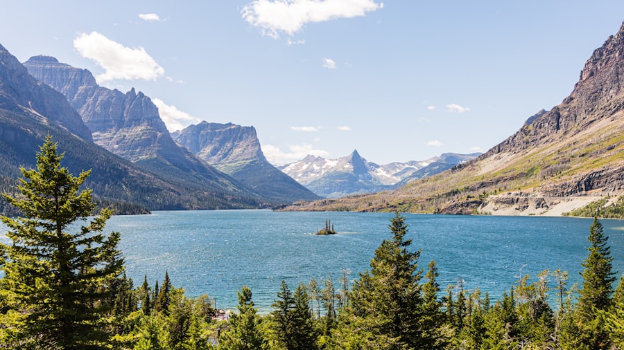
The formation, growth, and decay of ice sheets have exerted a profound influence on global climate and sea level throughout Earth’s history. The sheer volume of ice locked up in glaciers has a significant impact on ocean-atmosphere circulation and the distribution of heat around the planet.
Albedo Effect: The Cooling Power of Ice
Ice and snow have a high albedo, meaning they reflect a large proportion of incoming solar radiation back into space. As ice sheets grow, they increase the Earth’s albedo, leading to further cooling and making it easier for more ice to form. This positive feedback loop is a crucial factor in the initiation and maintenance of glacial periods. Conversely, as ice sheets melt, less solar radiation is reflected, leading to increased absorption of heat and further warming.
Ocean Circulation: The Global Conveyor Belt
The formation of large ice sheets can significantly impact ocean circulation patterns. The formation of dense, cold, salty water at high latitudes as sea ice forms and brine is expelled can drive deep ocean currents, forming a global “conveyor belt” that transports heat and nutrients around the planet. Changes in ice sheet size and meltwater input can disrupt these currents, leading to significant shifts in regional and global climate. For instance, a massive influx of freshwater from melting glaciers can freshen surface waters in the North Atlantic, potentially inhibiting the formation of deep water and slowing down the Gulf Stream, which brings warmth to Europe.
Sea Level Change: The Scars of Meltwater
Perhaps the most dramatic and directly observable impact of glaciation on the modern world is its influence on sea levels. During glacial periods, vast amounts of water are locked up in ice sheets, causing global sea levels to drop significantly. Conversely, during interglacial periods, as ice sheets melt, this water is released back into the oceans, causing sea levels to rise. Evidence of past sea level fluctuations can be found in coastal geomorphology, such as raised beaches and submerged shorelines. The dramatic rise in sea level observed over the past century is a stark reminder of the ongoing melting of glaciers and ice sheets, a direct consequence of past and present climate change.
Paleontological and Biological Evidence: Life in a Frozen World
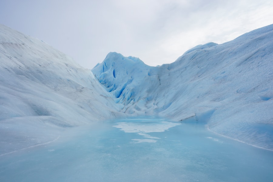
The existence of ice ages has profoundly influenced the evolution and distribution of life on Earth. Glacial periods have acted as powerful selective pressures, driving extinctions and migrations, while also creating unique ecological niches that have fostered the development of specialized organisms.
Fossil Distribution: Tracing Past Life
The fossil record provides irrefutable evidence of how life has adapted to and been shaped by glacial cycles. The distribution of fossils of certain species can indicate past climatic conditions. For example, finding fossils of cold-adapted species in regions that are now temperate suggests that those areas were once covered by ice or experienced much colder climates. Conversely, the presence of warm-adapted species in now-frigid regions can indicate past interglacial periods when ice receded.
Adaptive Evolution: Surviving the Cold
The harsh conditions of glacial periods have driven the evolution of remarkable adaptations in organisms that survived. Many species developed thicker fur or blubber to insulate themselves from the cold, while others developed physiological mechanisms to cope with freezing temperatures. The life cycles of plants and animals were also influenced, with many species adapting to shorter growing seasons or relying on stored reserves during long winters. The genetic makeup of many extant species bears the imprint of these past adaptations.
Migration and Extinction: The Great Reshuffling
Glacial advances and retreats have also caused significant migrations and extinctions. As ice sheets expanded, habitable areas would shrink, forcing species to migrate to warmer regions or face extinction. Conversely, as ice retreated, new territories would become available, leading to recolonization and the potential for speciation. The repeated cycles of expansion and contraction of ice sheets have led to repeated reshuffling of life on Earth, shaping the biodiversity we see today. For instance, the Bering land bridge, exposed during periods of low sea level when water was locked up in ice sheets, facilitated the migration of flora and fauna between Asia and North America, significantly impacting the evolutionary trajectories of both continents.
The evidence left by glaciers can be seen in various geological formations and landscapes, which tell a story of Earth’s climatic history. For a deeper understanding of how natural processes shape our environment, you might find it interesting to explore the article on the Mexican auto industry, which discusses the impact of industrial growth on the landscape. This connection between natural and human-made changes highlights the ongoing evolution of our planet. You can read more about it in this related article.
Modern Glaciology: Monitoring Our Frozen Future
| Glacier Evidence | Description |
|---|---|
| Moraines | Ridges of debris left behind by a moving glacier |
| Erratics | Large boulders transported and deposited by glaciers |
| Drumlins | Smooth, elongated hills formed by glacial action |
| U-shaped valleys | Valleys carved out by glaciers into a U-shape |
The study of glaciers and ice sheets is not merely an academic pursuit; it is a vital endeavor for understanding and predicting our planet’s future. Modern glaciology utilizes advanced technologies to monitor the health of glaciers and ice sheets, providing crucial data for climate modeling and policy-making.
Satellite Monitoring: A Global Perspective
Satellites play a critical role in modern glaciology, providing a global perspective on ice cover, ice thickness, and ice melt. Remote sensing technologies allow scientists to map the extent of glaciers, track their retreat, and estimate the volume of ice lost. Data from satellites like NASA’s ICESat-2 and ESA’s CryoSat-2 are vital for monitoring changes in ice elevation and surface velocity, providing early warnings of significant ice loss.
Ground-Based Research: In-Situ Measurements
While satellites provide a broad overview, ground-based research remains essential for detailed, in-situ measurements. Scientists conduct fieldwork on glaciers to measure ice velocity, snow accumulation, melt rates, and the thermal properties of the ice. This direct data collection is crucial for calibrating remote sensing data and for understanding the complex physical processes occurring at the ice-atmosphere and ice-bedrock interfaces. Researchers often drill ice cores on smaller glaciers to study their recent history and to understand the impact of localized climate change.
Ice Core Analysis: Continuing the Legacy
The tradition of ice core analysis continues to be a cornerstone of modern glaciological research. Extracting new, longer ice cores from deep within existing ice sheets, and exploring new geographical locations, allows scientists to extend our understanding of past climate far beyond previously accessible limits. The detailed atmospheric and isotopic records contained within these cores are indispensable for refining climate models and for understanding the long-term drivers of climate change. The analysis of impurities within recent ice core layers can also reveal trends in human-induced pollution.
The frozen legacy of glaciers is a profound testament to Earth’s dynamic nature. From the colossal sculptures of mountainous terrain to the microscopic archives of atmospheric history, glacial evidence offers an unparalleled window into our planet’s past, present, and future. The ongoing melting of these icy giants serves as a stark reminder of our interconnectedness with the environment and the urgent need to understand and address the challenges of a changing climate. The silent language of ice speaks volumes, urging us to listen and to act.

The Boulder That Shouldn’t Exist
FAQs
What is the evidence left by glaciers?
Glaciers leave behind various types of evidence, including moraines, drumlins, eskers, and glacial erratics. These features are formed as the glacier moves and deposits material, shaping the landscape in the process.
How do moraines provide evidence of past glaciation?
Moraines are ridges of debris left behind by a glacier as it moves and melts. They can be used to determine the extent and direction of past glaciation, as well as the size and movement of the glacier.
What are drumlins and how do they indicate glacial activity?
Drumlins are elongated hills formed by the movement of glaciers. They indicate the direction of ice flow and can be used to reconstruct the movement of glaciers in the past.
What role do eskers play in understanding glacial history?
Eskers are long, winding ridges of sediment deposited by meltwater streams flowing within or beneath a glacier. They provide evidence of the presence of a glacier and the direction of ice flow.
How do glacial erratics contribute to our understanding of past glaciation?
Glacial erratics are large boulders that have been transported and deposited by glaciers. They can be used to track the movement of glaciers and determine the source of the rock, providing valuable information about past glaciation.