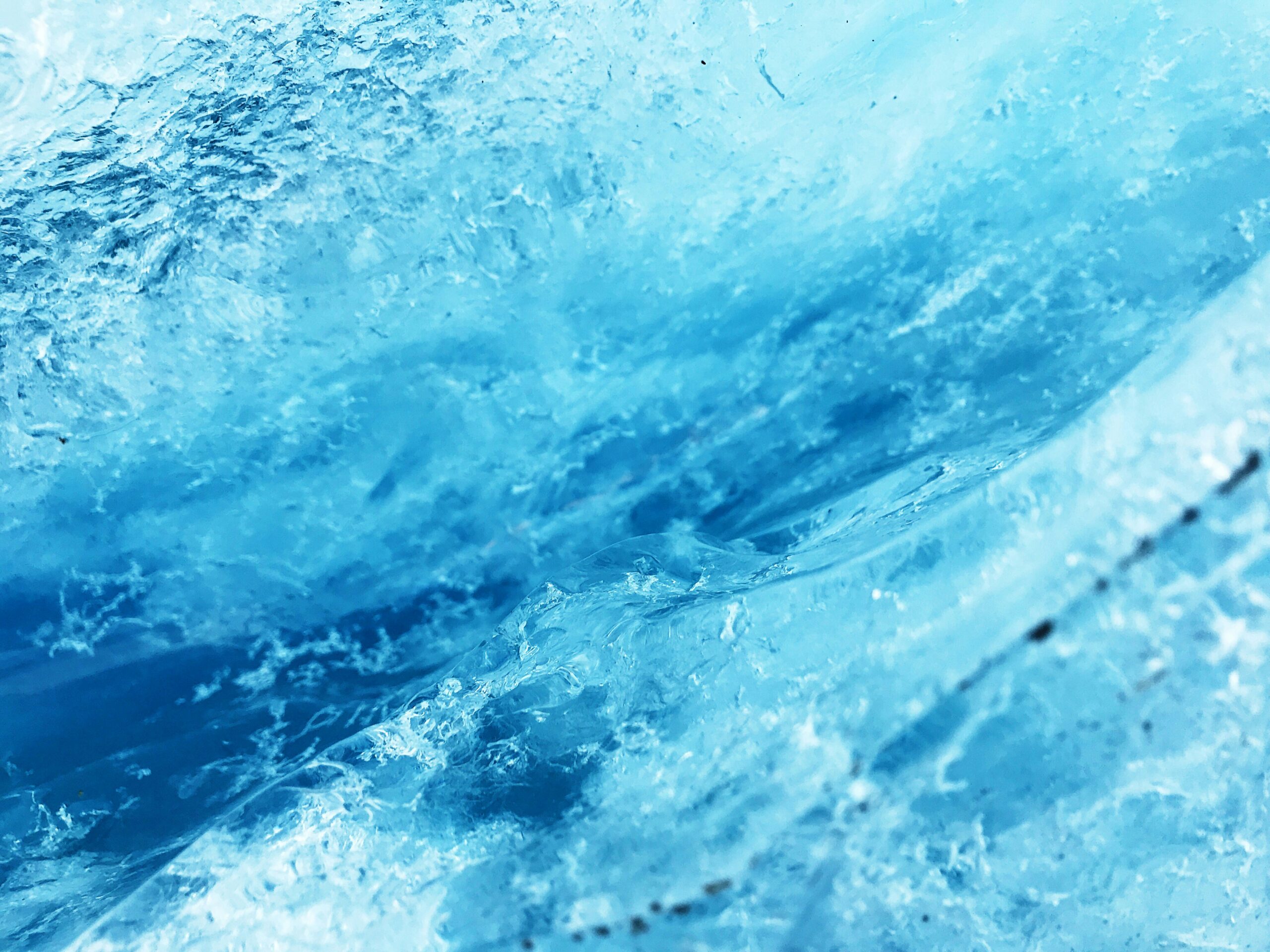
Nature’s grandest sculptors are not chisels and hammers, but the inexorable, slow-moving force of glaciers. For millennia, these frozen rivers have flowed across the Earth’s surface, their immense weight and abrasive power shaping the land into breathtaking masterpieces of rock and ice. These glacier-carved landscapes, found in regions once, or still, dominated by ice, offer a profound glimpse into the planet’s geological past and the dynamic forces that continue to mold its present and future. From towering fjords to sprawling moraines, these environments showcase a dramatic artistry that inspires awe and fuels scientific inquiry.
The power of a glacier to carve the landscape lies in its sheer mass and the persistent motion it possesses. Unlike the relatively swift action of water, glacial erosion is a process of immense scale and ponderous timescale, operating over thousands, even millions, of years. The ice itself, a dense and heavy substance, exerts tremendous pressure on the bedrock beneath. This pressure, coupled with the angular fragments of rock frozen within the ice, creates a formidable erosional tool.
Plucking: The Glacier’s Grip
One of the primary mechanisms by which glaciers erode rock is known as plucking, or quarrying. As a glacier moves downhill, its base encounters irregularities in the bedrock. Meltwater, generated by the pressure of the ice and geothermal heat, can seep into cracks and fissures. When this meltwater refreezes, it expands, exerting outward pressure on the surrounding rock. The overlying ice then exerts a downward and forward force, effectively breaking off and lifting chunks of bedrock. These dislodged rock fragments, ranging from small grains to massive boulders, become embedded in the glacier’s base and are carried along, contributing to the ice’s erosive capacity. This process is particularly effective in areas with well-jointed bedrock, allowing for easier fracturing. The plucked debris acts like sandpaper, abrading the underlying rock as the glacier advances.
Abrasion: The Grinding Force
The second major erosional process is abrasion. The rock fragments embedded in the glacier’s base and sides grind against the bedrock as the ice flows. This grinding action polishes and scratches the rock surface, creating features like striations (parallel grooves) and chatter marks (crescent-shaped fractures). Imagine a giant jigsaw puzzle made of rock, with the glacial ice being the giant hand that relentlessly grinds down the pieces. The harder and more angular the debris within the ice, the more effective the abrasion. This process can transform even the most resistant rock into finer sediment, contributing to outwash plains and glacial flour, which gives meltwater streams their milky appearance. The sheer volume of material moved by glaciers during their existence means that abrasion can sculpt vast areas of bedrock into smooth, undulating forms.
Corrasion and Glacial Polish: The Finer Touches
Beyond plucking and abrasion, two related phenomena further refine the glacier’s artistry. Corrasion refers to the erosive action of rock fragments that are being dragged across a rock surface by the tools of erosion, in this case, the glacier. It’s the friction generated by these carried rocks that wears down the bedrock. The result of prolonged abrasion and corrasion, especially on softer rocks, is glacial polish. This is a smooth, shiny surface, often resembling glass, created when the bedrock has been extensively worn down by fine glacial sediment. Glacially polished surfaces are exquisite examples of the subtle yet powerful artistry of ice. They are often found in areas that were once deeply buried beneath thick ice sheets and bear witness to the immense pressures and grinding forces that shaped them.
The landscape shaped by glaciers is a fascinating subject that reveals the powerful forces of nature at work over millennia. For an insightful exploration of how natural phenomena can influence economies and environments, you might find the article on Mexico’s economy particularly interesting. It discusses various factors that contribute to economic growth, much like how glacial movements have sculpted the terrain. You can read more about it in this article: Will Mexico’s Economy Surpass the US?.
Landforms of the Valley Glacier: Sculpting the Highlands
Valley glaciers, those that are confined to pre-existing river valleys, are responsible for some of the most iconic and dramatic glacial landforms on Earth. As they descend from higher elevations, these glaciers widen and deepen their beds, transforming U-shaped valleys from their V-shaped, river-formed ancestors.
U-Shaped Valleys: The Signature of Glacial Flow
Perhaps the most defining feature of valley glaciation is the U-shaped valley. Unlike river valleys, which are typically V-shaped due to the downcutting action of flowing water, glaciers, with their immense bulk and erosive power, widen their beds and scrape away at the valley walls. The ice plucks rock from the sides and bottom, and the sheer weight of the glacier smooths and rounds the valley floor. The result is a characteristically broad, flat-bottomed valley with steep, often near-vertical sides. These valleys evoke a sense of grandeur and are often home to spectacular vistas. The sheer scale of these transformations is astonishing; a small stream can carve a modest V-shape over millennia, while a glacier can sculpt a vast U-shape in a geologically similar timeframe.
Hanging Valleys: Tributary Remnants
When a larger glacier flows through a main valley, smaller tributary glaciers often flow into it from adjacent valleys. These tributary glaciers, being less massive and with shorter flow paths, erode their own valleys to a lesser degree than the main glacier. When the glaciers retreat, the mouths of these tributary valleys are often left perched high above the floor of the main U-shaped valley, creating hanging valleys. Waterfalls cascade down from these elevated valleys, adding a picturesque element to the landscape. These waterfalls are a visual reminder of the relative erosional power of the different glacial tributaries and the dramatic changes in valley floor levels after deglaciation. They frequently become prime locations for hydroelectric power generation, demonstrating the lasting practical impact of these geological processes.
Roche Moutonnée: The Glacier’s Footprint
A roche moutonnée is a distinctive rock formation found in glaciated areas. It is an asymmetrical hill or outcrop of bedrock that has been eroded by a glacier moving over it. The upstream side, facing the direction of glacial flow, is typically smoothed and rounded by abrasion and glacial polish, resembling the back of a sheep (hence the French name, “moutonné” meaning “wooled”). The downstream side, however, is often characterized by steep, jagged faces created by the process of plucking, as the glacier pulled away fragments of rock as it moved past. These formations provide clear evidence of the direction of glacial movement, acting as nature’s own directional markers. Examining multiple roches moutonnées in an area can help reconstruct the complex flow patterns of ancient ice sheets.
Arêtes and Horns: Jagged Peaks of Erosion
When two glaciers erode adjacent valleys, the dividing ridge between them is sculpted into a sharp, knife-like edge known as an arête. As glaciers on either side of the ridge continue to erode, the arête becomes narrower and more jagged. If three or more glaciers erode from different directions around a single peak, the summit can be carved into a sharp, pyramid-like structure called a horn or pyramidal peak. The Matterhorn in Switzerland is a classic example of a glacial horn. These dramatic, spire-like formations represent the ultimate expression of glacial erosion attacking a mountain from multiple sides, peeling away rock and leaving behind these stark, dramatic pinnacles. They are often the most challenging peaks for mountaineers and are iconic symbols of alpine landscapes.
Landforms of the Ice Sheet: The Grand Scale of Continental Glaciation

Continental glaciers, vast expanses of ice that can cover entire continents, create landforms on an even grander scale than valley glaciers. These ice sheets, during their maximum extent, reshaped entire landscapes, leaving behind a legacy of features that can be observed across vast distances.
Moraines: The Piles of Glacial Debris
As glaciers move, they pick up, transport, and deposit vast quantities of rock and sediment. These deposited materials are collectively known as moraines. Moraines are among the most common glacial landforms and take various forms depending on their origin and location.
Terminal and Recessional Moraines: The Glacier’s Edges
A terminal moraine is formed at the furthest extent of a glacier’s advance. It is a ridge of unsorted till (rock debris deposited directly by a glacier) that marks the glacier’s maximum reach. As the glacier melts and retreats, it leaves behind this heap of material. Recessional moraines are formed when a glacier pauses in its retreat and deposits a ridge of till before continuing to melt back. These features can often be seen as a series of parallel ridges, indicating periods of stability during the glacial retreat. Studying the distribution and composition of terminal and recessional moraines is crucial for understanding the past positions and dynamics of ice sheets.
Lateral and Medial Moraines: The Sides of the Flow
Lateral moraines are ridges of till that form along the sides of a valley glacier, parallel to its flow. They are created by debris that falls from the valley walls onto the ice or is picked up from the sides of the glacier. When two valley glaciers merge, their adjacent lateral moraines can combine to form a medial moraine, a ridge of till that runs down the center of the combined glacier. These form prominent linear features within glacial valleys, often standing out as dark bands of debris against the lighter ice. Their presence indicates the merging of previously separate ice streams and the large volumes of material they carried.
Ground Moraines: The Underlying Blanket
Ground moraine is a widespread, undulating layer of till deposited beneath a retreating glacier. It often forms a gently rolling landscape, with hummocky terrain. Unlike the more defined ridges of other moraine types, ground moraine is a more continuous, often featureless, deposit that can cover vast areas. While less dramatic than other moraines, ground moraine is incredibly important for soil formation in glaciated regions, providing fertile material for agriculture. The sheer volume of material deposited as ground moraine often has a greater impact on the overall topography than the more prominent moraine ridges.
Drumlins: The Streamlined Hills
Drumlins are elongated, streamlined hills formed by the underlying bedrock and sediments being shaped by the flow of glacial ice. They are typically found in groups, or drumlinton fields, and are aligned with the direction of glacial movement. They are often described as looking like overturned bowls or giant teardrops. The steeper, blunter end faces the direction from which the ice advanced, while the gentler, tapered end points in the direction of glacial flow. Drumlins are thought to form through a process of either deposition and sculpting by ice overriding a till deposit, or by erosion of pre-existing till or bedrock. Their formation is still a subject of ongoing research, but their consistent orientation provides excellent clues about past ice flow patterns.
Eskers: The Winding Rivers of Ice
Eskers are long, sinuous ridges of sand and gravel deposited by meltwater streams flowing within, under, or on top of a glacier. As the glacier retreats, the stream channels that were once filled with ice become exposed as winding ridges on the landscape. These ridges can stretch for many kilometers and are often characterized by their irregular, serpentine form. Eskers represent the dynamic internal drainage systems of glaciers and are a testament to the powerful erosional and depositional forces of meltwater. Their sandy and gravelly composition makes them important sources of aggregate for construction.
Watery Residue: Glacial Lakes and Fjords
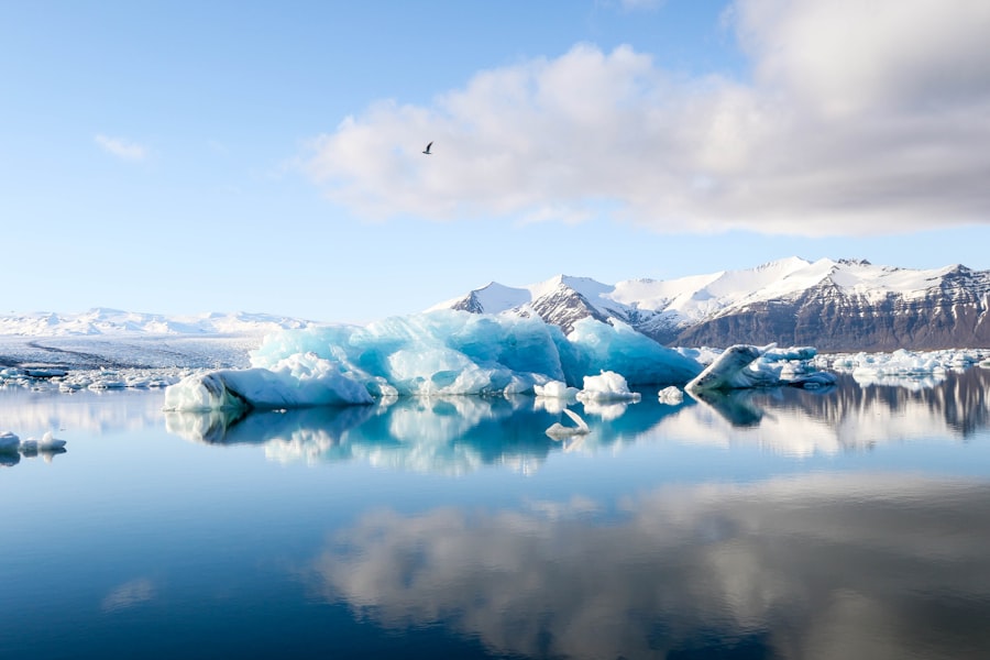
The erosive power of glaciers doesn’t just create landforms; it also dramatically alters drainage patterns, leading to the formation of unique aquatic environments.
Tarns and Cirques: The Mountain’s Eye-Sores
Tarns are small, mountain lakes that form in cirques. A cirque is a bowl-shaped hollow eroded by a glacier at the head of a mountain valley. As a glacier grows or retreats, it carves out this amphitheater-like feature. When the glacier melts, the cirque often fills with water, forming a tarn. These picturesque lakes are often found in stunning alpine settings, cradled by steep, rocky walls. The formation of cirques is one of the earliest stages of glaciation and their presence is a clear indicator of past glacial activity. The distinctive shape of a cirque can also influence local weather patterns and create microclimates.
Fjords: The Submerged Glacial Valleys
Fjords are perhaps the most dramatic and awe-inspiring glacial landforms. They are long, narrow, deep inlets of the sea that are formed when glaciers carve out valleys that extend below sea level and then retreat, allowing the sea to flood the valley. Fjords are characterized by their steep, often cliff-like sides, deep water, and their U-shaped cross-section inherited from their glacial origins. Norway, Chile, New Zealand, and Alaska are renowned for their spectacular fjords. The immense depth of fjords is a testament to the long periods of glacial erosion and the vast amount of ice that once occupied these valleys. The dramatic drop from the land to the seabed in a fjord is a direct result of the glacier’s relentless grinding power.
Kettle Lakes: Depressions of Melting Ice
Kettle lakes, or kettles, are depressions in glacial outwash plains or moraines that are formed by the melting of buried blocks of ice. As a glacier melts, large blocks of ice can become detached and become buried by glacial sediment. When these ice blocks eventually melt, they leave behind a depression that can fill with water, forming a kettle lake. These lakes are often irregularly shaped and can vary greatly in size. They are a common feature in areas that experienced significant continental glaciation and are a reminder of the substantial volumes of ice that once permeated the landscape.
The landscape shaped by glaciers offers a fascinating glimpse into Earth’s geological history, revealing how these massive ice formations sculpted valleys and mountains over millennia. For those interested in exploring the impact of natural forces on our environment, a related article discusses the various assets that can be influenced by such changes. You can read more about this intriguing topic in the article found here, which highlights the importance of understanding our planet’s dynamic systems.
The Enduring Legacy: Glacial Landscapes Today
| Glacier | Location | Area Covered | Features |
|---|---|---|---|
| Hardangerjøkulen | Norway | 73 square kilometers | U-shaped valleys, cirques, and moraines |
| Columbia Icefield | Canada | 325 square kilometers | Glacial lakes, hanging valleys, and arêtes |
| Perito Moreno Glacier | Argentina | 250 square kilometers | Ice caves, crevasses, and terminal moraine |
The evidence of past glaciation is etched across a significant portion of the Earth’s surface, shaping everything from its mountain ranges to its most fertile plains. Even in regions no longer covered by ice, the landforms created by these colossal forces continue to influence ecosystems, human settlement, and geological processes.
Ecosystems Shaped by Ice
Glacier-carved landscapes create unique habitats that support specialized flora and fauna. The porous nature of morainic deposits, for example, influences water infiltration and soil development, creating distinct plant communities. The steep, rocky slopes of U-shaped valleys and fjords provide nesting sites for birds and support resilient mountain vegetation. The nutrient-rich sediment carried by glacial meltwater can also enrich downstream ecosystems. These environments, born from the harsh conditions of glaciation, often harbor a rich biodiversity, adapted to the specific challenges and opportunities presented by these icy origins. The slow decomposition of glacial debris can also release minerals over long periods, contributing to the long-term fertility of soils in these regions.
Human Interaction and Adaptation
Throughout history, humans have been drawn to and shaped by glacial landscapes. The fertile soils deposited by ground moraines and outwash plains have supported agriculture in many regions. The abundant water resources from glacial melt have been vital for human settlement and industry. Moreover, the dramatic beauty of these landscapes has attracted tourism and inspired art, literature, and scientific exploration. However, human activities, such as deforestation and urbanization, can impact these fragile ecosystems, highlighting the need for responsible stewardship. The management of water resources in glaciated regions is particularly important as the world faces changing climatic conditions.
The Future of Glacial Landscapes
As the Earth’s climate continues to warm, the future of glacial landscapes is a pressing concern. The retreat of glaciers and ice sheets has profound implications, including sea-level rise and changes in water availability. Understanding the past behavior of glaciers and their erosional power provides crucial context for predicting future changes and mitigating their impacts. The study of these magnificent landforms is not merely an academic pursuit; it is essential for understanding our planet’s dynamic past and planning for its uncertain future. The very tools that shaped these enduring masterpieces are now themselves in a state of rapid transformation, a stark reminder of the interconnectedness of Earth’s systems.

The Boulder That Shouldn’t Exist
FAQs
What are glaciers?
Glaciers are large masses of ice that move slowly over land, formed from the accumulation and compaction of snow over many years.
How do glaciers shape the landscape?
Glaciers shape the landscape through processes such as erosion, transportation, and deposition. As they move, glaciers carve out valleys, create moraines, and leave behind other distinctive landforms.
What are some examples of landscapes shaped by glaciers?
Examples of landscapes shaped by glaciers include fjords, U-shaped valleys, cirques, and drumlins. These features are often found in regions that were once covered by glaciers, such as parts of North America, Europe, and Antarctica.
How do glaciers affect the environment?
Glaciers play a crucial role in regulating global climate and sea levels. They also provide freshwater resources for many communities and support unique ecosystems.
What is the current status of glaciers around the world?
Many glaciers around the world are retreating due to climate change, leading to concerns about water resources, sea level rise, and the loss of unique landscapes. Scientists continue to monitor and study the impact of these changes on the environment.