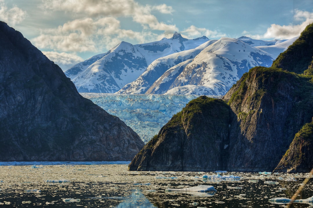
The earth’s surface is a tapestry woven with the threads of time and immense power, and nowhere is this more evident than in the majestic, slow-motion sculpting power of glaciers. These colossal rivers of ice, born from accumulated snow over centuries, are not static behemoths but dynamic agents of change, responsible for carving, shaping, and fundamentally altering the landscapes they inhabit. From the jagged peaks of mountain ranges to the broad, U-shaped valleys that cradle sparkling lakes, the fingerprints of glacial erosion and deposition are etched indelibly across vast swathes of our planet. To understand the Earth’s terrain is to understand the profound influence of these frozen giants.
The genesis of a glacier is a patient, incremental process, dictated by climate and geography. It begins with the accumulation of snow in regions where snowfall consistently exceeds melting and evaporation. These environments are typically found at high altitudes in mountainous areas or at high latitudes in polar regions.
The Role of Altitude and Latitude
The critical factor for glacier formation is sustained cold temperatures. Mountains, reaching into the colder upper atmosphere, provide the necessary frigid conditions. Similarly, polar regions, perpetually bathed in low-angled sunlight and experiencing prolonged winters, are prime locations for ice accumulation. The higher the altitude or the closer to the poles, the greater the likelihood of snowfall persisting through the warmer months, laying the foundation for glacial development.
Persistent Snowfields and Firn Formation
As layers of snow accumulate year after year, the weight of the upper layers compresses the snow beneath. This compression transforms fluffy, crystalline snow into a denser, granular substance known as firn. Firn is an intermediate stage between snow and glacial ice. It is characterized by its interlocking granules and has lost much of its airy structure. This process can take decades to centuries, depending on the rate of snowfall and the ambient temperature.
The Transformation to Glacial Ice
The journey from firn to solid glacial ice is a further transformation driven by intense pressure. As more snow and firn pile up, the pressure on the lower layers increases dramatically. This pressure causes the firn grains to melt and refreeze repeatedly, expelling air and causing the ice crystals to grow larger and fuse together.
Compression and Recrystallization
The constant compression forces air out of the firn, creating a denser, more homogeneous substance. The water molecules within the firn also undergo significant structural changes. Through a process called recrystallization, the individual ice crystals grow, merging with their neighbors and forming larger, interlocking hexagonal structures. This is what gives glacial ice its characteristic deep blue hue, as the denser ice absorbs most wavelengths of light, reflecting back primarily blue.
The Point of No Return: Flowing Ice
Once the accumulated ice reaches a sufficient thickness – typically around 50 meters – it begins to deform and flow under its own weight. This is the defining characteristic of a glacier: it is not merely a static mass of ice but a dynamic, flowing body. The internal stresses caused by its immense weight overcome the strength of the ice, causing it to move downslope or outward from its origin. At this point, a true glacier has been born, ready to begin its work of shaping the Earth.
Glaciers have played a significant role in shaping the Earth’s landscape, carving valleys and creating unique geological formations over millennia. Their powerful movement and melting processes have not only altered the physical environment but also influenced human history and settlement patterns. For a deeper understanding of how ancient civilizations may have interacted with these changing landscapes, you can explore the article on uncovering evidence of a lost advanced civilization at this link.
Glacial Erosion: The Art of Carving
Glaciers are formidable erosive agents, possessing a power that far surpasses that of rivers or wind. Their immense weight and the abrasive nature of the ice itself allow them to sculpt the land with remarkable efficiency. The processes involved are varied and contribute to the dramatic landforms we associate with glaciated regions.
Plucking: The Glacier’s Grip
One of the primary mechanisms of glacial erosion is plucking, also known as quarrying. As a glacier flows over bedrock, meltwater can seep into cracks and fissures. When this meltwater freezes, it expands, exerting pressure on the rock. The subsequent movement of the glacier can then dislodge enlarged blocks of rock, which are then incorporated into the ice and carried along.
Freeze-Thaw Cycles and Bedrock Dislodgement
The freeze-thaw cycle is instrumental in plucking. Water freezes in fractures, expands, and widens the cracks. The glacier’s forward motion, even when slight, can then exploit these weakened zones. As the glacier moves, the embedded ice drags these dislodged rock fragments, acting like a giant chisel. This process is particularly effective on gently sloping bedrock and in areas with pronounced jointing.
Abrasion: The Sandpaper of Ice
Once rock fragments are incorporated into the ice, they act as abrasive tools as the glacier moves. This process is known as abrasion. The embedded rocks, ranging from fine sand to massive boulders, grind against the bedrock beneath and along the sides of the glacier, smoothing and scouring the landscape.
Striations and Grooves
The continuous grinding action of glacial debris leaves behind distinctive marks on the bedrock. These can range from fine scratches called striations, caused by sand-sized particles, to deeper grooves and channels carved by larger rocks. The direction of these striations and grooves indicates the direction of glacial flow, providing valuable clues for reconstructing past ice movements.
Rock Flour and Polished Surfaces
The finest debris, pulverized rock particles suspended in the meltwater, is known as rock flour. This fine sediment contributes to the milky or turquoise appearance of many glacial lakes. The abrasive action can also create remarkably smooth, polished surfaces on exposed bedrock, a testament to the relentless action of the ice.
Corrasion and Glacial Milch
A related term, corrasion, often encompasses the combined effects of plucking and abrasion, emphasizing the scraping and grinding action of the ice combined with its debris load. The term “glacial milch” is sometimes used to describe the turbid meltwater laden with fine sediment from abrasion, which flows from the snout of a glacier.
Quarrying and Rostrum Formation
The forces of plucking are particularly evident at the base of obstacles. As ice flows over a resistant rock feature, it may pluck away more material from the lee side (downstream side) than the stoss side (upstream side). This can lead to the formation of asymmetric landforms, with a steeper, plucked face and a more gently sloping, abraded face. This differential erosion is a hallmark of glacial action.
Landforms Carved by Glacial Erosion: The Legacy of Ice
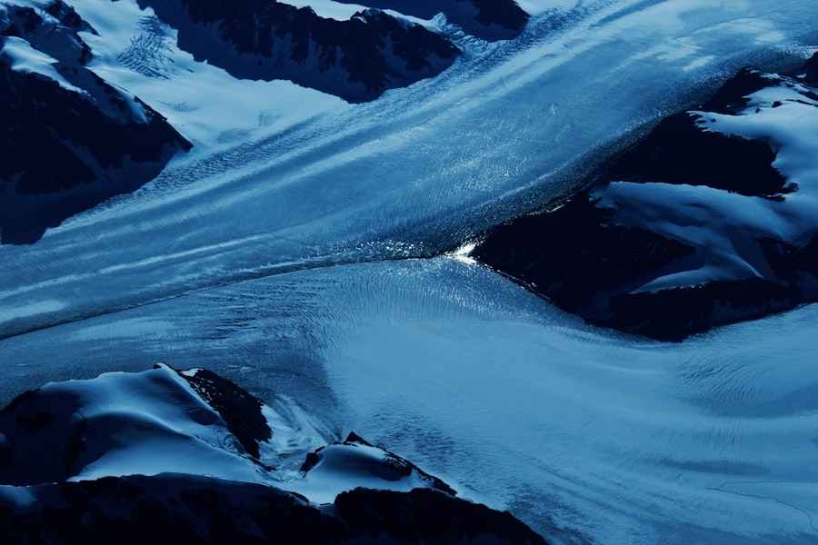
The erosive power of glaciers has sculpted a diverse array of iconic landforms, each bearing the unmistakable signature of ice’s relentless sculpting. These features tell a story of immense forces and the passage of time.
U-Shaped Valleys: The Signature of Valley Glaciers
Perhaps the most classic glacial landform is the U-shaped valley. Before glaciation, river valleys are typically V-shaped, with steep sides and narrow floors. As a valley glacier advances, it widens and deepens the valley, smoothing out the sharp angles and creating a broad, flat-bottomed trough with steep, often near-vertical sides.
Truncated Spurs and Hanging Valleys
As the glacier carves its path, it often overrides and truncates the triangular spurs of land that project into the original V-shaped valley. These truncated spurs, now isolated and steep-sided, are known as ‘roches moutonnées’ on a larger scale and contribute to the dramatic, stepped appearance of glaciated landscapes. Tributary glaciers, often less powerful than the main valley glacier, carve shallower valleys. When these glaciers retreat, the mouths of these tributary valleys are left high up on the main valley walls, creating ‘hanging valleys.’ Waterfalls often cascade from these hanging valleys, a poignant reminder of the erosive power that once shaped them.
Cirques: The Amphitheaters of the Mountains
Cirques are distinctive, bowl-shaped depressions carved into the heads of mountain valleys. They are formed by the action of ice plucking and abrasion at the starting point of a glacier. The back wall of a cirque is typically steep and often concave, while the floor is relatively flat.
Tarns and Arêtes
As a glacier within a cirque retreats, meltwater often collects in the hollowed-out floor, forming a circular lake known as a tarn. Tarns are often picturesque features, nestled within their rocky amphitheaters. When two cirques erode back-to-back, they can form a sharp, knife-edged ridge called an arête. Arêtes are often dramatic features, separating glaciated valleys and contributing to the rugged beauty of mountain ranges.
Fjords: Submerged Glacial Valleys
In coastal mountainous regions, glaciers that flow down to the sea can carve deep, steep-sided valleys that are later flooded by rising sea levels. These are known as fjords, and they are among the most awe-inspiring natural features on Earth.
Marine Erosion and Submergence
Fjords are essentially drowned glacial valleys. The immense erosive power of the glacier, often extending below sea level, carves a deep trough. As the ice retreats and sea levels rise, the saltwater inundates the valley, creating these magnificent inlets with sheer cliffs plunging into the deep waters. The deepest parts of fjords are often found furthest inland, reflecting the maximum erosive power of the glacier before it reached the sea.
Glacial Deposition: The Gifts of Meltwater and Ice
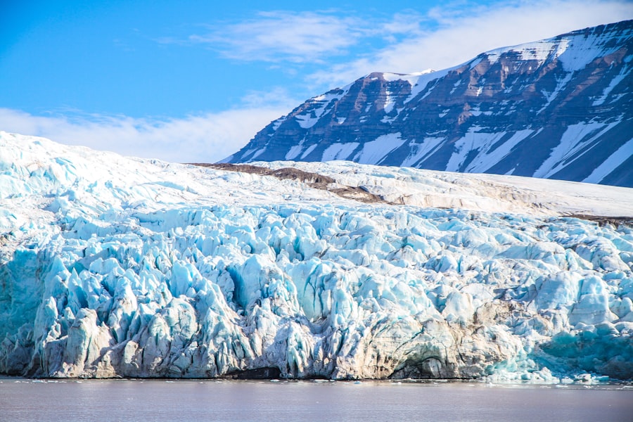
As glaciers retreat or melt, they deposit the vast amounts of sediment they have transported. This deposited material, known as glacial till or drift, creates a unique set of landforms that are as important in shaping the terrain as the erosive processes.
Till: The Unsorted Debris of Glacial Movement
Glacial till is the unsorted mixture of clay, silt, sand, gravel, and boulders deposited directly by melting ice. It is characterized by its heterogeneous composition, with particles of all sizes jumbled together without any stratification.
Moraines: Ridges of Accumulated Debris
Moraines are ridges or mounds of till deposited at the edges or base of a glacier. They are a direct record of the glacier’s former extent and movement.
Terminal Moraines
A terminal moraine forms at the furthest point reached by a glacier. It is a ridge of till that marks the glacier’s maximum advance.
Lateral Moraines
Lateral moraines form along the sides of a valley glacier, deposited by the ice as it moved down the valley. They appear as long, parallel ridges on the valley floor.
Medial Moraines
When two or more valley glaciers merge, their lateral moraines combine to form a medial moraine, a ridge running down the center of the merged glacier.
Ground Moraines
A ground moraine is a broad sheet of till deposited beneath a retreating glacier. It often forms undulating terrain.
Stratified Drift: Sorted by Meltwater
Unlike till, which is deposited directly by ice, stratified drift is sorted and layered by the meltwater streams that flow from the glacier. This process creates more organized depositional landforms.
Eskers: Winding Ridges of Sand and Gravel
Eskers are long, winding ridges of sand and gravel deposited by meltwater streams flowing within, under, or upon a glacier. As the ice melts, the stream channels are left behind as elevated ridges. They often meander across the landscape, reflecting the path of the subglacial or englacial streams.
Outwash Plains: Broad Expanses of Sediment
Outwash plains, also known as sandur, are broad, fan-shaped plains of stratified drift deposited by meltwater streams flowing away from the snout of a glacier. These plains are characterized by braided stream channels and can extend for many kilometers.
Kames and Kame Terraces
Kames are irregular mounds or hills of sand and gravel deposited by meltwater streams in depressions on the surface of a glacier or at its margin. Kame terraces are similar deposits that form along the sides of glacial valleys, marking the former level of the ice.
Glacial Lakes: Ponds Left Behind
Glacial lakes are a common feature of glaciated landscapes, formed in a variety of ways by glacial activity.
Kettle Lakes
Kettle lakes form when large blocks of ice, detached from a retreating glacier, become buried in till or outwash. As the ice melts, it leaves behind a depression that fills with water. These kettles can vary greatly in size and depth.
Finger Lakes
Finger lakes are long, narrow lakes often found in U-shaped valleys, filling the glacial troughs left by valley glaciers. They are often aligned parallel to the direction of glacial flow.
Glaciers have played a significant role in shaping the Earth’s landscape, carving valleys and creating unique geological formations over millennia. Their slow but powerful movement has not only altered the physical environment but also influenced ecosystems and human settlements. For a deeper understanding of how natural forces can impact geopolitical landscapes, you might find it interesting to read about the shifting dynamics between nations in the context of environmental changes in this article on geopolitical shifts.
The Lasting Impact: Glaciers and Present-Day Landscapes
| Glacier | Impact on Landscape |
|---|---|
| U-shaped valleys | Glaciers carve out deep, U-shaped valleys as they move, shaping the landscape. |
| Erratics | Glaciers transport large boulders and rocks, depositing them in new locations as they melt, creating erratic formations. |
| Glacial lakes | As glaciers retreat, they leave behind depressions that fill with water, forming glacial lakes. |
| Moraines | Glaciers deposit rocks, sand, and other debris in ridges called moraines, which alter the landscape. |
The influence of glaciers extends far beyond the immediate areas they covered. Their legacy is etched into the very fabric of our planet’s geography, impacting everything from freshwater resources to the productivity of agricultural lands.
Shaping Water Systems and Freshwater Resources
The meltwater from remaining glaciers and ice sheets is a vital source of freshwater for many regions, particularly in mountain areas. Rivers fed by glacial melt provide essential water for drinking, agriculture, and industry. The formation of moraines can also create natural dams, impounding water and forming lakes that serve as crucial reservoirs.
Hydrological Cycles and Seasonal Flows
Glacial melt significantly influences regional hydrology. During the warmer months, glacial meltwater can sustain river flows, ensuring a steady supply of water even during dry periods. This predictable seasonal input is vital for ecosystems and human populations.
Impact on Agriculture and Settlement
The fertile soils found in many glaciated regions are a direct result of glacial deposition. The ground moraines and outwash plains provide rich, well-drained land for agriculture. The dramatic landscapes carved by glaciers, such as U-shaped valleys and lakes, also attract tourism and have influenced the location of human settlements throughout history.
Mineral Resources and Boulder Fields
The transport of rocks and minerals by glaciers has also led to the distribution of valuable resources. Boulders and cobbles deposited by glaciers can be found far from their original source, providing clues to geological history and sometimes indicating the presence of mineral deposits.
Climate Change and the Future of Glaciers
The world’s glaciers are retreating at an alarming rate due to anthropogenic climate change. This melting has profound implications for sea-level rise, freshwater availability, and the stability of global climate systems. Observing and understanding these changes is crucial for predicting future environmental scenarios and for developing effective mitigation and adaptation strategies.
Sea Level Rise and Coastal Impact
The melting of glaciers and ice sheets contributes significantly to global sea-level rise, threatening coastal communities and ecosystems worldwide. Changes in glacial meltwater also affect ocean currents and salinity, with far-reaching consequences.
Ecological and Biological Impacts
The loss of glacial habitats has significant ecological impacts, affecting species that are uniquely adapted to cold environments. Changes in water availability and temperature also impact freshwater ecosystems and the distribution of plant and animal life. The ongoing melt represents not just a geological phenomenon but a critical ecological crisis.
In conclusion, glaciers are not merely frozen relics of the past; they are active agents that have profoundly shaped and continue to influence Earth’s terrain. Their power to erode and deposit has created some of the planet’s most spectacular and enduring landscapes, leaving an indelible mark on our world. Understanding their formation, their erosive and depositional processes, and their ongoing transformation in a changing climate is essential for comprehending our planet’s dynamic geological history and for anticipating its future. The story of Earth’s terrain is inextricably linked to the story of ice.

The Boulder That Shouldn’t Exist
FAQs
1. What are glaciers and how do they form?
Glaciers are large masses of ice that form from the accumulation and compaction of snow over many years. They form in areas where more snow falls than melts, and the weight of the overlying snow causes the lower layers to compress into ice.
2. How do glaciers change the landscape?
Glaciers change the landscape through processes such as erosion, transportation, and deposition. As glaciers move, they can carve out valleys, create deep fjords, and leave behind moraines and other landforms.
3. What evidence is there that glaciers have changed the landscape in the past?
Evidence of past glacial activity can be found in the form of U-shaped valleys, cirques, hanging valleys, and other glacial landforms. Glacial striations, moraines, and erratic boulders are also indicators of past glacial activity.
4. How have glaciers contributed to shaping the Earth’s surface over time?
Glaciers have played a significant role in shaping the Earth’s surface over millions of years. They have sculpted mountains, carved out deep valleys, and left behind distinctive landforms that are still visible today.
5. What are some examples of landscapes that have been shaped by glaciers?
Examples of landscapes shaped by glaciers include the fjords of Norway, the Great Lakes region in North America, the Alps in Europe, and the Himalayas in Asia. These areas bear the unmistakable imprint of past glacial activity.