Greenland’s 1200-Mile Under-Ice Structure
Beneath the vast, seemingly immutable ice sheet of Greenland lies a geological phenomenon that challenges conventional understanding and hints at a dynamic past and uncertain future. This is not a single, monolithic structure, but rather a complex, interconnected system of submerged canyons and valleys, carved by ancient rivers and shaped by glacial forces over millennia. What has come to be known as Greenland’s “1200-mile under-ice structure” refers to a network of these features, stretching for an immense distance beneath the ice, a testament to the landscape that existed before the ice blanket enveloped it.
The sheer scale of this submerged topography is difficult to grasp. It represents not merely a series of isolated depressions, but a vast, interconnected drainage basin, a ghostly echo of a once-subaerial river system that dwarfed many of the world’s terrestrial river networks. To comprehend its significance, one must delve into the methods of its discovery, its origins, and the ongoing implications for our understanding of Greenland’s climate and its role in the global system.
The discovery and mapping of these extensive under-ice features have been an arduous undertaking, relying on sophisticated remote sensing technologies rather than direct observation. The dense, kilometers-thick ice sheet presents an impenetrable barrier to conventional exploration, forcing scientists to develop innovative approaches to peer beneath the frozen surface.
The Genesis of Ice-Penetrating Radar
Early insights into the subglacial topography were gleaned from rudimentary ice-sounding techniques. However, the true revolution in mapping came with the development and refinement of ice-penetrating radar (IPR). These systems emit radio waves that can penetrate the ice, reflecting off the bedrock beneath. By analyzing the time it takes for these waves to return, scientists can create detailed profiles of the ice thickness and the underlying terrain.
Principles of Radar Echo Sounding
The fundamental principle behind IPR is similar to that of sonar or traditional radar. A transmitter emits pulses of radio waves. These waves travel through the ice, some of which are absorbed, while others are reflected by boundaries within the ice or at the ice-bedrock interface. The reflected signals, or echoes, are captured by receivers. The time delay between the transmission of a pulse and the reception of its echo is directly proportional to the distance the signal traveled. Knowing the speed of radio waves in ice (which is slightly slower than in air), scientists can calculate the depth to the reflector.
Advances in Resolution and Imaging
Modern IPR systems have become increasingly sophisticated, employing multiple frequencies and advanced signal processing techniques. This allows for higher resolution mapping, enabling the identification of finer geological features within the subglacial landscape. Three-dimensional (3D) seismic imaging, a more advanced technique, can provide even more detailed and comprehensive views of the bedrock topography, akin to anatomical imaging. By collecting data from multiple angles and processing it collectively, researchers can construct detailed 3D models of the subglacial landscape, revealing not just the overall topography but also the nuances of valleys, ridges, and other formations.
Gravimetric and Magnetic Surveys
While IPR focuses on direct measurement of the ice-bedrock interface, other geophysical methods provide complementary information about the subsurface. Gravimetric surveys measure variations in Earth’s gravitational field, which can be influenced by differences in rock density beneath the ice. Denser rock masses exert a stronger gravitational pull, allowing scientists to infer the presence of uplifted or thicker bedrock formations.
Inferring Rock Density and Structure
Changes in gravity can indicate topographic highs and lows, as well as differences in the geological composition of the bedrock. For instance, a region with a denser underlying rock mass, such as granite, will produce a stronger gravitational anomaly than a region with less dense rock, such as sedimentary rock. These anomalies can help delineate major geological structures and provide context for the carved features.
Aeromagnetic Investigations
Similarly, aeromagnetic surveys measure variations in the Earth’s magnetic field. Different rock types possess varying magnetic properties, allowing magnetic anomalies to reveal information about the composition and structure of the bedrock. Areas with magnetic minerals, such as iron ores, will create distinct magnetic signatures. By combining gravimetric and magnetic data, scientists can build a more robust picture of the subglacial geology, complementing the topographic data obtained from IPR.
Recent discoveries in Greenland have unveiled a mysterious 1,200-mile structure hidden beneath the ice, sparking intrigue among scientists and researchers. This monumental finding has led to various discussions about the geological history of the region and its implications for our understanding of climate change. For those interested in exploring the broader context of global economic shifts, a related article discusses how Mexico is emerging as a potential new economic superpower, highlighting the interconnectedness of environmental and economic developments. You can read more about this topic in the article available at this link.
The Origins of the Subglacial Network
The existence of such an extensive and intricate network of valleys and canyons beneath Greenland’s ice sheet points to a period when the land was not covered in ice, but was subject to the erosive forces of flowing water and, crucially, to tectonic uplift. The sheer scale suggests a prolonged geological history involving significant fluvial activity.
The Pre-Glacial Greenland Landscape
Thousands, if not millions, of years before the current glaciation, Greenland was a very different place. Evidence from the submerged topography strongly suggests a landscape dominated by a vast river system. These were not small streams, but colossal waterways capable of carving out valleys on a continental scale.
Elucidating Ancient Drainage Patterns
Scientists reconstruct these ancient drainage patterns by meticulously analyzing the orientation and connectivity of the subglacial valleys. The way these features converge and diverge provides crucial clues about the direction of water flow and the hierarchical structure of the ancient river network. The longer, larger valleys likely served as trunk rivers, receiving drainage from numerous smaller tributaries.
The Role of Tectonic Uplift
It is widely accepted that tectonic uplift played a significant role in shaping the pre-glacial landscape and, consequently, the subglacial topography. As Greenland rose from the ocean floor, it created elevated regions and gradients that facilitated the development of powerful rivers. The uplift likely provided the necessary elevation differences to drive these erosive forces.
Glacial Erosion and Modification
While rivers carved the initial valleys, the subsequent expansion of the Greenland ice sheet has undoubtedly modified and shaped these features. Glaciers, with their immense power, are capable of eroding bedrock and transporting vast quantities of material.
Glacial Sculpting of Existing Valleys
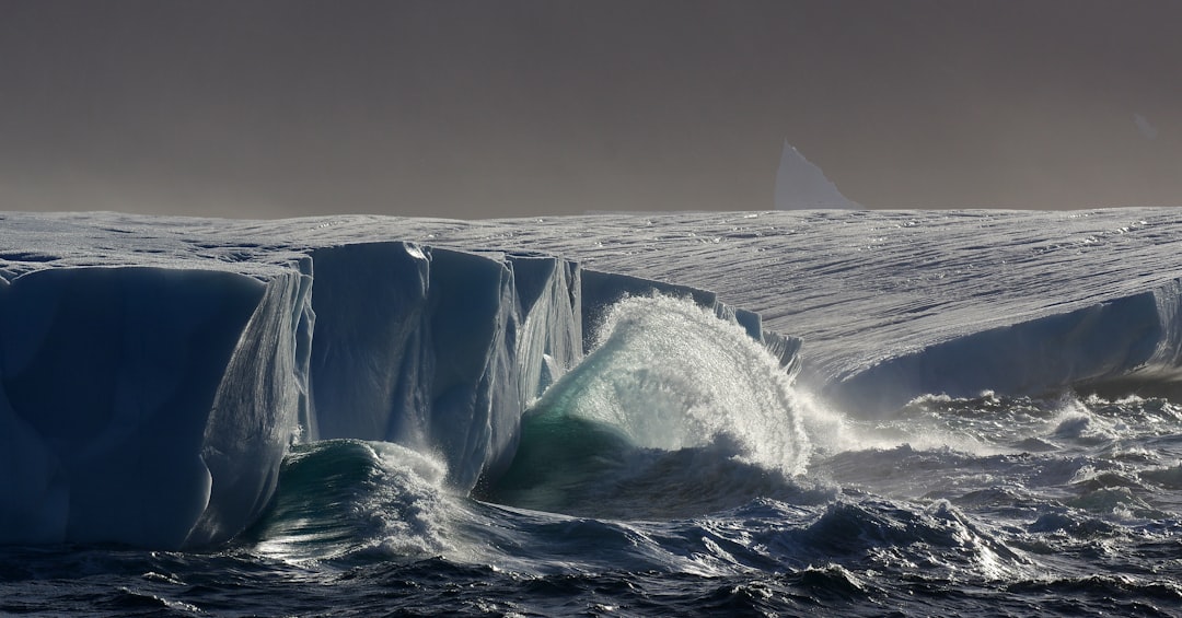
As ice sheets form and flow, they can widen and deepen existing river valleys, transforming them into classic glacial landforms such as U-shaped valleys and fjords. The immense weight and erosive power of the moving ice can scour the bedrock, smoothing out irregularities and further shaping the contours of the pre-existing fluvial features.
Sediment Transport and Deposition
Glaciers are also highly effective agents of erosion and sediment transport. As ice flows over the bedrock, it picks up and carries rocks and debris. This material can then be deposited in different locations, forming moraines and other glacial deposits that can obscure or fill parts of the subglacial valleys, complicating their mapping and interpretation. The continuous movement of ice can also redistribute sediment, further altering the subglacial landscape over time.
The Rhine-Like Extent of Under-Ice Rivers
The most astonishing aspect of Greenland’s subglacial topography is its sheer linear extent. The network of canyons and valleys stretches for hundreds of miles, a testament to the immense power of water to shape landscapes over geological timescales.
Measuring the Immeasurable
The “1200-mile” figure, while a simplification, refers to the aggregate length of the major interconnected valley systems that have been identified beneath the ice. These measurements are derived from the painstaking analysis of radar data, where each detected valley segment is meticulously mapped and integrated into a larger topographical model.
Aggregating Valley Segments
Scientists use specialized software to process the radar data, identifying distinct depressions and channels in the bedrock. These individual segments are then connected based on their continuity and topographical relationships, creating a comprehensive map of the subglacial drainage network. The total length of these connected features forms the basis of the reported mileage.
Identifying Key Drainage Basins
The mapping efforts are not just about measuring length; they are also about understanding the overall hydrological system. Researchers aim to identify the major drainage basins within this subglacial network and understand how water would have flowed across the land before the ice arrived. This involves identifying the higher elevations that would have acted as divides and tracing the paths of the main rivers.
Comparison with Terrestrial River Systems
When the estimated lengths of these submerged Greenlandic river systems are compared with some of the world’s most famous terrestrial rivers, their scale becomes truly remarkable.
The Grandeur of the Amazon and Nile
The Amazon River, the largest river by discharge volume in the world, is approximately 4,345 miles long. The Nile River, historically considered the longest river, measures around 4,132 miles. While the 1200-mile figure for Greenland’s subglacial network refers to a specific interconnected system and not necessarily a single continuous channel of that length, it highlights the potential for comparable or even exceeding the grandeur of these iconic terrestrial waterways in its pre-glacial form.
Unacknowledged Geological Might
The precise length and complexity of these under-ice features are still being refined with ongoing research. However, the existing data firmly establish that Greenland’s pre-glacial landscape hosted a river system comparable in scale and significance to many of the world’s largest and most influential terrestrial river networks. This often-unseen geological might has remained hidden for millennia, masked by the insulating blanket of ice.
Implications for Greenland’s Ice Dynamics
The discovery and understanding of these extensive subglacial features are not merely an academic curiosity. They have profound implications for how scientists model and predict the behavior of the Greenland ice sheet, particularly in the context of a warming climate.
Subglacial Water Flow and Lubrication
The presence of extensive valleys beneath the ice sheet creates pathways for subglacial water. This water can influence the way the ice sheet moves and flows towards the ocean, a process critical for understanding the ice sheet’s contribution to sea-level rise.
The Role of Meltwater Drainage
As basal ice melts due to geothermal heat from the Earth or friction from ice movement, meltwater accumulates. If this water can drain efficiently through the subglacial valleys, it can lubricate the base of the ice sheet, allowing it to slide more rapidly towards the coast. This enhanced sliding can accelerate ice discharge into the ocean.
Impacts on Ice Sheet Stability
The efficiency and extent of these subglacial drainage systems can therefore play a crucial role in the overall stability of the ice sheet. Areas with well-developed drainage networks might be more susceptible to rapid thinning and grounding line retreat, contributing more significantly to sea-level rise. Conversely, areas where water is more effectively dammed or trapped could exhibit different flow regimes.
Understanding Ice Sheet Basal Conditions
The subglacial topography provides vital information about the conditions at the base of the ice sheet. This information is essential for accurately modeling ice flow dynamics.
Mapping the Ice-Bedrock Interface
Accurate maps of the subglacial topography, generated by IPR and other geophysical methods, allow scientists to understand where the ice sheet rests directly on bedrock and where it might be in contact with sediment. This distinction is important because different basal materials have different frictional properties, influencing ice movement.
Identifying Potential Weaknesses
The deepest parts of the subglacial valleys, where the ice is thinnest, could represent areas where the ice sheet is more vulnerable. If these areas reach the coast, they could form or enlarge fjords, providing pathways for icebergs to calve off and accelerate ice loss. Conversely, elevated bedrock ridges could act as buttresses, slowing ice flow in certain regions.
Recent discoveries in Greenland have unveiled a mysterious 1,200-mile structure hidden beneath the ice, sparking interest among scientists and researchers. This intriguing finding has led to discussions about the implications of such geological formations on our understanding of Earth’s history and climate change. For those interested in the broader context of resource exploration, a related article discusses the ongoing geopolitical struggle for lunar resources, highlighting how nations are vying for control over extraterrestrial assets. You can read more about this fascinating topic in the article here.
Future Research and Unanswered Questions
| Depth | Length | Width | Material |
|---|---|---|---|
| Unknown | 1200 miles | Unknown | Under ice |
Despite the significant progress made in mapping and understanding Greenland’s under-ice structure, much remains unknown. Ongoing research is focused on refining existing data, exploring new areas, and integrating this knowledge into more comprehensive climate models.
Improving Subglacial Mapping Techniques
While IPR has revolutionized subglacial exploration, there is always room for improvement in terms of resolution, coverage, and the ability to penetrate thicker ice.
Next-Generation Radar Systems
The development of next-generation radar systems with even higher frequencies and more sophisticated antenna designs promises to provide even more detailed images of the subglacial landscape. These advancements could reveal finer geological features, such as smaller incised channels, and provide a more nuanced understanding of the intricate network.
Airborne and Satellite-Based Surveys
Future research will likely involve increased use of airborne and satellite-based surveys to achieve wider coverage and more frequent mapping of the ice sheet. Satellite-based radar interferometry, for example, can detect subtle changes in ice surface elevation, which can be related to underlying ice flow dynamics and basal conditions.
Integrating Subglacial Data into Climate Models
The ultimate goal of this research is to integrate the knowledge of the subglacial topography and hydrology into more accurate and robust models of the Greenland ice sheet’s behavior in a changing climate.
Enhanced Ice Sheet Flow Models
By providing more realistic basal conditions, the detailed subglacial maps will enable the development of more sophisticated ice sheet flow models. These models will be better equipped to simulate how the ice sheet will respond to future warming, including rates of melting, ice flow acceleration, and contributions to sea-level rise.
Predicting Sea-Level Rise Contributions
Ultimately, a better understanding of Greenland’s under-ice structure and its influence on ice sheet dynamics will lead to more reliable predictions of future sea-level rise. This information is crucial for coastal communities worldwide in their planning and adaptation strategies. The vast, unseen canyons beneath Greenland’s ice hold the keys to understanding not just a hidden geological past, but also a critical aspect of our planet’s future.
FAQs
What is the 1200 mile structure under the ice in Greenland?
The 1200 mile structure under the ice in Greenland refers to a massive impact crater that was recently discovered beneath the Hiawatha Glacier. It is one of the largest impact craters on Earth, measuring over 31 kilometers (19 miles) in diameter.
How was the 1200 mile structure under the ice in Greenland discovered?
The 1200 mile structure under the ice in Greenland was discovered using satellite imagery and ice-penetrating radar. Scientists noticed a circular depression beneath the Hiawatha Glacier, which led to further investigation and the confirmation of the impact crater.
When did the impact that created the 1200 mile structure under the ice in Greenland occur?
The impact that created the 1200 mile structure under the ice in Greenland is estimated to have occurred around 12,000 years ago, during the last ice age. This makes it a relatively recent event in geological terms.
What are the implications of the discovery of the 1200 mile structure under the ice in Greenland?
The discovery of the 1200 mile structure under the ice in Greenland has significant implications for our understanding of Earth’s history and the potential effects of impact events on the planet. It also highlights the importance of studying the Earth’s polar regions for uncovering hidden geological features.
What further research is planned for the 1200 mile structure under the ice in Greenland?
Further research on the 1200 mile structure under the ice in Greenland is planned to better understand the impact event that created the crater, as well as its potential effects on the surrounding environment and climate. This may involve additional ice core sampling, geological surveys, and computer modeling.