Shifting Shores and Ancient Pathways
The story of human migration across continents is one of ingenuity, adaptation, and an intimate dance with a planet in constant flux. For early humans venturing into new territories, the very landscape was both an obstacle and an opportunity. Among the most significant, yet often overlooked, geographical features that shaped these prehistoric journeys were the vast bodies of water that emerged and retreated with the waxing and waning of the Ice Age. These glacial lakes, born from the melting ice sheets, did not merely represent barriers; they also offered unique routes for dispersal, dictating the patterns of settlement and the eventual peopling of the Earth. Understanding the dynamic interplay between Ice Age geography and the formation of these ancient lake systems is crucial to unraveling the complex tapestry of early human movement.
The Quaternary Period, particularly the Pleistocene Epoch, is synonymous with the Ice Ages – cyclical periods of glaciation characterized by massive ice sheets covering large swathes of the Northern Hemisphere. These frozen titans fundamentally reshaped the Earth’s surface through erosion and deposition, but their most profound impact on human migration in many regions was their role in creating and draining immense freshwater lakes. As ice sheets advanced, they dammed rivers, creating natural reservoirs that swelled to enormous sizes, often exceeding the dimensions of present-day Great Lakes. When these ice sheets retreated, the meltwater accumulated, and as the ice load was removed, the landmasses rebounded, altering drainage patterns and leading to the desiccation or reconfiguration of these prehistoric water bodies. These dramatic hydrological shifts were not static events; they occurred over thousands of years, presenting opportunities and challenges that early human populations had to navigate. The availability of water, the presence of fertile lacustrine plains, and the potential for travel across or around these expansive bodies of water all played a critical role in shaping where ancient peoples went, how they traveled, and ultimately, where they settled.
The Glacial Genesis of Mega-Lakes
The formation of these Ice Age lakes was a direct consequence of the immense power of glaciers. As continental ice sheets expanded, they carved out valleys, scoured bedrock, and pushed vast quantities of sediment before them. The most significant mechanism for lake creation was glacial damming. Rivers that flowed across the path of an advancing ice sheet would be impounded, their waters backing up behind the icy barrier to form immense proglacial lakes. The size and duration of these lakes were directly linked to the extent and stability of the ice sheets. Some lakes existed only during glacial advances, disappearing as the ice receded, while others persisted for millennia, evolving with the fluctuating climate.
The topography of the land beneath the ice also played a crucial role. Areas with pre-existing depressions or basins, such as ancient river valleys or fault lines, were particularly susceptible to becoming lake beds. The erosive power of glaciers could deepen these basins, making them ideal catchments for meltwater. Furthermore, the moraines, the ridges of rock and debris deposited by glaciers, often served as natural dams, trapping water behind them. These moraines could be massive, kilometers wide and hundreds of meters high, effectively holding back colossal volumes of water for extended periods. The drainage of these lakes, when it occurred, was often catastrophic, involving the breaching of the moraine dam or the rerouting of the meltwater as the ice margin shifted. These sudden or gradual changes in water levels and the emergence of new landforms had a direct and profound impact on the movement of early human groups.
The Ice Age Water Network: Barriers and Bridges
The vastness of Ice Age lakes presented formidable barriers to human movement, forcing populations to either circumnavigate their shores or find ways to traverse them. However, these same lakes could also act as vital arteries, facilitating migration and dispersal. The shores of these ancient water bodies often provided abundant resources – fish, waterfowl, and edible plants – making them attractive areas for settlement and resource exploitation. Consequently, early human groups likely followed the coastlines of these lakes, using them as guides and sources of sustenance as they explored new territories.
In some instances, the lakes may have facilitated direct crossings. During periods of extreme cold, when the lakes froze over, they could have provided solid pathways for travel. This is particularly plausible in regions that experienced prolonged and intense glaciation. The frozen surfaces of these immense lakes, potentially kilometers wide, could have offered an accessible means of bypassing difficult terrestrial terrain, allowing for faster and more direct movement across otherwise impassable landscapes. The feasibility of such frozen crossings would have depended on the specific climatic conditions, the duration of freezing periods, and the ice’s thickness and stability. Archaeological evidence, though often ephemeral, hints at the potential for such trans-lacustrine migrations.
The study of ice age geographic changes reveals fascinating insights into prehistoric lake crossings that shaped early human migration patterns. As glaciers receded, vast lakes formed and later dried up, creating land bridges that allowed ancient peoples to traverse regions that were once impassable. For a deeper understanding of how ancient societies adapted to their environments, you can explore related concepts in the article on rationing systems in the ancient world, which discusses how resource management was crucial for survival during challenging climatic conditions. You can read more about it here: Rationing Systems in the Ancient World.
Mapping the Ancient Waterways: Evidence and Interpretation

Reconstructing the paleogeography of Ice Age lakes and understanding their impact on human migration requires piecing together evidence from a variety of scientific disciplines. Geologists, geomorphologists, and paleoclimatologists provide the foundational understanding of glacial processes, lake formation, and climatic shifts. They analyze landforms, sediment cores, and isotopic data to map the extent and duration of ancient lakes. Hydrologists and glaciologists offer insights into water flow patterns and ice dynamics.
Archaeologists, in turn, look for evidence of human presence in the vicinity of these ancient lake systems. This includes the discovery of stone tools, hearths, animal remains, and skeletal fragments. The distribution of these artifacts can reveal settlement patterns and migration routes. The dating of these sites, often using radiocarbon dating or luminescence dating techniques, allows researchers to correlate human activity with specific glacial and interglacial periods, and therefore with the presence or absence of particular lake systems. The integration of these diverse lines of evidence is crucial for building a comprehensive picture of how Ice Age geography shaped prehistoric human movements.
Paleontological Clues in Lacustrine Sediments
The sedimentary layers deposited in ancient lake beds serve as invaluable archives of both environmental history and potential evidence of early human activity. These fine-grained sediments, often accumulated over thousands of years, can contain a wealth of information. Paleontologists analyze fossilized remains of microscopic organisms, such as diatoms and pollen grains, to reconstruct past climatic conditions, water chemistry, and vegetation types. Changes in the species composition or abundance of these microfossils can indicate shifts in temperature, precipitation, and the overall health of the lake ecosystem.
Beyond the microscopic, larger fossil remains within lacustrine sediments can also shed light on the fauna that inhabited these ancient lakes and their surrounding environments. Fish bones, shells of aquatic invertebrates, and the remains of waterfowl can indicate the productivity of the lake and the types of food sources available. Occasionally, sediments might also contain fragments of larger terrestrial animals that frequented the lake shores for water or food. While direct evidence of human interaction with these lakes, such as hearths or butchered animal bones, is less common in the sedimentary record itself, the presence of fauna indicative of a rich ecosystem would have undoubtedly attracted early human hunter-gatherer groups, leading them to establish temporary or more permanent camps in these resource-rich areas. The careful excavation and analysis of these sediment cores, combined with meticulous dating, provide a crucial temporal framework for understanding the environmental conditions that influenced human migration patterns.
Archaeological Fingerprints on Ancient Shorelines
The archaeological record is the most direct testament to the presence and movement of early humans. As Ice Age glaciers advanced and retreated, and the vast lakes they formed waxed and waned, human populations adapted their movements and settlement strategies accordingly. Archaeologists meticulously search for signs of human occupation along the ancient shorelines of these extinct lake systems. The discovery of stone tool assemblages, projectile points, and processing implements provides insights into the technologies and subsistence strategies employed by these early peoples.
The spatial distribution of these archaeological sites is particularly revealing. If sites are found clustered along the former margins of a large glacial lake, it suggests that this water body played a significant role in their lives. These locations would have offered abundant food resources, fresh water, and potentially served as important travel corridors. The absence of sites in areas that were likely submerged by lakes, or in regions directly blocked by glaciers, further strengthens the hypothesis that these geographical features influenced migratory routes. Furthermore, the types of artifacts found at different sites can indicate the extent of their territories and the pathways they took. For instance, if similar tool types are found hundreds of kilometers apart, connected by the former shores of a lake system, it suggests a pattern of migration or dispersal facilitated by that water body. The temporal sequencing of these sites, established through dating techniques, allows researchers to build a chronological narrative of human presence and movement in relation to the evolving glacial landscape.
Navigating the Frozen Frontier: Ice Age Lake Crossing Strategies
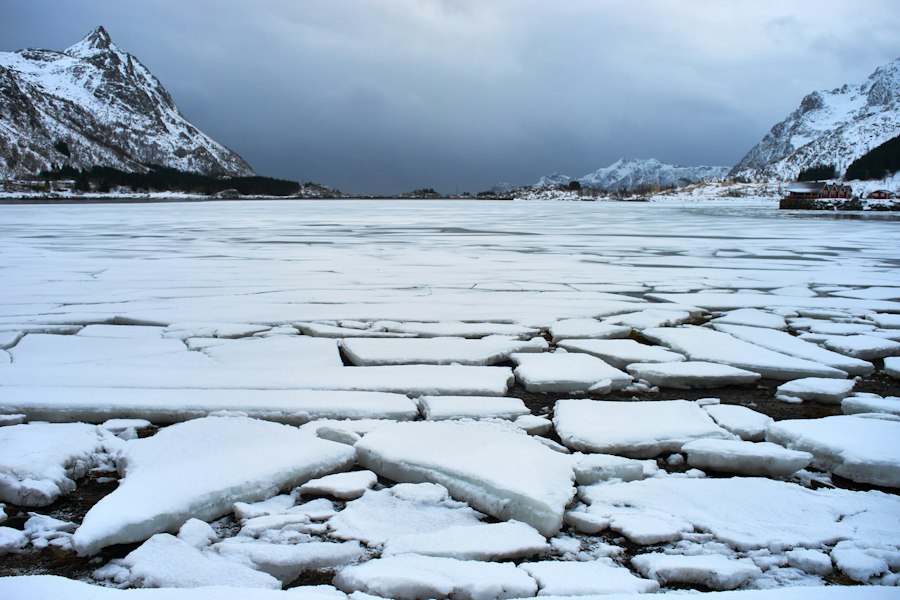
The presence of immense glacial lakes, whether frozen or open water, presented distinct challenges and opportunities for prehistoric human populations. The strategies employed to navigate these watery landscapes would have varied greatly depending on the specific conditions, the technological capabilities of the groups, and the surrounding environment. For groups adapted to cold climates, the frozen surfaces of these lakes could have offered the most straightforward means of transit.
The study of ice age geographic changes reveals fascinating insights into prehistoric lake crossings that shaped early human migration patterns. Researchers have uncovered evidence suggesting that ancient lakes served as critical pathways for early populations, facilitating their movement across vast landscapes. For a deeper understanding of how these environmental shifts influenced human history, you can explore a related article that delves into Antarctica’s hidden secrets and its role in these transformations. Check it out here.
The Lure of Frozen Pathways
During the coldest phases of the Ice Age, when continental ice sheets were at their maximum extent, large glacial lakes would have been frozen over for significant periods. This frozen expanse could have transformed a formidable barrier into a viable pathway. Imagine early human groups, possibly clad in animal skins and equipped with rudimentary sleds or simply on foot, traversing the vast, solid surfaces of what are now extinct mega-lakes. The potential for such frozen crossings opens up intriguing possibilities for rapid dispersal across large geographical areas.
The effectiveness of these frozen pathways would have been dictated by the thickness and stability of the ice. Evidence for such crossings might be indirect, inferred from the geographical distribution of archaeological sites. If tool types or cultural practices are found on opposite sides of a former lake basin, with no obvious terrestrial route connecting them, it strongly suggests a crossing of the frozen water. It is plausible that these crossings were not always direct, but rather followed the contours of the ice, perhaps utilizing areas where ice floes or pressure ridges offered slightly easier passage. The presence of certain animal species, like migratory birds or seals, that utilized the ice for their own movements, might also have drawn human groups onto the frozen lakes, both for hunting opportunities and as a guide for safe travel.
The Art of Circumvention and Resource Exploitation
When direct crossing was not feasible, either due to open water or unstable ice, early humans would have employed strategies of circumvention. This would have involved following the shorelines of the lakes, utilizing the abundant resources these environments offered. The shores of glacial lakes were often rich ecosystems, attracting a variety of fauna, from fish and waterfowl to terrestrial animals that came to drink. This made them prime locations for hunting and gathering.
These shoreline routes would have served as natural highways, guiding human movement across vast distances. As groups followed the expanding or retreating shorelines, they would have encountered new territories, discovered new resources, and potentially come into contact with other human groups. The process of circumvention also implied a deeper understanding of the local geography. Groups would have learned to identify safe passages around bays, navigate through marshy delta regions, and locate reliable freshwater sources along the lake margins. The archaeological record along these ancient shorelines often reveals evidence of sustained occupation, with campsites and processing areas indicating that these areas were not just transit zones but also important resource bases. The exploitation of lacustrine environments would have required specialized knowledge and technologies, such as fishing techniques and the ability to process aquatic resources, further shaping the cultural adaptations of these early populations.
Legacy of the Lakes: Shaping Modern Landscapes and Migratory Patterns
The impact of Ice Age glacial lakes extends far beyond the prehistoric era. The dramatic processes of their formation and disappearance have left an indelible mark on the modern landscape, and the patterns of human migration they fostered continue to resonate. The geological formations left behind by these ancient water bodies are still evident, influencing present-day ecosystems and human settlement.
Geological Echoes in the Modern Terrain
Even though the massive glacial lakes of the Pleistocene have long since vanished, their geological legacy is undeniable. The basins they occupied are often visible today as vast plains, fertile agricultural lands, or even as the foundations for modern cities. The outwash plains deposited by glacial meltwater rivers that fed these lakes are some of the most productive agricultural regions in the world. The moraines that once dammed these lakes are now often prominent topographical features, shaping local drainage and influencing settlement patterns.
The Great Lakes of North America, a direct descendant of the meltwater from the Laurentide Ice Sheet, are a prime example of this enduring legacy. While their formation is more recent than many of the earlier glacial lakes, they represent a continuation of this grand hydrological history. The understanding of these modern lakes and their dynamics can provide valuable insights into the behavior and impact of their prehistoric predecessors. Similarly, the vast plains of Siberia, dotted with numerous smaller lakes and wetlands, are a testament to the extensive glaciation and the subsequent development of lacustrine environments that shaped the movement of early humans across that continent.
Enduring Migratory Legacies
The patterns of human movement established during the Ice Ages, influenced by the presence and absence of glacial lakes, had long-lasting consequences for the peopling of the Earth. Regions that were made accessible by the temporary drying of lake beds or the freezing of their surfaces likely saw earlier and more sustained human settlement. Conversely, areas that remained barriers due to open water or impassable glacial terrain would have been settled later or bypassed altogether.
The migratory routes forged by following ancient lake shores and navigating their potential crossings became ingrained in the collective memory and spatial knowledge of early human groups. These established pathways, passed down through generations, likely influenced later migrations as well, even as the climate stabilized and the lakes disappeared. The distribution of genetically distinct human populations across continents can, in part, be traced back to these initial dispersal events, which were so profoundly shaped by the dynamic geography of the Ice Age, particularly the ubiquitous presence of glacial lakes. Understanding these ancient water crossings is not just about deciphering the past; it is about recognizing how fundamental geological forces continue to shape the human story.