
The icy winds of Greenland have long held secrets, whispered only by the creaking glaciers and the biting air. For decades, one of the most enigmatic of these secrets lay buried beneath miles of snow and ice – Camp Century, a seemingly innocuous U.S. Army research base established in the late 1950s. What was officially presented as a pioneering effort in Arctic living and scientific exploration was, in reality, a far more ambitious and covert undertaking. Now, with the declassification of radar imagery, a new window has opened into the true nature of Camp Century, revealing not just a military outpost, but a phantom city built beneath the ice, intended for a purpose far grander, and arguably more chilling, than previously imagined.
The Cold War Imperative: A Shadow Beneath the Ice
The geopolitical climate of the Cold War cast a long shadow over every facet of American policy, and the Arctic was no exception. As the United States and the Soviet Union engaged in a high-stakes technological and ideological race, the vast, often overlooked expanses of Greenland became a strategic frontier. The prevailing thought was that beneath the seemingly impenetrable ice sheet, a hidden infrastructure could be established, shielded from conventional attack and strategically positioned to project power. Camp Century, established in 1959, was conceived as a bold, if somewhat audacious, realization of this vision. Officially, its purpose was to test the feasibility of constructing and operating a military base in sub-glacial conditions, to study the effects of extreme cold on personnel and equipment, and to conduct scientific research, particularly in glaciology and meteorology. However, the scale of the construction and the secrecy surrounding its development hinted at a deeper agenda. The declassified radar images provide compelling evidence that the architects of Camp Century were not merely interested in testing the limits of Arctic engineering; they were actively building a hidden, underground city, a phantom metropolis designed for a world forever altered by the threat of nuclear war.
The Technological Leap: Engineering in an Alien Environment
Building a habitable settlement within the Greenland ice sheet was a monumental engineering challenge, pushing the boundaries of what was then considered technologically feasible. The concept was to construct a network of tunnels and structures, excavated from the ice itself, and covered by a thick layer of snow and ice. This innovative approach offered natural insulation and protection. The primary construction method involved using prefabricated aluminum modules, which were then transported to the site and assembled within ice tunnels. These tunnels were not simply dug; they were deliberately carved and stabilized, creating a complex subterranean network. The radar imagery allows us to see the intricate geometry of these excavated spaces, revealing a structured layout that goes far beyond mere temporary shelters. It suggests a long-term vision, a commitment to establishing a permanent, if concealed, presence. The declassified images provide a tangible record of the sheer ambition and the technological prowess that went into making this sub-glacial dream a reality. They illuminate the ingenuity required to overcome the immense pressures of the ice, the challenges of permafrost, and the logistical nightmares of operating in such an unforgiving environment.
The recent analysis of Camp Century radar images has shed light on the hidden structures beneath the ice, revealing intriguing insights into the past. For those interested in exploring how ancient rulers may have manipulated historical narratives, a related article titled “Uncovering the Deceptions of Ancient Rulers” provides a fascinating perspective on the intersection of archaeology and history. You can read more about it here: Uncovering the Deceptions of Ancient Rulers.
The Unseen Network: Mapping Camp Century’s Subterranean Architecture
Beyond the Surface: The Radar’s Revelation of Hidden Structures
The most striking revelations from the declassified radar images lie in their ability to pierce the thick ice and reveal the subterranean infrastructure of Camp Century. While surface photographs and official documents offered a glimpse into the more visible elements of the base, the radar data paints a far more comprehensive picture of its hidden depths. These images depict a sprawling network of interconnected tunnels, chambers, and larger structures carved directly into the ice. They reveal a deliberate and intricate design, suggesting a complex logistical and functional layout. The radar waves, capable of penetrating the ice, bounced back from the various surfaces of the excavated spaces, creating a topographical map of the sub-glacial city. This allowed researchers to discern the dimensions, shapes, and connections of the underground facilities, effectively mapping a world that had been intentionally concealed from view. The resolution of these images, though perhaps not as sharp as modern-day satellite imagery, is sufficient to identify distinct features and understand the overall architecture of the base.
Tunnel Systems: The Arteries of the Phantom City
The radar imagery clearly delineates extensive tunnel systems that formed the backbone of Camp Century. These tunnels were not merely access routes; they were designed to accommodate the movement of personnel, vehicles, and supplies. The images show the distinct pathways, their apparent width, and how they interconnected different areas of the base. Some tunnels appear to be wider, suggesting they were designed for larger vehicles or perhaps even for the deployment of specialized equipment. The declassified images reveal a strategic placement of these tunnels, facilitating efficient movement and ensuring a degree of isolation between different functional areas. They are the arteries of this phantom city, vital conduits that brought the subterranean settlement to life and allowed for its covert operations to proceed unimpeded. The patterns observed in these tunnel networks suggest a meticulous planning process, where efficiency and security were paramount considerations.
Dedicated Chambers and Larger Structures: The Heart of the Operation
Beyond the connecting tunnels, the radar imagery also reveals the presence of larger, more specialized chambers and structures within Camp Century. These appear to be distinct spaces, possibly designed for specific functions such as laboratories, living quarters, storage facilities, or even more sensitive operations. The radar reflections from these larger areas are often more intense, indicating denser materials or different geometric formations that suggest purposeful construction rather than random excavation. The declassified images allow for an analysis of their spatial arrangement, hinting at the hierarchy and organization of the base. The presence of these distinct, substantial subterranean spaces further underscores the idea that Camp Century was intended to be more than just a temporary research station. It was conceived as a functioning, self-contained entity, a hidden hub of activity deep beneath the frozen surface.
The Nuclear Undercurrent: Operation Iceworm and Its True Ambitions
Project Iceworm: The Unspoken Mission
Perhaps the most startling revelation gleaned from the declassified radar images, when considered alongside other declassified documents, is the true purpose of Camp Century: Operation Iceworm. While officially presented as a scientific endeavor, the underlying objective of Project Iceworm was to establish a network of launch sites for intercontinental ballistic missiles (ICBMs) buried beneath the Greenland ice sheet. The radar imagery provides irrefutable evidence of the extensive excavation and construction undertaken to support this audacious plan. The sheer scale of the tunneling and the presence of large, strategically placed chambers are consistent with the requirements for housing and deploying nuclear missiles. This was a defensive strategy designed to provide the United States with a secure, retaliatory strike capability that would be virtually immune to a first strike from the Soviet Union. The declassified radar images offer a visual testament to the immense resources and effort invested in this clandestine military project.
Missile Silos Beneath the Ice: A Strategic Masterpiece or a Perilous Gamble?
The radar imagery, when interpreted with the knowledge of Operation Iceworm, allows us to visualize what would have been a groundbreaking, albeit terrifying, strategic deployment. The declassified images suggest the presence of large, strategically positioned areas within the ice tunnels that could have served as missile silos. These would have been excavated to precise specifications, allowing for the vertical deployment of ICBMs. The radar data helps map these potential silo locations, highlighting their depth and the surrounding excavated spaces, which would have been necessary for launch operations and support systems. The concept was to bury these missiles so deeply that they would be protected from initial nuclear attacks. The radar images therefore become a map of a hidden nuclear arsenal, a silent testament to the escalating tensions and the lengths to which nations would go during the Cold War. Whether this was a strategic masterpiece or a perilous gamble with potentially catastrophic environmental consequences is a question that continues to resonate.
The Unforeseen Consequences: A Looming Environmental Threat
The declassified radar images, while revealing the strategic ambitions of Camp Century, also inadvertently highlight the immense environmental risks associated with such a project. The base was constructed in a dynamic glacial environment, and the excavation and occupation of the ice tunnels inevitably had an impact. While the initial construction may have seemed stable, the movement of the ice sheet over time presented a significant and growing challenge. The declassified radar images, when studied in conjunction with later surveys, reveal the gradual deformation and movement of the ice tunnels. This indicates that the base was slowly being consumed by the very environment it sought to exploit. The long-term implications of a nuclear arsenal buried beneath a melting ice sheet are deeply concerning. The declassified radar imagery, by showing the scale of the construction, also serves as a stark reminder of the potential for unforeseen environmental consequences, a legacy that continues to linger decades after the base was abandoned.
Beyond the Military: Scientific Pursuits Under the Ice
Glaciological Research: A Unique Laboratory
Despite its primary military objective, Camp Century also served as a platform for significant scientific research, particularly in the field of glaciology. The unique environment of the ice sheet provided an unparalleled opportunity to study glacial dynamics, ice core analysis, and the long-term climatic history of the region. The declassified radar images, while focusing on the man-made structures, indirectly reveal the context in which this research was conducted. They illustrate the sheer scale of the excavation required to create the base, which in turn facilitated access to deeper ice layers for scientific sampling. The existence of these underground laboratories and research facilities, evidenced in the radar data, underscores the dual-purpose nature of Camp Century. It was a military outpost and a scientific laboratory, a testament to the multifaceted strategic thinking of the era.
Climate Data and Ice Core Samples: A Window to the Past
The scientific endeavors at Camp Century yielded invaluable data regarding past climate conditions. Ice cores extracted from deep within the Greenland ice sheet provided a detailed record of atmospheric composition, temperature variations, and volcanic activity stretching back thousands of years. The declassified radar images, by showing the infrastructure that supported this research, indirectly highlight the significance of these scientific findings. They demonstrate the commitment to scientific exploration, even within a highly classified military context. The ability to conduct research in such an extreme and protected environment allowed for the collection of pristine ice samples, free from surface contamination, offering a clearer and more accurate understanding of Earth’s climate history. This scientific legacy, facilitated by the infrastructure revealed in the radar images, continues to inform our understanding of climate change today.
Recent discussions around the Camp Century radar images have sparked interest in the broader implications of climate change and environmental degradation. For those looking to understand the interconnectedness of these issues, an insightful article on the deforestation crisis can provide valuable context. You can read more about this looming catastrophe and its potential impact on our planet by visiting this article. Understanding these environmental challenges is crucial as we navigate the complexities of climate science and its effects on our world.
The Legacy of Camp Century: Lessons Learned and Lingering Questions
| Data/Metric | Description |
|---|---|
| Radar Images | Images obtained through radar technology to study the Camp Century ice core. |
| Ice Core Analysis | Study of the ice core to understand past climate conditions and environmental changes. |
| Research Findings | Discoveries and insights obtained from analyzing the radar images and ice core data. |
| Scientific Publications | Publications or papers presenting the research findings and conclusions. |
The Inevitable Retreat: Abandonment and Decommissioning
The dream of a permanent, sub-glacial city, however technologically impressive, was ultimately a battle against nature. The dynamic nature of the Greenland ice sheet proved to be a formidable adversary. The constant movement and deformation of the ice led to the closure of tunnels and the eventual abandonment of Camp Century in 1966. The declassified radar images, when viewed in comparison to later aerial surveys, can show evidence of this gradual decay and the slow engulfment of the base by the ice. The retreat was not a single event, but a gradual process of the ice reclaiming its territory. The abandonment was a stark reminder that even the most advanced engineering can be humbled by the immense power of natural forces. The radar images, in this context, become a record of a bold experiment that, while ultimately unsuccessful in its long-term military goals, provided invaluable lessons about operating in extreme environments.
Environmental Concerns: A Frozen Time Capsule of Potential Danger
The legacy of Camp Century extends beyond its military and scientific achievements; it also encompasses a lingering environmental concern. The base was abandoned, but not fully decommissioned. Significant amounts of waste, including nuclear materials and fuel, were left behind, buried beneath the ice. The declassified radar images, by illustrating the extensive nature of the base, also highlight the scale of the potential environmental hazard. As the Greenland ice sheet continues to melt due to climate change, there is a growing concern that these buried contaminants could eventually be released into the environment. The radar imagery serves as a crucial tool for understanding the extent of the buried infrastructure and the potential locations of these hazardous materials, aiding in any future efforts to assess and mitigate the environmental risks.
Declassified Intelligence: A Window into the Past and a Warning for the Future
The declassification of the radar imagery from Camp Century represents a significant step in understanding the complexities of the Cold War and the hidden agendas that shaped geopolitical landscapes. These images offer a tangible, visual record of a monumental undertaking, revealing a phantom city built for strategic advantage. They provide invaluable insights into the engineering capabilities, the military ambitions, and the scientific curiosity of the era. However, the story of Camp Century, as revealed by these declassified images, is also a cautionary tale. It highlights the potential for ambitious projects to have unforeseen environmental consequences and serves as a reminder of the immense power of both human ingenuity and the natural world. The secrets buried beneath the Greenland ice, brought to light through declassified radar, offer a profound lesson about the past and a stark warning for the future.
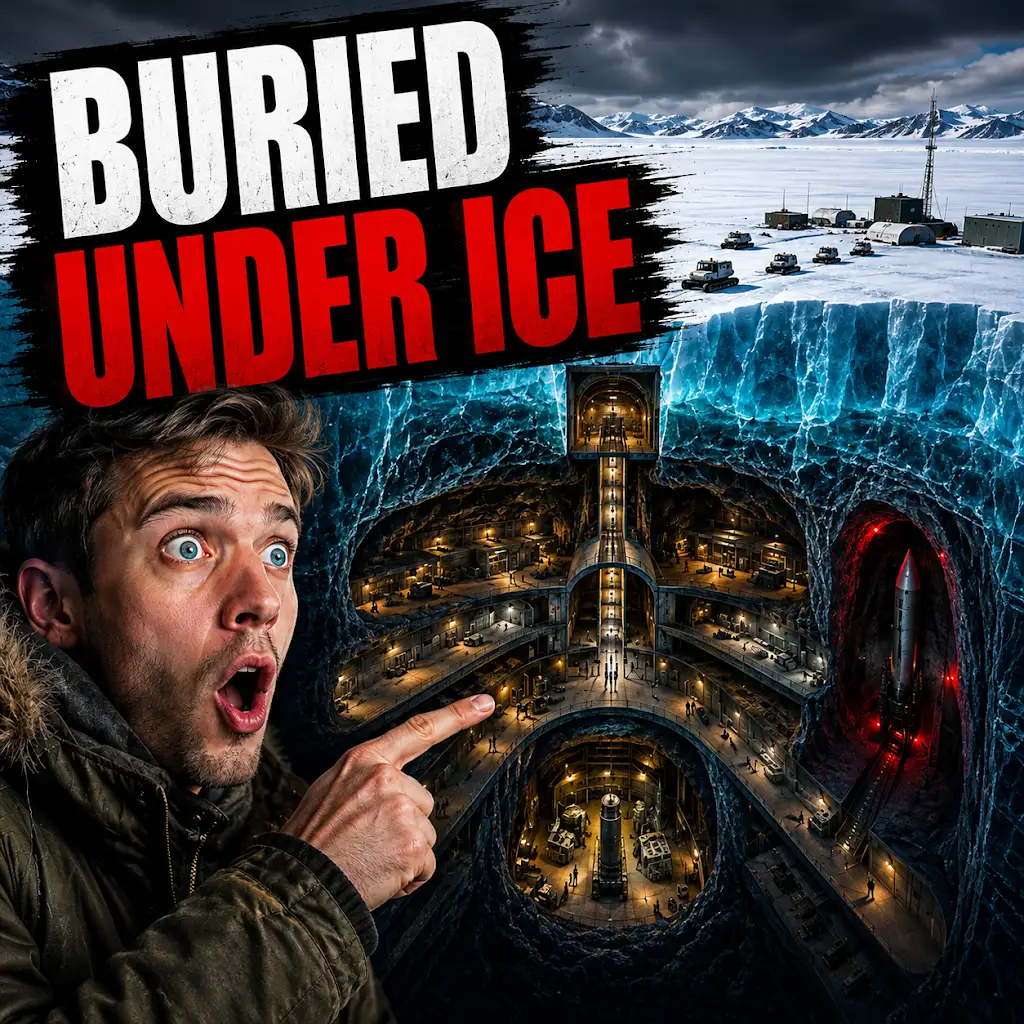
The U.S. Built a Nuclear City Under Greenland. The Ice Won.
FAQs
What are the Camp Century radar images?
The Camp Century radar images are aerial radar scans of the ice sheet covering Camp Century, a former military base in Greenland. These images were recently declassified and have provided new insights into the ice sheet’s structure and potential impact on sea level rise.
How were the radar images obtained?
The radar images were obtained using airborne radar systems that emit radio waves and measure the time it takes for the waves to bounce back from the ice sheet. This data is then used to create detailed maps of the ice sheet’s thickness and internal structure.
What do the radar images reveal about Camp Century’s ice sheet?
The radar images reveal that the ice sheet covering Camp Century is much thicker and more complex than previously thought. They show layers of ice and snow that have accumulated over thousands of years, as well as evidence of past climate changes and ice flow patterns.
Why are the radar images important?
The radar images are important because they provide valuable information about the dynamics of the ice sheet and its potential impact on sea level rise. Understanding the structure and behavior of the ice sheet is crucial for predicting future changes and developing strategies to mitigate the effects of climate change.
What are the implications of the radar images for climate research?
The radar images have implications for climate research as they contribute to our understanding of the processes driving ice sheet dynamics. This information can help scientists improve their models of ice sheet behavior and make more accurate predictions about future sea level rise.