The Earth’s climate system is a dynamic entity, prone to dramatic shifts throughout geological history. Among the most significant of these transformations was the Last Glacial Maximum (LGM), a period approximately 20,000 years ago when vast ice sheets covered much of the Northern Hemisphere. This colossal accumulation of ice fundamentally reshaped coastlines, influenced global weather patterns, and left an indelible mark on the planet’s geography. Understanding the sea level shifts during the LGM is crucial for comprehending not only past climate dynamics but also the potential impacts of future climate change.
The LGM was characterized by the apex of glaciation. Enormous ice sheets, far larger than any we see today, dominated the continental landscapes. Across North America, the Laurentide Ice Sheet stretched from the Arctic to the Mid-Atlantic region, while the Cordilleran Ice Sheet covered much of western Canada and the northwestern United States. In Europe, the Scandinavian Ice Sheet blanketed Scandinavia and extended into northwestern Russia and northern Germany. These ice masses were not mere blankets of snow; they were colossal rivers of ice, kilometers thick in places, exerting immense pressure on the Earth’s crust.
Laurentide Ice Sheet’s Influence
The Laurentide Ice Sheet, the largest of the LGM ice masses, played a pivotal role in global sea level. Its sheer size meant that an enormous volume of Earth’s water was locked up in its frozen form. As this ice accumulated over millennia, it drew water from the oceans, leading to a significant drop in global sea level. The southward expansion of the Laurentide Ice Sheet also influenced atmospheric circulation, steering weather systems and impacting precipitation patterns across the globe. The weight of this ice sheet also caused isostatic depression of the Earth’s crust beneath it, a phenomenon that would have long-lasting consequences.
Scandinavian Ice Sheet’s Role
Similarly, the Scandinavian Ice Sheet was a formidable glacial feature. Its presence further contributed to the global reduction in sea level. The accumulation and movement of this ice mass also had localized impacts on the Earth’s crust, leading to subsidence. The geographical position of the Scandinavian Ice Sheet meant it had a significant influence on the climate of Europe, contributing to colder temperatures and different precipitation regimes.
Antarctic Ice Sheet: A Constant Presence
While the Northern Hemisphere witnessed the dramatic waxing and waning of continental ice sheets, the Antarctic Ice Sheet, though also larger during the LGM, remained a more stable, albeit expanded, feature. The expansion of the Antarctic Ice Sheet, while contributing to sea level fall, did so on a different scale compared to the vast North American and Eurasian ice sheets. However, its presence still meant a significant volume of water was sequestered on the continent.
Smaller Glacial Advancements
Beyond the major ice sheets, numerous smaller glaciers and ice caps also expanded significantly across mountain ranges and higher latitude regions of the Southern Hemisphere. These, while individually less impactful than the continental ice sheets, collectively contributed to the overall sequestration of water from the oceans, further driving down global sea levels.
The Last Glacial Maximum (LGM) was a significant period in Earth’s climatic history, characterized by extensive ice sheets and lower sea levels. Understanding the implications of this period is crucial for grasping how current climate change might affect sea levels in the future. For a deeper exploration of how various factors, including human activities, influence our environment, you can read about the role of private companies in military space infrastructure in this related article: Private Companies’ Role in Military Space Infrastructure.
Dramatic Sea Level Fall
The most direct and profound consequence of the LGM ice age was the dramatic drop in global sea level. As mentioned, vast quantities of water were locked up in the immense ice sheets, effectively removing it from the oceans. This led to a global regression of coastlines, exposing substantial areas of the continental shelves.
The Magnitude of the Drop
Scientific estimates, derived from a variety of geological and geochronological methods, indicate that global sea levels during the LGM were approximately 120 to 130 meters lower than they are today. This is a staggering figure, representing a substantial portion of the current ocean volume. Imagine walking kilometers out into what is now the ocean floor, on dry land, to reach the edge of the continental shelf. This was the reality during the LGM.
Exposed Land Bridges
This significant sea level drop had profound implications for land-based ecosystems and the dispersal of species, including early human populations. The most notable consequence was the exposure of land bridges that connected continents and islands previously separated by water.
Beringia: A Crucial Connection
Perhaps the most famous of these exposed land bridges was Beringia, which connected Siberia (Asia) with Alaska (North America). This vast landmass, far wider than the modern Bering Strait, acted as a crucial corridor for the migration of plants, animals, and ultimately, humans from Asia into the Americas. The geography of Beringia, including its varied topography and potential for supporting life, has been a subject of intense scientific study.
Sundaland and Sahul: Southern Expansions
In the Southern Hemisphere, the lowered sea levels exposed significant portions of the continental shelves in Southeast Asia (Sundaland) and Australasia (Sahul). Sundaland connected mainland Southeast Asia with the islands of Borneo, Sumatra, and Java, creating a large, continuous landmass. Similarly, Sahul connected mainland Australia with New Guinea and Tasmania. These connections facilitated the movement of fauna and flora and played a vital role in the human colonization of these regions.
Other Exposed Continental Shelves
Beyond these prominent examples, numerous other continental shelves around the world were exposed. These newly accessible coastal plains would have been rich in resources, offering new habitats for terrestrial life and potential hunting grounds for early humans. The geological evidence for these exposed areas includes submerged river valleys, ancient shorelines, and sediment deposits found far offshore.
Impact on Coastal Ecosystems
The retraction of the sea had a dramatic impact on coastal ecosystems. Vast intertidal zones, deltas, and estuaries would have been exposed, creating new terrestrial landscapes. Marine ecosystems would have been compressed and altered, with many species confined to smaller, deeper basins. The geological record of these changes, found in marine sediments and coastal landforms, provides valuable insights into the past ecological conditions.
Isostatic Adjustments and Relative Sea Level

While global sea level fell uniformly due to water being locked in ice, the relative sea level experienced by a particular location was also influenced by other geological processes, most notably isostatic adjustment. The immense weight of the LGM ice sheets caused the Earth’s crust to depress beneath them. Conversely, areas far from the ice sheets experienced a slight uplift.
Glacial Isostatic Depression
As ice sheets grew, their enormous weight pressed down on the Earth’s lithosphere, causing it to buckle and subside. This process, known as glacial isostatic depression, led to a significant lowering of the land surface beneath the ice. Consequently, even if global sea level fell, the relative sea level in these depressed areas would have been higher than it would have been without the ice sheet’s weight.
Glacial Isostatic Uplift
Conversely, areas peripheral to the ice sheets, and especially those far from glacial centers, experienced a relative uplift of the Earth’s crust. This was due to the displacement of mantle material outwards as the crust was depressed elsewhere. This rebound effect meant that in areas like the inter-tropical regions, the land might have been effectively higher relative to the global sea level than it would have been in a non-glacial period.
Post-Glacial Rebound: The Aftermath of Ice Melt
The most dramatic manifestation of isostatic adjustment, however, occurred after the LGM as the ice sheets began to melt. As the immense weight of the ice was removed, the depressed land masses began to slowly rebound, a process that continues to this day. This post-glacial rebound, or isostatic uplift, has resulted in significant changes in relative sea level in formerly glaciated regions.
Rising Land, Falling Relative Sea Level
In areas that were once heavily glaciated, such as Scandinavia and parts of Canada, the land is still rising. This means that even though global sea levels have risen considerably since the LGM due to melting ice, the relative sea level in these specific regions has either risen very slowly or, in some cases, has even fallen in certain locales as the land rises faster than the ocean. Ancient coastlines can be found many meters above present-day sea level in these areas, a testament to the ongoing rebound.
Coastal Subsidence in Peripheral Areas
Conversely, areas that experienced peripheral uplift during the LGM, due to the displacement of mantle material, are now experiencing a relative sea level rise as the uplifted regions slowly subside back towards equilibrium. This complex interplay of forces means that understanding sea level change requires considering both global and local geological factors.
The Importance of Relative Sea Level
The distinction between global and relative sea level is crucial for understanding the geological evidence found across the planet. Beaches, marine terraces, and submerged landforms are all indicators of past sea levels, but their interpretation must account for local isostatic adjustments. The study of these features, often conducted by geologists and geomorphologists, provides the primary evidence for past sea level fluctuations.
Evidence for Sea Level Changes
Reconstructing past sea levels is a challenging endeavor, but a wealth of geological and geochronological evidence allows scientists to piece together the story of sea level shifts during the LGM and beyond. This evidence comes from various sources, each offering a unique perspective on the Earth’s fluctuating hydrosphere.
Marine Terraces and Shorelines
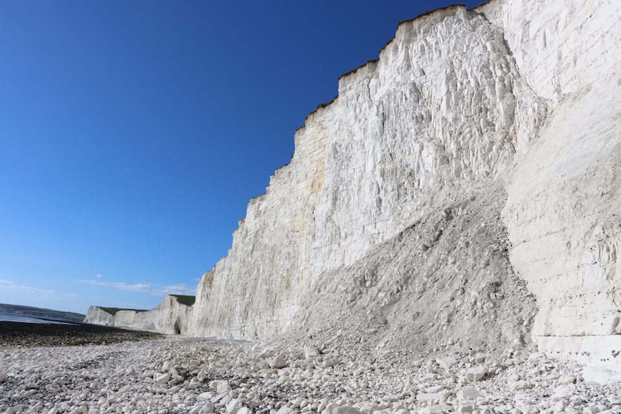
One of the most visually striking forms of evidence for past sea level changes is the presence of marine terraces. These are flat, step-like platforms that form along coastlines as sea level rises and falls. During the LGM, with its lower sea levels, ancient shorelines were located far out on the present-day continental shelf. As sea levels rose, new shorelines formed. The remnants of these older, higher sea level stands are preserved as terraces. In areas that have undergone significant isostatic uplift, these ancient shorelines can be found kilometers inland and many meters above present-day sea level.
Coral Reefs
Coral reefs are sensitive indicators of sea level change. They grow in shallow, sunlit waters and their vertical growth is closely tied to sea level. During periods of lower sea level, coral reefs would have been exposed and died off. As sea level rose, new reefs would have colonized the newly submerged surfaces. The study of the stratigraphy and dating of fossil coral reefs provides a detailed record of past sea level fluctuations. Variations in the thickness and composition of reef layers can reveal periods of stability, rapid sea level rise, and sea level drop.
Sediment Cores and Geochemistry
Sediments deposited in marine basins and estuaries hold a wealth of information about past environmental conditions, including sea level. By analyzing sediment cores, scientists can identify changes in the types of organisms present, the mineral composition, and the physical characteristics of the sediments, all of which can be linked to sea level. For example, the presence of terrestrial plant material in a marine sediment core indicates a time of lower sea level when the coastline was further offshore. Geochemical proxies, such as the isotopic composition of oxygen in marine fossils, can also be used to reconstruct past sea surface temperatures and infer global ice volume, which is directly related to sea level.
Submerged Landscapes
The glaciated regions of the world, particularly the continental shelves, harbor evidence of landscapes that were once above sea level. Submerged rivers valleys, prehistoric coastlines, and even ancient human settlements have been discovered on the ocean floor. These features are direct evidence of the significant sea level drop during the LGM. Sonar mapping and underwater archaeological surveys have revealed astonishing details of these drowned landscapes, offering glimpses into the past.
Dating Techniques
Crucially, all this geological evidence is dated using various chronometric techniques. Radiocarbon dating is effective for relatively recent geological periods (up to about 50,000 years ago), making it ideal for studying LGM sea level changes. Uranium-series dating and luminescence dating are used for older materials. By accurately dating geological markers associated with specific sea levels, scientists can construct precise sea level curves, illustrating the rate and magnitude of past changes.
The study of the Last Glacial Maximum sea level provides crucial insights into ancient climates and their impact on human civilizations. Understanding how sea levels fluctuated during this period can shed light on the environmental conditions that influenced early economies and settlement patterns. For a deeper exploration of how historical economies were affected by climatic changes, you can read this related article on the fall of ancient economies, which discusses various factors that contributed to their decline. This connection between climate and economic stability is essential for comprehending the broader implications of past environmental shifts. You can find the article here: the fall of ancient economies.
Implications for Modern and Future Sea Levels
| Location | Sea Level Change (meters below present day) |
|---|---|
| North America | -130 |
| South America | -130 |
| Europe | -120 |
| Asia | -120 |
| Africa | -120 |
| Australia | -120 |
The study of sea level shifts during the Last Glacial Maximum is not merely an academic exercise in understanding Earth’s past. It holds profound implications for our understanding of present-day sea level rise and predictions for the future, especially in the context of anthropogenic climate change. The processes that drove sea level changes in the past are relevant to the challenges we face today and will face in the future.
Understanding Past Warming and Sea Level Rise
The deglaciation that followed the LGM, leading to the current interglacial period, was a period of significant global warming and consequent sea level rise. While this warming was naturally driven by orbital cycles, the rate and magnitude of sea level rise during that period provide a valuable analogue for understanding the potential consequences of current, human-induced warming. By studying how quickly coastlines retreated and how ecosystems adapted during the last deglaciation, we can gain insights into the challenges of current sea level rise.
The Melting Ice Sheets of Today
The major ice sheets of Greenland and Antarctica are currently losing mass at an accelerating rate due to global warming. The melting of these ice sheets is the primary driver of modern sea level rise. The scale of these ice sheets, while smaller than those of the LGM, is still substantial enough to cause significant sea level rise if they were to melt completely. Understanding the dynamics of ice sheet melting and their contribution to sea level during past warm periods is crucial for refining models of future sea level change.
Coastal Vulnerability and Adaptation
The exposed continental shelves and land bridges of the LGM serve as a stark reminder of how dynamic coastlines can be. As global sea levels continue to rise due to climate change, coastal communities around the world are increasingly vulnerable to flooding, erosion, and inundation. The historical context provided by the LGM sea level shifts highlights the long-term nature of these changes and the need for robust adaptation strategies, including land-use planning, infrastructure development, and potentially managed retreat from vulnerable areas.
Paleoclimate as a Predictor
The Earth’s climate system has a degree of inertia. Past climate events, especially those involving significant changes in ice volume and sea level, offer valuable insights into the long-term trajectory of climate change. By studying the paleo-record, scientists can identify tipping points and thresholds in the climate system that, if crossed, could lead to rapid and irreversible changes in sea level. This knowledge is essential for informed policy-making and for mitigating the worst impacts of future climate change. The lessons learned from the Last Glacial Maximum’s dramatic sculpting of our planet’s coastlines continue to resonate, offering a crucial perspective on our present and future relationship with the oceans.

Could Humanity Remember a World That No Longer Exists?
FAQs
What was the Last Glacial Maximum (LGM) sea level?
The Last Glacial Maximum (LGM) sea level refers to the lowest sea level during the last glacial period, which occurred approximately 20,000 years ago. At this time, global sea levels were about 130 meters lower than they are today.
What caused the lower sea levels during the Last Glacial Maximum?
The lower sea levels during the Last Glacial Maximum were primarily caused by the accumulation of water in massive ice sheets covering large portions of North America, Europe, and Asia. This resulted in a significant amount of water being removed from the oceans and stored as ice on land.
How do scientists study the Last Glacial Maximum sea level?
Scientists study the Last Glacial Maximum sea level by examining geological evidence such as ancient shorelines, coral reefs, and sediment cores. By analyzing these indicators, researchers can reconstruct past sea levels and gain insights into the extent of ice sheets and the distribution of water on Earth during this time.
What impact did the lower sea levels during the Last Glacial Maximum have on the Earth’s geography?
The lower sea levels during the Last Glacial Maximum exposed vast areas of land that are currently underwater, such as the continental shelves. This had a significant impact on the Earth’s geography, creating land bridges that allowed for the migration of animals and early humans between continents.
How does the study of the Last Glacial Maximum sea level contribute to our understanding of climate change?
Studying the Last Glacial Maximum sea level provides valuable information about past climate change and its effects on the Earth’s oceans and ice sheets. This knowledge can help scientists better understand the processes driving climate change today and make more accurate predictions about future sea level rise.