The ebb and flow of ancient ice sheets, colossal forces that sculpted Earth’s surface, played a pivotal role in the story of early human migration and settlement. Understanding the intricate dance between prehistoric peoples and these dynamic glacial boundaries is crucial for unlocking the secrets of human dispersal, technological innovation, and adaptation. This exploration delves into the methodologies and challenges of mapping these ancient settlements, revealing how humanity navigated and ultimately thrived in landscapes profoundly shaped by ice.
The Glacial Footprint and Early Human Presence
The Late Pleistocene and early Holocene epochs witnessed the waxing and waning of massive ice sheets, particularly across North America and Eurasia. These periods of glaciation profoundly altered geography, creating distinct ecological zones and formidable barriers. As ice retreated, it exposed new territories, opened migration corridors, and simultaneously created or destroyed vital resources. Prehistoric humans, driven by needs for food, shelter, and social connectivity, were inherently attuned to these environmental shifts. Their movements were not random but often strategically dictated by the availability of resources concentrated along the retreating glacial margins.
Interpreting the Landscape of the Past
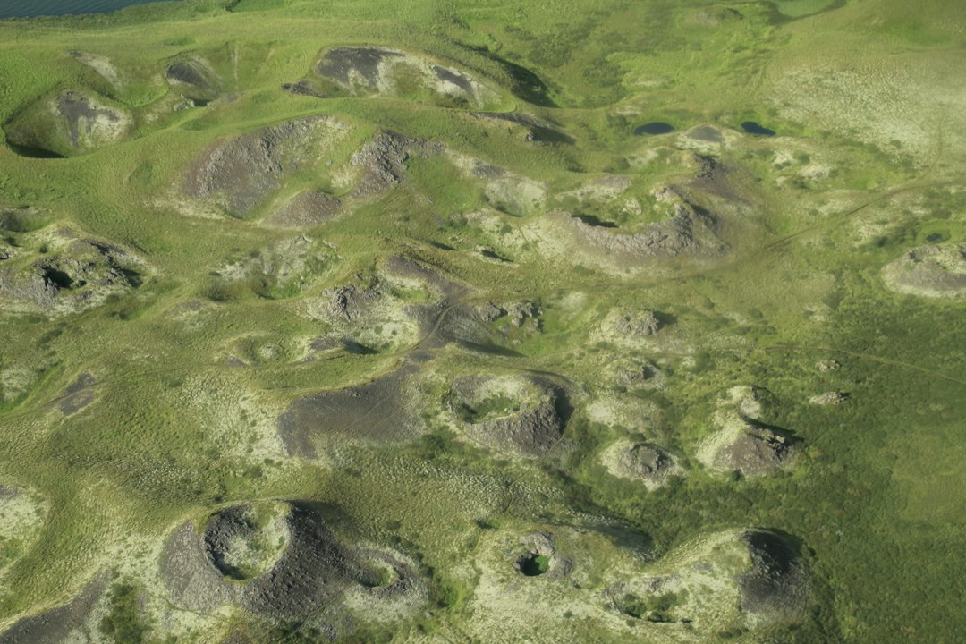
The very act of mapping prehistoric settlements along glacial boundaries requires a deep understanding of paleogeography. This involves reconstructing the ancient landscape as it was during the time of human occupation, a complex endeavor that relies on integrating multiple lines of evidence. Geologists meticulously study glacial landforms—moraines, out-of-wash plains, proglacial lakes—to delineate the extent and retreat patterns of ice sheets. These geomorphic features provide a foundational framework for understanding the physical environment. Paleoenvironmental reconstructions, drawing on pollen analysis from lake sediments and ice cores, offer insights into the vegetation and climate of these ancient landscapes. Changes in plant communities directly correlate with animal populations, which in turn were the primary draw for early human hunters and gatherers. Understanding the types of flora and fauna present, and their distribution in relation to the ice margins, is paramount to inferring potential human settlement patterns.
The Critical Role of Proxies and Reconstructions
Because direct evidence of human activity is often buried or eroded, researchers depend heavily on proxies. These indirect indicators are the building blocks of our understanding. For instance, a stratum of ancient hearths found near a kame terrace suggests human presence exploiting resources associated with glacial outwash. Similarly, lithic scatters—collections of stone tools and debris—are direct but spatially limited evidence of past human occupation. The interpretation of these proxies must be grounded in a robust understanding of the paleoenvironmental context. A rich assemblage of faunal remains, particularly of now-extinct megafauna, found in proximity to glacial features, strongly suggests a site of importance for hunter-gatherer groups who relied on these large animals for sustenance. Conversely, the absence of such evidence, coupled with unfavorable environmental conditions, could indicate a region less conducive to sustained human habitation.
Recent studies in mapping prehistoric human settlements have shed light on how ancient populations adapted to glacial boundaries, revealing significant insights into their migration patterns and survival strategies. For a deeper understanding of the technological advancements and architectural marvels of these ancient civilizations, you can explore a related article that discusses evidence of their sophisticated capabilities. This article, titled “The Lost Legacy of Ancient Civilizations: Evidence of Advanced Technology and Architectural Marvels Found in Archaeological Discoveries,” provides a fascinating perspective on the achievements of our ancestors. You can read it here: The Lost Legacy of Ancient Civilizations.
Methodologies for Locating Ancient Habitations

The endeavor to map prehistoric settlements along glacial boundaries is a multidisciplinary pursuit, drawing upon archaeology, geology, paleoclimatology, and sophisticated geospatial technologies. These methods are constantly evolving, allowing for increasingly precise and expansive investigations. The traditional approach of systematic archaeological survey, while still vital, is now augmented by advanced techniques that can identify subtle anomalies and predict areas of high archaeological potential.
Traditional Survey and Excavation Techniques
Systematic pedestrian surveys have long been the cornerstone of archaeological discovery. Teams of archaeologists meticulously walk transects across the landscape, visually scanning for surface artifacts such as stone tools, pottery shards, or hearth remnants. Areas identified through survey are then often subjected to targeted excavation. Excavation is a labor-intensive process that reveals buried archaeological deposits in three dimensions, providing context and allowing for the recovery of a wider range of artifacts, organic materials, and ecofacts. Radiocarbon dating of organic materials from excavated contexts provides crucial temporal control, anchoring the human presence within specific periods of glacial retreat. These foundational methods, while time-consuming, have laid the groundwork for our understanding of many prehistoric sites.
Leveraging Geospatial Technologies for Predictive Modeling
Modern archaeology has been revolutionized by the advent of Geographic Information Systems (GIS) and remote sensing technologies. GIS allows for the integration and analysis of vast datasets, including digital elevation models, geological maps, paleoenvironmental reconstructions, and known archaeological site locations. By layering these data, researchers can identify correlations between environmental factors and archaeological occurrences. For example, a GIS model might predict that areas with specific soil types, proximity to ancient river terraces, and within a certain distance of a known glacial margin are more likely to contain undiscovered prehistoric settlements. Remote sensing, including aerial and satellite imagery, lidar (Light Detection and Ranging), and even drone-based photogrammetry, can reveal subtle topographic features or vegetation patterns that might indicate past human activity, such as former field systems or the outlines of ancient structures, even when these are no longer visible on the ground. Lidar, in particular, can penetrate forest canopy, uncovering hidden archaeological landscapes that would otherwise remain invisible.
The Power of Digital Elevation Models (DEMs) and Geophysical Surveys
Digital Elevation Models (DEMs) are instrumental in visualizing and analyzing the topographic nuances of glacial landscapes. These models, derived from various sources including satellite altimetry and ground-based surveys, can highlight subtle landforms associated with past glacial activity, such as meltwater channels or eskers, which often served as important travel routes or settlement locations for early humans. In conjunction with DEMs, geophysical survey techniques such as ground-penetrating radar (GPR) and magnetometry can non-invasively detect subsurface anomalies indicative of human activity. GPR can identify buried features like hearths, pits, or even walls by measuring variations in the electrical properties of the soil. Magnetometry detects variations in the Earth’s magnetic field, which can be caused by fired clay in hearths or by the disturbance of soil during human occupation. These techniques allow archaeologists to identify promising areas for targeted excavation with greater confidence, reducing the need for broad-scale disturbance of the landscape.
Challenges in Mapping and Interpretation
The study of prehistoric human settlements along glacial boundaries is fraught with unique challenges, stemming from the very nature of the ancient environment and the limitations of available evidence. The passage of millennia, coupled with the relentless forces of geological change, has often degraded or obliterated the archaeological record.
The Ephemeral Nature of Early Archaeological Evidence
Prehistoric human activity, especially during the Paleolithic and Mesolithic periods, often left behind ephemeral traces. Hunter-gatherer societies, with their mobile lifestyles, did not construct permanent monumental structures. Their camps were often temporary, leaving behind hearths, lithic scatters, and faunal remains that can be easily dispersed by natural processes such as erosion, solifluction, or later human activity. The materials used by these early peoples, such as bone, wood, and hides, are also highly perishable, rarely surviving the ravages of time except in exceptional preservation conditions, such as waterlogged environments or frozen ground. This makes locating and interpreting their settlements a challenging puzzle.
The Dynamic Nature of Glacial Landscapes
Glacial environments are inherently dynamic. The immense power of ice sheets can reshape landscapes dramatically, eroding or burying evidence of past human occupation. Retreating ice fronts create unstable terrain, prone to flooding and mass movements, which can further disturb or obliterate archaeological sites. Proglacial lakes, while offering potential resources, could also expand and contract, altering coastlines and submerging or exposing areas over time. The subsequent Holocene epoch has also witnessed significant landscape evolution, including soil formation, vegetation changes, and river meandering, all of which can obscure or modify the archaeological record. Understanding these post-depositional processes is crucial for correctly interpreting the spatial relationships between archaeological finds and glacial features.
Dating the Past: The Limits of Chronology
Establishing precise chronologies for prehistoric settlements along glacial margins can be a significant hurdle. Radiocarbon dating, while invaluable, has limitations. Organic materials may be contaminated, or the samples may be too small or degraded for reliable dating. Furthermore, radiocarbon dating has a limited range, typically extending back around 50,000 years, which may not encompass the earliest human occupations in some glaciated regions. Other dating techniques, such as luminescence dating of sediments or OSL (Optically Stimulated Luminescence) dating of quartz grains, can extend this range and provide dates for when sediments were last exposed to sunlight, offering indirect dating of human occupation. However, these methods also have their own challenges and require careful calibration and interpretation. Precisely correlating archaeological events with specific stages of glacial retreat can thus be difficult, often resulting in broad temporal windows rather than pinpoint accuracy.
Reconstructing Human Behavior and Adaptation
Mapping settlements is only the first step; the ultimate goal is to understand how prehistoric humans lived, adapted, and interacted with their glacial environments. By analyzing the spatial distribution of sites, the artifacts found within them, and their relationship to specific glacial features, researchers can reconstruct aspects of their diet, mobility patterns, social organization, and technological choices.
Resource Procurement and Settlement Strategies
The proximity of settlements to glacial features often offers clues about resource procurement strategies. Early humans were adept at exploiting the opportunities presented by these dynamic landscapes. For instance, meltwater streams and outwash plains often attracted large herbivores, making these areas prime hunting grounds. Glacial retreat exposed new land for foraging, and the meltwater lakes and rivers provided sources of freshwater and fish. Settlement patterns likely reflected these resource gradients. Archaeological sites might be found concentrated along glacial valleys, which acted as natural corridors for both animal migration and human movement. The size and density of lithic scatters or faunal assemblages can indicate the duration and intensity of occupation, providing insights into whether a site was a short-term hunting camp or a more substantial base camp for a longer period.
Technological Innovations Driven by Glacial Environments
The challenges and opportunities presented by glacial environments likely spurred technological innovation. The need to process tough animal hides for clothing and shelter in cold climates, or to create tools for hunting large game, would have driven the development of more sophisticated lithic technologies. Specialized tools for butchering, hide scraping, and woodworking would have been essential. The selection of raw materials, such as flint or chert, often dictated by their proximity to glacial deposits, also played a role. Understanding the chaîne opératoire (the sequence of actions involved in manufacturing a tool) for artifacts found at these sites can reveal the ingenuity of early toolmakers in adapting to their specific environmental constraints and available resources. The development of projectile points for hunting, or specialized tools for ice and snow navigation, though difficult to definitively prove without exceptional preservation, can be inferred from the archaeological record.
Mobility and Social Networks in a Changing World
The shifting glacial boundaries would have necessitated flexible mobility strategies. As ice retreated, new territories opened up, and access to previously inaccessible areas became possible. This likely influenced the movement patterns of both human groups and their prey. Mapping settlements in relation to each other and to paleoenvironmental data can help reconstruct these mobility networks. The presence of similar artifact types or raw materials at geographically distant sites can indicate trade or social interaction between different groups. The location of settlements in relation to geographical barriers, such as mountain ranges or large river systems formed by glacial meltwater, can also shed light on how these early populations navigated their world and maintained social connections across a vast and often challenging landscape. The need to exploit seasonal resources, dictated by the fluctuating proximity of the ice margin and associated flora and fauna, would have been a primary driver of these mobility strategies.
Recent studies have shed light on how mapping prehistoric human settlements can reveal insights into glacial boundaries and their impact on early human migration. For a deeper understanding of how environmental factors shape human habitation, you might find the article on securing long-term human presence on the moon particularly intriguing. It explores the challenges and strategies related to sustaining life in extreme conditions, drawing parallels to how ancient humans adapted to their changing environments. You can read more about it in this article.
The Future of Glacial Boundary Archaeology
| Metric | Description | Value/Range | Unit | Source/Method |
|---|---|---|---|---|
| Settlement Age | Estimated age of prehistoric human settlements near glacial boundaries | 10,000 – 40,000 | Years Before Present (BP) | Radiocarbon Dating |
| Distance from Glacial Boundary | Proximity of settlements to the nearest glacial margin during the Last Glacial Maximum | 0 – 50 | km | GIS Spatial Analysis |
| Elevation of Settlements | Altitude of prehistoric sites relative to sea level | 100 – 1500 | meters | Topographic Mapping |
| Artifact Density | Number of artifacts found per square meter at settlement sites | 5 – 200 | artifacts/m² | Archaeological Excavation |
| Glacial Boundary Shift | Distance glacial boundaries moved since settlement occupation | 10 – 100 | km | Glacial Geomorphology |
| Climate Proxy Data | Temperature estimates during settlement periods derived from ice cores and sediment | -10 to 5 | °C anomaly from present | Paleoclimate Reconstruction |
The ongoing study of prehistoric human settlements along glacial boundaries promises to yield further profound insights into our past. As technological capabilities advance and interdisciplinary collaboration deepens, our understanding of humanity’s earliest migrations and adaptations will continue to expand. The lessons learned from these ancient peoples’ resilience and ingenuity remain relevant even today.
Advances in Dating and Paleoenvironmental Reconstruction
Future research will benefit immensely from refinements in dating techniques. Extended radiocarbon dating capabilities, coupled with advancements in luminescence and other geochronological methods, will allow for more precise temporal placement of archaeological sites within specific glacial chronologies. Furthermore, the increasing resolution of paleoenvironmental reconstructions, derived from sophisticated analysis of ice cores, lake sediments, and marine records, will provide a more nuanced understanding of the climatic and ecological conditions that prehistoric populations experienced. This will allow for more accurate predictions of resource availability and environmental challenges, enabling a deeper interpretation of settlement patterns and human behavior. The integration of these high-resolution datasets will be key to unlocking the fine-grained details of human adaptation.
The Role of Digital Archaeology and Big Data Analysis
The field of digital archaeology is poised to play an increasingly significant role. The digitization of existing archaeological records, coupled with the generation of new high-resolution spatial data from remote sensing and geophysical surveys, will create massive datasets. The application of big data analytics and artificial intelligence (AI) to these datasets holds immense potential for identifying previously unrecognized patterns and correlations. Machine learning algorithms could be trained to recognize subtle archaeological signatures in remote sensing imagery or to predict areas of high archaeological potential based on complex environmental variables. The visualization of these vast datasets in immersive virtual environments will also facilitate new ways of exploring and interpreting the prehistoric landscape.
Global Perspectives and Comparative Studies
While much research has focused on specific regions like North America and Scandinavia, a more global perspective is emerging. Comparative studies of human settlement patterns along glacial boundaries in different parts of the world will reveal commonalities and divergences in adaptation strategies. Understanding how different groups, facing similar environmental pressures but possessing different cultural toolkits and social structures, responded to the challenges of living near retreating ice sheets will provide a richer, more comprehensive picture of human resilience and innovation. This comparative approach is essential for understanding the universality and diversity of human adaptation throughout prehistory. The study of these ancient interactions with ice offers not just a glimpse into our deep past but also a valuable perspective on human-environment dynamics that continues to resonate today.

Beneath the Ice: Surviving the Ice Age 20,000 Years Ago
FAQs
What is the significance of mapping prehistoric human settlements?
Mapping prehistoric human settlements helps archaeologists understand how ancient civilizations lived, interacted with their environment, and evolved over time.
How do researchers determine glacial boundaries in prehistoric times?
Researchers use a variety of methods, including studying landforms, analyzing sediment deposits, and examining ancient climate data to determine glacial boundaries in prehistoric times.
Why is it important to study glacial boundaries in relation to prehistoric human settlements?
Studying glacial boundaries in relation to prehistoric human settlements provides insights into how early humans adapted to changing environmental conditions, such as the advance and retreat of glaciers.
What tools and technologies are used to map prehistoric human settlements and glacial boundaries?
Researchers use a combination of satellite imagery, LiDAR technology, ground-penetrating radar, and geographic information systems (GIS) to map prehistoric human settlements and glacial boundaries with precision.
How can mapping prehistoric human settlements and glacial boundaries contribute to our understanding of human history?
By mapping prehistoric human settlements and glacial boundaries, researchers can reconstruct past landscapes, track human migration patterns, and gain insights into the cultural and technological development of ancient civilizations.