
NASA Radar Uncovers Camp Century Under Ice
A once-secret military base, buried beneath nearly two kilometers of Greenland ice, has been revealed through the innovative use of radar technology by NASA. Camp Century, a Cold War-era American military installation, was originally constructed in 1959 with the ambitious goal of housing a significant number of troops and serving as a potential launch site for nuclear missiles. Its existence was officially acknowledged by the U.S. government in 1997, but its exact nature and the extent of its abandonment remained somewhat shrouded in mystery for decades. Now, thanks to sophisticated radar sounding conducted by NASA scientists, a detailed and unprecedented picture of the buried base and the surrounding ice sheet is emerging, shedding new light on both its historical significance and the environmental challenges it poses today.
The discovery and detailed mapping of Camp Century are not merely an exercise in Cold War archaeology. The base’s buried nature, combined with the dynamic processes of the Greenland ice sheet, presents a concerning environmental quandary. As the ice melts due to accelerating climate change, the abandoned military infrastructure, along with any remaining hazardous materials, risks being released into the environment. NASA’s radar work is therefore crucial not only for historical understanding but also for informing future environmental remediation efforts.
The establishment of Camp Century was a direct product of the geopolitical tensions of the Cold War. The United States, seeking to maintain a strategic advantage over the Soviet Union, embarked on a series of ambitious military projects across the globe. In the Arctic, the vast and seemingly inhospitable landscape of Greenland offered unique opportunities for military operations and scientific research, often intertwined.
A Strategic Foothold in the Arctic
The Arctic region held immense strategic importance during the Cold War. Its proximity to both the United States and the Soviet Union made it a critical theater for surveillance, reconnaissance, and potential missile deployment. The vast, sparsely populated terrain also offered a degree of concealment and isolation that was appealing to military planners. Camp Century, situated deep within Greenland, was conceived as a vital component of this Arctic strategy.
Operation Iceworm and the Subsurface Ambition
Camp Century was officially known as a scientific research station, but its true purpose was far more complex. Under the guise of scientific inquiry, the U.S. Army initiated “Operation Iceworm,” a project designed to explore the feasibility of constructing and operating military facilities beneath the ice sheet. The intention was to leverage the insulating properties of the ice to create a camouflaged and protected base, capable of housing thousands of personnel and potentially launching intercontinental ballistic missiles. The idea was that such a base would be incredibly difficult for adversaries to detect and attack.
Engineering Marvel or Hubris?
The engineering feat required to build Camp Century was considerable. In the harsh Arctic environment, a vast network of tunnels and buildings was excavated and constructed directly into the ice. The base featured living quarters, recreational facilities, a hospital, a power plant, and even a pressurized nuclear reactor. At its peak, it housed over 200 personnel. However, the ambitious nature of the project also foreshadowed its eventual demise, as the inherent instability of building within a moving ice sheet proved to be a significant challenge.
In a fascinating exploration of hidden landscapes, NASA’s radar technology has unveiled the remnants of Camp Century, a secret U.S. military base buried beneath the Greenland ice sheet. This discovery not only sheds light on Cold War history but also raises questions about climate change and its impact on polar regions. For those interested in how strategic planning and development unfold in different contexts, a related article discusses Mexico’s ambitious industrial zone plan, which aims to enhance economic growth and infrastructure. You can read more about it here: Mexico’s Strategic Development Industrial Zone Plan.
Radar’s Revealing Gaze: Peering Through the Ice
The challenge of studying an object buried under kilometers of ice has historically been immense. Traditional excavation methods would be prohibitively expensive, environmentally destructive, and practically impossible on such a scale. This is where NASA’s advanced radar technology has proven to be a game-changer, offering a non-invasive and highly effective means of surveying the buried installation.
The Power of Ice-Penetrating Radar
Ice-penetrating radar (IPR) systems operate by transmitting radio waves into the ice and then measuring the reflected signals. Different materials and structures beneath the ice reflect these radio waves differently, allowing scientists to create detailed maps of the subsurface. The frequency of the radar waves is carefully chosen to penetrate the ice to the desired depth while still providing sufficient resolution to distinguish features. For Camp Century, a lower frequency radar was essential to reach the considerable depth at which the base lies.
Data Collection and Interpretation
NASA’s researchers utilized specialized aircraft equipped with sophisticated IPR systems to fly over the Greenland ice sheet in precise grids. These flights collected vast amounts of data, which were then processed and analyzed to create 3D reconstructions of the subsurface. The radar signals provided information about the geometry of the buried structures, their composition, and their relationship to the surrounding ice. Interpreting these complex datasets requires advanced algorithms and considerable expertise to differentiate between natural ice formations and man-made structures.
Mapping the Extent of the Buried Base
The radar data has allowed scientists to map the full extent of Camp Century’s footprint, revealing the intricate network of tunnels and structures that were once a hive of activity. This mapping goes beyond simply identifying the location of the base; it provides insights into the layout of the facility, the size of individual buildings, and the overall configuration of the underground complex. This detailed understanding of the base’s physical dimensions is crucial for assessing the potential environmental risks associated with its eventual exposure.
The Environmental Time Bomb: Camp Century’s Legacy
While Camp Century was conceived as a strategic asset, its current state presents a growing environmental concern. The melting of the Greenland ice sheet, driven by anthropogenic climate change, is bringing the buried base closer to the surface, threatening to release potentially hazardous materials into the pristine Arctic environment.
The Accelerating Melt of the Greenland Ice Sheet
Global warming is causing the Greenland ice sheet to melt at an alarming rate. This meltwater contributes significantly to global sea-level rise and has far-reaching implications for the Arctic ecosystem. As the ice thins and recedes, features buried for decades, like Camp Century, are increasingly exposed. The radar data has provided crucial information about the rate at which the ice is thinning above the base, helping scientists to predict when and how it might become fully uncovered.
Potential Release of Hazardous Materials
Camp Century was a military installation, and as such, it likely contains a variety of materials that could be harmful if released into the environment. This includes fuels, lubricants, building materials containing chemicals, and potentially even radioactive waste from the base’s nuclear reactor. The radar data has been instrumental in identifying the location of these potential sources of contamination within the buried complex.
The Risk of Contamination and Ecological Impact
The melting ice and eventual exposure of Camp Century raise serious concerns about the contamination of Greenland’s freshwater sources and marine environments. These pristine ecosystems are already under stress from climate change, and the addition of anthropogenic pollutants could have devastating consequences for Arctic wildlife and the indigenous communities that depend on these resources. Understanding the precise composition and location of the hazardous materials is a critical first step in planning for potential remediation.
Beyond Archaeology: Scientific Insights from the Buried Base
The revelation of Camp Century through radar extends beyond its historical and environmental implications. The detailed imaging of the base and the surrounding ice sheet offers valuable scientific insights into glacial dynamics and the impact of climate change on ice sheets.
Understanding Ice Flow and Deformation
The construction and subsequent abandonment of Camp Century created a significant anomaly within the ice sheet. The weight of the structures and the presence of the buried complex have influenced the flow and deformation of the ice above and around it. Radar data allows scientists to study these localized ice dynamics, providing a unique field laboratory for understanding how ice sheets respond to stress and change over time.
The Ice Sheet as a Repository of History
Beyond the military base itself, the ice sheet acts as a vast archive of environmental history. Radar surveys can reveal past surface features, snow accumulation patterns, and even evidence of ancient volcanic eruptions, all preserved within the ice layers. This makes the ice sheet a valuable resource for paleoclimatology and understanding long-term environmental trends.
Informing Climate Models and Projections
The detailed understanding of ice sheet behavior gained from studying areas like Camp Century can directly inform and improve climate models. By observing how the ice interacts with buried structures and how it deforms under different conditions, scientists can refine their predictions of future ice loss, sea-level rise, and other climate-related phenomena.
Recent advancements in radar technology have unveiled the hidden remnants of Camp Century, a secret U.S. military base buried beneath the ice of Greenland. This discovery not only sheds light on Cold War history but also raises questions about the impact of climate change on polar regions. For those interested in exploring how ancient civilizations navigated their worlds, a fascinating article on Minoan celestial navigation can be found here, offering insights into the sophisticated techniques used by early navigators.
The Path Forward: Remediation and Future Research
| Data/Metric | Value |
|---|---|
| Location | Beneath the ice in Greenland |
| Discovery | Revealed by NASA radar |
| History | Former US military base during the Cold War |
| Depth | Approximately 100 feet below the surface |
| Size | Extends over 55,000 square meters |
The uncovering of Camp Century by NASA radar is not an endpoint but a beginning. The knowledge gained from these surveys is crucial for developing strategies to address the environmental challenges posed by the buried base and for guiding future research in the Arctic.
Assessing the Scope of the Environmental Threat
The detailed mapping of Camp Century by radar is the essential first step in assessing the full scope of the environmental threat. This includes identifying the specific types and quantities of hazardous materials present, their locations within the base, and the predicted timeline for their exposure due to ice melt. This information is vital for informed decision-making regarding remediation efforts.
Developing Remediation Strategies
Once the environmental risks are fully understood, the challenge of remediation begins. This is a complex and potentially expensive undertaking. Solutions might range from containment strategies to prevent the release of pollutants to the careful removal and disposal of hazardous materials. The logistics of operating in the remote and challenging Arctic environment add significant complexity to any remediation plan.
Continued Monitoring and Research
The dynamics of the Greenland ice sheet are constantly changing. Therefore, continued monitoring of the Camp Century site and the surrounding ice is essential. NASA’s radar technology, along with other remote sensing techniques and on-the-ground measurements, will be crucial for tracking the rate of ice melt, the progression of the base’s exposure, and the effectiveness of any remediation efforts. Further research into the environmental impacts of ice melt and the behavior of buried Cold War sites will be vital for protecting the Arctic in a warming world.
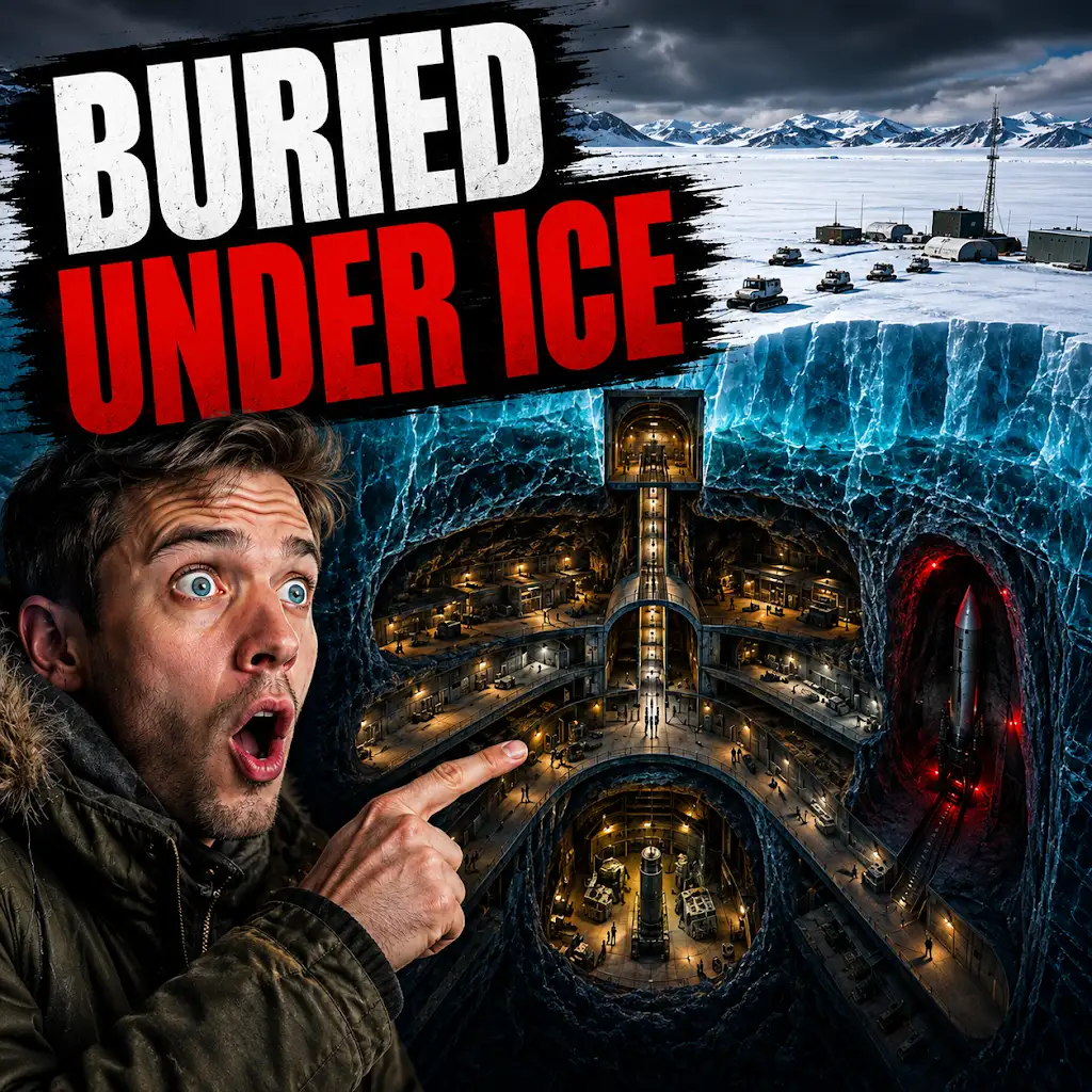
The U.S. Built a Nuclear City Under Greenland. The Ice Won.
FAQs
What did the NASA radar reveal about Camp Century?
The NASA radar revealed that Camp Century, a Cold War-era military base built beneath the ice in Greenland, is still intact and buried beneath the ice sheet.
How was the NASA radar able to detect Camp Century?
The NASA radar used a technique called radar echolocation to penetrate the ice and map the underlying bedrock and any buried structures, such as Camp Century.
Why is the discovery of Camp Century significant?
The discovery of Camp Century is significant because it provides valuable information about the stability and movement of the Greenland ice sheet, as well as the potential environmental impact of the abandoned military base.
What was the purpose of Camp Century when it was built?
Camp Century was built by the US military in the 1950s as part of a secret project known as “Project Iceworm,” which aimed to deploy ballistic missiles within the ice sheet as a deterrent against potential Soviet aggression.
What are the potential implications of the discovery of Camp Century?
The discovery of Camp Century raises questions about the environmental and geopolitical implications of abandoned military infrastructure in the Arctic, as well as the long-term impact of climate change on ice-covered regions.