
NASA’s Spaceborne Imaging Radar-C (SIR-C) mission, operating aboard the Space Shuttle Endeavour in 1994 and again in 1997, proved to be more than just a technological marvel; it acted as an archaeological trowel, gently revealing the Sahara Desert’s deeply buried secrets. This advanced radar system, capable of penetrating dry sand, unveiled a landscape far more dynamic and historically rich than surface observation could ever suggest.
Understanding Radar’s Principles
Radar, which stands for Radio Detection and Ranging, functions by transmitting radio waves towards the Earth’s surface and then analyzing the reflected signals. Unlike optical imaging, which relies on visible light, radar waves can penetrate certain materials that block visible light, most notably dry sand. This ability is fundamental to SIR-C’s success in the Sahara. The radio waves, typically in the microwave portion of the electromagnetic spectrum, pass through the loose, dry sand grains, interacting with materials and structures buried beneath. The strength and polarization of the returning signal provide crucial information about the subsurface geometry and composition. SIR-C employed multiple frequencies and polarizations, offering a more detailed and nuanced view than single-frequency, single-polarization systems.
SIR-C’s Technological Advancements
The SIR-C instrument represented a significant leap in radar technology. It was equipped with three different radar systems: a L-band (1.25 GHz), a C-band (5.3 GHz), and an X-band (9.6 GHz), though the X-band was less frequently used for deep penetration studies in the Sahara. The L-band, with its longer wavelength, was particularly adept at penetrating deeper into the sand. The C-band offered a balance between penetration and resolution. Furthermore, SIR-C could operate in various polarizations (horizontal and vertical transmission and reception), allowing scientists to distinguish different types of surface roughness and material properties. This multi-frequency and multi-polarization capability was like having a set of specialized tools, each suited for a different task of subsurface excavation.
Penetrating the Sandy Blanket
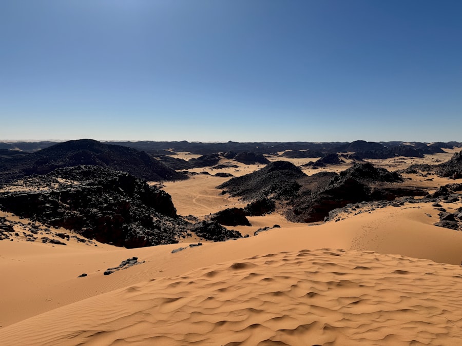
The Sahara Desert, a vast expanse covering much of North Africa, is characterized by its immense sand seas, or ergs. These ergs are not static, but dynamic environments shaped by wind into ever-shifting dunes. Beneath this apparently featureless expanse of sand lies a geological and archaeological record stretching back millennia. Traditional methods of archaeological investigation, such as excavation, are laborious, time-consuming, and often impractical across such a vast and remote region. For centuries, the desert’s sandy mantle has acted as a protective, albeit obscuring, shroud, safeguarding its buried history. SIR-C’s ability to pierce this sandy veil provided an unprecedented opportunity to map these hidden features without disturbing the delicate desert ecosystem.
NASA’s SIR-C radar findings in the Sahara have unveiled significant geological features that could reshape our understanding of the region’s history and landscape. These discoveries echo the themes explored in a related article that delves into ancient mysteries and engineering feats, such as the enigmatic stone blocks of Baalbek. For more insights into the fascinating connections between ancient civilizations and modern technology, you can read the article here: Unraveling the Baalbek Stone Block Mystery.
Unveiling Ancient Waterways and Human Habitation
Mapping Paleochannels and River Systems
One of the most significant discoveries made by SIR-C was the mapping of extensive ancient river systems and paleochannels, or relict riverbeds, buried beneath the sand. These ancient waterways are like the fossilized arteries of a long-deceased giant, indicating a time when the Sahara was a much wetter and greener environment. By analyzing the radar reflections, scientists were able to delineate the sinuous paths of rivers that once flowed across the landscape, some of which are immense in scale, comparable to the Nile River. These paleochannels are often marked by a contrast in the radar signature due to differences in sediment composition and moisture content compared to the surrounding sand.
Evidence of Past Lakes and Wetlands
Beyond rivers, SIR-C also revealed the presence of ancient lake beds and wetland areas. These features are often characterized by flat, smooth surfaces in radar imagery, reflecting the still waters of the past. The radar signals are altered by the fine-grained sediments that settle in calm water environments, creating distinct patterns that can be identified. The identification of these ancient bodies of water is crucial for understanding past climate conditions and the potential for sustained human settlement. It’s like finding the fingerprints of a vanished civilization, left behind in the very soil.
Locating Potential Habitation Sites
The presence of ancient water sources is a strong indicator of past human habitation. SIR-C’s ability to map these features provided archaeologists with a roadmap for identifying potential sites of human activity. By correlating the location of paleochannels and lake beds with areas of unusual radar reflectivity, scientists could pinpoint locations where ancient pastoralists and hunter-gatherers might have settled. These radar signatures can sometimes highlight subtle variations in the ground surface that are indicative of old settlements, such as cleared areas or evidence of earthworks.
Discovering Geological Structures and Landforms
Identifying Buried Rock Formations
The SIR-C radar was not only sensitive to water-related features but also to the underlying geological structures. It could penetrate the sand to reveal significant variations in the bedrock. This included identifying ancient hills, mountains, and other rock formations that are now completely obscured by sand. These geological features often have a distinct radar echo based on their material properties and morphology. The resolution of SIR-C allowed for the mapping of these features with a surprising level of detail. It’s akin to an X-ray vision for the desert’s subterranean skeleton.
Mapping Fault Lines and Tectonic Activity
The mission also provided insights into the geological history of the Sahara by revealing buried fault lines and evidence of past tectonic activity. These features are often expressed as linear or curvilinear discontinuities in the radar signal, indicating fractures or displacements in the subsurface. Understanding these geological structures helps scientists unravel the complex tectonic evolution of the region and its susceptibility to seismic events. This offers a glimpse into the powerful forces that have shaped the Earth beneath the sands, a testament to nature’s enduring power.
Characterizing Sediment Transport and Dune Dynamics
While sand dunes might appear to be static features from a distance, they are in constant motion, driven by wind. SIR-C data allowed researchers to study the subsurface structure of these dunes, providing insights into the processes of sand deposition and erosion. The radar could differentiate between different layers of sand within the dunes, revealing their internal architecture and how they have evolved over time. This granular understanding of dune formation is crucial for predicting future landscape changes and understanding the desert’s ongoing transformation.
Reconstructing Past Climates and Environmental Change

Evidence of a Wetter Sahara
The discoveries made by SIR-C have provided compelling evidence for a significantly wetter Sahara in the past, a period often referred to as the “Green Sahara.” The vast network of ancient rivers and lakes mapped by the radar indicates a climate that was capable of supporting a much more verdant landscape, with flowing water and extensive vegetation. This contrasts sharply with the hyper-arid conditions prevalent today. The presence of these features is like scattered emeralds on a once-lush tapestry, now hidden by the desert’s golden weave.
Understanding the Holocene Climate Optimum
These findings are particularly important for understanding the Holocene Climate Optimum, a period roughly 10,000 to 5,000 years ago, when global temperatures were generally warmer. In North Africa, this period was characterized by increased monsoon rainfall, which transformed the Sahara into a savanna-like environment. SIR-C’s radar imagery provides the spatial detail to map the extent and nature of these wetter conditions across vast areas, offering a more comprehensive picture of this crucial climatic phase.
The Desertification Process
By understanding the past hydrological systems and habitation patterns, scientists can better reconstruct the process of desertification – the phenomenon by which fertile land becomes desert. SIR-C data allows for the tracing of the retreating water sources and the subsequent abandonment of human settlements, offering a tangible record of this gradual environmental transformation. It’s a silent narrative of change, etched into the subsurface, waiting to be read.
Recent findings from NASA’s SIR-C radar mission have provided valuable insights into the Sahara Desert’s geological features and landscape changes. These discoveries not only enhance our understanding of the region’s environment but also have broader implications for global geopolitics. For instance, the data could inform discussions around resource management and international cooperation, similar to the themes explored in a related article on the geopolitical impact of the Artemis Accords. You can read more about this topic by visiting this article.
Implications for Archaeology and Future Exploration
| Location | Findings | Impact |
|---|---|---|
| Sahara Desert | Identified ancient river channels | Revealed evidence of past water flow and potential for habitability |
| Vegetation zones | Mapping of vegetation distribution | Provided insights into ecological patterns and environmental changes |
| Geological features | Identification of fault lines and rock formations | Contributed to understanding of tectonic activity and landscape evolution |
Guiding Future Fieldwork
The precise mapping of buried features by SIR-C has significantly refined the strategies for archaeological fieldwork in the Sahara. Instead of conducting extensive and often unfruitful surveys, archaeologists now have targeted areas identified by radar as having the highest potential for discoveries. This efficiency saves valuable time, resources, and minimizes the impact on the fragile desert environment. It’s like handing an archaeologist a detailed map to a hidden treasure, rather than sending them on a blind hunt.
Revolutionizing Landscape Archaeology
SIR-C has revolutionized the field of landscape archaeology, demonstrating the power of remote sensing in uncovering the history of human interaction with the environment over long timescales. It has shown that much of our planet’s past is not lost, but merely hidden, and can be accessed with the right tools. The impact of this technology extends beyond the Sahara, offering a blueprint for exploring other sandy or vegetated regions where conventional archaeological methods are challenged.
The Legacy of SIR-C
The data collected by NASA’s SIR-C mission continues to be analyzed and interpreted, yielding new insights into the Sahara’s hidden past. The mission’s success has underscored the importance of advanced radar technology for Earth observation and resource management. It has illuminated the dynamism of desert environments and the profound impact of climate change on human history, serving as a stark reminder of our planet’s ever-evolving nature. The legacy of SIR-C is not just in the secrets it uncovered, but in the doors it opened for future scientific inquiry, proving that even the most impenetrable desert can yield its stories to persistent, intelligent observation.
FAQs
What is the NASA SIR-C radar?
The NASA SIR-C (Shuttle Imaging Radar-C) is a radar system that was flown on the Space Shuttle Endeavour in 1994. It was designed to collect radar images of the Earth’s surface for scientific research and exploration.
What were the findings of the NASA SIR-C radar in the Sahara?
The NASA SIR-C radar revealed previously unknown ancient river channels beneath the sands of the Sahara desert. These channels indicated that the region was once home to a network of rivers and lakes, providing valuable insights into the geological history of the area.
How did the NASA SIR-C radar make these findings?
The radar was able to penetrate the surface of the Sahara desert and map the underlying topography using microwave energy. This allowed scientists to detect the ancient river channels and reconstruct the landscape of the region from millions of years ago.
What significance do these findings have?
The discovery of ancient river channels in the Sahara has significant implications for understanding the region’s past climate and hydrology. It also provides valuable information for studying the Earth’s geological history and the potential for finding evidence of past life in similar environments on other planets.
What are the future implications of the NASA SIR-C radar Sahara findings?
The findings from the NASA SIR-C radar in the Sahara could lead to further research into the region’s geological history and the potential for uncovering more evidence of past water and life. It also highlights the importance of using advanced radar technology for studying and understanding Earth’s past and present environments.