Navigating the Frozen Unknown: Prehistoric Winter Travel Without a Compass
The image of early humans braving the harsh realities of prehistoric winters often conjures visions of huddled figures seeking warmth around a fire, their movements restricted to the immediate vicinity of their shelters. However, archaeological evidence and the inherent ingenuity of our ancestors suggest a far more expansive and dynamic relationship with the frozen landscape. While the modern concept of a magnetic compass is a recent invention, prehistoric peoples possessed a remarkable toolkit of observational skills and natural knowledge that allowed them to navigate vast distances during the unforgiving winter months. Their ability to travel and thrive in these challenging conditions speaks volumes about their deep understanding of the natural world and their capacity for sophisticated problem-solving. This article delves into the sophisticated, yet entirely natural, techniques that prehistoric communities likely employed to navigate their environments when the sun was low, the days short, and the land blanketed in snow and ice.
Prehistoric navigation during winter months posed significant challenges, particularly in the absence of modern tools like compasses. Early humans relied on a combination of natural indicators, such as the position of the sun, the stars, and even the behavior of animals to guide their journeys through snow-covered landscapes. For a deeper understanding of how ancient civilizations adapted to their environments and developed sophisticated techniques for survival, you can explore the article on ancient climate control, which discusses various methods used by early societies to regulate their surroundings. For more information, visit Mastering Ancient Climate Control.
Celestial Signposts in the Winter Sky

The absence of a magnetic compass did not render the night sky useless for prehistoric navigators. In fact, the clear, cold nights of winter often provided unparalleled visibility of the celestial sphere, turning the heavens into a reliable and unchanging map. Early humans, closely attuned to the rhythms of nature, would have meticulously observed the stars and their predictable movements. These celestial bodies offered constant reference points, guiding them across the frozen plains and through snow-laden forests.
The Unwavering Pole Star
Perhaps the most fundamental celestial marker for navigation, particularly in the Northern Hemisphere, would have been Polaris, the North Star. Even in the dim light of winter, its relative immobility in the night sky made it an invaluable directional beacon. Prehistoric observers would have noticed that while other stars appeared to rotate around a fixed point, Polaris remained virtually stationary. This observation would have been crucial for establishing a consistent north-south bearing. By locating Polaris, individuals could orient themselves and maintain a chosen direction of travel, whether hunting, migrating, or returning to a familiar encampment. The angle of Polaris above the horizon also provided a rough indication of latitude, a rudimentary form of geographical positioning that would have been essential for longer journeys. While the precise measurement of this angle might have been beyond the scope of early methods, its consistent elevation would have served as a recognizable landmark.
The Sun’s Arc: A Daily Compass
During the short winter days, the sun, despite its low trajectory across the sky, remained a primary navigational tool. Prehistoric peoples would have understood the sun’s predictable daily path. In the Northern Hemisphere, the sun rises roughly in the east, travels across the southern part of the sky, and sets roughly in the west. By observing the sun’s position at different times of the day, travelers could maintain a general direction. For instance, knowing that the sun was in the south at midday would allow them to orient themselves perpendicular to that bearing, indicating east or west. The shadow cast by an upright object, such as a person or a stick, would also have been a crucial indicator. The direction of the shadow, which points opposite to the sun, would have provided a clear indication of east or west, especially around sunrise and sunset. As the day progressed, the subtle shift in the shadow’s length and direction would have offered continuous positional cues.
Lunar Phases and Stellar Constellations
Beyond the pole star and the sun, the moon and constellations offered additional navigational aids. The moon, in its various phases, provided a visible marker that moved across the sky. While its apparent movement might have seemed more complex than the sun’s, the regular progression of its phases would have been understood. Furthermore, specific constellations, with their recognizable patterns of stars, served as celestial landmarks. Groups of stars that appeared consistently in certain parts of the sky at particular times of the year would have been familiar to experienced navigators. These constellations could be used to gauge time and direction, especially on nights with less moonlight. Imagine a hunter tracking game through a snow-covered forest under a clear, starlit sky. They might have used the distinctive shape of Ursa Major (the Big Dipper) to point them towards the North Star, or followed the general path of the Pleiades to estimate their westward progress.
Terrestrial Landmarks: The Imprint of the Landscape

While the sky offered a grand, overarching map, the immediate environment provided a wealth of detail for prehistoric navigators. The natural features of the land – mountains, rivers, valleys, and even the subtle variations in vegetation – became integral components of their navigational strategies. These terrestrial cues were particularly vital during periods of limited visibility, such as during snowstorms or when traveling through dense forests.
Rivers and Ridges: Natural Arteries and Boundaries
Rivers and streams, even when partially frozen, often served as natural highways. They flowed in predictable directions, often carving paths through valleys and leading to larger bodies of water. Prehistoric peoples likely followed river courses for miles, knowing that they would eventually lead to known hunting grounds, resources, or settlements. Similarly, prominent ridges and mountain ranges acted as significant geographical markers. They provided elevated vantage points from which to survey the surrounding landscape and identify distant landmarks. Traveling along the crest of a ridge could offer a clear, unobstructed path and a wider field of vision, preventing disorientation. Conversely, these features also acted as boundaries, helping individuals understand their position within a larger territory. A seasoned hunter would know that crossing a particular river or navigating around a specific mountain range would lead them into a different ecological zone with its own set of resources and potential dangers.
Vegetation Patterns and Snow Drifts
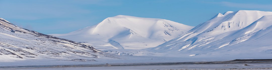
Even the seemingly uniform blanket of winter snow could offer navigational clues. The way snow accumulated on different slopes, the formation of drifts against natural obstacles, and the patterns of snow cover on vegetation would have been observed and understood. For example, snow might have accumulated more deeply on north-facing slopes, while south-facing slopes might have retained patches of bare ground or exposed rocks. These variations, however subtle, would have provided directional information. The types of trees and their distribution could also serve as markers. Evergreens, which retain their needles year-round, would have stood out against deciduous trees, and their density or arrangement might have indicated proximity to certain areas. A particular grove of ancient, gnarled oaks might have been a well-known waypoint on a familiar route.
Animal Trails and Water Sources
The behavior of animals, intrinsically linked to the landscape, also provided valuable navigational cues. Prehistoric hunters would have been acutely aware of the established trails that animals used to move between feeding grounds, water sources, and shelter. Following these well-worn paths, even in the snow, could lead to productive hunting areas or to destinations known to be frequented by specific species. Equally important were the locations of unfrozen water sources. In winter, open water would have been a rare and precious commodity, often found at the mouths of springs or where rivers flowed over rapids and were less likely to freeze solid. Knowing these locations would have been crucial for survival and could also guide movement towards areas where game congregated.
The Art of Wayfinding: Sensory and Practical Techniques
Beyond observing celestial bodies and terrestrial features, prehistoric navigators relied on a suite of practical and sensory techniques to maintain their bearings and ensure they did not become lost. These methods involved keen observation, a developed sense of direction, and the ability to interpret subtle environmental cues that modern individuals often overlook.
Sense of Direction and Proprioception
While difficult to quantify scientifically, it is widely believed that early humans possessed a highly developed innate sense of direction, often referred to as proprioception. This refers to the body’s awareness of its position and movement in space. Combined with constant practice and experience, this innate ability, honed through necessity, would have allowed individuals to maintain a general sense of direction even when visual cues were limited. Think of someone who can instinctively navigate their way home through familiar streets even in the dark. This innate sense, amplified by a life lived outdoors and a dependence on accurate movement, would have been a fundamental tool.
Soundscapes and Wind Patterns
Sound travels differently through varied landscapes, and prehistoric people would have been attuned to these sonic clues. The distant roar of a waterfall, the rush of wind through a mountain pass, or even the sound of migrating birds could all provide directional information. Similarly, the prevailing wind direction, especially in open landscapes, would have been a constant, albeit subtle, indicator. Experienced travelers might have learned to recognize how the wind felt on their skin or how it affected the snowdrift patterns, using this information to maintain a chosen course. The sound of a river, even when unseen, could guide someone towards a vital water source or a known travel route.
The Use of “Memory Maps” and Storytelling
Crucially, prehistoric navigation was not solely reliant on immediate observation. It was also deeply embedded in collective knowledge passed down through generations. Oral traditions, stories, and songs would have contained detailed descriptions of routes, landmarks, and the safe passage through treacherous terrain. These “memory maps” were not static but dynamic, incorporating seasonal changes and recent observations. Elders would have passed on vital information about the best times to travel, the dangers to avoid, and the signs that indicated proximity to familiar places. These narratives were not just entertainment; they were practical guides, ensuring the survival and prosperity of the community. A story about a legendary hunt might also detail the specific mountain passes and river crossings required to reach that fabled hunting ground.
Prehistoric winter navigation without a compass is a fascinating topic that highlights the ingenuity of early humans in adapting to their environment. They relied on natural indicators such as the position of the sun, stars, and even the behavior of animals to find their way during the harsh winter months. For a deeper understanding of how ancient practices can inform modern navigation techniques, you might find it interesting to explore this related article on the evolving challenges in today’s market, which can be found here.
Adapting to the Elements: Winter-Specific Challenges and Solutions
| Metric | Description | Estimated Value/Range | Notes |
|---|---|---|---|
| Primary Navigation Cues | Natural indicators used for direction finding | Sun position, stars, wind patterns, terrain features | Winter conditions limited visibility; reliance on celestial bodies was crucial |
| Visibility Range | Distance over which landmarks or celestial bodies could be seen | 1-5 km (landmarks), up to 20 km (stars on clear nights) | Snow and storms reduced visibility significantly |
| Navigation Accuracy | Estimated directional accuracy without compass | ±15° to ±30° | Varied with experience and environmental conditions |
| Travel Speed | Average speed during winter navigation on foot or sled | 2-4 km/h | Slower speeds due to snow and cold weather |
| Duration of Travel | Typical length of navigation journeys in winter | Several hours to multiple days | Dependent on distance and weather conditions |
| Use of Landmarks | Frequency of identifiable natural features used | High | Rivers, mountain ridges, tree lines were key guides |
| Star Navigation | Reliance on stars for orientation during night | Moderate to High | Polaris used in Northern Hemisphere for north direction |
| Wind Direction | Use of prevailing wind patterns as directional aid | Moderate | Wind direction often consistent in winter, aiding orientation |
The winter environment presented unique challenges that demanded specific adaptations in navigational strategies. The omnipresent snow and ice, while sometimes obscuring familiar terrain, also offered new opportunities and necessitated a different approach to travel.
Navigating Snow-Covered Terrain
Deep snow could make travel arduous and disorienting. However, prehistoric peoples likely developed techniques to navigate these conditions. They might have learned to recognize subtle differences in snow consistency, identifying areas of firmer snow that offered better traction or areas where it was safer to travel. They might have used poles or staffs not only for balance but also to probe the depth of the snow or to test the integrity of ice. Following established animal trails was particularly advantageous in deep snow, as these paths were often more compacted and easier to traverse. The ability to read the subtle signs left by animals in the snow – their tracks, their droppings, the way they had disturbed the snow – would have been an essential survival skill.
Ice Travel and Frozen Waterways
Frozen rivers, lakes, and even coastal waters could become vital transportation routes during winter. However, traveling on ice required a deep understanding of its properties and a cautious approach. Prehistoric navigators would have learned to identify signs of safe ice, such as its thickness, color, and the absence of cracks or open water. They would have understood that ice was generally thicker closer to the shore and thinner over deeper water. They might have used tools to test the ice before committing their full weight, and they likely developed techniques for crossing thin ice safely, perhaps by spreading their weight or moving in a specific manner. Following the established routes of animals that frequently crossed frozen waterways would also have provided a degree of reassurance regarding ice stability.
Whiteouts and the Importance of Redundancy
Whiteout conditions, where falling snow and fog obscure all visual cues and create a disorienting visual field, represent one of the most extreme navigational challenges. In such situations, relying solely on visual landmarks or celestial bodies would have been impossible. This is where the importance of redundancy in their navigational toolkit becomes evident. The ability to rely on auditory cues, the feel of the wind, and a strong innate sense of direction would have been critical. Furthermore, traveling in groups, with each individual maintaining awareness of their surroundings and the group’s general direction, would have provided a safety net. The collective knowledge and shared memory of the group would have been a powerful tool against disorientation.
The Enduring Legacy of Prehistoric Navigation
The sophisticated techniques employed by prehistoric peoples for winter navigation without a compass are a testament to their profound connection with the natural world and their remarkable capacity for adaptation. These methods, honed over millennia of survival and exploration, demonstrate that human ingenuity is not solely dependent on technological advancements. The ability to read the stars, understand the landscape, interpret subtle environmental cues, and rely on collective knowledge represents a form of navigation that is deeply embedded in our evolutionary history.
A Foundation for Future Exploration
While the advent of the magnetic compass and modern GPS systems has revolutionized travel, the fundamental principles of prehistoric navigation remain relevant. Understanding how our ancestors navigated in challenging conditions can offer valuable insights into developing more sustainable and intuitive wayfinding methods. It reminds us of the importance of observation, environmental awareness, and the power of human senses. The legacy of these ancient navigators lives on not just in archaeological findings but in the very fabric of human exploration, inspiring a continued appreciation for the natural world and our innate ability to find our way within it. The lessons learned from their journeys across frozen landscapes continue to resonate, underscoring the enduring power of observation and the profound wisdom of the natural world.

20,000 Years Ago | The Coldest Journey in Human History
FAQs
How did prehistoric people navigate during winter without a compass?
Prehistoric people likely used various natural clues for navigation during winter, such as observing the position of the sun, moon, and stars, tracking animal movements, and recognizing landmarks like mountains or rivers.
Did prehistoric people use any tools or instruments for winter navigation?
While prehistoric people did not have compasses, they may have used simple tools like a stick or bone to track the movement of shadows, which could indicate direction. They might have also used natural materials like moss or lichen to determine cardinal directions.
How important was knowledge of the environment for prehistoric winter navigation?
Knowledge of the environment was crucial for prehistoric winter navigation. Understanding the behavior of animals, the changing positions of celestial bodies, and the geography of the land helped prehistoric people navigate successfully during winter.
Were there any specific techniques prehistoric people used for winter navigation?
One technique prehistoric people may have used for winter navigation is creating mental maps of their surroundings based on landmarks, natural features, and celestial observations. They may have also relied on oral traditions and passed down knowledge of navigation techniques.
How did prehistoric winter navigation without a compass differ from modern navigation methods?
Prehistoric winter navigation relied heavily on observation, natural clues, and environmental knowledge, whereas modern navigation methods often involve the use of advanced technology like GPS, compasses, and maps. Prehistoric navigation was more intuitive and based on a deep understanding of the natural world.