Space Reveals Ancient Structures on Earth
The vast expanse of space, once perceived as an empty void, has in recent decades become an unparalleled observatory for humanity. From its silent vantage point, satellites and orbital telescopes have begun to illuminate secrets hidden for millennia on our own planet. These celestial eyes, unhindered by atmospheric distortion and capable of capturing the subtlest variations in light and topography, are revealing evidence of ancient human endeavors that have long eluded ground-based exploration. The story of human civilization is being rewritten, not by the dusty archives of history, but by the pristine images beamed down from the heavens.
For centuries, archaeologists and historians have relied on meticulous excavation, careful surveying, and sometimes sheer serendipity to uncover the remnants of past societies. However, many ancient sites, particularly those in remote or geographically challenging areas, remained hidden, their features obscured by dense vegetation, shifting sands, or the simple passage of time. Space-based imaging technologies have revolutionized this process, offering a bird’s-eye perspective that can transcend earthly limitations.
Satellite Platforms and Their Capabilities
The advent of sophisticated satellite technology has provided humanity with an unprecedented ability to map and analyze the Earth’s surface. These orbiting platforms are equipped with a diverse array of sensors, each designed to capture different aspects of the terrestrial environment.
Optical Imaging: Seeing What the Eye Can’t
Optical satellites, similar to advanced digital cameras in space, capture images in visible light. While seemingly straightforward, these instruments possess resolutions far beyond what is discernible to the naked eye, allowing for the identification of subtle color variations in the soil, vegetation patterns, and even faint outlines of man-made features. Historical aerial photography, itself a precursor to space imaging, laid the groundwork for understanding how subtle changes in vegetation health or soil moisture can betray the presence of buried structures. Space-based optical imaging takes this a step further, providing consistent, high-resolution coverage of vast areas. By comparing images taken at different times, subtle changes can be detected, hinting at archaeological features that may have been overlooked in earlier surveys.
Multispectral and Hyperspectral Imaging: Beyond the Visible Spectrum
Beyond visible light, multispectral and hyperspectral sensors capture electromagnetic radiation across a much broader spectrum, including infrared and ultraviolet wavelengths. Different materials on Earth reflect and absorb these wavelengths in unique ways. For instance, certain types of ancient stone or compacted earth might exhibit distinct spectral signatures that differentiate them from the surrounding natural landscape. By analyzing these spectral fingerprints, archaeologists can identify areas with a high probability of containing archaeological remains, even if they are not visually apparent. This is particularly effective for detecting subtle differences in soil composition and vegetation growth that can be influenced by buried features.
LiDAR: Peering Through the Canopy
One of the most transformative technologies in this domain is Light Detection and Ranging (LiDAR). LiDAR systems emit laser pulses and measure the time it takes for them to return after reflecting off the Earth’s surface. By processing these return times, highly accurate three-dimensional maps of the topography can be generated. Critically, LiDAR can penetrate dense forest canopies, revealing the ground surface beneath. This has been a game-changer for discovering ancient settlements, roadways, and agricultural systems that were previously completely hidden by thick jungle growth, such as those found in the Maya lowlands and the Amazon basin.
Radar Imaging: Seeing Through Obstacles
Radar imaging, particularly Synthetic Aperture Radar (SAR), offers another powerful tool. SAR systems emit microwaves and analyze the backscattered signals. Unlike optical or LiDAR, radar can penetrate clouds and even soil or sand to a certain extent, making it ideal for surveying regions with persistent cloud cover or arid environments. This has proven invaluable in uncovering ancient settlements buried beneath the sands of the Sahara Desert or the shifting dunes of the Arabian Peninsula. The way radar waves interact with different materials can reveal changes in surface roughness and dielectric properties, often indicative of man-made constructions.
Recent advancements in satellite technology have unveiled fascinating insights into ancient structures that were previously hidden from view. One such discovery involves the exploration of Antarctica’s hidden coastline, where researchers have identified potential remnants of ancient civilizations. For a deeper understanding of these findings and their implications, you can read more in the article titled “Exploring Antarctica’s Hidden Coastline” available at this link.
Unveiling Lost Civilizations: Case Studies from Orbit
The application of space-based technologies has led to the discovery and re-evaluation of numerous ancient sites, shedding new light on the scale and complexity of past human societies. These discoveries are not merely additions to existing knowledge; they often necessitate a significant revision of our understanding of human history and ingenuity.
The Amazonian Mega-Cities: A Paradigm Shift in Amazonian Archaeology
For decades, the Amazon rainforest was largely considered an environment incapable of supporting large, complex societies. The prevailing view was that the soil’s nutrient poverty and the dense vegetation made large-scale agriculture and urbanism unsustainable. However, LiDAR surveys in regions like the Llanos de Mojos in Bolivia and the Upano Valley in Ecuador have dramatically challenged this notion.
LiDAR’s Revelation of Upano Valley
In the Upano Valley, LiDAR technology revealed an extensive network of settlements, including large platforms, plazas, and a sophisticated system of roads and canals, dating back over 2,500 years. The sheer scale and complexity of these interconnected settlements suggest a highly organized society with a substantial population. This discovery, made possible by peering through the dense forest canopy, has fundamentally altered our understanding of pre-Columbian Amazonia, demonstrating that complex urbanism and sophisticated landscape modification were present much earlier and on a far grander scale than previously believed.
The Llanos de Mojos and Agricultural Ingenuity
Similarly, LiDAR in the Llanos de Mojos has uncovered evidence of vast agricultural landscapes, including raised fields, canals, and earthworks, dating back thousands of years. These systems were designed to manage water and enhance soil fertility, allowing for sustained food production to support significant populations. The intricate network of water management systems speaks to a profound understanding of the local environment and a remarkable capacity for large-scale engineering.
The Rise and Fall of Angkor: Reimagining Khmer Civilization
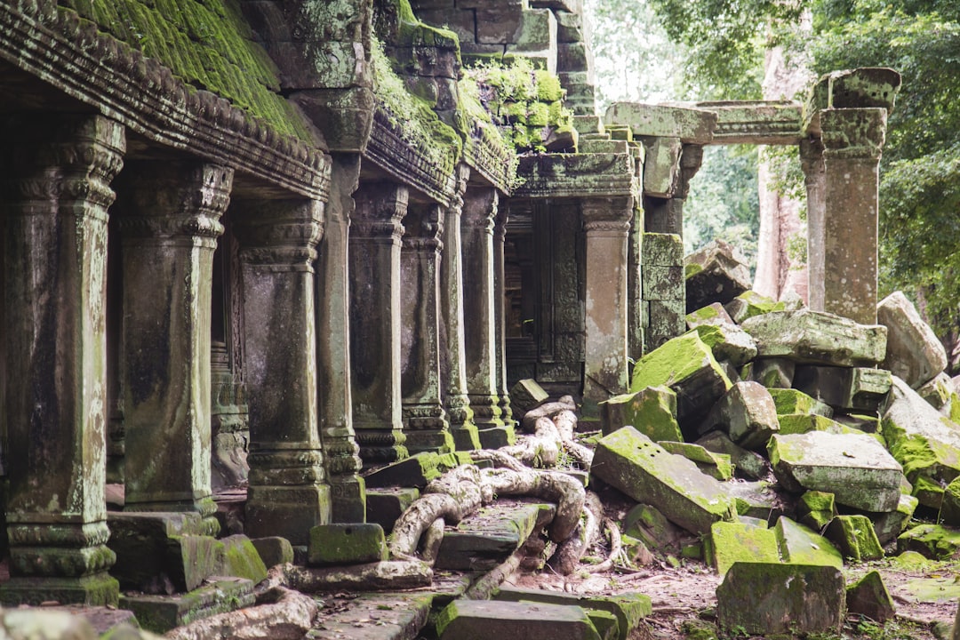
The Angkorian Empire, responsible for the magnificent temples of Angkor Wat, is one of Southeast Asia’s most celebrated ancient civilizations. While the monumental temples have long been known, the full extent of its urban infrastructure and its complex water management system remained partially understood.
LiDAR’s Mapping of the Angkorian Metropolis
Recent LiDAR surveys over the Angkor region in Cambodia have revealed an astonishingly vast and intricate urban landscape sprawling far beyond the immediate vicinity of the temples. The data uncovered a complex network of roads, canals, reservoirs, and residential areas, suggesting a far larger and more densely populated metropolis than previously imagined. This “hidden city” underneath the jungle canopy has rewritten our understanding of the scale of the Khmer Empire and the sophisticated hydraulic engineering that supported its population. The LiDAR data has allowed archaeologists to map the ebb and flow of water across the landscape, crucial for understanding agricultural productivity and the empire’s resilience.
Understanding the Water Management System
The intricate water management system, a defining characteristic of Angkor, has been further elucidated by space-based imaging. The vast network of canals and reservoirs was not merely for irrigation; it played a critical role in controlling floods, providing potable water, and even facilitating transportation. By analyzing the spatial relationships between these features revealed from orbit, researchers can better understand the strategic planning and engineering prowess of the Khmer people.
The Sahara’s Buried Past: Nomadic Empires and Forgotten Cities
The Sahara Desert, a seemingly barren and inhospitable expanse, has yielded remarkable archaeological discoveries thanks to space-based radar and optical imaging. The shifting sands have long preserved evidence of past human activity, but these traces have been elusive to ground exploration.
Radar Penetration and Ancient Road Networks
Radar imaging has been particularly effective in the Sahara, allowing for the detection of buried structures and features beneath the sand. This has led to the identification of ancient trade routes, settlements, and even large fortified compounds that were once centers of power and commerce. These discoveries suggest that the Sahara was not always the desert it is today, but rather a landscape that supported vibrant and complex societies in the past. The ability of radar to “see” through the sand has opened up a new frontier in North African archaeology.
Optical Imagery and Oasis Civilizations
Optical satellite imagery has also played a role in identifying the remnants of ancient oases that once supported human settlements. By analyzing patterns of vegetation growth and subtle soil discolorations, archaeologists can pinpoint locations where ancient wells, irrigation systems, and habitations might be found. These discoveries paint a picture of a much more verdant and populated Sahara in antiquity, with flourishing civilizations dependent on sophisticated water management techniques.
Advancements in Data Analysis: Extracting Meaning from Orbital Data
The sheer volume of data generated by space-based imaging is immense. Extracting meaningful archaeological information requires sophisticated analytical techniques and the expertise of both remote sensing specialists and archaeologists. This interdisciplinary approach is crucial for translating raw data into historical insights.
Artificial Intelligence and Machine Learning: Automating Discovery
Artificial intelligence (AI) and machine learning (ML) algorithms are increasingly being employed to analyze satellite imagery. These tools can be trained to recognize patterns and features indicative of archaeological sites, such as geometric shapes, linear features, and subtle textural variations. This automation significantly speeds up the discovery process, allowing researchers to sift through vast datasets more efficiently and identify potential sites that might be missed by human observation alone.
Pattern Recognition and Anomaly Detection
AI excels at identifying subtle anomalies in the landscape that might represent human modification. By learning from known archaeological sites, these algorithms can then be applied to new datasets to flag areas of interest, suggesting potential sites for further investigation on the ground. This process is akin to teaching a computer to “see” like an archaeologist, but with the capacity to analyze far more data.
Geophysics and Remote Sensing Integration: A Multi-Layered Approach
The insights gained from space-based imaging are often combined with data from ground-based geophysical surveys. Techniques such as ground-penetrating radar (GPR), magnetometry, and electrical resistivity can provide detailed subsurface information, complementing the broader spatial coverage of satellite data.
Complementary Data Sources
When satellite imagery identifies a potential area of interest, geophysical surveys can be employed to map the subsurface archaeology in greater detail. This integrated approach provides a more comprehensive understanding of a site, from its overall layout to the specific features and artifacts buried beneath the surface. It’s a synergistic relationship where each technology enhances the strengths of the other.
Historical Data and Archival Research: Ground-Truthing from the Past
The interpretation of space-based imagery is also informed by historical records and archival research. Examining historical maps, old aerial photographs, and written accounts can provide crucial context and help confirm the presence of ancient features identified from orbit. This interdisciplinary approach ensures that findings are not only technologically validated but also historically grounded.
Rethinking Our Past: The Broader Implications of Orbital Archaeology

The discoveries made through space-based imaging are not merely isolated finds; they are fundamentally reshaping our understanding of human history, our relationship with the environment, and the potential for sophisticated societies in unexpected places.
Challenging Preconceptions About Ancient Societies
The revelations from space imaging are consistently challenging long-held assumptions about the capabilities and limitations of ancient peoples. The scale of infrastructure, the complexity of engineering, and the density of populations in regions previously thought to be sparsely inhabited demonstrate a far greater level of human ingenuity and societal organization than previously acknowledged.
From Small Villages to Complex Urban Centers
The shift from viewing ancient Amazonia as a land of small, scattered villages to recognizing it as the home of extensive urban networks fundamentally alters our understanding of indigenous American civilizations. Similarly, the sheer size of the Angkorian metropolis redefines the concept of ancient urbanism in Southeast Asia.
The Human-Environment Interface: Ancient Adaptation and Sustainability
Many of these discoveries highlight the sophisticated ways in which ancient societies adapted to and modified their environments. The intricate water management systems of the Khmer, the agricultural innovations of the Amazonian peoples, and the ancient oasis civilizations of the Sahara all demonstrate a profound understanding of ecological principles and a capacity for sustainable living, at least for extended periods.
Lessons for Modern Sustainability
By studying these ancient successes and failures, we can glean valuable insights into sustainable practices that could inform our own approaches to environmental management and resource utilization in the face of contemporary challenges. The sophisticated irrigation and land management techniques of ancient societies offer potential blueprints for modern ecological stewardship.
The Future of Archaeological Exploration: A New Frontier in Space
The ongoing development of space-based technologies promises even more exciting discoveries in the future. As sensor technology improves and data analysis techniques become more sophisticated, we can expect to uncover even more hidden chapters of human history. The ability to access remote and challenging environments from space ensures that the Earth’s past is far from fully revealed.
Next-Generation Satellites and Sensors
Future generations of satellites will likely feature even higher resolutions, more advanced spectral capabilities, and novel sensing techniques. This will enable the detection of ever-fainter archaeological signatures and the exploration of previously inaccessible regions. The pursuit of knowledge from space is an ongoing and accelerating endeavor.
Recent advancements in satellite technology have allowed researchers to uncover ancient structures that were previously hidden beneath dense vegetation and soil. This fascinating discovery sheds light on the civilizations that once thrived in these areas. For those interested in exploring the implications of such findings on modern demographics and labor advantages, a related article can be found here: demographic edge. These ancient sites not only provide insight into historical societies but also influence contemporary understanding of population dynamics.
Preserving Our Heritage: The Role of Space in Heritage Management
| Structure | Location | Discovery Date | Method of Discovery |
|---|---|---|---|
| Pyramids of Giza | Egypt | 2600 BC | Satellite Imaging |
| Nazca Lines | Peru | 1927 | Aerial Photography |
| Stonehenge | England | 3000 BC | Satellite Imaging |
| Angkor Wat | Cambodia | 1860 | Aerial Photography |
Beyond discovery, space-based technologies also play a crucial role in the monitoring and preservation of existing archaeological sites. Understanding the scope of heritage sites and their vulnerability is essential for effective conservation efforts.
Monitoring Heritage Sites for Threats
Satellites can be used to monitor known archaeological sites for threats such as erosion, encroachment by development, illegal excavation, and environmental degradation. By regularly imaging these sites, authorities can detect changes and implement timely interventions to protect them. This proactive approach is vital for safeguarding invaluable cultural heritage.
Detecting Looting and Vandalism
Changes in satellite imagery can sometimes reveal evidence of illegal activities such as looting or vandalism at archaeological sites. Identifying these threats from orbit allows for rapid response and enforcement actions, helping to deter such destructive behaviors and protect fragile historical evidence.
Mapping and Inventorying Cultural Landscapes
Space-based imaging enables the comprehensive mapping and inventorying of entire cultural landscapes, not just individual sites. This holistic approach allows for a better understanding of how ancient settlements interacted with their surrounding environments and how human activity shaped the land over millennia. This broad perspective is crucial for understanding the interconnectedness of past societies and their territories.
Understanding Human Impact Over Time
By analyzing historical and contemporary satellite imagery, researchers can track the long-term impact of human activities on landscapes. This allows for the identification of patterns of land use, resource exploitation, and environmental change that have occurred over centuries, providing valuable context for understanding the present.
The journey of discovery from space is far from over. As our celestial vantage point continues to expand and our technological capabilities advance, the Earth’s ancient past will undoubtedly yield further astonishing revelations, reminding us of the rich and complex tapestry of human history that lies, often unseen, beneath our feet and within our reach, thanks to the silent sentinels orbiting above.

260 Ancient Graves Were Hiding in This “Empty” Desert
FAQs
What are the ancient structures discovered from space?
Ancient structures discovered from space refer to archaeological sites and ruins that have been identified using satellite imagery and remote sensing technology. These structures can include ancient cities, temples, pyramids, and other man-made features that have been hidden or obscured by vegetation, soil, or other natural elements.
How are ancient structures discovered from space?
Ancient structures are discovered from space using satellite imagery and remote sensing technology. These tools allow archaeologists and researchers to identify subtle changes in the landscape that may indicate the presence of ancient structures. For example, differences in vegetation or soil patterns can reveal the outlines of buried or hidden structures.
What is the significance of discovering ancient structures from space?
The discovery of ancient structures from space is significant because it can provide valuable insights into past civilizations and cultures. These discoveries can help researchers understand how ancient societies lived, built their cities, and interacted with their environment. Additionally, the identification of these structures can lead to further archaeological exploration and preservation efforts.
Where have ancient structures been discovered from space?
Ancient structures have been discovered from space in various regions around the world, including Egypt, Central America, South America, the Middle East, and Southeast Asia. These discoveries have revealed the presence of ancient cities, temples, and other architectural marvels that were previously unknown or hidden from view.
What are some examples of ancient structures discovered from space?
Some examples of ancient structures discovered from space include the ancient city of Caracol in Belize, the pyramids of Egypt, the Nazca lines in Peru, and the ancient city of Angkor in Cambodia. These discoveries have provided valuable insights into the history and architecture of these ancient civilizations.