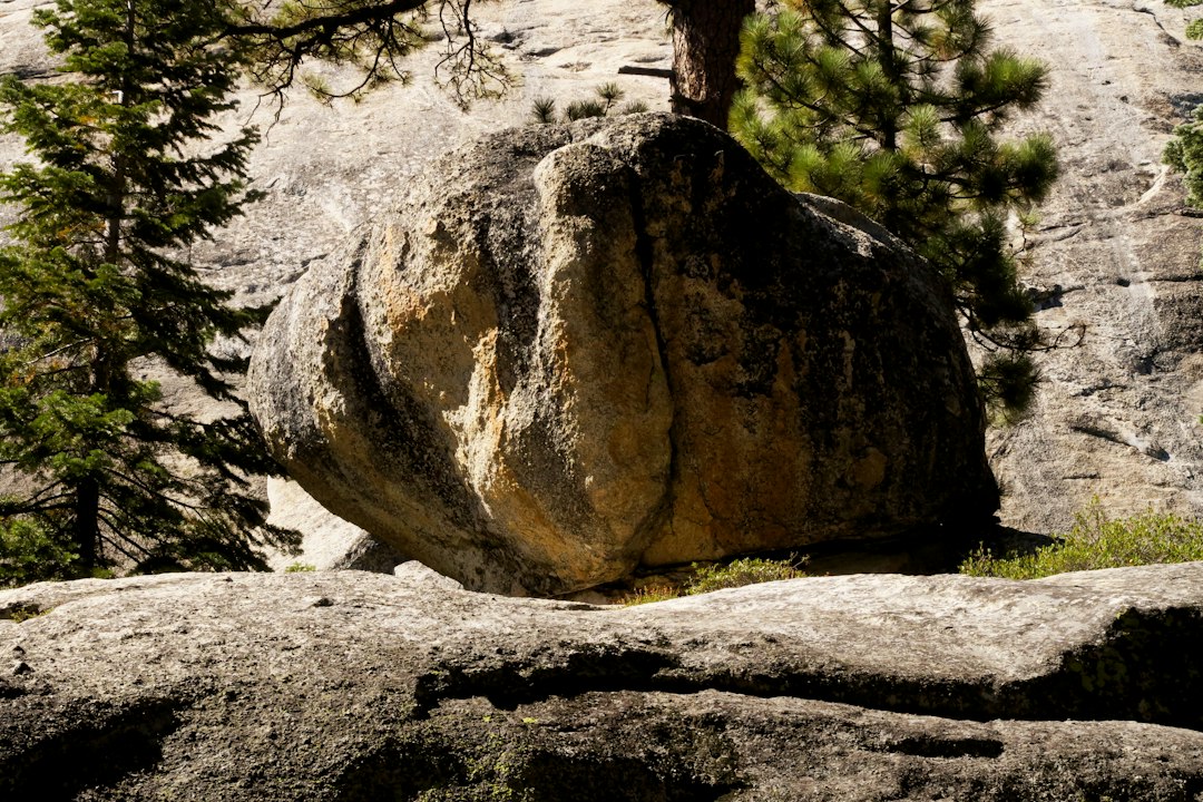
The rugged landscapes of early exploration were often unforgiving, a labyrinth of forests, mountains, and plains where misdirection could spell disaster. In such environments, intrepid explorers, whether indigenous peoples navigating ancestral territories or early European adventurers charting unknown territories, relied on a diverse toolkit for survival. Among the most enduring and often overlooked of these tools were the “split boulder landmarks.” These naturally occurring or subtly modified rock formations, characterized by a distinctive fissure or crack, served as invaluable markers, silently guiding travelers across vast and potentially treacherous terrains. Their significance lies not only in their practical utility but also in the intricate understanding of the natural world that their use implies.
The Silent Sentinels of the Trail
Split boulders, by their very nature, stand out against a backdrop of undifferentiated terrain. A large rock, naturally fractured by the forces of time, ice, and geological stress, presents a unique and memorable silhouette. This distinctiveness was crucial for navigators who lacked the advanced tools of modern cartography. These formations acted as beacons, points of reference that could be spotted from a distance, providing confirmation of direction or indicating a turn-off point. Unlike ephemeral signs like cairns, which could be easily dislodged or washed away, a split boulder offered a permanent and resilient marker. Their ubiquity across various geological settings – from arid deserts to alpine regions – ensured their widespread applicability as navigational aids. The sheer size and permanence of many split boulders meant they could endure for centuries, outlasting the fleeting presence of individual explorers and serving generations of travelers.
Geological Origins and Natural Features
The formation of split boulders is a testament to the raw power of natural processes. Thermal expansion and contraction, driven by daily and seasonal temperature fluctuations, cause immense stress within rock masses. Over long periods, these stresses can propagate existing micro-fractures, leading to significant splits. Freeze-thaw cycles, particularly prevalent in temperate and colder climates, play an equally vital role. Water seeps into existing cracks, and when it freezes, it expands, exerting outward pressure that widens the fissure. Repeated cycles of freezing and thawing can eventually cleave even the most massive rocks. Tectonic activity, though less constant, can also contribute to splitting, with seismic events causing sudden and dramatic fracturing. Some split boulders might have originated from larger rockfalls, where initial impacts created fractures that were then further elaborated by weathering processes. The specific mineral composition and structural integrity of the rock also influence its susceptibility to splitting. For instance, rocks with inherent weaknesses or bedding planes are more prone to fracturing than homogenous, massive formations.
Indigenous Knowledge and Human Adaptation
For indigenous populations, split boulders were not merely natural phenomena but integral components of a deeply ingrained understanding of their environment. These formations were often incorporated into complex oral traditions, with stories and legends associated with specific split boulders, imbuing them with cultural significance and reinforcing their mnemonic value. These stories served as a cultural map, passed down through generations, detailing routes, resource locations, and the significance of specific landmarks. A split boulder might mark the entrance to a sacred valley, the best fishing spot, or a crucial point on a migration route. The choice of which split boulder to use as a landmark was likely deliberate, favoring those that were most visible, uniquely shaped, or strategically positioned. Some split boulders may have been subtly enhanced by human hands, perhaps by the addition of symbolic carvings or by strategically clearing surrounding vegetation to improve visibility. This human adaptation transformed a natural feature into a culturally resonant and functionally enhanced navigational aid. The indigenous peoples’ intimate knowledge of seasonal changes, animal behavior, and weather patterns further complemented the use of split boulders, allowing them to interpret the landscape with remarkable precision.
In the study of ancient navigation, the use of split boulder landmarks has been a fascinating topic, as these natural formations often served as crucial reference points for early travelers. An insightful article that delves into the broader implications of geographic features on human behavior and navigation is available at this link: The Influence of Geographic Determinism. This piece explores how the physical landscape has shaped human societies and their movements throughout history, providing valuable context for understanding the significance of landmarks like split boulders in ancient navigation practices.
The Cartography of the Unseen

In the absence of compasses and printed maps, early explorers relied on an intuitive understanding of their surroundings, a form of “mental cartography.” Split boulders played a pivotal role in this process, acting as fixed points in a fluid landscape. They provided anchors for memory, allowing explorers to orient themselves and retrace their steps with confidence. The process of using a split boulder as a landmark was often multimodal. An explorer might see a split boulder from a distance, confirming their general direction. Upon reaching it, they might then use its distinctive fissure as a reference point to align with another distant feature, such as a uniquely shaped mountain peak or a distinctively colored patch of vegetation. The “split” itself could also provide directional information. Depending on its orientation, the crack might point towards a specific valley, a water source, or a passage through an impassable barrier.
Memory Palaces and Trail Markers
The human brain is adept at remembering spatial information, and split boulders acted as potent mnemonic devices, forming the backbone of “memory palaces” for travelers. Instead of relying on abstract representations, explorers associated specific routes and destinations with tangible, enduring features in the landscape. A split boulder might represent a crucial junction where a path diverged, a warning sign to avoid a dangerous area, or an invitation to proceed towards a known resource. The repetition of encountering the same split boulder on different journeys would further solidify its significance and the associated routes. This iterative process of encountering and utilizing landmarks allowed for the development of complex mental maps that were both detailed and adaptable. For those familiar with the territory, a split boulder wasn’t just a rock; it was a signpost, a story, a memory trigger all rolled into one. The subtle variations in the appearance of a split boulder – the color of the moss growing in its crack, the angle of its fissure, the surrounding flora – could all contribute to its unique identity and its place in the explorer’s mental atlas.
Strategic Placement and Sequential Navigation
The effectiveness of split boulders as navigational aids was often amplified by their strategic placement. Explorers would intentionally select routes that incorporated a series of split boulders, creating a sequential chain of markers. This allowed for a step-by-step approach to navigation, reducing the cognitive load and the risk of error. Imagine a journey requiring several turns; a sequence of split boulders could indicate each precise change in direction. The first boulder might signify a northwesterly heading, the second, a slight turn to the west after crossing a ridge, and a third, a descent into a specific canyon. This systematic approach transformed a complex journey into a series of manageable segments. The visibility of these boulders from a considerable distance was paramount. Explorers would likely have identified prominent split boulders along their intended path during reconnaissance or through the knowledge of local guides. The alignment of multiple split boulders, when viewed from a specific vantage point, could also create a natural “line of sight” that guided travelers for miles. This sequential reliance meant that missing a single marker could lead to significant disorientation, underscoring the importance of careful observation and memory.
Beyond the Obvious: Subtle Modifications and Cultural Imprints

While many split boulders served their purpose in their natural state, evidence suggests that early explorers sometimes enhanced their visibility or symbolic meaning through subtle modifications. These modifications were typically minimal, designed to preserve the natural appearance of the landmark while increasing its utility. Such alterations speak to a deep respect for the natural world, where intervention was carefully considered and executed. The deliberate choice of split boulders that were already striking in appearance and strategically located was often sufficient. However, when further enhancement was deemed necessary, it was done with precision.
Carvings and Symbolic Engravings
In some instances, split boulders bear faint carvings or engravings that may have served to further identify them or convey additional information. These markings, often weathered and difficult to discern, could represent clan symbols, directional arrows, or even simple tally marks indicating distance or time. The act of carving a stone symbol was a deliberate act of communication, intended to endure for generations. The location of these carvings, often within the split itself or on particularly smooth surfaces, suggests a conscious effort to integrate the symbol with the natural form of the boulder. The interpretation of these markings is often challenging, requiring deep knowledge of the cultural context in which they were created. They represent a tangible link between the natural landscape and the human desire to leave a mark, to communicate across time and space. The subtle nature of these carvings often means they are overlooked by casual observers, yet for those initiated into their meaning, they transform a natural landmark into a rich repository of information and cultural heritage.
Vegetation Management and Site Preparation
Another form of subtle modification involved the management of surrounding vegetation. Clearing brush or small trees around a split boulder could significantly enhance its visibility from a distance. This was a practical measure, ensuring that the landmark remained discernible regardless of seasonal foliage changes. This practice also demonstrates a keen understanding of sightlines and the importance of unobstructed views in navigation. In some cases, the area immediately surrounding a split boulder might have been kept clear of undergrowth, creating a small, defined space. This could serve to make the landmark more noticeable from afar or to provide a designated stopping point for travelers. Such preparation, while seemingly minor, highlights the deliberate and systematic approach early explorers took to their journeys. The goal was not to dominate nature, but to work in harmony with it, utilizing its inherent features and making them more accessible through judicious and respectful intervention.
The Legacy of Stone and Memory
The practice of using split boulder landmarks, though largely superseded by modern technology, leaves an enduring legacy. These silent sentinels are a testament to the ingenuity and deep environmental knowledge of early explorers. They remind us that navigation is not merely about following a line on a map but about understanding and interacting with the landscape. The stories embedded within these formations continue to resonate, offering a glimpse into the lives and journeys of those who came before. The continued existence of these split boulders, enduring through centuries of geological and human change, is a powerful reminder of their significance. They are living artifacts, connecting us to the past and inspiring a deeper appreciation for the natural world and the human capacity for adaptation and exploration.
Archaeological Evidence and Modern Discoveries
Archaeological research has increasingly shed light on the systematic use of split boulder landmarks. Surveys in areas with known historical trails often identify clusters of split boulders that align with ancient pathways. The discovery of associated artifacts, such as pottery shards or remnants of campsites, near these formations further corroborates their role as navigational markers. Modern archaeologists employ techniques such as LiDAR (Light Detection and Ranging) to scan dense vegetation and reveal subtle landscape modifications, including the potential presence of man-made enhancements to natural landmarks like split boulders. These discoveries are helping to reconstruct the complex navigational systems employed by past societies. The careful excavation and analysis of these sites are crucial for understanding the depth of knowledge and the sophistication of the methods used by early peoples. The presence of specific types of rock, or the orientation of the split in relation to celestial bodies, can also offer further clues about the intended use of these markers.
Enduring Significance and Future Appreciation
While GPS devices and digital maps have revolutionized exploration, the concept of using natural landmarks for orientation remains relevant. Hikers and outdoor enthusiasts often still rely on distinctive features to maintain their bearings. The study of split boulder landmarks encourages a renewed appreciation for our natural surroundings and the historical context of exploration. It prompts us to look at the landscape not just as a backdrop, but as a repository of information and stories. Future appreciation for these ancient navigation aids lies in their preservation and in educating future generations about their historical and cultural importance. Recognizing split boulders as more than just rocks, but as deliberate navigational tools, enriches our understanding of the past and our connection to the land. They serve as humble yet profound reminders of the human drive to explore, to understand, and to leave a lasting imprint on the world, often through the most elemental and enduring of materials: stone.
Ancient navigators often relied on prominent natural features, such as split boulders, to guide their journeys across vast landscapes. These landmarks served not only as waypoints but also as cultural symbols, embedding stories and histories into the very fabric of the terrain. For a deeper understanding of how ancient civilizations utilized their environment for navigation, you might find the article on the secret military agenda of space exploration intriguing, as it explores the intersection of human ingenuity and the natural world. You can read more about it here.
The Human Element: Stories and Lore of the Split Stones
| Landmark Name | Location | Estimated Age | Navigation Purpose | Notable Features |
|---|---|---|---|---|
| Split Boulder of Cape Verde | Cape Verde Islands, Atlantic Ocean | Approx. 2,000 years | Coastal navigation marker for early sailors | Distinctive natural split visible from sea |
| Split Boulder of Madagascar | East Coast of Madagascar | Approx. 1,500 years | Reference point for ancient maritime trade routes | Large granite boulder with a vertical fissure |
| Split Boulder of the Red Sea | Near Bab-el-Mandeb Strait | Approx. 2,500 years | Landmark for navigating narrow straits | Split rock formation used as a visual guide |
| Split Boulder of the Mediterranean | Coast of Sicily | Approx. 2,200 years | Marker for ancient Phoenician and Greek sailors | Natural cleft in coastal rock formations |
The practical utility of split boulders as navigational aids is undeniably significant, but their importance often extends beyond mere functionality. These ancient markers became interwoven with the cultural fabric of the communities that utilized them, accumulating stories, legends, and a unique lore. These narratives transformed utilitarian rocks into imbued symbols, enriching the journey and imbuing the landscape with meaning. The split boulder was not just a point on a map; it was a character in the ongoing epic of human presence in the land.
Oral Traditions and Mythological Narratives
For many indigenous cultures, split boulders were often featured in origin stories, trickster tales, or legends of ancient heroes. A particularly prominent split boulder might be attributed to the act of a mythical being, such as a giant splitting the rock with a mighty blow, or a deity using it as a resting place. These narratives served multiple purposes: they reinforced the cultural significance of the landmark, provided mnemonic cues for navigation through repetition and memorable imagery, and transmitted ethical or social lessons. The stories associated with a split boulder could explain its unique formation, its connection to important ancestral figures, or its role in significant historical events. The act of recounting these tales during journeys also served to strengthen community bonds and pass down cultural knowledge from elder to younger generations. The landscape itself became a living text, and the split boulders were its most prominent chapters.
Personal Accounts and Explorer Diaries
European explorers, too, documented their encounters with and reliance on natural landmarks. While their methods might differ from indigenous practices, their diaries and journals often speak to the critical role of distinctive rock formations in their expeditions. An entry might describe spotting a familiar split boulder after days of arduous travel, signaling that they were back on course or nearing a known encampment. The relief and reassurance conveyed in such accounts highlight the psychological importance of these markers. These personal reflections provide a human-centered perspective on the use of split boulders, revealing the emotions and challenges faced by those navigating unfamiliar territories. The “aha!” moment of recognizing a landmark after a period of uncertainty or doubt would have been a powerful emotional experience, solidifying the boulder’s place in the explorer’s personal cartography. The careful description of these formations in their logs demonstrates their perceived value and reliability.
Challenges and Interpretations of Split Boulder Navigation
Navigating by split boulders, while effective, was not without its challenges and required a sophisticated understanding of environmental cues and human adaptation. The interpretation of these natural signs demanded careful observation, contextual knowledge, and a degree of risk assessment. Misinterpretation or the failure to locate a crucial marker could have dire consequences.
Environmental Factors and Temporal Changes
The natural world is dynamic, and split boulders are not immune to change. Weathering, erosion, and geological shifts could alter the appearance of a landmark over time. A fissure might widen, a portion of the boulder could collapse, or vegetation growth could obscure it. Explorers had to be aware of these potential changes and adapt their understanding accordingly. Furthermore, the visibility of a split boulder could vary significantly with the seasons. Dense foliage in spring and summer might hide a marker that would be readily apparent in the bareness of winter. Light conditions, too, played a role; a boulder that was easily spotted in the bright light of midday might be difficult to discern in the low light of dawn or dusk, or during overcast conditions. The presence of snow or fog could render even the most prominent split boulder invisible, forcing reliance on other, more subtle navigational methods.
Human Error and Cultural Context
The reliance on human memory and interpretation inherently introduced the possibility of error. An explorer might misremember the precise location of a split boulder, confuse it with a similar formation, or incorrectly interpret its directional significance. The cultural context of a split boulder was also crucial. A formation that was a vital landmark for one group might be entirely overlooked or misinterpreted by another. The symbolic markings on a boulder, if present, would only be meaningful to those who understood their cultural language. The risk of error was amplified when traversing unfamiliar territories or when encountering split boulders that had been used by different groups with potentially different navigational conventions. The interpretation of subtle variations in the split’s shape, angle, or the surrounding terrain could also lead to differing navigational conclusions, highlighting the need for shared understanding or expert guidance. The subjective nature of perception meant that what one individual saw as a definitive marker, another might dismiss.