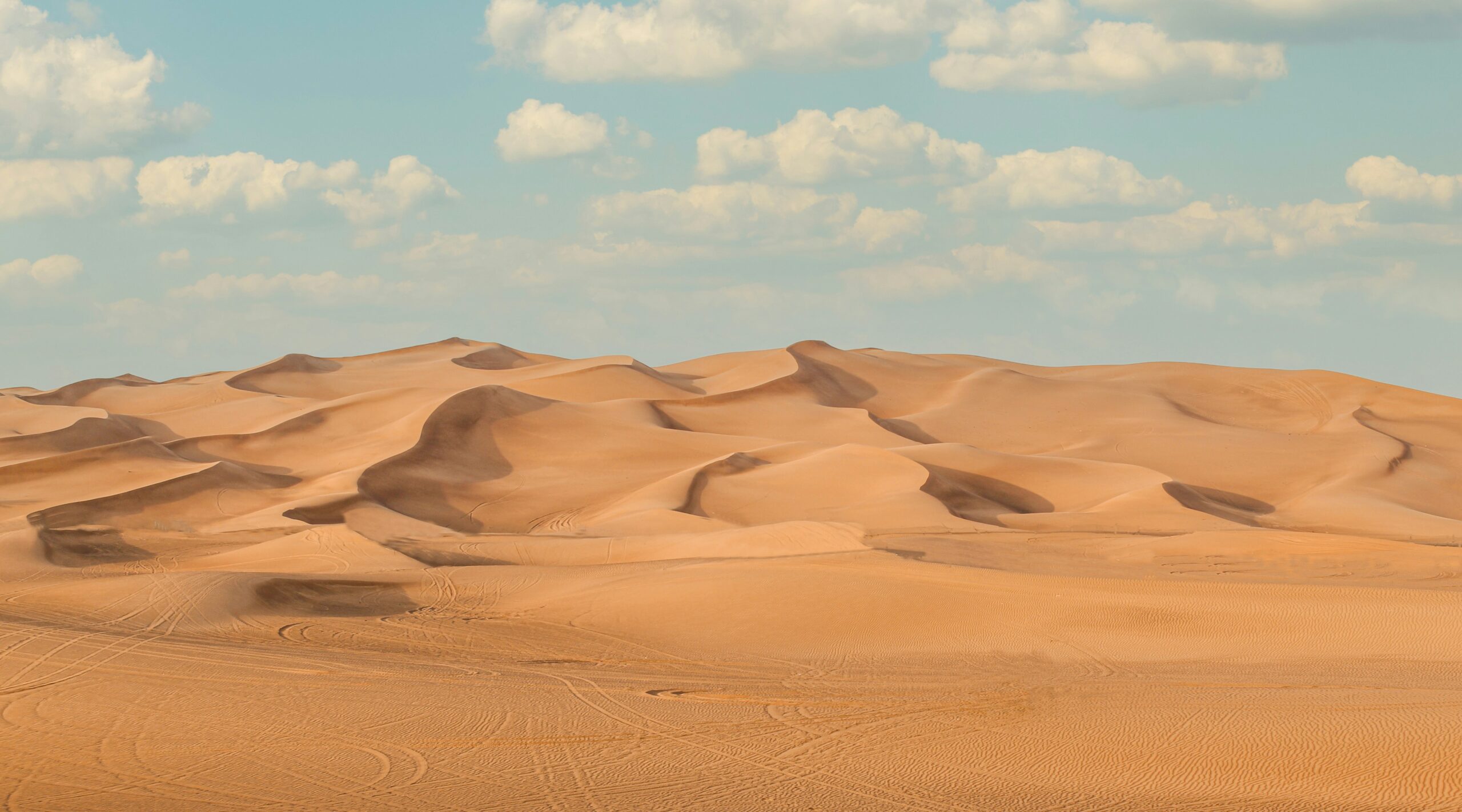
The Earth’s surface is a dynamic tapestry, constantly shaped by an array of forces, both geological and atmospheric. Among its most striking features are the vast, arid expanses known as deserts. Far from being static anomalies, desert formation is an intricate and enduring natural process, unfolding over immense timescales. While human activities can exacerbate desertification, the fundamental mechanisms driving the creation and expansion of these arid regions are deeply rooted in the planet’s climatic cycles and geological evolution. Understanding these natural processes is crucial to appreciating the Earth’s climatic history and the resilience of its ecosystems.
A cornerstone of natural desert formation lies in the planet’s primary atmospheric circulation patterns, particularly the Hadley Cell, which dictates where air rises and falls, and thus where rainfall is abundant or scarce. At the equator, intense solar radiation causes air to heat up and rise, carrying moisture with it. As this air ascends, it cools, and the moisture it holds condenses, leading to heavy precipitation in the tropics – the rainforest belts. After releasing its moisture, this now dry air flows poleward at high altitudes.
Subtropical High-Pressure Belts
As this dry air reaches approximately 30 degrees north and south of the equator, it begins to descend. This descending air compresses and warms, creating bands of high atmospheric pressure. These subtropical high-pressure belts are characterized by stable, clear skies and a lack of significant rainfall. Because the air is sinking, it is also absorbing moisture from the surface rather than releasing it. This persistent downward movement of dry air is a primary driver for the formation and maintenance of many of the world’s major deserts, including the Sahara, the Arabian Desert, and the Australian Outback. The lack of atmospheric uplift and moisture replenishment in these regions prevents the development of cloud cover and precipitation, leading to arid conditions.
The Role of Air Descending and Warming
The air that descends in the subtropical regions has already been stripped of most of its moisture after rising and releasing precipitation in the equatorial belt. As it sinks, it undergoes adiabatic warming, meaning it heats up due to increased pressure without any external heat source. This warming effect further decreases the air’s relative humidity, making it even less likely to form clouds or produce rain. This creates a self-perpetuating cycle where the very conditions that lead to dry air descending also enhance its drying capacity, effectively suppressing rainfall over vast terrestrial areas.
The Interplay with Intertropical Convergence Zone (ITCZ)
The ITCZ, a belt of low pressure near the equator where the trade winds of the Northern and Southern Hemispheres converge, plays a vital role in regulating rainfall in tropical and subtropical regions. While the ITCZ is responsible for the wet seasons in monsoon climates, its seasonal migration significantly impacts the precipitation patterns in adjacent arid and semi-arid zones. As the ITCZ shifts poleward during summer, it brings rain to regions that might otherwise be dry. Conversely, when the ITCZ retreats towards the equator during winter, these regions fall under the influence of the descending dry air of the subtropical high-pressure belts, leading to arid conditions. This latitudinal oscillation of the ITCZ, influenced by factors like solar insolation, is a crucial factor in the alternating wet and dry phases observed in many regions adjacent to deserts.
Deserts are fascinating ecosystems that form through a variety of geological and climatic processes. One related article that explores the broader implications of environmental changes is titled “Haiti: State Failure and Its Consequences.” This piece delves into how environmental degradation and climate change can exacerbate issues in vulnerable regions, potentially leading to desertification. For more insights on this topic, you can read the article here: Haiti: State Failure and Its Consequences.
The Impact of Topography: Rain Shadows and Mountainous Barriers
The geographical features of a planet’s surface, particularly mountains, can dramatically influence rainfall patterns and contribute directly to desert formation through the phenomenon known as a rain shadow. Mountains act as formidable barriers, forcing prevailing winds carrying moisture to ascend.
Orographic Lifting and Precipitation
When moist air masses encounter a mountain range, they are forced to rise. As the air climbs the windward side of the mountain, it cools due to expansion at lower atmospheric pressure. This cooling leads to condensation, forming clouds and ultimately resulting in significant precipitation on the side of the mountain facing the wind. This process is known as orographic lifting.
Leeward Side Desiccation
Once the air has passed over the mountain crest and begins to descend on the leeward side, it warms significantly due to compression (adiabatic warming). This warming increases the air’s capacity to hold moisture, effectively drying it out. As a result, the leeward side of a mountain range receives very little rainfall, creating a dry, arid region known as a rain shadow. Prominent examples include the Atacama Desert in South America, which lies in the rain shadow of the Andes Mountains, and the Great Basin Desert in North America, shielded by the Sierra Nevada and Cascade ranges.
Altitudinal Variations and Moisture Barriers
The elevation of mountain ranges plays a significant role in their ability to create rain shadows. Higher mountains can block moisture-laden air more effectively, leading to more pronounced arid conditions on their leeward sides. Furthermore, even smaller mountain ranges can create localized rain shadow effects, contributing to variations in regional aridity. The presence of a mountain barrier can effectively divide a region into two distinct climatic zones: a wet, humid area on the windward side and a dry, desert-like environment on the leeward side.
The Influence of Proximity to Oceans and Ocean Currents

The presence or absence of large bodies of water, and the temperature of those waters, can profoundly impact regional climate and contribute to the formation and sustenance of deserts. While oceans are typically associated with moisture and rainfall, certain oceanic conditions can paradoxically lead to aridity.
Cold Ocean Currents and Arid Coasts
When cold ocean currents flow along the western coasts of continents, they can significantly cool the overlying air. This cool air, as it moves inland, tends to be stable and less prone to lifting and condensation. Paradoxically, these cold currents can lead to the formation of coastal deserts. This phenomenon is observed along the coasts of the Namib Desert in Africa (influenced by the Benguela Current) and the Atacama Desert in South America (influenced by the Humboldt Current).
Subsidence and Stable Air Masses
Cold ocean currents contribute to atmospheric stability. The cold water cools the air directly above it, creating a dense, stable layer. This stable air resists vertical movement, preventing the formation of the convective storms that bring rainfall. When this cool, stable air moves over land, it often remains stable, and any moisture it carries is less likely to condense and fall as rain. This process, combined with the general aridity of the subtropical high-pressure belts, can create extremely dry coastal desert environments.
Inland Continentality and Moisture Depletion
Regions located far from the moderating influence of large bodies of water, known as continental interiors, tend to experience more extreme temperature variations and significantly drier conditions. As air masses travel across vast landmasses, they progressively lose their moisture through precipitation. By the time these air masses reach the interior of continents, they are often depleted of moisture, contributing to arid or semi-arid climates. The Gobi Desert in Central Asia and the deserts of the interior of Australia are prime examples of deserts formed, in part, due to their continental location.
Diurnal Temperature Range and Evaporation
Inland continental locations are characterized by a large diurnal temperature range – significant differences between daytime high temperatures and nighttime low temperatures. During the day, intense solar radiation heats the dry land surface, leading to high temperatures. At night, the absence of cloud cover and the dry atmosphere allow heat to radiate rapidly back into space, causing temperatures to plummet. This extreme temperature fluctuation, combined with the low humidity, can lead to increased evaporation rates from any available surface moisture, further exacerbating aridity.
Earth’s Orbital Cycles and Long-Term Climatic Shifts

The geological history of Earth reveals dramatic shifts in climate, including periods where regions are now arid were once lush and verdant. These long-term climatic changes are significantly influenced by subtle, yet powerful, variations in Earth’s orbit around the Sun. These cyclical changes, known as Milankovitch cycles, have a profound impact on the distribution of solar radiation across the planet.
Precession of the Equinoxes and Solar Insolation
One of the key Milankovitch cycles is the precession of the equinoxes. This refers to the slow wobble of Earth’s axis, which causes the timing of the seasons to shift in relation to Earth’s orbit. Over periods of approximately 23,000 years, this wobble alters the amount of solar insolation (solar radiation received) that different parts of Earth receive at different times of the year. This variation can lead to shifts in monsoon systems and significant changes in regional rainfall patterns. For instance, research confirms that the Sahara’s existence is primarily due to natural variations in solar insolation driven by Earth’s orbital precession, which influences the West African Monsoon.
The “Green Arabia” Phenomenon and Monsoonal Retreat
The “Green Arabia” period, occurring roughly between 11,000 and 5,500 years ago, serves as a compelling example of how orbital cycles can dramatically alter landscapes. During this time, the Arabian Peninsula was characterized by extensive lake systems and rivers. The transition to the current desert state was driven by the northward retreat of the African and Indian monsoons, a direct consequence of these orbital cycles. As the monsoons weakened and shifted, the grasslands of Arabia gradually transformed into the arid landscapes we see today. This demonstrates that desert formation is not a static endpoint but a phase within a much larger, cyclical climatic system.
Eccentricity and Axial Tilt Variations
In addition to precession, other Milankovitch cycles include variations in Earth’s orbital eccentricity (the shape of its orbit, which varies between nearly circular and slightly elliptical) and changes in the obliquity (tilt) of Earth’s axis. The eccentricity of Earth’s orbit affects the total amount of solar radiation received by the planet, while changes in axial tilt influence the intensity of the seasons. The interplay of these cycles over tens to hundreds of thousands of years can lead to periods of glaciation (ice ages) and interglacial periods, as well as significant regional climatic shifts that can drive desert expansion or contraction.
Deserts are fascinating ecosystems that arise from a combination of climatic and geographical factors, leading to their unique landscapes and biodiversity. For a deeper understanding of how economic factors can influence land use and potentially contribute to desertification, you might find this article on the impact of dollar devaluation on various assets interesting. It explores how shifts in economic stability can affect land management practices, which in turn may lead to changes in desert formation. You can read more about it here.
Polar Regions and the Formation of Ice Deserts
| Process | Description |
|---|---|
| Low Precipitation | Deserts are formed in areas with low precipitation, typically less than 250 mm (10 inches) of rain per year. |
| Rain Shadow Effect | Mountains can block moisture from reaching certain areas, creating a “rain shadow” effect and leading to desert formation on the leeward side. |
| High Evaporation | In desert regions, high temperatures and low humidity lead to rapid evaporation of any moisture, further contributing to arid conditions. |
| Wind Erosion | Wind erosion can remove topsoil and vegetation, creating barren landscapes and contributing to desertification. |
While the popular image of a desert conjures up images of sand dunes and scorching heat, the definition of a desert is based on aridity – a severe lack of precipitation. By this definition, the Earth’s polar regions, despite their icy exteriors, are vast deserts. These frigid environments receive very little precipitation, making them some of the driest places on Earth.
Low Temperatures and Limited Evaporation
The extreme cold temperatures in polar regions significantly limit evaporation. Water in any form (liquid or ice) is less likely to vaporize into the atmosphere when temperatures are well below freezing. This low rate of evaporation means that any precipitation that does fall tends to accumulate as snow and ice, rather than returning to the atmosphere. Consequently, the overall moisture content of the air in polar regions is extremely low.
Extreme Aridity and Low Precipitation Rates
Despite the presence of vast amounts of frozen water, the actual rate of precipitation in polar deserts is remarkably low, often comparable to or even less than that of hot deserts. The cold air masses that dominate these regions hold very little moisture. For example, the interior of Antarctica receives less than 50 millimeters of precipitation per year, making it the largest desert on Earth. The Arctic also experiences low precipitation, although coastal areas can receive more due to proximity to oceans.
Preservation of Ancient Climates
The extreme cold and aridity of polar deserts have a remarkable effect on preserving past environmental conditions. Ice cores extracted from polar ice sheets contain trapped air bubbles and layers of dust and volcanic ash that provide invaluable records of Earth’s atmospheric composition, temperature, and climate over hundreds of thousands of years. This makes polar deserts crucial natural archives for understanding the planet’s climatic history and the processes that have led to the formation of diverse landscapes, including the warmer deserts we are more familiar with.
The Emergence of Modern Desert Landscapes
The modern configuration of Earth’s desert landscapes, as we largely recognize them today, began to take shape during a significant period of global climatic and geological change that commenced approximately 4 to 2 million years ago. This era coincided with the intensification of glacial climates and substantial tectonic shifts that reshaped global atmospheric circulation patterns.
The Quaternary Glaciation and Aridification
The onset of the Quaternary period, marked by repeated cycles of glaciation and deglaciation, had a profound impact on global climate. During glacial periods, vast ice sheets covered large parts of the Northern Hemisphere, leading to global cooling and a southward shift in the subtropical high-pressure belts. This shift expanded the reach of arid conditions, contributing to the growth of existing deserts and the formation of new ones. Conversely, during interglacial periods, when ice sheets retreated, some desert regions may have experienced increased rainfall. The dynamic interplay between glacial and interglacial cycles has been a key factor in shaping the extent and distribution of deserts over geological time.
Tectonic Influences and Atmospheric Circulation
Major tectonic events, such as the uplift of mountain ranges and the formation of continental landmasses, also played a crucial role in the emergence of modern desert landscapes. The formation of major mountain belts, like the Himalayas and the Andes, created significant rain shadow effects, leading to the aridification of adjacent regions. Furthermore, the arrangement of continents and oceans influences global atmospheric and oceanic circulation patterns. Changes in these patterns, driven by plate tectonics, can alter the distribution of moisture and temperature across the globe, leading to the long-term establishment of arid zones. The Sahara’s 10% expansion over the last century, with two-thirds attributed to natural climatic patterns like the Atlantic Multidecadal Oscillation and a third to climate change, highlights the ongoing evolution of these landscapes, even within the modern era.
In conclusion, the formation of deserts is a complex and multifaceted natural process, driven by a combination of atmospheric circulation, topography, oceanic influences, and long-term Earth cycles. While the pressures of climate change can amplify these processes, the fundamental mechanisms of desert formation are deeply embedded in the Earth’s natural systems. Understanding these natural processes provides vital context for appreciating the delicate balance of our planet’s climate and the enduring power of natural forces.

The Sahara Won’t Stay a Desert Forever
FAQs
1. What are the main factors that contribute to the formation of deserts?
Deserts are formed due to a combination of factors such as low precipitation, high evaporation rates, and extreme temperatures. These factors create arid and dry conditions, leading to the formation of deserts.
2. How does the process of desert formation occur?
Desert formation occurs when there is a lack of moisture in the air, which prevents the formation of clouds and subsequent rainfall. This lack of precipitation leads to dry and arid conditions, creating a desert environment.
3. What are the different types of deserts and how are they formed?
There are four main types of deserts: subtropical deserts, coastal deserts, cold deserts, and rain shadow deserts. Subtropical deserts are formed due to high pressure systems that prevent moisture from entering the region, while coastal deserts are formed due to cold ocean currents. Cold deserts are formed in areas with low temperatures and little precipitation, and rain shadow deserts are formed on the leeward side of mountain ranges where the air is dry after passing over the mountains.
4. How long does it take for a desert to form?
The process of desert formation can take thousands of years, as it involves a gradual shift in climate and environmental conditions. Factors such as changes in ocean currents, atmospheric pressure systems, and geological processes all contribute to the formation of deserts over long periods of time.
5. What are some examples of well-known deserts and how were they formed?
Some well-known deserts include the Sahara Desert in Africa, the Arabian Desert in the Middle East, the Mojave Desert in North America, and the Gobi Desert in Asia. These deserts were formed due to a combination of factors such as geographic location, atmospheric conditions, and geological processes that led to the arid and dry environments we see today.