The Sahara Desert, a vast expanse of aridity stretching across North Africa, is not merely a static landscape of sand dunes. Its creation is a dramatic testament to the interplay of colossal geological forces and subtle shifts in Earth’s orbital dance over millennia. Far from being a permanent fixture, the Sahara has undergone cycles of verdancy and desiccation, shaped by a complex interplay of orbital variations and tectonic activity that sculpted its present-day form.
The most significant long-term driver of the Sahara’s climatic fluctuations lies in its relationship with the Sun, specifically in the predictable variations of Earth’s orbit and axial tilt. These subtle, cyclical changes, known as Milankovitch cycles, dictate the amount and distribution of solar radiation received by the planet, profoundly influencing global climate patterns, including monsoonal systems that once brought life-giving rains to the Sahara.
The Precession of the Equinoxes: Shifting Seasons
One of the key Milankovitch cycles is the precession of the equinoxes, a wobble in Earth’s axis that causes the timing of the solstices and equinoxes to shift over approximately 23,000 years. This cycle directly impacts the intensity of seasons in different hemispheres. During periods when the Northern Hemisphere summer occurs when Earth is closest to the Sun (perihelion), the northern continents experience hotter, drier summers. Conversely, when Northern Hemisphere summer coincides with Earth being farthest from the Sun (aphelion), summers are milder. This seemingly small shift has enormous consequences for the atmospheric circulation patterns that drive monsoons.
Obliquity: The Tilt That Matters
Another crucial Milankovitch cycle is Earth’s axial tilt, or obliquity, which varies between approximately 22.1 and 24.5 degrees over a roughly 41,000-year period. A greater tilt leads to more extreme seasonal differences – hotter summers and colder winters. A lesser tilt results in milder seasons with less temperature variation. For the Sahara, the degree of obliquity plays a pivotal role in determining the strength and reach of the West African Monsoon. A higher obliquity, with more pronounced seasonal temperature contrasts, can amplify the monsoon, allowing it to penetrate further north into what is now hyper-arid desert, fostering periods of lush vegetation and even large inland lakes.
Eccentricity: The Elliptical Earth
Finally, the eccentricity of Earth’s orbit, describing the degree to which its orbit deviates from a perfect circle, also fluctuates over periods of approximately 100,000 and 400,000 years. While this cycle has a less direct impact on daily weather, it modulates the intensity of the other two cycles. When Earth’s orbit is more eccentric, the effects of perihelion and aphelion are magnified, leading to more pronounced variations in solar insolation and, consequently, more extreme climatic shifts over geological timescales.
The Holocene Climatic Optimum: A Greener Sahara
The interplay of these orbital cycles has led to distinct climatic epochs in the Sahara’s history. The most well-documented period of significant rainfall and verdancy occurred during the Holocene Climatic Optimum, roughly between 11,700 and 5,000 years ago. During this time, Northern Hemisphere summers were more intense due to favorable Milankovitch forcings, leading to a robust West African Monsoon that extended deep into the Sahara. Evidence from pollen analysis, fossil lacustrine deposits, and rock art depicting animals like giraffes, elephants, and hippopotamuses paints a vivid picture of a once-fertile landscape, teeming with life and crisscrossed by rivers and lakes.
The formation of the Sahara Desert has intrigued scientists and researchers for decades, with various theories exploring its origins and development over time. A related article that delves into the broader implications of geographical changes and their impact on human activities is available at this link: The Geopolitical Impact of Artemis Accords. This article discusses how shifting landscapes, including deserts like the Sahara, can influence geopolitical dynamics and resource management in the region.
Tectonic Sculpting: The Foundation of Aridity
While orbital changes dictate the climate’s potential for moisture, tectonic activity has provided the fundamental geological framework that dictates the Sahara’s overall dryness and influences the patterns of its eventual desertification. The immense scale and geological history of the African continent, shaped by plate tectonics, have created the very conditions that make the Sahara susceptible to becoming a desert.
The African Plate’s Rift Systems: Creating Topography
The most significant tectonic influence on the Sahara’s formation is the presence and activity of the Great Rift Valley system and associated rifts. These vast extensional zones, where the Earth’s crust is pulling apart, have created dramatic topographical features. The Ethiopian Highlands, the East African Plateau, and the Atlas Mountains, all formed by tectonic uplift and volcanic activity, act as significant barriers to moisture-laden winds from the oceans.
The Atlas Mountains: A Rain Shadow Effect
The Atlas Mountains, forming a formidable barrier along the northwestern edge of Africa, play a crucial role in keeping moisture out of the Sahara. As prevailing westerly winds from the Atlantic Ocean encounter the high peaks of the Atlas, they are forced to rise. This ascent causes the air to cool and condense, releasing its moisture as rainfall on the western slopes of the mountains. By the time the air descends on the eastern, leeward side – directly into the Sahara – it is significantly drier, creating a pronounced rain shadow effect that perpetuates aridity across vast inland regions.
The Role of Uplift and Isostasy: Shaping Drainage
Large-scale tectonic uplift across North Africa has also influenced ancient drainage systems. Uplifted regions can divert or even extinguish rivers, preventing them from reaching the sea and contributing to inland drainage basins that are prone to evaporation. The principle of isostasy, where the Earth’s crust floats in equilibrium on the mantle, also plays a role. Changes in the distribution of mass due to sedimentation or erosion, driven by tectonic forces, can cause crustal adjustments that subtly alter land elevations and influence how water flows across the landscape.
Ancient Seas and Sedimentary Basins: The Legacy of Water
The geological record of the Sahara is not solely one of aridity. Vast sedimentary basins, such as the Chad Basin and the Congo Basin, testify to periods when these areas were submerged under ancient seas or filled with large freshwater lakes. The formation and subsequent desiccation of these basins are intrinsically linked to tectonic activity that either created depressions holding water or caused them to uplift and drain. The sedimentary rock layers deposited during these wetter periods now lie beneath the desert sands, containing clues to the Sahara’s past and the processes that led to its transformation.
The Feedback Loop: Climate and Tectonics in Concert
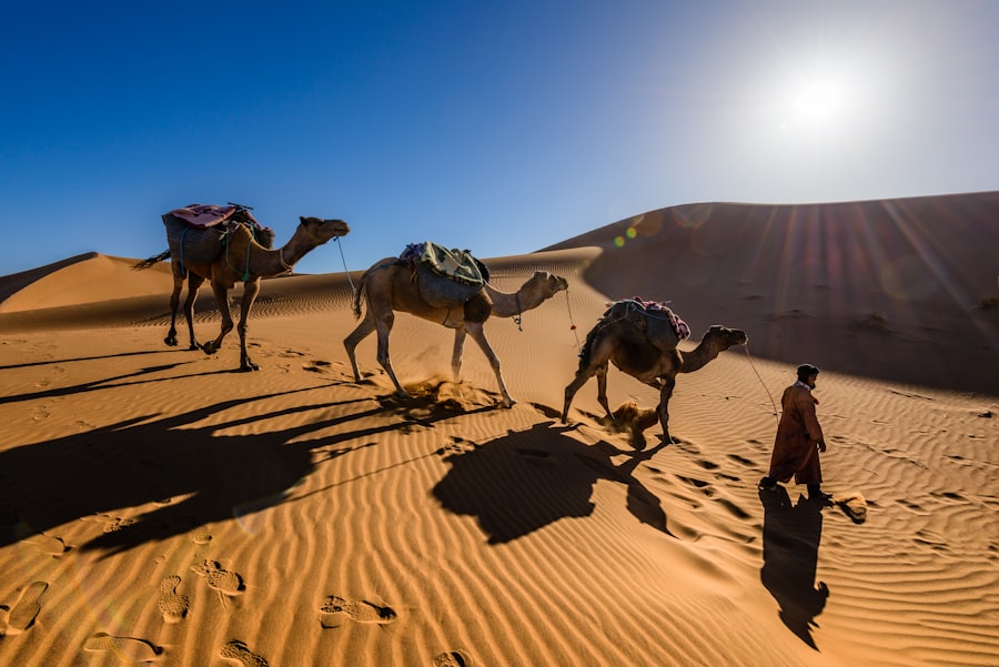
The relationship between orbital forcing and tectonic activity is not a simple cause-and-effect. Instead, these forces interact in a complex feedback loop, amplifying and modulating each other’s impact on the Sahara’s climate and landscape.
Hydro-tectonic Feedbacks: Shaping Rainfall Patterns
When periods of enhanced monsoonal rainfall occurred in the Sahara, fueled by favorable orbital configurations, the increased water flow could have had its own tectonic consequences. River erosion can carve canyons and influence sediment deposition, which in turn can exert stress on the Earth’s crust. While direct, rapid tectonic responses to rainfall are uncommon, over geological timescales, changes in groundwater levels and sediment loading can subtly influence the stress regime within the crust, potentially affecting fault activity or isostatic adjustments.
Topographical Amplification of Orbital Signals
Conversely, tectonic features like the Atlas Mountains can amplify the impact of orbital variations. During periods of strong monsoons, the presence of these mountains would have served to funnel moisture further inland, creating more pronounced wet zones in their lee. When the monsoons wane, the rain shadow effect becomes even more critical, hastening the desertification process in regions just beyond the mountains’ influence. The existing topography, shaped by tectonics, therefore, acts as a template upon which orbital-driven climate changes play out.
The Subtlety of Long-Term Change: Gradual Desertification
The formation of the Sahara was not an abrupt event but a gradual process spanning hundreds of thousands of years. The slow nature of both orbital cycles and tectonic plate movements means that the Sahara’s transformation into a desert was a protracted affair. Periods of increased aridity would have intensified, while brief but significant interglacial periods would have allowed for temporary reprieves of greenery. This cyclical nature, driven by both external orbital forcings and internal tectonic shaping, is what defines the Sahara’s dynamic history.
The Drying of the Sahara: A Multi-Stage Process
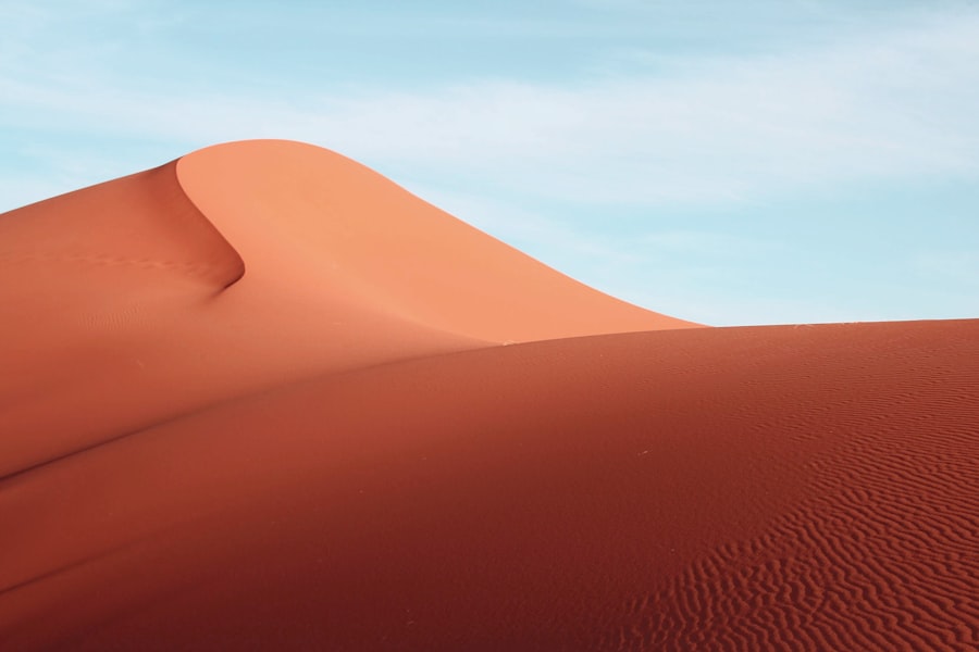
The transition from a vegetated landscape to the hyper-arid desert we see today occurred in distinct stages, meticulously documented by paleoclimatological and geological evidence. Understanding these stages reveals how the forces of orbital change and tectonics converged to create this iconic desert.
The Decline of the Monsoon: Orbital Shifts and Atmospheric Reorganization
As Northern Hemisphere summers became less intense due to shifts in Milankovitch cycles, the West African Monsoon began to weaken and retreat poleward. This retreat, occurring over millennia, marked the gradual aridification of the Sahara’s northern reaches. Atmospheric circulation patterns shifted, less moisture was transported inland, and the once-perennial rivers began to flow more intermittently.
The Role of Increased Atmospheric Dust: A Positive Feedback
As the Sahara began to dry, increased aridity led to more exposed soil and rock surfaces susceptible to wind erosion. This resulted in a significant increase in atmospheric dust transport. This dust, when transported over oceans, can affect cloud formation and albedo, potentially influencing global climate in ways that could reinforce arid conditions. Furthermore, increased dust deposition on land can smother vegetation, hindering its recovery even during brief periods of increased rainfall.
Geological Evidence of Desiccation: Salt Flats and Dune Fields
The geological record offers irrefutable evidence of this drying process. The formation of vast salt flats (playas) in former lake beds indicates periods of significant evaporation where water bodies shrank and evaporated, leaving behind thick deposits of salt and other minerals. The subsequent development of massive sand dune fields, such as the ergs, signifies the dominance of wind as the primary geomorphic agent, transporting and accumulating sand that was once held by vegetation.
The formation of the Sahara Desert has intrigued scientists for decades, with various theories suggesting a combination of climatic changes and geological processes over millions of years. One fascinating aspect of this transformation involves the Earth’s orbital variations, which have influenced climate patterns significantly. For a deeper understanding of how celestial mechanics can impact our planet’s environment, you can read more in this related article on Earth-Moon Lagrange points. This exploration sheds light on the broader cosmic factors that may contribute to terrestrial changes, including the arid conditions that characterize the Sahara today.
The Sahara Today and Its Future: An Ongoing Evolution
| Cause | Description |
|---|---|
| Climate Change | The shift in Earth’s climate patterns led to the desertification of the Sahara region. |
| Plate Tectonics | The movement of tectonic plates altered the landscape and contributed to the formation of the desert. |
| Orbital Shifts | Changes in the Earth’s orbit and tilt affected the distribution of sunlight and precipitation in the region. |
| Human Activities | Overgrazing, deforestation, and agricultural practices have accelerated the desertification process. |
The Sahara Desert remains a dynamic environment, constantly shaped by the interplay of atmospheric processes, geological stability, and the legacy of past climatic regimes. While major tectonic shifts are slow, the cycles of aridity and occasional, localized rainfall continue to influence its character.
The Enduring Influence of Orbital Cycles: Subtle Variations
Even in its current hyper-arid state, the Sahara is not entirely immune to the influence of orbital cycles. While the capacity for widespread greening is limited by current tectonic configurations and a generally weaker monsoon, subtle variations in rainfall patterns and temperature can still occur over millennial timescales, influenced by the ongoing Milankovitch cycles. Scientists are studying these subtle shifts to understand potential future climatic scenarios.
The Role of Human Activity: Modern Impacts
While tectonic activity and orbital changes are colossal, long-term forces, human activity has become a significant factor influencing the Sahara’s environment in more recent times. Deforestation, overgrazing, and unsustainable agricultural practices in the Sahelian fringe, the transitional zone south of the Sahara, can exacerbate desertification and contribute to land degradation, making the region more vulnerable to arid conditions.
The Sahara as a Natural Laboratory: Understanding Earth Systems
The Sahara Desert, with its stark beauty and long, complex history, serves as a crucial natural laboratory for scientists studying Earth’s climate systems, geological processes, and the resilience of life in extreme environments. By unraveling the intertwined stories of orbital changes and tectonic activity, researchers gain invaluable insights into the planet’s past and future, understanding the delicate balance that governs the habitability of our world. The formation of the Sahara isn’t just a story of a desert’s birth; it’s a profound illustration of the immense forces that continuously shape our planet.

The Ancient World Buried Beneath the Sahara
FAQs
What caused the formation of the Sahara Desert?
The formation of the Sahara Desert can be attributed to a combination of factors including changes in the Earth’s orbit, the movement of tectonic plates, and the drying up of ancient lakes and rivers.
How did changes in the Earth’s orbit contribute to the formation of the Sahara Desert?
Changes in the Earth’s orbit, known as Milankovitch cycles, have led to variations in the amount of sunlight reaching different parts of the Earth. These variations in solar radiation have influenced the distribution of rainfall, contributing to the arid conditions in the Sahara region.
What role did the movement of tectonic plates play in the formation of the Sahara Desert?
The movement of tectonic plates has led to the uplift of mountain ranges, such as the Atlas Mountains, which have blocked moisture-bearing winds from reaching the Sahara region. This has contributed to the desertification of the area.
How did the drying up of ancient lakes and rivers impact the formation of the Sahara Desert?
The drying up of ancient lakes and rivers in the Sahara region has resulted in the loss of water sources and the expansion of arid conditions. This has further contributed to the transformation of the area into a desert.
What evidence supports the theories about the formation of the Sahara Desert?
Scientific studies, including geological and climate data, as well as evidence from fossil records, provide support for the theories about the formation of the Sahara Desert. These studies help to piece together the complex factors that have shaped the landscape over millions of years.