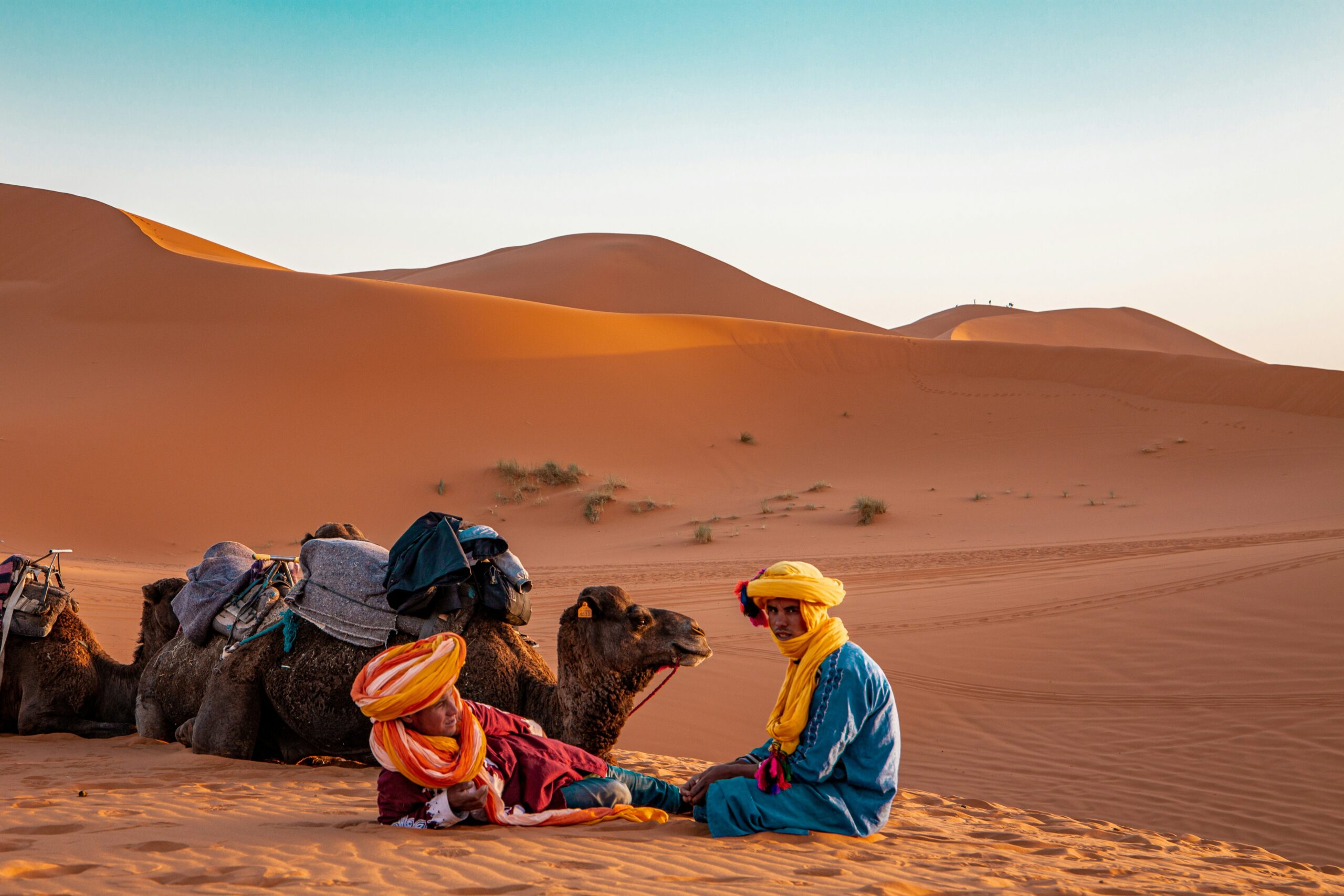
The vast expanse of the Sahara Desert, a seemingly immutable wasteland of sand and rock, is a testament to the dynamic nature of our planet. Its formation is not a singular event, but rather a complex narrative woven by climatic shifts, geological processes, and the subtle, yet powerful, influence of atmospheric circulation. To understand the birth of this iconic desert, one must journey through millennia, exploring the environmental and geographical forces that sculpted its current form.
The Sahara, as it exists today, is a product of cycles of aridity that have spanned vast geological timescales. While many associate deserts with permanent dryness, the Sahara has experienced periods of significant rainfall in its past, a stark contrast to its present-day desolation. These climatic fluctuations are primarily driven by the Earth’s orbital parameters, a phenomenon known as Milankovitch cycles.
The slow, predictable changes in Earth’s orbit around the sun, the tilt of its axis, and the wobble of its spin, influence the amount and distribution of solar radiation received by different regions. These variations, over tens of thousands of years, can alter atmospheric circulation patterns, leading to profound shifts in rainfall.
The Green Sahara: A Lost World
During certain periods, particularly around 8,000 to 5,000 years ago, the Sahara was a verdant landscape teeming with life. This era, often referred to as the “Green Sahara,” was characterized by monsoon rains that extended far into what is now the hyper-arid core of the desert. Evidence for this lost world can be found in the form of rock art depicting flourishing ecosystems, including giraffes, elephants, and hippopotami, animals that would be unfathomable in the contemporary Sahara. Ancient lake beds and river channels, now buried beneath sand, further corroborate the existence of a far wetter climate.
The monsoon system, crucial to the Green Sahara, is a seasonal reversal of winds that brings heavy rainfall. During periods of increased solar insolation over the Northern Hemisphere’s landmasses, the land heats up more intensely, creating low-pressure systems that draw moist air from the Atlantic Ocean. This moisture, fueled by the summer sun, would then precipitate across a vast swathe of North Africa, transforming the Sahara into a savanna-like environment.
The Onset of Aridity: Retreat of the Rains
The transition from the Green Sahara to the arid desert was a gradual process, driven by the subtle shifts in Milankovitch cycles. As Earth’s orbital parameters changed, the intensity of solar radiation decreased in the Northern Hemisphere, weakening the land-based heat lows and, consequently, the poleward penetration of the monsoon. The moist air masses began to retreat, leaving behind drier conditions.
This climatic shift was not uniform or immediate. There were likely periods of oscillation, with fluctuating rainfall patterns before a more permanent trend towards aridity took hold. The Sahara’s transformation was a slow unravelling of a once vibrant ecosystem, a testament to the profound impact of long-term climatic drivers.
The Role of Atmospheric Circulation: The Hadley Cell and the ITCZ
Beyond the grand cycles of orbital mechanics, the Sahara’s aridity is intrinsically linked to global atmospheric circulation patterns. The Hadley Cell, a major atmospheric circulation pattern, plays a pivotal role in establishing and maintaining arid conditions in the subtropics, where the Sahara is located.
The Hadley Cell is characterized by rising air in the tropics, where solar heating is most intense. As this air rises, it cools and releases moisture, leading to heavy rainfall in the equatorial regions. Once in the upper atmosphere, this air then travels poleward. Around 30 degrees latitude, both north and south, this descending air cools and becomes drier. As it sinks, it compresses and warms, creating high-pressure systems. These high-pressure systems are associated with clear skies and lack of precipitation, making them ideal breeding grounds for deserts.
The Intertropical Convergence Zone (ITCZ), a belt of low pressure and convergence where the trade winds of the Northern and Southern Hemispheres meet, also plays a crucial role. The ITCZ’s position shifts seasonally, migrating north and south following the sun. In the Northern Hemisphere summer, the ITCZ moves northward, bringing rain to regions like the Sahel, south of the Sahara. However, its northernmost extent typically does not reach the core of the Sahara, leaving it under the influence of the descending, dry air of the Hadley Cell.
The transformation of the Sahara into a desert is a fascinating topic that intertwines climate change, geological shifts, and human history. For those interested in exploring how environmental factors shape regions, a related article discusses the skilled engineering talent in Mexico and how similar challenges in resource management and adaptation can be observed globally. You can read more about this in the article at Mexico’s Skilled Engineering Talent.
Geological Underpinnings: A Foundation of Ancient Lands
While climate is the primary architect of the Sahara’s aridity, its geological history has provided the essential foundation and shaped its diverse landscapes. The Sahara is not simply a vast sandy sea; it is a mosaic of ancient geological formations, mountain ranges, and sedimentary basins that have been sculpted by countless years of erosion.
The bedrock of the Sahara is composed of some of the oldest geological formations on Earth, dating back to the Precambrian era. These ancient rocks, including igneous and metamorphic formations, have been uplifted, eroded, and re-deposited countless times throughout geological history.
Ancient Shields and Basins: The Sahara’s Deep History
The Sahara encompasses several ancient continental shields, vast regions of Precambrian igneous and metamorphic rock that form the stable cores of continents. These include the West African Craton and the Saharan Metamorphic Belt. Theseshields represent parts of the Earth’s crust that have remained relatively undisturbed for billions of years.
Interspersed with these shields are large sedimentary basins. These basins are areas where sediments have accumulated over vast periods, often in marine or lacustrine (lake) environments. Examples include the vast, largely unexplored Kufra Basin in Libya and the Murzuq Basin in southern Libya. These basins contain thick sequences of sedimentary rocks, including sandstones, shales, and limestones, which tell a story of changing depositional environments throughout Earth’s history.
Tectonic Events: Shaping the Landscape
Major tectonic events have also played a role in shaping the Sahara’s topography. While the region is not currently characterized by active plate boundaries like the Himalayas or the Andes, it has experienced periods of significant tectonic activity in its distant past.
The opening and closing of ancient oceans, such as the Tethys Sea, as well as rift events that led to the formation of large depressions, have contributed to the diverse geological structures found within the Sahara. These events fractured and deformed the crust, creating fault lines, mountain ranges, and basins that would later be influenced by erosion and deposition. The Hoggar Mountains in Algeria and the Tibesti Mountains in Chad are examples of uplifted massifs that represent the enduring influence of past tectonic forces.
The Power of Erosion: Sculpting the Desert’s Features
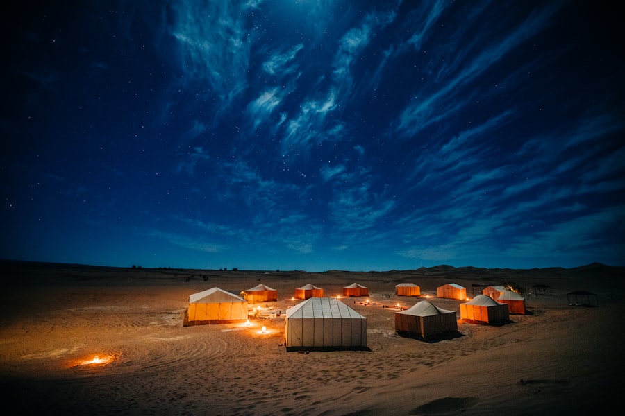
Once the climate shifted and the geological foundations were laid, the relentless forces of erosion began to sculpt the Sahara’s characteristic landscapes. In arid and semi-arid environments, erosion takes on different forms than in wetter climates, and the Sahara offers a prime example of these processes.
Water, though scarce, is a powerful erosive agent, especially during the infrequent but intense rainfall events. Wind, however, is the dominant force shaping the Sahara’s iconic sandy seas.
Water Erosion: Flash Floods and Wadis
When rain does fall in the Sahara, it often comes in the form of intense, short-lived thunderstorms. Lacking significant vegetation to absorb the moisture, the water quickly runs off the surface, carving ephemeral channels known as wadis. These wadis can grow into vast networks, dissecting plateaus and carrying large amounts of sediment.
Flash floods, though rare, can be devastating. They can quickly transform dry riverbeds into raging torrents, reshaping the landscape and carrying debris for considerable distances. Over long periods, these water erosion processes have contributed to the formation of canyons, mesas, and other fluvial landforms within the Sahara. Evidence of ancient floodplains can be seen in the layered sediments found in many parts of the desert.
Aeolian Erosion: The Sculpting Hand of Wind
Wind is the undisputed master sculptor of the Sahara. The constant movement of air across the vast, open plains picks up and transports sand and dust particles. This process, known as aeolian erosion, is responsible for the formation of the Sahara’s most recognizable features: sand dunes.
The types and shapes of sand dunes are highly dependent on wind direction and speed, as well as the availability of sand. Barchan dunes, crescent-shaped formations, are common in areas with a consistent wind direction. Star dunes, with multiple arms radiating from a central peak, form in areas with variable wind directions. Linear dunes, long and parallel, can stretch for hundreds of kilometers.
The movement of sand itself is a significant erosive force. As sand particles are blown across the landscape, they abrade and wear down rock surfaces, a process known as abrasion. This can lead to the formation of ventifacts, rocks that have been polished and shaped by the wind. Deflation, the lifting and removal of fine particles, can also occur, leaving behind larger gravels and stones, forming areas of regs (stony plains).
The Sahara’s Diverse Topography: More Than Just Sand
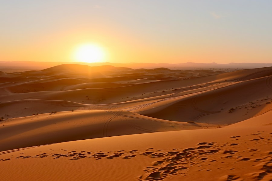
While sand dunes are the most iconic image associated with the Sahara, the desert’s topography is remarkably diverse. Vast areas are characterized by rocky plains, mountainous regions, and exposed geological formations that showcase the interplay of climate and geology.
The formation of these varied landscapes is a direct result of the differential erosion of the underlying geological structures under the prevailing arid conditions.
Regs and Hammadas: Stony Deserts
Large portions of the Sahara are covered by regs, vast expanses of stony desert where the fine sand and dust have been blown away, leaving behind a pavement of gravel and stones. These regs are formed through a process of deflation, where the wind selectively removes lighter particles.
Hammadas, on the other hand, are elevated plateaus of bare rock. They are formed when the softer sedimentary layers are eroded away, exposing harder, more resistant bedrock. These hammadas often rise abruptly from the surrounding plains, creating dramatic and stark landscapes. Their relatively flat surfaces are a testament to long periods of erosion and planation.
Mountains and Massifs: Ancient Uplifts
The Sahara is not entirely flat. Scattered across its vastness are mountain ranges and massifs, remnants of past tectonic uplift and volcanic activity. The Hoggar Mountains in Algeria, the Tibesti Mountains in Chad, and the Aïr Mountains in Niger are prominent examples.
These mountain ranges, though weathered and eroded, often support a more diverse microclimate due to their elevation. They can trap some moisture, allowing for the survival of more resilient plant and animal life. Their rugged slopes are a product of geological uplift followed by millennia of wind and water erosion, which has carved out canyons and sculpted rocky peaks.
Salt Pans and Oases: Where Water Persists
In some depressions and basins, where underground water sources are closer to the surface, salt pans and oases can form. Salt pans, known as chotts or sebkhas, are flat, dry lake beds that are often covered in a crust of salt. They form when shallow bodies of water evaporate, leaving behind dissolved minerals. During rare rainfall events, these pans can temporarily fill with water.
Oases are areas where groundwater emerges at the surface, supporting vegetation and creating pockets of life within the arid landscape. These precious havens are often formed at the intersection of underground aquifers and permeable surface layers. Their formation is a testament to the importance of hydrological processes, even in the driest of environments, and their preservation is vital for human and ecological survival in the Sahara.
The transformation of the Sahara into a vast desert is a fascinating topic that intertwines climate change and ancient civilizations. Researchers have uncovered evidence that suggests the region was once a lush landscape, teeming with life and human activity. This dramatic shift raises questions about how environmental changes can impact societies. For those interested in exploring the remnants of these ancient cultures, a related article discusses the discovery of ancient cities and their pneumatic foundations, shedding light on the ingenuity of past civilizations. You can read more about this intriguing subject here.
The Sahara’s Ongoing Evolution: A Dynamic Landscape
| Factors | Effects |
|---|---|
| Climate change | Decreased rainfall and increased temperatures leading to desertification |
| Human activities | Overgrazing, deforestation, and agriculture contributing to soil erosion |
| Geological changes | Shifts in tectonic plates and changes in ocean currents altering climate patterns |
| Natural processes | Wind erosion and sand dune formation accelerating desert expansion |
The formation of the Sahara Desert was not a singular event that concluded in the distant past. The forces that shaped it continue to operate, albeit at a slower pace, making the Sahara a dynamic and evolving landscape. Understanding its past provides crucial insights into its present and potential future.
The very processes that created the desert, climate change and erosion, are ongoing. While the major shifts in orbital forcing that governed the Green Sahara are long-term, decadal and centennial variations in rainfall can still influence the extent of the desert and the productivity of its marginal regions.
Desertification: A Modern Concern
In recent decades, the Sahara has been at the forefront of concerns about desertification. Desertification is the process by which fertile land becomes desert, typically as a result of drought, deforestation, or inappropriate agriculture. While natural climate variability plays a role, human activities have amplified these processes in and around the Sahara.
Overgrazing, unsustainable agricultural practices, and deforestation in the Sahel region, the southern fringe of the Sahara, have led to soil degradation and the loss of vegetation. This loss of vegetative cover makes the soil more susceptible to wind and water erosion, accelerating desertification. The Sahara’s expansion southward is a tangible manifestation of these ongoing processes.
The Future Sahara: Climate Change and Human Impact
The future of the Sahara will undoubtedly be shaped by global climate change and continued human impact. Predictions for regional climate change in North Africa suggest a complex interplay of factors, with some models indicating potential increases in temperature and further shifts in precipitation patterns.
Understanding the historical formation of the Sahara provides a valuable framework for assessing future scenarios. The resilience of desert ecosystems, adapted to extreme conditions, is remarkable. However, the pace of anthropogenic climate change and land degradation poses unprecedented challenges. Efforts to combat desertification, promote sustainable land management, and address the root causes of climate change are crucial for mitigating further expansion of arid landscapes and preserving the delicate balance of existing ecosystems within and on the borders of this vast and fascinating desert. The Sahara’s story is a continuous narrative of Earth’s response to climatic and geological forces, a story that is still being written.

The Ancient World Buried Beneath the Sahara
FAQs
1. What factors led to the formation of the Sahara Desert?
The formation of the Sahara Desert can be attributed to a combination of natural factors, including changes in the Earth’s orbit, the movement of tectonic plates, and shifts in ocean currents and atmospheric circulation patterns.
2. How did climate change contribute to the desertification of the Sahara?
Climate change played a significant role in the desertification of the Sahara. Over thousands of years, the region experienced a gradual drying out due to changes in the Earth’s orbit and axial tilt, leading to reduced rainfall and the expansion of arid conditions.
3. What impact did human activities have on the transformation of the Sahara into a desert?
While natural factors were the primary drivers of desertification in the Sahara, human activities such as overgrazing, deforestation, and unsustainable agricultural practices have exacerbated the process, leading to soil degradation and further desert expansion.
4. How long did it take for the Sahara to become a desert?
The transformation of the Sahara into a desert occurred over a period of several thousand years, with the gradual onset of arid conditions beginning around 7,000 years ago and continuing to the present day.
5. Is the Sahara Desert still expanding today?
Yes, the Sahara Desert is still expanding today, with ongoing desertification processes driven by both natural and human-induced factors. This expansion poses significant challenges for the region’s ecosystems and human populations.