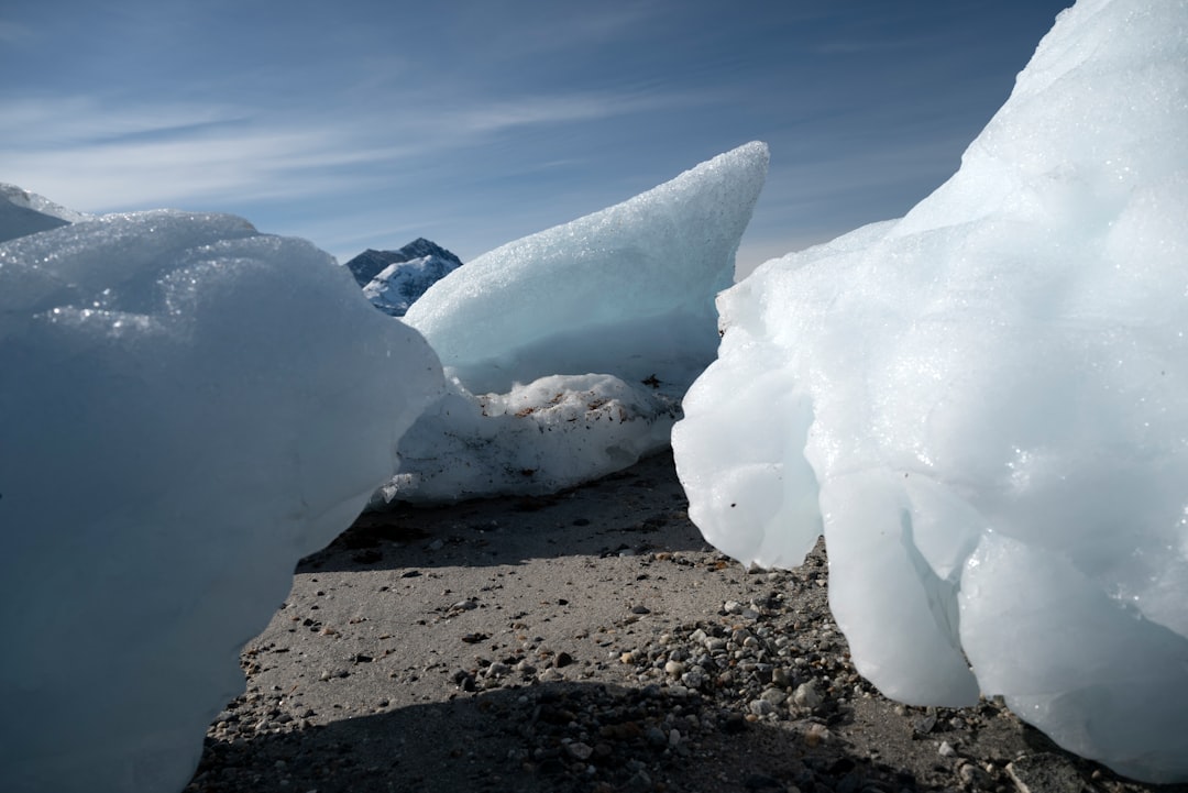
The Ice Age, a period of dramatic climatic fluctuation marked by vast continental ice sheets, left an indelible and transformative mark on the North American continent. This ancient epoch, spanning roughly from 2.6 million to 11,700 years ago, was not a single, monolithic event but rather a series of glacial and interglacial cycles. During the glacial periods, massive ice sheets, some kilometers thick, advanced and retreated, sculpting the very landscape and profoundly influencing its flora, fauna, and potential for human settlement. Understanding the impact of the Ice Age on North America requires delving into the geological forces unleashed, the biological adaptations that arose, and the enduring legacy that continues to shape the continent today.
The most tangible and visually striking impact of the Ice Age on North America is its dramatic reshaping of the land. The sheer weight and grinding power of the immense glaciers acted as colossal sculpting tools, carving out valleys, eroding mountains, and depositing vast quantities of sediment. This process of glacial erosion and deposition fundamentally altered the topography, creating many of the iconic landscapes that define North America.
Glacial Erosion: Carving the Continent
The relentless movement of glacial ice across the land was a powerful erosive force.
Valley Glaciation: The U-Shaped Masters
One of the most characteristic features left by valley glaciers are the distinctively U-shaped valleys found in mountainous regions. Unlike river valleys, which are typically V-shaped, glacial valleys are broad, with steep, often polished sides and a flat or gently sloping floor. As ice flowed downhill, it would scour the bedrock, widening and deepening existing river channels. This process could also lead to the truncation of spurs, creating dramatic hanging valleys where tributary glaciers met the main ice flow. Glacial erosion in mountainous areas also led to the formation of cirques – bowl-shaped depressions at the head of glacial valleys – and aretes, sharp, knife-edge ridges formed where two cirques erode back-to-back.
Ice Sheet Erosion: Sheet Over and Scour
Beyond mountainous regions, vast continental ice sheets, like the Laurentide Ice Sheet that covered much of eastern and central Canada and the northern United States, exerted a different but equally profound erosive influence. These immense ice masses smoothed over much of the pre-existing topography, abrading bedrock and stripping away soil and vegetation over vast areas. Areas that experienced significant ice sheet erosion often exhibit a more subdued, rolling terrain, with numerous depressions that would later fill with water to form lakes. This scouring action also played a role in the formation of features like roche moutonnées, which are asymmetrical bedrock hills that have been streamlined by glacial ice, with a gently sloping, abraded upstream side and a steeper, plucked downstream side.
Glacial Deposition: Building New Landscapes
As the glaciers advanced and, more importantly, retreated, they acted as massive conveyor belts, carrying and depositing enormous volumes of rock and sediment, collectively known as glacial drift.
Till: The Unsorted Legacy
The most common form of glacial deposit is till, an unsorted mixture of clay, silt, sand, gravel, and boulders deposited directly by melting ice. This jumbled material fills in depressions, forms irregular hummocky terrain, and can create significant changes in soil composition. Moraines, ridges of till deposited at the margins of glaciers, are prominent landforms. Terminal moraines mark the furthest extent of a glacier, while lateral moraines form along its sides. Recessional moraines, built up during periods when the ice front paused during retreat, are also common.
Stratified Drift: Sorted by Water
Meltwater streams and rivers flowing from glaciers also played a crucial role in shaping the landscape by transporting and sorting glacial sediment. This material, known as stratified drift, is characterized by layers of sorted sand and gravel. Outwash plains, vast, flat areas of sand and gravel deposited by meltwater flowing beyond the glacial margin, are a common feature. Eskers, long, winding ridges of sand and gravel deposited by meltwater streams flowing within or beneath the ice, are another distinctive landform. Kames, isolated hills of sand and gravel deposited in ice-walled depressions, are also common.
Glacial Lakes: Water’s Embrace
The uneven deposition of glacial drift, coupled with the scouring action of ice, created countless depressions in the landscape. As the ice retreated, these depressions filled with meltwater, forming vast glacial lakes.
The Great Lakes: A Monumental Legacy
Perhaps the most significant glacial lakes are the Great Lakes of North America, which owe their existence entirely to glacial activity. During the last glacial maximum, the massive Laurentide Ice Sheet scoured out and deepened pre-existing river valleys. As the ice retreated, meltwater pooled in these depressions, forming series of proglacial lakes. Over thousands of years, these lakes have evolved, with outlets shifting and shorelines changing due to isostatic rebound and erosion. The Great Lakes represent one of the largest surface freshwater systems on Earth, a direct and enduring legacy of the Ice Age.
Other Glacial Lakes
Beyond the Great Lakes, numerous smaller glacial lakes dot the North American landscape, particularly in the glaciated portions of Canada and the northern United States. These lakes, such as the Finger Lakes in New York and the numerous lakes of the Canadian Shield, are vital ecosystems and important sources of freshwater.
The Ice Age played a crucial role in shaping the landscape of North America, influencing everything from the formation of the Great Lakes to the distribution of flora and fauna across the continent. For a deeper understanding of how geological processes impact land use and ownership, you might find the article on legal frameworks for lunar mining property rights interesting, as it draws parallels between terrestrial and extraterrestrial resource management. You can read more about this topic in the article here: Legal Framework for Lunar Mining Property Rights.
The Great Exchange: Migration and Evolution of Life
The waxing and waning of ice sheets created a dynamic environment that profoundly influenced the distribution, evolution, and survival of North American fauna and flora. These cycles acted as powerful drivers of both migration and adaptation, ultimately shaping the biodiversity of the continent.
Megafauna and the Glacial Epoch
The Pleistocene epoch, often referred to as the Ice Age, is synonymous with the reign of megafauna – large mammals that roamed the continent. The dramatic climate fluctuations and the availability of vast, open landscapes during glacial periods were ideal for these colossal creatures.
Giants of the Pleistocene
North America was home to an astonishing array of megafauna during the Ice Age. This included iconic species such as the woolly mammoth and its close relative, the Columbian mammoth, mastodons, giant ground sloths like Megalonyx and Paramylodon, sabre-toothed cats like Smilodon, dire wolves, short-faced bears, and the American horse. These animals were adapted to the relatively cool and dry conditions prevalent during glacial periods, often possessing thick fur for insulation and specialized diets suited to a range of vegetation, from the grassy steppes of the interior to the more boreal forests.
Adaptations to Cold
Many of these large mammals possessed remarkable adaptations for survival in frigid conditions. Thick, shaggy fur, layers of subcutaneous fat, short limbs and ears to minimize heat loss, and specialized circulatory systems were common features. Their sheer size also offered an advantage, providing a larger surface area to volume ratio which helped retain body heat.
Plant Life Under Pressure
Plant communities also underwent dramatic shifts in response to glacial cycles. As ice sheets advanced, vegetation was pushed southward, leading to the formation of vast boreal forests and tundra environments. During interglacial periods, warmer temperatures allowed for the expansion of deciduous forests and grasslands.
Refugia and the Southern Exodus
When glaciers advanced, vast areas of North America were covered by ice, forcing plant life to retreat to ice-free refugia, often located at lower latitudes or at lower altitudes in mountain ranges not completely covered by ice. These refugia acted as vital reservoirs, preserving plant genetic diversity. Areas like the unglaciated parts of the Pacific Northwest and the southern United States played critical roles in this regard.
Post-Glacial Recolonization
As the glaciers retreated, meltwater provided new habitats and soil development commenced. Pioneer species, often grasses and hardy shrubs, were among the first to colonize these newly exposed landscapes. Over time, as soil conditions improved and the climate stabilized, more complex plant communities, including forests, established themselves. This process of recolonization was a slow but crucial step in rebuilding the continent’s ecosystems.
The Ice Age played a crucial role in shaping the landscape and ecosystems of North America, influencing everything from the formation of the Great Lakes to the migration patterns of ancient species. Understanding these changes can provide insights into how early humans adapted to their environment during this period. For a deeper exploration of how memory and learning can help us understand historical events, you might find this article on mnemonic devices particularly interesting. It highlights the importance of memory in connecting us to our past, much like the Ice Age connects us to the geological history of the continent.
The Enigma of Extinction: Megafauna and Humans
The end of the Ice Age, approximately 11,700 years ago, coincided with a widespread extinction event, particularly among the megafauna. While climate change undoubtedly played a role, the arrival and expansion of humans in North America is a significant factor often cited in their disappearance.
Co-evolution and Predation
For millennia, megafauna and their predators co-existed. However, the arrival of anatomically modern humans, with their sophisticated hunting techniques and tools, presented a novel and relentless pressure.
Hypotheses of Extinction
Several hypotheses attempt to explain the megafaunal extinction. The “overkill hypothesis” suggests that human hunting alone drove many species to extinction. The “climate change hypothesis” posits that rapid warming at the end of the Ice Age altered habitats and stressed populations already struggling to adapt. A growing consensus acknowledges a combination of factors, with human impact likely playing a significant role, especially in conjunction with environmental shifts. The loss of these large herbivores had cascading effects on the ecosystems they inhabited, altering vegetation patterns and impacting the survival of other species.
The Rise of Humanity: Paleo-Indians and Their World

The Ice Age profoundly shaped the initial human occupation of North America, influencing migration routes, settlement patterns, and the development of early technologies. The Bering Land Bridge, a vast landmass that emerged during glacial periods when sea levels dropped, played a pivotal role in connecting Asia and North America.
The Bering Land Bridge: The Gateway to a New Continent
During periods of maximum glaciation, vast amounts of water were locked up in ice sheets, causing global sea levels to drop significantly. This exposed the continental shelf between Siberia and Alaska, creating the Bering Land Bridge, or Beringia.
A Corridor for Migration
Beringia was not a narrow strait but a vast, habitable region, likely supporting tundra and steppe environments. This land bridge served as a crucial corridor for the migration of animals and, subsequently, for the movement of early human populations from Asia into North America.
Timing is Everything
The timing of this migration is a subject of ongoing research. Evidence suggests that humans likely crossed Beringia in multiple waves, with some crossings potentially occurring as early as 20,000 years ago or even earlier, though definitive evidence for very early crossings remains debated. The presence of the Laurentide and Cordilleran ice sheets created “ice-free corridors” that would have opened up for human migration into the interior of North America as they retreated.
Clovis and Beyond: Early Paleo-Indian Cultures
The earliest widely accepted evidence of human presence in North America is associated with the Clovis culture, characterized by its distinctive fluted projectile points.
The Clovis Horizon
The Clovis culture, dating to approximately 13,500 to 12,800 years ago, is found across much of North America. Clovis people were highly mobile hunter-gatherers who preyed on megafauna. Their sophisticated stone tools, particularly the finely crafted Clovis points, are hallmarks of this period.
Pre-Clovis Debates
The existence of human populations in North America prior to the Clovis culture, known as pre-Clovis populations, is a significant area of ongoing archaeological investigation. Sites like Monte Verde in Chile and Paisley Caves in Oregon have provided evidence suggesting human occupation dating back to before 13,500 years ago. These discoveries challenge earlier models and suggest a more complex and potentially earlier arrival of humans on the continent.
Adapting to a Changing Landscape
Early North American inhabitants were highly adaptable, developing technologies and subsistence strategies tailored to the specific environments they encountered.
Hunting and Gathering
The primary subsistence strategies of Paleo-Indians revolved around hunting large game, such as mammoths and bison, and gathering plant resources. Their understanding of animal behavior and plant life was crucial for their survival.
Nomadic Lifestyles
The availability of game and seasonal plant resources often dictated nomadic lifestyles, with groups moving extensively across the landscape to follow migratory animal herds and exploit ephemeral food sources. This mobility allowed them to maximize resource utilization over vast territories.
The Legacy of Ice: Modern North America
The impact of the Ice Age continues to resonate throughout North America, influencing its natural resources, its soils, and even its political and economic development. The geological and biological legacies of this ancient epoch are woven into the fabric of the continent.
Water Resources: The Glacial Tapestry
The vast quantities of freshwater found in North America are largely a product of glacial processes.
Lakes and Rivers
As previously discussed, the formation of the Great Lakes and countless smaller glacial lakes provided immense reservoirs of fresh water. Meltwater from glaciers also carved out the river systems that continue to sustain ecosystems and human populations across the continent. The continued melting of present-day glaciers and ice caps, though driven by modern climate change, is a direct continuation of the hydrological legacy of the Ice Age.
Aquifers
Glacial outwash plains deposited vast layers of sand and gravel, which now form productive aquifers – underground reservoirs of water. These aquifers are vital sources of drinking water and irrigation for many communities, particularly in the drier regions of the Great Plains.
Soil Fertility: A Gift from the Ice
Glacial till, while unsorted, often contains a rich mix of minerals derived from a wide range of bedrock. When weathered over millennia, this material contributes to the fertility of soils in many glaciated regions.
Productive Agricultural Lands
Areas like the American Midwest, with its deep, fertile soils derived from glacial till and loess deposits (wind-blown silt from glacial outwash plains), are among the most productive agricultural regions in the world. This fertility is a direct consequence of the grinding and mixing action of ancient glaciers.
Soil Structure and Drainage
The nature of glacial deposits also influences soil structure and drainage. In some areas, deposits of clay-rich till can lead to poorly drained soils, while sandy outwash plains promote rapid drainage. Understanding these characteristics is crucial for effective land management and agricultural practices.
Isostatic Rebound: The Rising Land
The immense weight of the ice sheets pressed down on the Earth’s crust. As the glaciers melted, the land, which had been depressed, began to slowly rebound. This process of isostatic rebound is still occurring in many parts of North America.
Ongoing Geological Change
This slow upward movement of the land can lead to observable geological changes, such as the gradual emergence of formerly submerged coastlines and changes in river gradients. Scientists monitor these subtle shifts to understand the ongoing geological processes shaping the continent.
Impact on Infrastructure
While the rebound is slow, in some areas, it can have subtle impacts on infrastructure and coastal environments over long periods. Coastal communities in formerly glaciated regions must consider the long-term implications of isostatic adjustments.
Enduring Ecosystems: Adaptations and Resilience
The Ice Age created a mosaic of habitats that continue to influence the distribution and evolution of species.
Tundra and Boreal Forests
The vast expanses of tundra and boreal forests that dominate the northern reaches of North America are a direct inheritance from the glacial and post-glacial periods. These ecosystems are uniquely adapted to cold climates and short growing seasons.
Biodiversity Hotspots
Areas that experienced repeated glaciation and survived in refugia often harbor unique biodiversity. The genetic adaptations that allowed species to survive extreme conditions during the Ice Age have contributed to their resilience and unique characteristics today. The post-glacial recolonization also led to fascinating patterns of species distribution and diversification.
In conclusion, the impact of the Ice Age on North America was a phenomenon of immense scale and profound consequence. From the dramatic sculpting of its physical landscape by ice and meltwater to the migration and adaptation of its flora and fauna, and the arrival and settlement of its first human inhabitants, the ancient ice sheets have left an indelible imprint. The continent’s freshwater resources, fertile soils, and even its ongoing geological evolution are all testaments to this transformative period. The legacy of the Ice Age is not merely a matter of geological history; it is a living, breathing force that continues to shape North America in countless ways to this day.

The Boulder That Shouldn’t Exist
FAQs
What was the Ice Age?
The Ice Age was a period of time when the Earth’s climate was much colder than it is today, resulting in large ice sheets covering much of the planet.
How did the Ice Age shape North America?
During the Ice Age, massive glaciers covered much of North America, shaping the landscape through processes such as erosion, deposition, and the carving of valleys and lakes.
What evidence of the Ice Age can be seen in North America today?
Evidence of the Ice Age in North America can be seen in the form of glacial landforms such as moraines, drumlins, and eskers, as well as in the presence of large lakes and the unique topography of regions like the Great Lakes and the Finger Lakes in New York.
How did the Ice Age impact the flora and fauna of North America?
The Ice Age had a significant impact on the flora and fauna of North America, leading to the extinction of many species and the adaptation and migration of others as the climate and landscape changed.
What are some key takeaways about how the Ice Age shaped North America?
Some key takeaways about how the Ice Age shaped North America include the formation of iconic landforms, the impact on biodiversity, and the lasting influence on the continent’s geography and ecosystems.