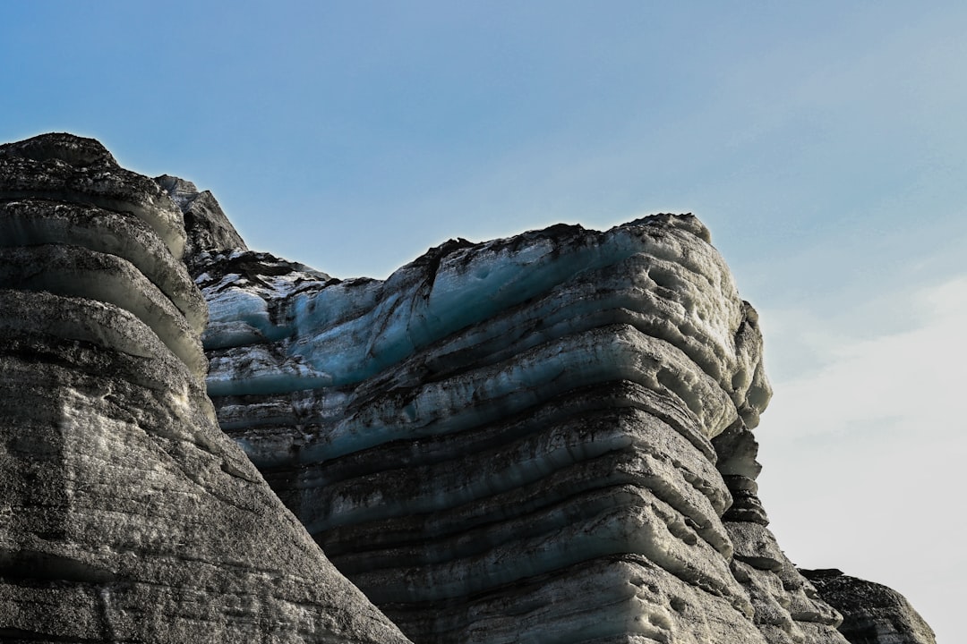
The landscape, sculpted by ancient forces, often presents puzzles that stretch the limits of human comprehension. Among the most captivating of these geological enigmas are the glacial erratics – colossal boulders, often dramatically out of place, resting on terrains that bear no resemblance to their stony origins. These silent giants, scattered across continents, have long been subjects of wonder and scientific inquiry. For centuries, their presence was attributed to myth and biblical floods. However, modern geology has gradually unveiled the extraordinary story behind these displaced monoliths, revealing them as profound testament to the immense power of glaciers.
The appearance of massive stones, far from any discernible bedrock of their composition, has always been a source of fascination. Imagine standing on a rolling plain in the American Midwest, a region characteristically composed of sedimentary soils, only to encounter a massive granite boulder, miles from the nearest granite quarry. These are the glacial erratics, and their incongruity has sparked debate and speculation for generations. Throughout history, before the advent of geology, explanations often leaned towards the fantastical or the divine.
Ancient Lore and Biblical Accounts
Early attempts to explain the presence of erratics often drew upon prevailing mythological frameworks or religious narratives. In many cultures, the sheer scale and sudden appearance of these boulders led to tales of giants, gods, or catastrophic natural events. The concept of a universal flood, potent in many ancient cosmologies and famously recounted in the biblical narrative of Noah’s Ark, was a common explanation. It was theorized that such a cataclysmic event could have transported these massive stones from distant lands, depositing them haphazardly as the waters receded. While lacking scientific rigor, these explanations highlight the profound impact these geological anomalies had on the human imagination, forcing early civilizations to seek answers in the stories they understood.
The Dawn of Scientific Inquiry: Early Geological Theories
As the scientific method began to take root, particularly during the Enlightenment and the subsequent centuries, natural philosophers started to move away from purely mythical explanations. Early geologists, however, faced their own challenges in formulating theories that could account for such dramatic displacements. Some proposed that land bridges, now submerged, might have allowed animals or natural forces to transport the rocks. Others contemplated the possibility of massive earthquakes or volcanic eruptions, though these explanations struggled to account for the widespread and often delicate placement of the erratics, some of which rest precariously, seemingly untouched by violent upheaval. The lack of a comprehensive understanding of Earth’s geological history and the mechanisms of large-scale landform creation meant that these early theories, while a step forward from myth, were ultimately incomplete.
Glacial erratics are fascinating geological features that provide insight into the movement of glaciers and the history of our planet’s climate. For those interested in exploring related topics, the article on wind harvesting offers a unique perspective on how ancient practices can inform modern sustainable energy solutions. You can read more about this intriguing connection in the article titled “Uncovering Ancient Secrets of Wind Harvesting” available at this link.
The Glacial Revelation: Ice as the Architect
The pivotal moment in understanding glacial erratics arrived with the burgeoning field of glaciology. As scientists began to study glaciers in mountainous regions and polar areas, they witnessed firsthand the immense erosive and transportive power of these slow-moving rivers of ice. The evidence was undeniable: glaciers were not just passive features of the landscape; they were active agents of geological change, capable of moving mountains.
The “Ice Age” Hypothesis: A Paradigm Shift
The concept of widespread glaciation, or “Ice Ages,” was a slow-developing but ultimately transformative idea. Initially, observations of glacial features in the Alps and Scandinavia began to suggest that ice had once extended far beyond its present-day limits. Pioneering geologists like Louis Agassiz, through extensive fieldwork and meticulous observation, argued forcefully for a past epoch when vast ice sheets had covered much of Europe and North America. This “Ice Age” hypothesis provided a revolutionary framework for understanding geomorphic features.
Evidence from the Alps: Agassiz’s Groundbreaking Work
Agassiz’s research in the Alps was crucial. He observed the distinct striations and polished surfaces on bedrock, the distinctive U-shaped valleys carved by ice, and the moraines – ridges of rock and debris deposited by glaciers. He also meticulously documented the presence of boulders that were clearly foreign to the local geology. His compelling arguments, initially met with skepticism, gradually gained acceptance, laying the foundation for the modern understanding of glacial epochs.
North American Discoveries: Broadening the Scope
Similar discoveries were being made in North America. Geologists observed the same glacial landforms: erratic boulders, polished bedrock, and vast morainal systems stretching across the continent. The realization that these phenomena were not isolated to specific mountain ranges but were widespread across vast swathes of land was a powerful confirmation of the Ice Age hypothesis. It painted a picture of Earth’s history as one of dramatic climatic shifts, with periods of intense glaciation that profoundly reshaped the planet’s surface.
The Mechanics of Ice Transport: How Rocks Moved
Once the concept of past glaciations was accepted, the mechanism by which these erratics were transported became clearer. Glaciers, as they advanced, were not merely scraping the surface; they were powerful erosional agents. The immense weight of the ice and the debris embedded within it allowed glaciers to grind down bedrock and pick up enormous rocks.
Entrapment within the Ice: Incorporation of Debris
During glacial advance, rocks and sediment of all sizes, from fine dust to colossal boulders, were incorporated into the basal ice, the ice at the bottom of the glacier that is in contact with the ground. This debris acted like sandpaper, further abrading the underlying bedrock and becoming frozen within the ice mass. Larger rocks were often lodged at the base or embedded within the glacier itself.
The Glacier as a Conveyor Belt: Movement and Deposition
As the glacier flowed, driven by gravity and the pressure of its own immense weight, it transported this incorporated debris over vast distances. The rate of movement might have been slow – measured in meters or tens of meters per year – but over the thousands of years that glaciers existed, these movements were significant. When the climate eventually warmed and the glaciers began to melt, the debris they carried was deposited. This deposition occurred in various ways, often marking the terminus or sides of the glacier.
Icebergs: The Final Stage of Transport
In some cases, especially in coastal or proglacial lake environments, icebergs calved from the melting glaciers could also act as transport mechanisms. These icebergs, laden with sediment and rocks, would float in the water, eventually melting and dropping their stony cargo onto the lakebed or seafloor. Some of these deposits, now exposed by subsequent geological uplift, can also be mistaken for glacial erratics, but their origin is subtly different, involving icebergs rather than the main body of the glacier.
Identifying the Unidentified: The Science of Provenance
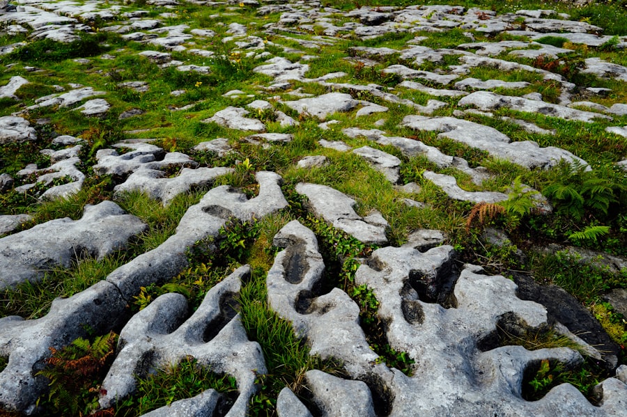
Determining the origin of a glacial erratic is a complex but essential part of understanding its journey. This process, known as provenance analysis, involves rigorous scientific investigation into the rock’s composition and structure, comparing it to potential source areas. It’s like being a detective, piecing together clues from the stone itself.
Petrographic Analysis: Unveiling the Rock’s Identity
The first step in identifying an erratic’s origin is often through petrographic analysis. This involves examining thin slices of the rock under a microscope to identify the types of minerals present and their relative proportions. Geologists can then compare this mineralogical fingerprint to known rock formations in the surrounding region.
Mineral Composition: The DNA of a Rock
The specific minerals found in an igneous or metamorphic rock, or the assemblage of rock fragments in a sedimentary rock, are unique to its formation environment. For instance, a granite erratic composed of specific feldspar and quartz varieties, along with certain accessory minerals like zircon or garnet, might point to a particular mountain range or geological province as its source.
Textural Clues: The Story of Formation
Beyond mineralogy, the texture of the rock – the size, shape, and arrangement of its constituent grains – also provides vital clues. A fine-grained, glassy texture might suggest volcanic origin, while a coarse-grained, interlocking texture could indicate slow cooling deep within the Earth. These textural characteristics, combined with mineralogical data, build a comprehensive profile of the rock’s genesis.
Geochemical Fingerprinting: Isotopic Signatures
For more precise determination, geochemical analysis can be employed. This involves analyzing the elemental composition of the rock, looking at trace elements and, crucially, isotopic ratios. Certain isotopes of elements like oxygen, strontium, or neodymium are incorporated during the formation of rocks and can act as unique “fingerprints” that can be traced back to specific geological provinces.
Isotope Ratios as Geographic Markers
The ratios of different isotopes of an element are not uniform across the Earth’s crust. They vary depending on the source of the materials and the geological processes involved in rock formation. By measuring these ratios in an erratic and comparing them to known isotopic signatures of various geological formations, scientists can significantly narrow down, or sometimes pinpoint, its original location. This method is akin to a high-tech DNA match for rocks.
Magnetic Properties: A Compass for the Past
The magnetic properties of certain rocks also offer valuable clues. Many igneous and metamorphic rocks contain magnetic minerals like magnetite. During their formation, these minerals align themselves with the Earth’s magnetic field at that time and location. By analyzing the direction and intensity of the remnant magnetism within an erratic, geologists can glean information about the latitude and orientation of its original location.
Paleomagnetism: Tracing Ancient Magnetic Fields
This field of study, known as paleomagnetism, allows scientists to reconstruct the Earth’s magnetic field as it was millions of years ago. The magnetic signature preserved within a rock can provide a surprisingly accurate indication of its past geographical position. This technique is particularly powerful when combined with other methods, offering a multi-faceted approach to provenance determination.
The Glacial Landscape: A Chronicle of Ice Ages

Glacial erratics are not isolated curiosities; they are integral components of a larger geological narrative. Their distribution, size, and relationship to other glacial landforms provide a rich chronicle of past ice ages, their extent, and their impact on the Earth’s surface.
Moraines: The Depositional Footprints of Glaciers
Moraines are ridges or mounds of till – a unsorted mixture of clay, sand, gravel, and boulders – deposited by glaciers. Glacial erratics are often found within, or on top of, these moraines, serving as stark reminders of the ice’s transportive power. The location and characteristics of moraines can precisely map the former margins of ice sheets.
Terminal and Recessional Moraines: Tracing Retreat
Terminal moraines mark the furthest extent of a glacier’s advance, while recessional moraines are formed as the glacier melts back. The presence of erratics within these features helps to solidify the understanding of where glaciers once stood and the pathways they took. The sheer volume of material, including countless erratics, deposited in these moraines indicates the immense erosive capacity of the ice.
Lateral and Medial Moraines: Ice Margins and Mergers
Lateral moraines form along the sides of glaciers, and medial moraines are created where two glaciers merge, their lateral moraines joining to form a central ridge. The erratics found within these structures reveal the dynamics of glacial flow and the zones where different ice streams interacted.
Glacial Till Plains: A Blanket of Debris
Vast plains, particularly in areas previously covered by continental ice sheets, are often composed of glacial till. These plains are pockmarked with erratics of all sizes, scattered as the ice sheet melted and uniformly deposited its load. The density and variety of erratics on these plains can offer insights into the composition of the bedrock over which the glacier had passed.
Distribution Patterns: Unraveling Ice Flow Directions
The distribution patterns of erratics across till plains can also reveal clues about the direction of ice flow. If a particular type of rock is found primarily on one side of a large geological formation, it strongly suggests that the glacier flowed from that formation towards the erratics. This can create maps of ancient ice-flow directions, providing crucial data for reconstructing ice sheet dynamics.
Erosional Features: Scars Left by the Ice
Beyond depositional landforms, the erosional features created by glaciers also provide context for erratics. Glacial valleys, scoured by ice, often have erratics perched on their sides or resting within them. U-shaped valleys, characteristic of glacial erosion, are frequently dotted with these displaced stones.
Striations and Polished Bedrock: The Grinding Action
The striations and polished bedrock left by moving ice bear testament to the abrasive power of glaciers. Boulders embedded in the ice would have been responsible for creating these marks. While the boulders themselves might have been transported further, the evidence of their passage remains etched into the landscape.
Glacial erratics are fascinating geological formations that provide insight into the movement of glaciers and the history of our planet’s climate. These large boulders, often found far from their original location, were transported by ice and deposited as glaciers retreated. For those interested in learning more about the impact of ancient geological processes on human civilization, a related article explores the remarkable engineering feats of ancient cultures and how they adapted to their environments. You can read more about this intriguing topic in the article Uncovering Ancient Engineering Marvels.
The Significance of Erratic Boulders: Beyond Curiosity
| Location | Size | Composition | Age |
|---|---|---|---|
| Alaska | 10 feet | Granite | 10,000 years |
| Switzerland | 6 feet | Sandstone | 20,000 years |
| Canada | 8 feet | Limestone | 15,000 years |
The study of glacial erratics extends far beyond satisfying a geological curiosity. These misplaced monoliths serve as invaluable archives, offering profound insights into past climates, Earth’s dynamic history, and even the potential for resource exploration.
Reconstructing Past Climates: Evidence of Glacial Epochs
The very existence of glacial erratics is irrefutable proof of past ice ages. Their widespread distribution across landmasses that are now temperate or even tropical underscores the dramatic climatic shifts Earth has undergone. By studying the composition and distribution of erratics, scientists can infer the extent and thickness of ancient ice sheets, providing essential data for climate modeling and understanding long-term climate change.
Ice Sheet Extent and Thickness: Mapping Glacial Boundaries
The presence of erratics in specific regions allows geologists to define the boundaries of ancient ice sheets. If erratics of a particular bedrock type are found far from their source region, it signifies that the ice must have extended at least that far. The size and density of erratics can also offer clues about the thickness of the ice, as thicker ice is capable of transporting larger and more numerous rocks.
Dating Glacial Events: Radiometric Techniques and Their Role
Radiometric dating techniques, applied to rocks within moraines or to erratics themselves, can help to assign ages to glacial events. By dating the surrounding geological materials or attempting to date minerals within the erratics, scientists can establish timelines for glacial advances and retreats, contributing to a detailed chronology of Earth’s glacial history. This allows for a deeper understanding of the periodicity of ice ages.
Understanding Glacial Dynamics: Ice Flow and Erosion Processes
The study of erratics provides a tangible link to the processes of glacial movement and erosion. Their presence in specific locations helps geologists to map ancient ice-flow directions, revealing the intricate pathways and dynamics of vast ice sheets. This understanding is crucial for reconstructing the behavior of glaciers in the past.
Mapping Ice Flow Lines: Tracking the Movement of Ice
By identifying the source region of erratics and their depositional location, scientists can effectively draw lines representing the direction of ice flow. Areas where erratics are concentrated can indicate the centers of ice accumulation or the paths of major ice streams. This mapping helps to visualize the vast, interconnected systems of ancient glaciers.
Illuminating Erosional Capabilities: Power of Ice
The sheer size and nature of some erratics underscore the immense erosive power of glaciers. The ability of ice to pluck, abrade, and transport such massive stones demonstrates a geological force capable of fundamentally reshaping landscapes. Observing how erratics are embedded within or deposited alongside other glacial features reinforces these understandings.
The Search for Resources: Following the Boulder’s Trail
Surprisingly, glacial erratics can also play a role in resource exploration. In regions with limited geological surveys or where bedrock is deeply buried, the presence of erratics can offer vital clues about the types of mineral deposits that might exist upstream.
Indicator Boulders: Clues to Mineralization
If an erratic is composed of a rock type known to be associated with valuable mineral deposits, such as copper or gold, then the area upstream of where it is found becomes a prime target for further exploration. These “indicator boulders” act as natural indicators, pointing prospectors towards potentially rich ore bodies that may lie hidden beneath the surface.
Mapping Geological Provinces: Understanding Subsurface Geology
The distribution of erratics can also help geologists to understand the broader geological provinces that the ice might have traversed. This can provide valuable information about the subsurface geology of a region, even where direct observation of bedrock is impossible due to thick glacial deposits or vegetation cover.
The mystery of glacial erratics, once shrouded in myth and speculation, has been largely unveiled by the persistent curiosity and rigorous scientific inquiry of geologists. These silent sentinels, scattered across the globe, are far more than mere stones. They are eloquent storytellers, each bearing an ancient tale of ice, movement, and the transformative power that has shaped our world. Their enduring presence serves as a constant reminder of Earth’s dynamic past and the profound forces that continue to sculpt its surface.

The Boulder That Shouldn’t Exist
FAQs
What are glacial erratics?
Glacial erratics are large rocks that have been transported and deposited by glaciers. They are often found in areas that were once covered by glaciers, but are now far from any source of similar rock.
How are glacial erratics formed?
Glacial erratics are formed when glaciers pick up rocks of various sizes and materials as they move. These rocks are then carried along with the glacier’s movement and eventually deposited in a new location when the glacier melts.
Where can glacial erratics be found?
Glacial erratics can be found in many parts of the world, including areas that were once covered by glaciers during the last ice age. They are often found in fields, forests, and other natural landscapes, and can be quite striking due to their size and the contrast with their surroundings.
What can glacial erratics tell us about past glacial activity?
Glacial erratics can provide valuable information about the movement and extent of past glaciers. By studying the size, shape, and composition of glacial erratics, scientists can learn more about the history of glacial activity in a particular area.
Are glacial erratics important for geological research?
Yes, glacial erratics are important for geological research because they can help scientists understand the movement and behavior of glaciers in the past. They can also provide insights into the types of rocks and materials that were present in a particular area during past glacial periods.