The reveal of an ancient history documentary map detailing early human migrations promises to be a monumental event for scholars and the public alike. This meticulously crafted visualization, born from decades of research and the latest in archaeological and genetic analysis, offers a dynamic and unprecedented view of how our ancestors spread across the globe. No longer confined to static timelines and fragmented evidence, this map presents a fluid narrative, tracing the intricate pathways and profound challenges faced by Homo sapiens as they ventured out of Africa and populated every habitable corner of the Earth. The documentary that accompanies this map will undoubtedly transform our understanding of prehistory, making these complex journeys accessible and engaging for a global audience.
The Genesis of the Migratory Map
The creation of this comprehensive map is the culmination of an ambitious, multidisciplinary endeavor. It represents a significant leap forward from previous attempts to chart human dispersal, integrating diverse fields of study to create a cohesive and scientifically robust picture. The project’s inception was driven by a desire to synthesize the ever-growing body of evidence concerning early human movements, recognizing that a visual, dynamic representation could unlock new insights and foster broader comprehension.
Uniting Disciplines for a Holistic View
The foundational element of this documentary map lies in its unprecedented integration of data from numerous scientific disciplines. Paleoanthropology, the study of fossil hominins, provides crucial evidence for the physical evolution and geographical presence of early human species. Archaeology contributes a wealth of information through the excavation of ancient sites, revealing tool use, settlement patterns, diet, and cultural practices that serve as markers of migration. Genetics, perhaps the most revolutionary contributor, offers a powerful lens through which to trace ancestral lineages and population movements through the analysis of ancient DNA (aDNA) and modern human genomes. The sequencing of genomes from ancient skeletal remains, for instance, allows researchers to pinpoint specific ancestral populations and the timing of their intermingling and dispersal. Furthermore, linguistics plays a vital role, with comparative studies of ancient and modern languages offering clues about the movement of peoples and the dissemination of cultural and technological innovations. Climatology and paleoclimatology provide the environmental context, revealing the shifting landscapes, ice ages, and resource availability that both hindered and facilitated migrations. By weaving together these disparate threads of evidence, the map transcends the limitations of any single discipline, presenting a more nuanced and accurate portrayal of our shared human journey.
Technological Innovations in Visualization
The sheer complexity of reconstructing millennia of human movement necessitates cutting-edge technological solutions for data analysis and visualization. The documentary map leverages advanced geospatial information systems (GIS) to integrate and display vast datasets, from fossil find locations and archaeological site distributions to genetic markers and environmental reconstructions. Sophisticated algorithms are employed to model migration routes, taking into account geographical barriers, resource availability, and estimated population growth rates. The visualization itself is dynamic, employing animation to depict the ebb and flow of human populations over time, with changing colors and densities representing population movements and densities. This allows for a visual representation of theoretical routes, highlighting areas of denser settlement, dispersal points, and potential bottlenecks. The use of 3D modeling further enhances the immersive experience, allowing viewers to explore ancient landscapes as they might have appeared during different migratory phases. This innovative approach to data presentation moves beyond traditional static maps, offering a living, breathing depiction of humanity’s epic expansion.
In exploring the fascinating topic of early human migrations, one can gain further insights by examining related articles that delve into the complexities of ancient history. For instance, the article on security strategies in modern contexts, while seemingly unrelated, offers a unique perspective on how migration patterns have evolved over time. To learn more about these strategic considerations and their implications, you can read the article here: Demystifying the Security Shoring Strategy. This connection highlights the enduring impact of migration on societal structures throughout history.
The African Exodus: Humanity’s First Great Journey

The narrative of human migration begins, unequivocally, with the story of our origins in Africa. The documentary map dedicates significant attention to this pivotal period, meticulously charting the initial emergence of Homo sapiens and their subsequent dispersal out of the continent. This phase is crucial for understanding not only the directionality of human movement but also the biological and cultural foundations that would be carried and adapted across the world.
Out of Africa: The Initial Wave
The “Out of Africa” model, long supported by fossil and genetic evidence, is brought to life with unparalleled clarity by the new map. It details the probable emergence of anatomically modern humans in East Africa, likely between 200,000 and 300,000 years ago. The map illustrates the earliest signs of expansion within the African continent itself, as small groups of hunter-gatherers began to explore and settle new territories, adapting to diverse environments. The initial migrations out of Africa are depicted as occurring in multiple waves, with the most significant and successful dispersal event typically dated to around 70,000 to 100,000 years ago. These early pioneers, facing a world vastly different from our own, would have possessed a remarkable resilience and adaptability, armed with developing cognitive abilities and sophisticated toolkits. The map traces these initial movements along the southern coast of the Arabian Peninsula, a region that may have been more fertile and hospitable during certain climatic periods, providing a stepping stone into Asia. It also considers evidence for potential earlier, less successful dispersals, highlighting the complex and non-linear nature of human expansion.
The Role of Environmental Catalysts
The migratory patterns depicted on the map are inextricably linked to the dynamic environmental conditions of the Pleistocene epoch. Fluctuations in global climate, characterized by glacial and interglacial cycles, played a profound role in shaping both the opportunities and challenges for early human migrants. During glacial periods, vast ice sheets would have rendered large swathes of the Northern Hemisphere uninhabitable, restricting human movement and confining populations to more temperate or tropical refugia. Conversely, interglacial periods, with their warmer temperatures and rising sea levels, would have opened up new land bridges and facilitated movement into previously inaccessible regions. The map visualizes these environmental shifts, illustrating how periods of drought and desertification in Africa may have driven populations towards coastal areas or more verdant river valleys, prompting exploration and eventual emigration. Similarly, the lowering of sea levels during glacial periods exposed continental shelves, creating land bridges that allowed humans to traverse between continents, most notably connecting Asia to North America via Beringia. The availability of resources, such as game animals and plant foods, would have been directly influenced by these climatic changes, dictating the feasibility and direction of migratory routes.
Populating Eurasia: Diverse Routes and Adaptations
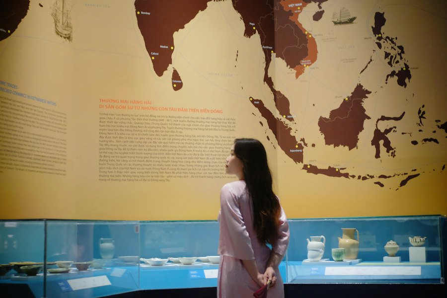
Following their departure from Africa, early human populations embarked on a monumental journey to populate the vast and diverse continent of Eurasia. The documentary map details the complex and often divergent pathways taken, showcasing the remarkable adaptability of humans to a wide range of environments and their encounters with other hominin species.
The Southern Route and its Expansion
One of the most well-supported routes of early human migration out of Africa is the so-called “southern route,” which traces a path along the coastlines of the Arabian Peninsula and into South Asia. The map vividly illustrates how these early explorers utilized coastal environments, exploiting marine resources and following river systems inland. From South Asia, this migration wave is shown to have spread eastward into Southeast Asia and eventually to the islands of Oceania. This route likely offered a relatively consistent food supply and less challenging terrain compared to inland routes, especially during periods when desertification was prevalent in parts of the Middle East. The genetic evidence strongly supports this migratory pulse, showing distinct lineages in populations across this vast geographical expanse that can be traced back to these early pioneers. The map highlights the incredible seafaring capabilities that would have been necessary for populations to cross into island Southeast Asia, demonstrating early human ingenuity and their ability to adapt to new challenges.
Across the Steppes and into Northern Latitudes
Another significant migratory trajectory involved venturing northward into the vast Eurasian steppes and eventually into more northerly latitudes. This route would have required adaptation to colder climates, different flora and fauna, and potentially more challenging nomadic lifestyles. The map depicts groups moving across the Iranian plateau, through Central Asia, and into the Russian steppes. This expansion is closely tied to the development of more sophisticated hunting techniques and the ability to track large game animals. The discovery of early human settlements in Siberia and even evidence of Neanderthal presence in these regions highlights the long and complex history of human habitation in northern Eurasia. The map also visualizes the eventual movement into Europe, likely occurring through several distinct phases, with early hominin populations establishing themselves in various regions before the arrival of later migratory waves. This Eurasian expansion was not a monolithic event but rather a series of complex, overlapping movements, each with its own unique challenges and adaptations.
Encounters with Other Hominins
A crucial and often overlooked aspect of early human migration is the encounter with other hominin species, most notably Neanderthals and Denisovans. The documentary map meticulously charts the geographical overlap and potential interactions between these groups. Evidence from paleogenetics has revealed that interbreeding occurred between Homo sapiens and Neanderthals, with most modern non-African populations carrying a small percentage of Neanderthal DNA. The map visualizes the regions where these encounters likely took place, such as the Levant, Eastern Europe, and Central Asia. Similarly, the discovery of Denisovan fossils in Asia suggests another hominin group with whom early Homo sapiens may have interacted and interbred. The map provides a visual representation of the overlapping territories and potential pathways of dispersal for these different hominin groups, allowing viewers to understand the complex genetic tapestry that resulted from these ancient interactions. These encounters were not necessarily violent confrontations but likely involved periods of cohabitation, cultural exchange, and genetic admixture, fundamentally shaping the genetic makeup of subsequent human populations.
Reaching the Ends of the Earth: Island Hopping and the Americas
The human saga of migration did not cease with the settlement of Eurasia. The documentary map dramatically illustrates the final, breathtaking stages of our species’ dispersal, reaching remote islands and eventually crossing the Bering Strait to populate the vast Americas. These journeys represent some of the most remarkable feats of human exploration and adaptation.
The Pacific Odyssey: Island Southeast Asia and Oceania
The colonization of island Southeast Asia and the vast expanse of Oceania represent some of the most astonishing achievements in human migration history. The documentary map highlights the sophisticated seafaring technologies and navigational skills that would have been required for these epic voyages. Starting from mainland Southeast Asia, early humans utilized rafts and rudimentary boats to cross significant stretches of water, reaching islands like Flores and eventually expanding into the vast Pacific. The map shows the gradual colonization of island chains, often involving leaps across hundreds of kilometers of open ocean. This expansion into Oceania occurred over tens of thousands of years, with distinct waves of migration populating New Guinea, Australia, and eventually the remote islands of Melanesia, Micronesia, and Polynesia. The environmental pressures and opportunities presented by these isolated islands, coupled with the development of specialized maritime cultures, drove the innovation and adaptation necessary for these incredible journeys. The map emphasizes the unique genetic and cultural diversity that emerged in these isolated populations.
The Bering Strait Crossing: Gateway to the Americas
The peopling of the Americas is a subject of ongoing research and debate, but the documentary map presents the most current scientific consensus, focusing on the eventual migration across the Bering land bridge, known as Beringia. During glacial periods, lowered sea levels exposed a vast landmass connecting Siberia and Alaska. The map visualizes this land bridge as a crucial corridor for the movement of animals and, consequently, early human hunter-gatherers. While the exact timing and routes of entry into the Americas are still being refined, the map depicts early human groups entering the continent, likely following game herds. Subsequent expansion occurred both along the Pacific coast and inland, with populations diversifying and adapting to the vastly different ecosystems of North and South America. The map also acknowledges the possibility of earlier, potentially coastal, migrations that may have occurred before the formation of the extensive ice sheets that blocked inland routes for a period. The remarkable speed at which humans spread across the Americas, from the Arctic to the tip of South America, is a testament to their incredible mobility and adaptability.
The Rise of Diverse American Cultures
Upon arrival in the Americas, human populations encountered a continent teeming with diverse environments and ecosystems, leading to the development of a remarkable array of distinct cultures. The documentary map illustrates the subsequent diversification of these populations, their adaptation to varied landscapes such as dense rainforests, arid deserts, and vast plains, and their development of unique subsistence strategies, technologies, and social structures. From the sophisticated agricultural societies of Mesoamerica and the Andean region to the hunter-gatherer traditions of North America and the complex societies of the Amazon basin, the map provides a visual overview of this incredible cultural mosaic. The discovery of ancient human settlements, burial sites, and artifact scatters across the Americas allows for the reconstruction of these early migratory patterns and the subsequent development of distinct cultural identities. The map underscores the fact that the story of human migration is not just about movement but also about the incredible diversity that emerges when humans adapt to and shape new environments over millennia.
In exploring the fascinating journey of early human migrations, one can gain deeper insights by examining the technological advancements that shaped these movements. An intriguing article discusses how ancient technologies were developed in response to scarcity, which played a crucial role in the survival and adaptation of early humans. For more information on this topic, you can read about it in the article on ancient technology and its impact on human migration patterns found here. Understanding these connections can enhance our appreciation of how early humans navigated their world.
Legacies of Migration: Shaping Our World Today
| Migration Route | Approximate Time Period | Regions Covered | Key Human Species | Significance |
|---|---|---|---|---|
| Out of Africa | ~70,000 – 60,000 years ago | Africa to Middle East | Homo sapiens | First major migration of modern humans out of Africa |
| Into Europe | ~45,000 – 40,000 years ago | Middle East to Europe | Homo sapiens, Neanderthals | Modern humans replaced or interbred with Neanderthals |
| Into Asia | ~50,000 – 40,000 years ago | Middle East to South and East Asia | Homo sapiens | Expansion into diverse Asian environments |
| Into Australia | ~65,000 – 50,000 years ago | Southeast Asia to Australia | Homo sapiens | One of the earliest sea crossings by humans |
| Into the Americas | ~20,000 – 15,000 years ago | Siberia to North and South America | Homo sapiens | Migration via Bering Land Bridge during Ice Age |
The ancient migratory journeys of our ancestors are not merely historical footnotes; they have profoundly shaped the world we inhabit today, influencing everything from our genetic makeup and cultural landscapes to our shared human heritage. The documentary map serves as a powerful reminder of this interconnectedness and the enduring impact of these epic voyages.
Genetic Heritage and Human Diversity
The genetic evidence painstakingly integrated into the map provides irrefutable proof of our shared ancestry. The subtle variations in DNA that differentiate human populations today are the result of millennia of migration, adaptation, and genetic drift. The map visually represents how genes flowed across continents, intermingling and diversifying over time. It highlights areas of significant genetic bottlenecking, where small founder populations gave rise to new lineages, and areas of extensive gene flow, where different groups mixed. Understanding these migratory pathways allows scientists to trace the origins of specific genetic traits, susceptibilities to certain diseases, and the evolutionary history of our species. The map serves as a powerful tool for understanding the biological underpinnings of human diversity, demonstrating that these differences are superficial and that we are all, at our core, descendants of the same intrepid explorers who ventured out of Africa.
Cultural Exchange and the Birth of Civilizations
The movement of people across the globe was intrinsically linked to the movement of ideas, technologies, and cultural practices. The documentary map illustrates how innovations in toolmaking, agriculture, language, and social organization spread along migratory routes, influencing and transforming the societies encountered. The development of agriculture, for instance, is depicted as a transformative event that allowed for the establishment of permanent settlements and the rise of complex civilizations. The map shows how agricultural practices, originating in centers like the Fertile Crescent, spread outwards, transforming landscapes and societies. Similarly, the diffusion of languages reflects the movement and interaction of peoples, providing linguistic clues to ancient migratory patterns. The ongoing process of cultural exchange, driven by migration and interaction, has been a constant force in shaping human history, leading to the rich tapestry of cultures that exists today. The map offers a visual narrative of this dynamic exchange, demonstrating how the interconnectedness of ancient peoples laid the groundwork for the globalized world we inhabit.
A Shared Human Story
Ultimately, the reveal of this ancient history documentary map offers a profound and unifying perspective on humanity. It underscores that our origins are shared, our journey global, and our legacy interconnected. By visualizing the arduous, often perilous, but ultimately triumphant migrations of our ancestors, the map invites us to reflect on our common humanity. It is a testament to the resilience, adaptability, and inherent curiosity that have driven our species to explore, settle, and thrive across the planet. The map serves as a powerful reminder that beneath the surface of our diverse cultures and appearances lies a single, continuous story of human endeavor, a narrative of constant movement and adaptation that continues to shape our present and future. The documentary and its accompanying map promise to be an invaluable resource, fostering a deeper understanding and appreciation for the epic migrations that have made us who we are.