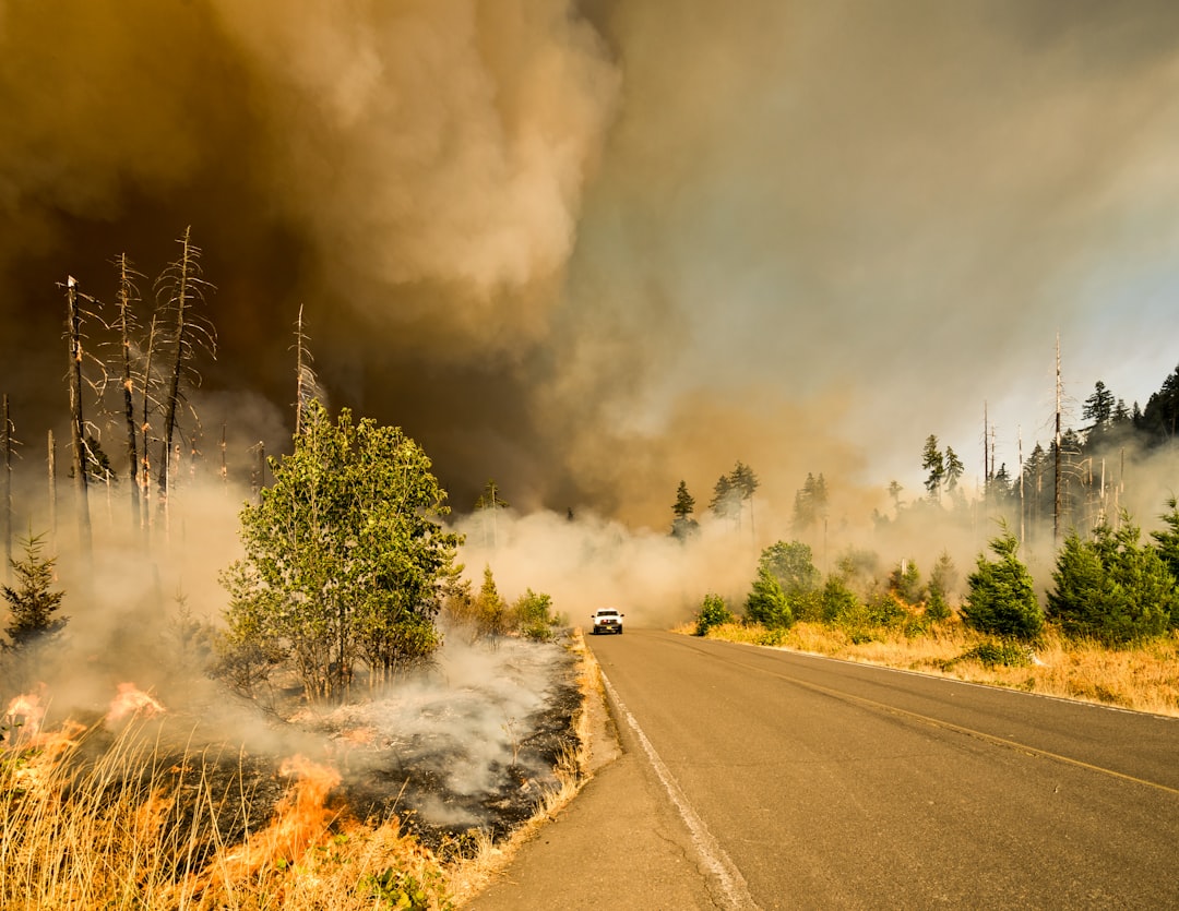
The Earth, a planet teeming with life, has also been a stage for cataclysmic events throughout its history. These ancient natural disasters, though ancient, have left indelible marks on the geological record and continue to shape our understanding of planetary evolution. Uncovering these past calamities offers a unique perspective on the immense forces that have sculpted our world and the resilience of life in their wake. By piecing together geological clues, paleontological evidence, and the analysis of ancient landscapes, scientists are constantly pushing the boundaries of our knowledge, revealing tales of volcanic super-eruptions that darkened skies for millennia, massive earthquakes that reshaped continents, and catastrophic floods that drowned vast swathes of land. These events, while terrifying in retrospect, provide crucial data for understanding present-day risks and predicting future hazards.
Volcanoes, dynamic conduits from the Earth’s molten core, have been responsible for some of the most dramatic and widespread natural disasters in Earth’s history. Their eruptions, ranging from effusive lava flows to explosive pyroclastic surges, have not only reshaped local topography but have had profound global consequences, influencing climate, triggering mass extinctions, and even altering the very atmosphere. Studying ancient volcanic deposits allows scientists to reconstruct the scale, frequency, and impact of these fiery behemoths.
Super-Eruptions: When the Earth Explodes
The most awe-inspiring and destructive volcanic events are the super-eruptions, events so colossal they are measured on a Volcanic Explosivity Index (VEI) of 8. These eruptions eject more than 1,000 cubic kilometers of material, a staggering volume that can blanket continents in ash and profoundly impact global climate.
The Toba Super-eruption: A Near-Extinction Event
One of the most well-documented super-eruptions occurred approximately 74,000 years ago at the site of present-day Lake Toba in Sumatra, Indonesia. The Toba eruption was not just a massive outpouring of magma; it was a catastrophic event that blanketed much of Southeast Asia and even reached Africa with thick layers of ash.
Evidence in the Geological Record
The geological signature of the Toba super-eruption is unmistakable. Vast deposits of Toba Tuff, a pulverized rock and glass fragment, are found across continents. This ash layer serves as a time marker, allowing geologists to precisely date geological formations and correlate events across vast distances. Studying the mineral composition of this ash provides insights into the magma chamber’s dynamics and the eruption column’s height.
The Volcanic Winter Hypothesis
The sheer volume of atmospheric aerosols injected into the stratosphere by Toba is believed to have triggered a prolonged volcanic winter, significantly reducing global temperatures for several years. This drastic climate shift is theorized to have caused a bottleneck in the human population, a concept known as the “Toba catastrophe theory.” While the exact magnitude and duration of these climatic effects are still debated, the evidence for a significant global cooling event is compelling.
Other Notable Super-eruptions
The Toba eruption is not an isolated incident. Geological history is punctuated by other monumental volcanic events. The Yellowstone caldera in the United States has experienced multiple super-eruptions in its past, the most recent being approximately 640,000 years ago. The Campi Flegrei in Italy, a vast caldera near Naples, also boasts a history of caldera-forming super-eruptions, with evidence pointing to a significant event around 40,000 years ago that coincided with the extinction of Neanderthals.
Submarine Volcanoes: Unseen Architects of Basins and Ridges
While terrestrial volcanoes capture our imagination with their explosive displays, submarine volcanoes play a crucial role in shaping the ocean floor. These underwater giants, responsible for the majority of Earth’s volcanic activity, create the mid-ocean ridges that crisscross the globe and form vast basaltic plateaus.
Seafloor Spreading and Mid-Ocean Ridges
The Mid-Atlantic Ridge, the Mid-Indian Ridge, and the East Pacific Rise are prime examples of volcanic plate boundaries where new oceanic crust is continuously generated. Magma rises from the mantle, erupts onto the seafloor, and solidifies, pushing older crust outwards. This continuous process of seafloor spreading is a fundamental mechanism of plate tectonics.
Hydrothermal Vents: Oases of Life
The interaction of superheated volcanic fluids with cold seawater at hydrothermal vents creates unique ecosystems. These vents, often found along mid-ocean ridges, spew mineral-rich fluids that support chemosynthetic bacteria, forming the base of a food web that includes specialized worms, crabs, and other marine life, existing in environments devoid of sunlight.
Ancient Oceanic Plateaus
Large igneous provinces (LIPs), extensive outpourings of volcanic rock, are often found on or near continents, but their origins are frequently linked to massive submarine volcanic events. The Ontong Java Plateau in the Pacific Ocean, for instance, is the largest known LIP, formed by colossal submarine eruptions approximately 120 million years ago. These events are believed to have released vast amounts of greenhouse gases, potentially impacting global climate and marine life.
Ancient natural disasters have shaped the course of human history, leaving behind intriguing mysteries that continue to captivate researchers. One such mystery is explored in the article titled “The Glacier Mystery: The Mirror’s Reflection,” which delves into the impact of ancient glacial movements on our planet’s landscape and ecosystems. To learn more about how these natural phenomena have influenced historical events, you can read the article here: The Glacier Mystery: The Mirror’s Reflection.
The Ground That Trembles: Earthquakes and Their Tectonic Legacy
Earthquakes, sudden releases of energy in the Earth’s crust, are among the most destructive natural disasters. They occur when tectonic plates grind past, collide with, or pull away from each other. The seismic waves generated by these movements can cause widespread devastation, from toppling buildings to triggering tsunamis and landslides.
The Mega-Thrusts of Subduction Zones
The most powerful earthquakes, known as megathrust earthquakes, occur at subduction zones where one tectonic plate dives beneath another. The immense friction and stress that build up over centuries are eventually released in a single, devastating rupture.
The Cascadia Megathrust Earthquake
The Pacific Northwest of North America is home to the Cascadia subduction zone, a region with a documented history of massive earthquakes. Evidence from submerged forests and tsunami deposit layers indicates that a magnitude 9.0 earthquake struck the Cascadia region in 1700, generating a massive tsunami that traveled across the Pacific Ocean, impacting coastlines as far away as Japan.
Paleoseismology: Reading the Earthquake Record
Paleoseismology is the study of past earthquakes that have not been recorded by human instruments. Geologists analyze sedimentary layers in coastal areas and fault zones, looking for evidence of ground shaking and displacement. The presence of liquefied sand, bentonite beds (indicating liquefaction and settling), and offset geological features provides a timeline of past seismic activity.
Tsunami Deposits: The Ocean’s Fury
Tsunami deposits are layered sediments of sand, gravel, and marine debris that are deposited inland by powerful waves. The study of these deposits in coastal regions allows scientists to reconstruct the size and frequency of past tsunamis, providing crucial information about the potential hazards posed by future megathrust earthquakes.
The Sumatra-Andaman Earthquake and Tsunami
The 2004 Sumatra-Andaman earthquake, a magnitude 9.1-9.3 megathrust event, is one of the most powerful earthquakes recorded in modern history. It ruptured a significant portion of the Sumatra-Andaman subduction zone, triggering a devastating tsunami that killed over 230,000 people across 14 countries. This event highlighted the interconnectedness of seismic activity and its catastrophic global reach.
Ancient Fault Ruptures and Transform Boundaries
While subduction zones are responsible for the most powerful earthquakes, other tectonic settings also experience significant seismic activity. Transform fault boundaries, where plates slide past each other horizontally, can generate large earthquakes.
The San Andreas Fault System
The San Andreas Fault in California is a prime example of a transform fault. It has been the source of numerous destructive earthquakes throughout history, including the 1906 San Francisco earthquake. By studying the historical seismic record and the geological features of the fault, scientists can estimate the recurrence intervals of large earthquakes and assess future risks.
Geomorphic Evidence of Faulting
The landscape itself bears the scars of ancient earthquakes. Offset streams, sag ponds, fault scarps (steps in the land caused by vertical ground displacement), and disturbed bedrock layers all provide visual clues about past fault movement.
Trenching Studies
Geologists excavate trenches across fault lines to examine disturbed sediment layers. This allows them to directly observe evidence of past earthquakes, such as evidence of fault rupture, ground cracking, and liquefaction, providing valuable data for reconstructing fault behavior over geological timescales.
The Deluge: Catastrophic Floods and Their Landscape-Altering Power

Rivers, often seen as symbols of life and sustenance, can also become agents of destruction when they overflow their banks on a massive scale. Ancient catastrophic floods, often triggered by glacial melt, volcanic activity, or massive rainfall events, have carved dramatic landscapes and reshaped entire regions.
Glacial Lake Outburst Floods (GLOFs): When Ice Dams Break
During glacial periods, enormous ice dams frequently formed, impounding vast lakes behind them. When these dams failed, the sudden release of immense volumes of water created catastrophic floods, capable of shaping entire drainage basins.
The Missoula Floods
One of the most dramatic examples of ancient flooding is the series of Missoula Floods that swept across the northwestern United States at the end of the last ice age. These floods, originating from Glacial Lake Missoula in Montana, carved the Channeled Scablands of eastern Washington, a landscape characterized by vast scoured bedrock channels, enormous ripple marks, and giant potholes.
Evidence in the Scablands
The Channeled Scablands are a testament to the immense power of these ancient floods. The sheer scale of the erosion, far beyond what a normal river could achieve, points to a catastrophic event. The presence of enormous gravel bars and erratics (boulders transported by ice and then water) stranded on higher ground further supports the glacial flood hypothesis.
Sedimentary Deposits as Timekeepers
The deposition of thick layers of sand and gravel, known as slackwater deposits, in the valleys and floodplains downstream of the flood source provides further evidence. The grain size and distribution of these deposits can indicate the speed and depth of the floodwaters.
Other Glacial Lake Outbursts
Similar catastrophic floods have been identified in other glaciated regions around the world, including Scandinavia and the Andes. These events played a significant role in shaping the post-glacial landscape and influencing river systems.
Volcanic-Triggered Floods: Lahars and Glacial Surges
Volcanic activity can also contribute to catastrophic flooding, often through the generation of lahars (volcanic mudflows) or by melting glaciers and igniting glacial lake outburst floods.
Lahars: Mud and Debris in Motion
When volcanic eruptions occur in areas with snow or ice, the heat can melt these frozen materials, mixing with volcanic ash, rock fragments, and debris to form fast-moving, destructive mudflows known as lahars. These flows can travel for long distances, burying everything in their path.
Ancient Lahar Deposits
The identification of ancient lahar deposits, characterized by their distinctive gray color and heterogeneous mixture of volcanic and water-transported material, allows scientists to reconstruct the frequency and scale of past volcanic floods.
Glacial Surges Ignited by Eruptions
Volcanic eruptions under or near glaciers can lead to rapid melting and subsequent glacial lake outburst floods. The eruption of Mount St. Helens in 1980, while not a purely ancient event, provides a modern analogue for the potential catastrophic flooding that can be triggered by such interactions.
The Planet Under Siege: Asteroid Impacts and the Threat from Space

While Earth’s internal processes can unleash immense destructive power, the planet has also been a target for extraterrestrial impacts. The collision of asteroids or comets with Earth has played a profound role in shaping its history, leading to mass extinctions and fundamentally altering the course of life.
The Chicxulub Impact: A World-Altering Event
The most famous extraterrestrial impact is the Chicxulub event, which occurred approximately 66 million years ago. This impact, caused by an asteroid estimated to be 10-15 kilometers in diameter, struck the Yucatán Peninsula in Mexico.
Evidence of the Impact
The evidence for the Chicxulub impact is overwhelming. The 180-kilometer-wide Chicxulub crater, largely buried beneath the Yucatán surface, is the most direct evidence. Surrounding the crater, scientists have found a global layer of iridium, an element rare on Earth’s surface but abundant in asteroids.
The K-Pg Boundary Layer
The K-Pg (Cretaceous-Paleogene) boundary, a distinct geological layer found worldwide, is rich in iridium and other impact-related materials, such as shocked quartz and tektites (small glass beads formed from melted and ejected rock). This layer marks the extinction of approximately 75% of plant and animal species on Earth, including the non-avian dinosaurs.
Consequences of the Impact
The immediate consequences of the Chicxulub impact were devastating, including colossal tsunamis, widespread wildfires ignited by the impact’s heat, and a massive ejection of dust and debris into the atmosphere. This atmospheric injection led to a prolonged period of darkness and cold, effectively shutting down photosynthesis and leading to the collapse of food webs.
Other Notable Impact Events
The Chicxulub event is not the only significant asteroid impact in Earth’s history. Evidence suggests other, albeit smaller, impacts have occurred throughout geological time, each leaving its mark on the planet’s surface and its evolutionary trajectory.
Meteor Crater, Arizona
Meteor Crater, also known as Barringer Crater, in Arizona, is a much smaller but well-preserved impact crater, approximately 1.2 kilometers in diameter, formed by the impact of an iron meteorite about 50,000 years ago. It provides a tangible example of the forces involved in extraterrestrial impacts.
The Search for Impact Craters
Scientists continue to search for and analyze impact craters around the globe and on the Moon, using remote sensing techniques and geological fieldwork. Understanding the frequency and scale of past impacts is crucial for assessing the long-term threat of asteroid collisions.
Ancient natural disasters have long fascinated historians and scientists alike, as they provide insight into the resilience of early civilizations. For those interested in understanding the broader implications of such events, a related article discusses potential economic impacts in modern times. You can explore this topic further in the article on worst-case economic scenarios unveiled, which highlights how natural disasters can shape economies even today. If you want to read more about it, click here.
The Shifting Landscape: Ice Ages and Their Sculpting Power
| Disaster | Location | Year | Impact |
|---|---|---|---|
| Flood | Mesopotamia | 2900 BC | Destroyed cities and agricultural land |
| Volcanic Eruption | Pompeii, Italy | 79 AD | Destroyed the city and killed thousands |
| Earthquake | Ancient Greece | 373 BC | Devastated cities and caused widespread destruction |
| Tsunami | Crete, Greece | 1600 BC | Caused widespread destruction and loss of life |
The Earth’s climate has not been static; it has oscillated between long periods of warmth and intense cold, known as ice ages. These periods of glaciation have profoundly shaped the planet’s surface, from carving mountain valleys to depositing vast plains of glacial till.
The Pleistocene Ice Ages: A Symphony of Ice and Meltwater
The most recent series of ice ages, spanning the Pleistocene epoch (approximately 2.6 million to 11,700 years ago), saw massive ice sheets advance and retreat across large portions of the Northern Hemisphere.
Glacial Landforms: The Art of Ice
Glaciers, vast rivers of ice, are powerful erosional agents. As they advance, they scrape and scour the underlying bedrock, creating distinctive landforms such as U-shaped valleys, cirques (bowl-shaped depressions), and fjords.
Till Plains and Moraines
When glaciers retreat, they leave behind unsorted mixtures of rock and sediment called till. This till can be deposited in various forms, including moraines (ridges of accumulated till), which mark the former extent of the ice sheets. The vast till plains of North America and Europe are a direct result of this glacial deposition.
Glacial Sediments as Climate Archives
The layers of sediment deposited by glaciers, as well as ice cores extracted from ancient ice sheets, act as invaluable archives of past climate conditions. By analyzing trapped air bubbles within ice cores, scientists can reconstruct historical atmospheric composition, temperature, and even volcanic events.
Snowball Earth: When the Planet Froze Over
Evidence suggests that Earth has experienced at least two periods of extreme glaciation, known as “Snowball Earth” events, where the planet was almost entirely covered in ice. These events, occurring in the Precambrian era, were likely triggered by a combination of factors, including atmospheric changes and geological processes.
The Sturtian and Marinoan Glaciations
The Sturtian glaciation (around 717 to 660 million years ago) and the Marinoan glaciation (around 640 to 635 million years ago) represent the most extreme phases of Snowball Earth. Evidence for these events includes widespread glacial deposits found in rocks that were located near the equator at the time, indicating that ice extended to low latitudes.
The Role of Carbon Dioxide
Understanding the causes and consequences of these extreme glaciations helps scientists refine their models of Earth’s climate system. The resilience of life to survive these periods of extreme cold also offers insights into the adaptability of life under harsh conditions.
Uncovering ancient natural disasters is an ongoing and multifaceted endeavor. These ancient calamities, from the fiery breath of volcanoes to the icy sculpturing of glaciers and the devastating impacts from space, have profoundly shaped our planet and the life it sustains. Each discovery, each unearthed fossil, each analyzed rock layer, adds another piece to the intricate puzzle of Earth’s dynamic and often turbulent past, offering invaluable lessons for understanding our present and safeguarding our future.

When the Mediterranean Became a Desert | The Messinian Salinity Crisis Explained
FAQs
What are some examples of ancient natural disasters?
Some examples of ancient natural disasters include the eruption of Mount Vesuvius in 79 AD, the earthquake and tsunami that destroyed the Minoan civilization in 1600 BC, and the volcanic eruption of Thera (modern-day Santorini) around 1600 BC.
How did ancient civilizations cope with natural disasters?
Ancient civilizations coped with natural disasters through various means, such as building structures to withstand earthquakes, creating early warning systems for tsunamis, and developing rituals and offerings to appease gods associated with natural phenomena.
What impact did ancient natural disasters have on civilizations?
Ancient natural disasters had significant impacts on civilizations, often leading to widespread destruction, loss of life, and displacement of populations. They also influenced cultural and religious beliefs, as well as shaping the development of urban planning and architecture.
What evidence do we have of ancient natural disasters?
Evidence of ancient natural disasters can be found in archaeological remains, such as layers of ash from volcanic eruptions, collapsed buildings from earthquakes, and sediment deposits from tsunamis. Historical accounts and myths from ancient civilizations also provide valuable insights into the impact of natural disasters.
How do ancient natural disasters compare to modern ones?
While ancient natural disasters and modern ones share similarities in terms of their destructive power, the main differences lie in the technological advancements and infrastructure that modern societies have in place to mitigate and respond to such events. Additionally, our understanding of the causes and effects of natural disasters has greatly improved with scientific advancements.