The whispers of Helike, a city swallowed by the sea, have echoed through millennia, tantalizing historians and archaeologists alike. For centuries, its legend, often dismissed as mere myth or exaggerated tale, persisted. The story, recounted by ancient writers like Pausanias and Strabo, spoke of a once-grand city, a prominent member of the Ionian League, tragically submerged beneath the waves of the Gulf of Corinth in a single night. The narrative painted a vivid picture of divine retribution, a petulant Poseidon reshaping the landscape in a catastrophic earthquake and subsequent tsunami. While compelling, the lack of definitive physical evidence relegated Helike to the realm of legend, a casualty of time and the shifting coastlines of Greece. However, the advent of geoarchaeology, the interdisciplinary study of how geological processes affect archaeological sites and vice versa, has begun to illuminate a path toward uncovering this lost civilization, transforming a mythical account into a tangible pursuit.
Helike’s story is deeply embedded in the fabric of ancient Greek mythology, a cautionary tale of hubris and the wrath of the gods. Its prominence in the Ionian League, a confederation of twelve cities, underscores its historical significance before its dramatic disappearance. The earliest accounts, from writers like Herodotus, allude to its existence, but it is Pausanias, in the 2nd century CE, who provides the most detailed narrative of its destruction. He describes how Helike, along with its neighboring city of Boura, was devastated by an earthquake followed by a tidal wave, causing the land to sink and the sea to inundate the city. Strabo, a geographer writing around the turn of the millennium, further corroborates the submergence, noting that the ruins of Helike could be seen beneath the waves and that ships could sail over them. These accounts, while consistent in their description of catastrophic destruction and inundation, lacked precise geographical markers, leaving the actual location a tantalizing mystery. The allure of a lost city, not just buried but utterly consumed by the sea, fueled a persistent, albeit often low-profile, search for centuries. This quest was fraught with challenges, as coastal erosion, sedimentation, and the dynamic nature of the Gulf of Corinth obscured any potential clues. The lack of definitive archaeological findings meant that Helike remained a compelling legend rather than a concrete historical entity, a subject for scholarly debate rather than systematic excavation.
Early Attempts and the Absence of Definitive Proof
Throughout history, various scholars and explorers have speculated about Helike’s possible whereabouts. These early efforts, often based on textual analysis and geographical assumptions, were heroic in their scope but ultimately fell short of providing irrefutable evidence. They relied on correlating ancient descriptions with the known topography of the region, attempting to pinpoint areas where seismic activity and sea-level change could have led to such a drastic transformation. However, the vagueness of the ancient texts and the immense geological changes that have occurred over two millennia proved formidable obstacles. Without a tangible artifact or a clearly identifiable submerged structure, these early searches yielded little more than educated guesses. The absence of a single, irrefutable piece of evidence meant that each purported discovery was met with skepticism, and the legend of Helike continued to reside primarily in the pages of classical literature.
The Technological Shift: From Text to Terrain
The shift in the approach to locating Helike marked a significant turning point. The reliance on solely textual interpretation began to wane, replaced by a more scientific and holistic methodology. This involved integrating geographical knowledge, historical context, and, crucially, advanced technologies that allowed for the investigation of submerged and buried landscapes. The growing understanding of geological processes, particularly those related to seismic activity and coastal dynamics in the Gulf of Corinth, provided a new framework for understanding Helike’s potential fate. This evolution in approach, moving from simply reading about the past to actively studying the physical evidence of the earth’s transformation, laid the groundwork for the modern geoarchaeological investigations.
Helike geoarchaeology provides valuable insights into ancient coastal settlements and their interactions with environmental changes. For a deeper understanding of how modern island communities are affected by similar vulnerabilities, you can explore the article on island vulnerability, which discusses the growing concerns related to climate change and rising sea levels. This article can be found at Island Vulnerability: A Growing Concern.
Geoarchaeology: Bridging the Gap Between Earth Science and Archaeology
Geoarchaeology, the discipline that examines the interplay between geological processes and archaeological phenomena, has emerged as the most potent tool in the quest to locate Helike. This field recognizes that ancient sites are not static entities but are inextricably linked to the dynamic geological environment in which they exist. By studying the sediments, landforms, and geological events that have shaped a region, geoarchaeology can reveal patterns of deposition, erosion, and seismic activity that may have affected ancient settlements. In the case of Helike, this approach offers a scientific lens through which to scrutinize the ancient accounts of its destruction, moving beyond mythological interpretations to a data-driven understanding of the natural forces at play.
Understanding the Gulf of Corinth: A Seismically Active Zone
The Gulf of Corinth is renowned for its intense seismic activity. Lying at the boundary between the Eurasian and African tectonic plates, it is a region characterized by rifting and extension, leading to frequent earthquakes. This geological context is crucial for understanding the potential mechanisms of Helike’s destruction. Geoarchaeologists can analyze seismic records, fault lines, and historical earthquake data to understand the frequency, magnitude, and likely impact of past seismic events in the area. This knowledge allows for a more informed assessment of how an earthquake might have affected the landscape and a coastal city like Helike. The very forces that likely contributed to its demise are now scientific subjects of study, providing valuable clues.
Sedimentology and Stratigraphy: Reading the Earth’s History
Sedimentology, the study of sediments, and stratigraphy, the study of layered rocks and soils, are fundamental to geoarchaeological investigations. By examining sediment cores taken from the seabed and the coastal plains around the Gulf of Corinth, geoarchaeologists can reconstruct the environmental history of the region. These cores act as time capsules, revealing layers of sediment deposited over millennia. The composition, texture, and characteristics of these layers can indicate past sea levels, periods of inundation, and the impact of catastrophic events such as earthquakes and tsunamis. The presence of specific sediment types, such as tsunami deposits, can provide compelling evidence for significant coastal inundation events that align with the historical accounts of Helike’s destruction.
Paleoenvironmental Reconstruction: Recreating the Ancient Landscape
Paleoenvironmental reconstruction involves using geological and biological evidence to understand the past environment of a particular area. For Helike, this means reconstructing the coastline and the landscape as it existed in antiquity. Geoarchaeologists analyze evidence such as ancient shorelines, fossilized plant and animal remains, and changes in sediment deposition to understand how the coast has evolved. This process helps to identify areas that may have been submerged or significantly altered by geological events. By understanding the ancient topography, researchers can more accurately assess where a city would have been situated and how it might have been affected by rising sea levels or seismic subsidence.
The Technological Arsenal: Probing Beneath the Surface
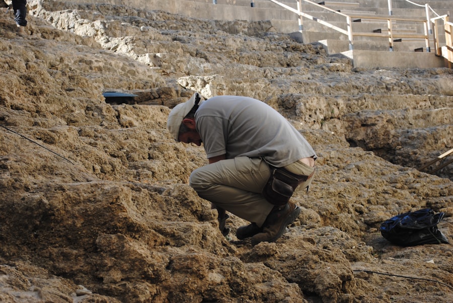
The quest for Helike has been significantly aided by the development and application of advanced technologies that allow for the non-invasive investigation of submerged and buried environments. These tools bridge the gap between the visible surface and the hidden depths, revealing archaeological features that would otherwise remain inaccessible. The integration of these technologies with geoarchaeological principles has created a powerful synergy, enabling researchers to explore the potential locations of Helike with unprecedented accuracy and detail.
Remote Sensing: Surveying from Above and Below
Remote sensing techniques have revolutionized the way archaeologists survey landscapes. In the case of Helike, these technologies are employed both above and below the water. Aerial and satellite imagery can detect subtle changes in land elevation, vegetation patterns, and even submerged structures that are not visible from the ground. For submerged sites, sonar and multibeam echosounder surveys are invaluable. These technologies emit sound waves that bounce off the seabed, creating detailed maps of the underwater topography. They can identify anomalies, such as rectilinear structures or mounds that might indicate the presence of ancient ruins, all without disturbing the seabed.
Geophysical Surveys: Unveiling Subsurface Features
Geophysical surveys employ various physical properties of the earth to map underground structures. Magnetometry, electrical resistivity, and ground-penetrating radar (GPR) are commonly used. Magnetometry detects variations in the earth’s magnetic field, which can be influenced by buried structures or fired materials. Electrical resistivity measures how easily electric current passes through the ground, revealing differences in soil composition and the presence of buried features. GPR uses radar pulses to image the subsurface, revealing layers and anomalies that can indicate buried walls, roads, or other archaeological remains. Applying these techniques to coastal areas and shallow offshore environments can uncover evidence of submerged settlements.
Sediment Core Analysis: The Stratigraphic Detective Work
As previously mentioned, sediment core analysis is a cornerstone of geoarchaeological investigation. Sophisticated drilling equipment is used to extract long cylinders of sediment from the seabed and coastal plains. These cores are then meticulously analyzed in the laboratory. Geoarchaeologists examine the grain size, composition, color, and presence of microfossils and artifacts within each layer. This allows them to build a detailed chronological record of sediment deposition, sea-level fluctuations, and disruptive events, such as earthquakes and tsunamis, which could have impacted human settlements. The precise dating of these layers, often through radiocarbon dating, provides a temporal framework for correlating geological events with proposed historical settlements.
The Helike Project: A Geoarchaeological Breakthrough
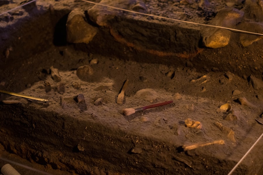
The dedicated efforts of the Helike Project, an international multidisciplinary research initiative, have been instrumental in pushing the boundaries of our understanding regarding the lost city. This project embodies the modern geoarchaeological approach, combining historical research, geological analysis, and advanced technological exploration. Their systematic investigations have moved Helike from the realm of myth towards a tangible archaeological reality, generating compelling evidence for its existence and its catastrophic demise.
Locating Potential Sites: The Power of Interdisciplinary Collaboration
The Helike Project’s success is a testament to the power of interdisciplinary collaboration. Historians and archaeologists provide the textual evidence and the historical context, while geologists and geophysicists bring their expertise in understanding the Earth’s processes and subsurface imaging. This synergistic approach allows for a more comprehensive and nuanced investigation. By cross-referencing ancient texts with geological data and geophysical surveys, the project has been able to identify discrete areas with a high probability of containing submerged archaeological remains that align with the historical narratives of Helike’s location and destruction. This process began by identifying the likely ancient coastline, a crucial first step in pinpointing the city’s potential position.
Geophysical Anomalies: Signatures of a Submerged City
During their extensive surveys of the Gulf of Corinth’s seabed, the Helike Project has identified numerous geophysical anomalies. These anomalies, detected through sonar and multibeam echosounders, have revealed features that are consistent with man-made structures. These include rectilinear shapes, linear alignments, and raised mounds that deviate from the natural seabed topography. These subsurface signatures are precisely what one would expect to find from a submerged ancient city, where structures have become buried under layers of sediment and seafloor deposits. The systematic mapping of these anomalies has narrowed down the search area significantly.
Sediment Cores and the Evidence of Catastrophe
The analysis of sediment cores retrieved from the areas surrounding these geophysical anomalies has provided some of the most compelling evidence to date. These cores have revealed distinct layers of sediment that indicate sudden and catastrophic inundation events. Specifically, the discovery of well-defined tsunami deposits, characterized by their disrupted stratigraphy, coarse grain size, and the presence of marine organisms inconsistent with normal deposition, offers potent corroboration for the ancient accounts. These geological signatures are interpreted as the direct result of a massive seismic event followed by a powerful tsunami that swept across the coastal plain, engulfing and burying settlements. The dating of these tsunami layers has also proven to be crucial, aligning with the timeframe suggested by the historical accounts of Helike’s destruction.
Recent studies in Helike geoarchaeology have shed light on the ancient city submerged by the sea, revealing insights into its cultural and environmental history. Researchers have utilized advanced techniques to analyze sediment layers, providing a clearer picture of the factors that contributed to the city’s demise. For those interested in exploring the complexities of historical narratives and their modern implications, a related article discusses the intricate dynamics of international relations, particularly in the context of trade. You can read more about it in this comprehensive guide on the US-China trade war here.
Uncovering the Geoarchaeological Narrative of Helike’s Demise
| Metrics | Data |
|---|---|
| Excavation Area | Approximately 30,000 square meters |
| Depth of Excavation | Up to 6 meters |
| Artifacts Unearthed | Over 6,000 artifacts |
| Time Period | 4th century BC to 4th century AD |
The collected geoarchaeological data paints a vivid and increasingly coherent picture of Helike’s final moments. It transcends the purely mythological explanation, providing a scientifically grounded narrative of how the city met its tragic end. This understanding is built upon the careful interpretation of geological evidence, revealing the precise sequence of events that led to the city’s submersion.
The Earthquake: The Initial Catalyst
The geoarchaeological evidence strongly suggests that a powerful earthquake was the primary catalyst for Helike’s destruction. Studies of the seismically active Gulf of Corinth indicate that large-magnitude earthquakes have occurred historically. Evidence from sediment cores, such as fault scarps or liquefaction features, can point to the direct impact of seismic shaking. The sudden displacement of land, known as subsidence, caused by such an earthquake would have effectively lowered the coastal plains, allowing the sea to advance inland. The sheer force of the earthquake would have also caused widespread structural damage to the city, initiating its collapse even before the arrival of the tsunami.
The Tsunami: The Inundating Force
Following the seismic event, a massive tsunami is believed to have inundated the region. The geoarchaeological signature of this tsunami is evident in the distinct sediment layers found in core samples. These layers are characterized by the deposition of large amounts of sediment, often mixed with debris from the destroyed city and marine life, rapidly burying the landscape. The extent of these deposits, and their inland reach, provides a measure of the tsunami’s power and its destructive impact on Helike. This inundation would have not only submerged the city but also reshaped the entire coastline, explaining why it was lost to the sea.
Post-Inundation Landscape: A Submerged Legacy
After the cataclysm, the landscape underwent a profound transformation. The lowered landmass, coupled with the deposition of vast quantities of sediment by the tsunami, resulted in the permanent inundation of Helike. Over time, further sedimentation and geological processes would have gradually buried the submerged ruins deeper beneath the seabed. This gradual burial, while obscuring the city from direct view, has also acted as a form of preservation, protecting the archaeological remains from degradation. The geoarchaeological investigation continues to unravel the post-inundation history of the area, piecing together how the landscape evolved and how the submerged legacy of Helike was eventually hidden from human sight.
The study of Helike geoarchaeology offers fascinating insights into ancient civilizations and their interactions with the environment. A related article discusses the intriguing theories surrounding the lost continent of Antarctica, which may provide context for understanding how ancient societies adapted to changing landscapes. For those interested in exploring this connection further, you can read about it in the article on the lost continent of Antarctica.
The Future of Helike: A Continuing Excavation in Time
The work of the Helike Project, grounded in the principles of geoarchaeology, has moved the study of this lost city from the realm of myth into the tangible world of scientific discovery. While significant progress has been made, the excavation of Helike is not a continuous process in the traditional sense, but rather a continuous excavation in time, achieved through the interpretation of geological and archaeological evidence. The ongoing research promises to further illuminate the history of this ancient civilization and the dramatic events that led to its disappearance.
Ongoing Research and Discoveries
The Helike Project remains active, continually refining its understanding of the site and its surroundings. New coring locations are being identified, and existing data is being re-analyzed with the latest technological advancements. Future research will likely focus on more targeted investigations of specific geophysical anomalies, potentially leading to the discovery of more substantial and well-preserved archaeological features. The ongoing quest is to uncover not just the location, but the detailed urban plan, artifacts, and insights into the daily lives of Helike’s inhabitants, all preserved beneath the waves and sediment.
Implications for Understanding Ancient Disasters
The geoarchaeological investigation of Helike has profound implications for our understanding of ancient natural disasters. By providing a tangible example of a city destroyed and submerged by seismic and tsunami activity, it validates and enriches the accounts of ancient historians. It allows for a more accurate assessment of the frequency and impact of such events in antiquity, providing valuable data for historical seismology and disaster preparedness. The story of Helike, once a myth, now serves as a potent reminder of the destructive power of nature and the enduring resilience of human attempts to understand and record their world.
Preserving a Submerged Heritage
The ongoing work at Helike also raises important questions about the preservation of submerged archaeological heritage. As technologies advance, more lost cities and ancient sites are likely to be discovered beneath the sea. Understanding how to investigate, document, and protect these fragile underwater environments is crucial. The geoarchaeological approach, with its emphasis on non-destructive methods and meticulous data collection, offers a model for responsible underwater archaeology. The story of Helike is far from over; it is a continuing narrative being written in the layers of the earth, waiting for future generations to decipher its secrets.

The Lost City That Was Never Really Lost
FAQs
What is Helike geoarchaeology?
Helike geoarchaeology is the study of the ancient Greek city of Helike, which was destroyed by an earthquake and subsequent tsunami in 373 BC. This field of study combines archaeology, geology, and geography to understand the geological and environmental factors that led to the city’s destruction.
What are the main goals of Helike geoarchaeology?
The main goals of Helike geoarchaeology are to uncover and study the remains of the ancient city of Helike, to understand the geological processes that led to its destruction, and to gain insights into ancient Greek civilization and its interactions with the environment.
What methods are used in Helike geoarchaeology?
Helike geoarchaeology employs a variety of methods, including excavation, geological surveys, sediment analysis, and remote sensing techniques such as ground-penetrating radar and LiDAR. These methods help researchers to reconstruct the ancient landscape, identify geological hazards, and locate archaeological remains.
What have been some key findings in Helike geoarchaeology?
Some key findings in Helike geoarchaeology include the discovery of the ancient city’s remains, evidence of the earthquake and tsunami that destroyed it, and insights into the city’s layout and infrastructure. Researchers have also uncovered artifacts and human remains that provide valuable information about ancient Greek society.
How does Helike geoarchaeology contribute to our understanding of ancient civilizations?
Helike geoarchaeology contributes to our understanding of ancient civilizations by providing insights into how they interacted with their environment, how they adapted to geological hazards, and how natural disasters shaped their societies. This field of study also helps to reconstruct the history and culture of the ancient city of Helike and its inhabitants.