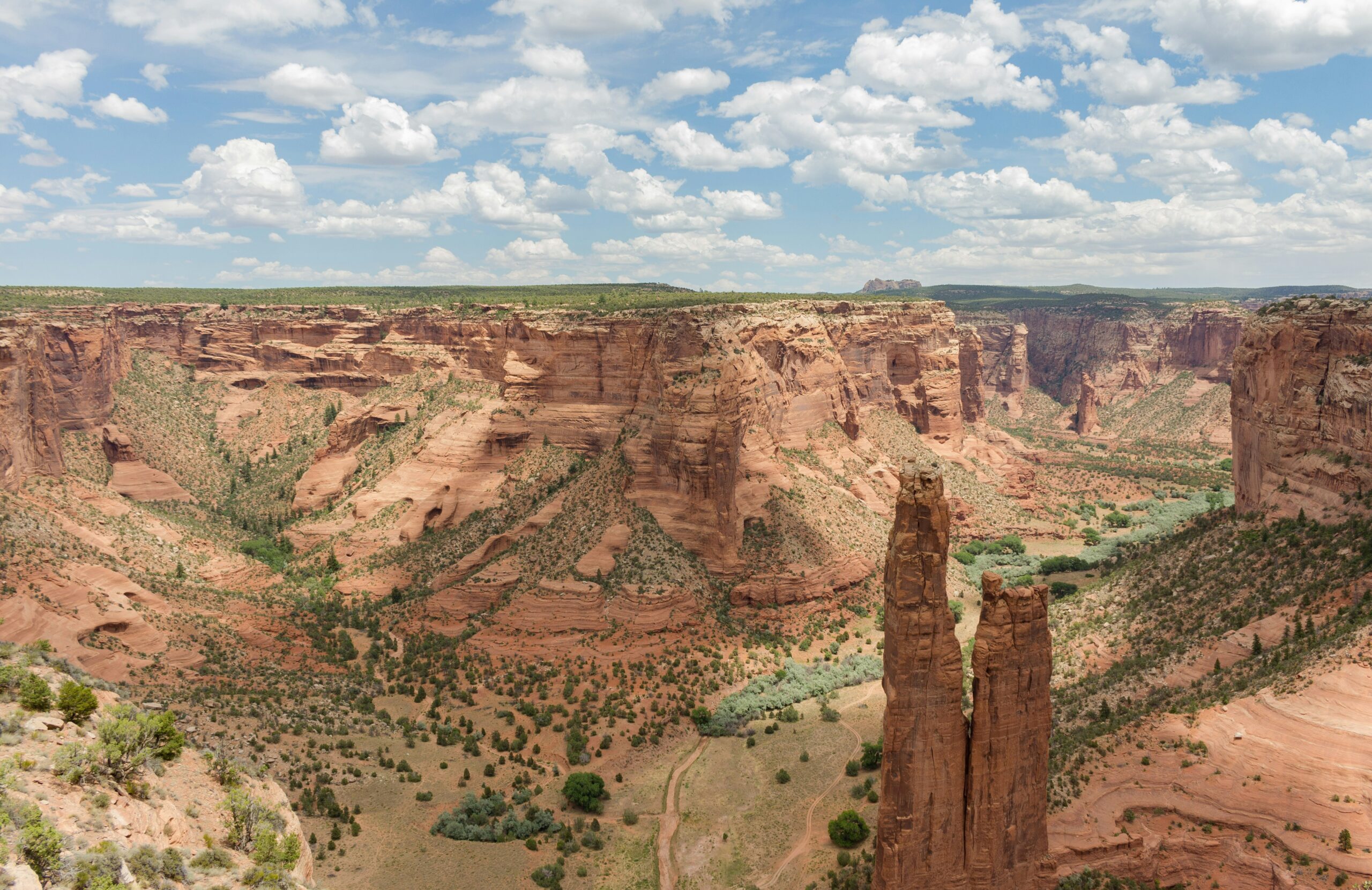
The earth beneath our feet, the towering mountains, the vast oceans – these are more than just landscapes. They are immense libraries, holding within their rock formations, mineral deposits, and fossilized remains the story of our planet’s dynamic past. Uncovering physical evidence in geology is the rigorous and often painstaking process by which scientists decipher these ancient narratives, transforming seemingly inert matter into windows to bygone eras. It’s a journey that transcends mere observation, delving into the intricate molecular structures, the colossal tectonic forces, and the gradual, imperceptible processes that have shaped Earth over billions of years. This exploration is fundamental to understanding everything from the origins of life to the distribution of natural resources and the prediction of future geological hazards.
The very foundation of geological inquiry rests upon the primary evidence found within the Earth’s crust: its rocks. Geologists classify rocks into three main categories based on their formation: igneous, sedimentary, and metamorphic. Each type offers a unique set of clues about the conditions under which it formed, the subsequent events it has endured, and the history of the Earth.
Igneous Rocks: A Glimpse into the Fiery Interior
Igneous rocks are born from the cooling and solidification of molten rock, either magma (beneath the surface) or lava (on the surface). Their textures and compositions are direct indicators of their thermal history.
Extrusive vs. Intrusive Formations
Extrusive igneous rocks, like basalt and rhyolite, form from lava that erupts onto the Earth’s surface. Their rapid cooling results in fine-grained or glassy textures, often with small to invisible crystals. This rapidity signifies volcanic activity, a direct manifestation of the Earth’s internal heat escaping. In contrast, intrusive igneous rocks, such as granite and gabbro, cool slowly beneath the surface. This slow cooling allows for the development of larger, visible crystals, creating coarser textures. The presence of large intrusive bodies, known as plutons or batholiths, provides evidence of significant magma chambers and prolonged periods of molten rock intrusion deep within the crust.
Mineral Assemblages as Thermometers and Barometers
The specific minerals found within igneous rocks are invaluable thermometers and barometers of their formation environment. Minerals like olivine and pyroxene typically form at high temperatures, indicative of deep mantle or fresh magma origins. Minerals such as feldspar and quartz are stable at lower temperatures, often found in evolved magmas. The presence and relative abundance of these minerals, along with accessory minerals, allow geologists to reconstruct the temperature and pressure conditions of magma crystallization. For instance, the discovery of high-pressure minerals like coesite or diamond within igneous rocks points to extremely deep crustal or even mantle pressures during their formation.
Isotopic Signatures: Tracing the Magma’s Source
Beyond mineralogy, isotopic analysis provides a powerful tool for tracing the origin and evolution of igneous rocks. The ratios of different isotopes of elements like oxygen, strontium, and neodymium within minerals can act as fingerprints, distinguishing between magmas derived from the mantle, ancient continental crust, or recycled oceanic crust. This allows geologists to map out the complex pathways of magma generation and differentiation deep within the Earth, revealing patterns of plate tectonics and mantle dynamics over geological time.
Sedimentary Rocks: Layers of Time and Environmental Archives
Sedimentary rocks are formed from the accumulation and cementation of sediment – fragments of pre-existing rocks, minerals, or organic matter. They are arguably the most informative rock type for reconstructing past environments, climates, and the evolution of life.
Stratigraphy: The Language of Layering
The fundamental principle of stratigraphy, the study of rock layers (strata), dictates that in an undisturbed sequence, the oldest layers are at the bottom and the youngest are at the top. This simple yet profound observation allows geologists to establish a relative chronology of geological events. Examining the thickness, continuity, and types of sedimentary layers can reveal information about depositional environments: shallow marine, deep ocean, river valleys, deserts, or glacial landscapes. Changes in lithology (rock type) over time within a stratigraphic column indicate shifts in depositional conditions, such as rising sea levels, sediment supply variations, or changes in climate.
Fossils: Whispers of Ancient Life
Perhaps the most captivating physical evidence within sedimentary rocks is the presence of fossils. These preserved remains or traces of ancient organisms are direct links to past life forms and provide invaluable insights into biological evolution, paleoecology, and paleobiogeography. The presence of marine fossils in what is now dry land is irrefutable evidence of past transgressions (sea level rise). The diversity and type of fossils found in a particular stratum can indicate the environmental conditions at the time of deposition – for example, coral reefs suggest warm, shallow, clear waters. The fossil record, when examined chronologically, provides the backbone for understanding the history of life on Earth, from the earliest microbial mats to the age of dinosaurs and beyond.
Sedimentary Structures: Clues to Dynamic Processes
Beyond fossils, sedimentary rocks preserve a variety of physical structures that offer clues about the processes that transported and deposited the sediment. Ripple marks, formed by the action of wind or water, indicate paleo-currents. Mud cracks, formed when fine-grained sediment dries and shrinks, point to periods of subaerial exposure. Cross-bedding, inclined layers within a larger bed, reveals the movement of sand dunes or submerged sandbars. These structures, collectively known as sedimentary structures, are like the footprints left by geological forces, allowing geologists to reconstruct ancient landscapes and depositional dynamics.
Metamorphic Rocks: Transformed by Heat and Pressure
Metamorphic rocks are formed when pre-existing rocks (igneous, sedimentary, or even other metamorphic rocks) are subjected to intense heat, pressure, or chemically active fluids, causing them to recrystallize and change their mineralogical and textural composition without melting.
Foliation and Lineation: The Imprint of Stress
A hallmark of many metamorphic rocks is foliation, a planar or layered arrangement of mineral grains that develops under directed pressure. This layering can range from the fine, parallel alignment of mica flakes in slate and schist to the distinct banding of alternating light and dark minerals in gneiss. Lineation, a linear arrangement of minerals, can also form under stress. The orientation and intensity of foliation and lineation provide direct evidence of the direction and magnitude of the stresses that have affected the rocks, offering crucial insights into tectonic processes like mountain building and plate collisions.
Index Minerals: Indicators of Metamorphic Grade
Specific minerals form and are stable only within particular ranges of temperature and pressure. These “index minerals” are critical for determining the metamorphic grade, or the intensity of metamorphism a rock has experienced. For example, the appearance of minerals like chlorite, then biotite, garnet, staurolite, and finally sillimanite in a sequence of metamorphic rocks indicates progressively higher temperatures and pressures. By mapping the distribution of these index minerals in a region, geologists can delineate zones of varying metamorphic intensity, revealing the scale and nature of ancient tectonic events.
Recrystallization and New Mineral Growth: Evidence of Transformation
The very nature of metamorphic rocks is their transformation. Observing the intricate interlocking of new mineral crystals that have grown during metamorphism, often replacing original minerals, is direct physical evidence of the geological processes at play. The chemistry of these newly formed minerals can also reveal information about the original rock composition and the presence of fluids that facilitated the metamorphic reactions.
Physical evidence in geology plays a crucial role in understanding the Earth’s history and the processes that shape its surface. One fascinating aspect of this field is the study of celestial bodies, such as the Moon, which can provide insights into geological processes beyond our planet. For an intriguing exploration of the Moon’s status and its implications for geology, you can read the article titled “Is the Moon a Sovereign Territory?” available at this link. This article delves into the legal and geological considerations surrounding lunar exploration and ownership, highlighting the intersection of geology and space law.
Beyond Rocks: The Crucial Role of Geomorphological Evidence
While rocks form the fundamental building blocks of geological understanding, the landforms they create and the processes that shape them also provide indispensable physical evidence. Geomorphology, the study of landforms and the processes that shape them, offers a dynamic perspective on Earth’s history.
Erosional Landscapes: Sculptures of Time
Erosion, the process by which rock and soil are worn away and transported, leaves an indelible mark on the Earth’s surface. Rivers carve valleys, glaciers sculpt mountains and fjords, and wind shapes deserts.
Karst Topography: The Dissolving Power of Water
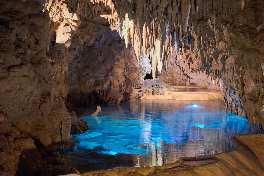
In areas with soluble bedrock, such as limestone, water can dissolve the rock over time, creating distinctive landforms like sinkholes, caves, and underground drainage systems. This karst topography is direct physical evidence of the chemical weathering and dissolution process, indicating past or present hydrological regimes and the presence of specific soluble rock types. The scale and complexity of karst features can reveal the age of the landscape and the duration of these weathering processes.
Glacial Features: Imprints of Ice Ages
The powerful erosive and depositional forces of glaciers have left dramatic evidence in many parts of the world. U-shaped valleys, cirques, moraines (accumulated debris), drumlins (streamlined hills), and erratics (large boulders transported by ice) are all clear indicators of past glaciation. The presence and extent of these features allow geologists to reconstruct the size and movement of ancient ice sheets, providing crucial data for understanding past climate change and its impact on landscapes.
Depositional Landscapes: Archives of Transport and Accumulation
Sediment transported by various agents of erosion is eventually deposited, forming distinct landforms.
Alluvial Fans and Deltas: The Work of Waterways
Where rivers emerge from mountainous terrain or enter larger bodies of water, they deposit sediments, creating alluvial fans and deltas respectively. The size, shape, and internal structure of these depositional features provide evidence of sediment load, river discharge, and the underlying topography. Examining drill cores within these features can reveal cycles of sediment deposition, indicating fluctuating river activity and sea-level changes.
Aeolian Deposits: The Reach of Wind
In arid and semi-arid regions, wind is a significant agent of erosion and deposition. Sand dunes, loess deposits (fine, wind-blown silt), and desert pavement are all physical evidence of aeolian processes. The orientation of dunes and the sorting of sediment grains can reveal prevailing wind directions and intensities, offering insights into past climate conditions.
Microscopic Marvels: The Evidence Within Minerals and Rocks
Geological evidence is not solely confined to visible landforms and macroscopic rock structures. At the microscopic level, minerals and the fine details of rock textures hold a wealth of information.
Petrography: The Art of Thin Sections
Petrography, the study of rocks in thin section under a microscope, is a cornerstone of modern geology. A thin slice of rock, carefully prepared and mounted on a glass slide, allows geologists to examine the individual mineral grains, their shapes, sizes, and arrangements, as well as the relationships between them.
Mineral Identification and Textural Analysis
Through petrographic analysis, geologists can identify minerals based on their optical properties – how they interact with polarized light. This allows for precise mineral identification, even in fine-grained rocks where macroscopic identification is difficult. Furthermore, the textures observed in thin sections – such as the intergranular relationships, the presence of alteration rims, or the evidence of grain breakage and deformation – provide critical clues about the rock’s formation history, diagenesis (processes occurring after deposition but before metamorphism), and the stresses it has endured.
Fluid Inclusions: Trapped Time Capsules
Minerals can trap tiny pockets of ancient fluids within their crystal structures as they grow. These “fluid inclusions” are microscopic time capsules, preserving samples of the fluids that were present during the mineral’s formation. Analysis of the composition and temperature of these trapped fluids can reveal incredibly detailed information about the conditions under which the mineral crystallized, including the salinity of pore water, the presence of dissolved gases, and the temperature of formation. This is invaluable for understanding processes like ore formation, diagenesis, and even the conditions under which life may have emerged.
Geochronology: The Unfolding of Deep Time
While stratigraphy provides relative dating, geochronology provides absolute ages for rocks and geological events. This is achieved through the study of radioactive isotopes.
Radiometric Dating: Earth’s Most Accurate Clocks
Radioactive elements decay at a constant, predictable rate, a process known as radioactive decay. By measuring the ratio of parent radioactive isotopes to their stable daughter isotopes within a mineral, geologists can calculate the time that has elapsed since the mineral crystallized. This technique, called radiometric dating, is the most powerful tool for establishing an absolute timescale for Earth’s history. For example, dating zircons by Uranium-Lead methods has provided ages for the oldest rocks on Earth, pushing back our understanding of the planet’s formation.
Paleomagnetism: Rewinding the Earth’s Magnetic Field
As magnetic minerals crystallize in cooling igneous rocks or settle in sediments, they align themselves with the Earth’s magnetic field at that time. This preserved magnetic orientation, known as paleomagnetism, acts like a compass frozen in time. By studying the direction and intensity of the paleomagnetic field recorded in rocks of different ages, geologists can reconstruct the past movements of tectonic plates, understand the process of magnetic field reversals, and establish global chronologies.
The Evidence of Water and Ice: Agents of Change

Water and ice, in their various forms, are not just geological agents; they are powerful sculptors and carriers of evidence that record Earth’s climatic history and hydrological cycles.
Hydrological Evidence: The Flow of Time
The presence and behavior of water in its liquid and solid states provide a constant stream of geological information.
Groundwater Systems and Aquifers: A Subsurface Record
The study of groundwater, including its flow patterns, chemical composition, and the rock formations it saturates (aquifers), offers insights into recharge rates, residence times, and the geological history of a region. Chemical analysis of groundwater can reveal the types of rocks it has interacted with, providing geochemical evidence of subsurface geology. The extraction and flow of groundwater can also reveal connectivity between different geological units and highlight the impact of human activity on subsurface systems.
Glacial Sediments and Landforms: Frozen History
As mentioned earlier, glaciers leave behind distinct deposits, such as till (unsorted glacial debris), outwash plains (sorted sediment deposited by meltwater), and varves (annual sediment layers in glacial lakes). These deposits are vital archives of past glaciations, providing information about ice movement, thickness, and the timing of glacial advance and retreat. The isotopic composition of ice cores drilled from glaciers provides a direct record of past atmospheric temperatures and composition, offering unparalleled insights into climate change over millennia.
Paleoclimatic Indicators: Decoding Past Climates
The physical evidence preserved in rocks and landforms allows geologists to reconstruct past climates, a crucial endeavor for understanding current environmental changes and predicting future scenarios.
Fossil Assemblages as Climate Proxies
Beyond simply identifying past life, the types of fossils found can act as sensitive indicators of past climate conditions. The presence of tropical plant fossils in a region now experiencing temperate climates, or marine organisms adapted to specific temperature ranges, directly testifies to significant past climatic shifts.
Sedimentological Proxies
Sedimentary structures like freshwater diatom assemblages in ancient lake beds can indicate precipitation and evaporation patterns. The presence of specific mineral precipitates, like evaporites (salts) formed in arid environments, similarly points to past climatic regimes characterized by high evaporation rates.
In the study of geology, physical evidence plays a crucial role in understanding the Earth’s history and processes. For instance, the analysis of rock formations and sediment layers can reveal significant information about past climates and geological events. A fascinating article that discusses the implications of physical evidence in various fields can be found at this link, which explores how different types of evidence inform our understanding of complex systems, much like how geological evidence helps us piece together the Earth’s narrative.
The Unfolding Narrative: Integrating Diverse Evidence
| Physical Evidence in Geology | Definition |
|---|---|
| Fossils | Remains or traces of ancient life preserved in rock |
| Rock Layers | Stratification of rocks that provide information about past environments |
| Mineral Deposits | Concentrations of minerals that indicate past geological processes |
| Faults and Folds | Structural features that reveal tectonic activity |
The power of uncovering physical evidence in geology lies not in the isolated discovery of a single clue, but in the masterful integration of diverse datasets. A geologist’s work is akin to that of a detective, piecing together fragments of information from disparate sources to form a coherent picture of past events.
The Synergy of Disciplines: A Holistic Approach
Modern geological research often involves a multidisciplinary approach. For example, understanding the formation of a particular ore deposit might require:
- Petrography: To identify the minerals present and textural relationships.
- Geochemistry: To analyze the elemental and isotopic composition of the rocks and minerals, tracing the source of metals and the fluids involved.
- Geochronology: To date the mineralization events, providing a timeline for the geological processes.
- Structural Geology: To understand the faulting and folding that created the plumbing system for mineral-bearing fluids.
- Remote Sensing: To map geological structures and rock types over large areas, identifying potential exploration targets.
This integrated approach allows geologists to build a more complete and nuanced understanding of the complex geological processes that have shaped our planet.
Unraveling Earth’s History: From Formation to the Present
By meticulously studying and interpreting physical evidence, geologists have been able to reconstruct the grand narrative of Earth’s history. They have traced the planet’s formation from a swirling disc of dust and gas, witnessed the emergence and diversification of life in its oceans, documented the monumental collisions and rifting of continents, and understood the cycles of ice ages and warmer periods that have characterized its climatic evolution. The physical evidence, from the oldest zircons within the Earth’s crust to the youngest sedimentary layers deposited by our modern rivers, forms the indelible record of this long and complex journey. It is a testament to the enduring power of the natural world to preserve its own history, waiting patiently to be uncovered, interpreted, and ultimately understood.

When the Mediterranean Became a Desert | The Messinian Salinity Crisis Explained
FAQs
What is physical evidence in geology?
Physical evidence in geology refers to the tangible, observable features and characteristics of the Earth’s surface and subsurface that provide information about its geological history, processes, and composition. This evidence includes rock formations, fossils, minerals, landforms, and other geological features.
How is physical evidence used in geology?
Geologists use physical evidence to study and interpret the Earth’s history, understand geological processes, and make predictions about future changes. By analyzing physical evidence, geologists can reconstruct past environments, identify ancient climates, and determine the sequence of geological events that have shaped the Earth’s surface.
What are some examples of physical evidence in geology?
Examples of physical evidence in geology include sedimentary rock layers, fossilized remains of plants and animals, volcanic deposits, fault lines, mineral deposits, and landforms such as mountains, valleys, and canyons. These features provide valuable information about the Earth’s past and present geological processes.
How is physical evidence dated in geology?
Geologists use a variety of dating techniques to determine the age of physical evidence in geology. These techniques include radiometric dating of rocks and minerals, stratigraphic correlation of rock layers, and analysis of fossil assemblages. By combining these methods, geologists can establish the relative and absolute ages of geological features.
Why is physical evidence important in geology?
Physical evidence is important in geology because it provides a direct record of the Earth’s history and helps scientists understand the processes that have shaped the planet over millions of years. By studying physical evidence, geologists can make informed decisions about resource management, environmental conservation, and natural hazard mitigation.