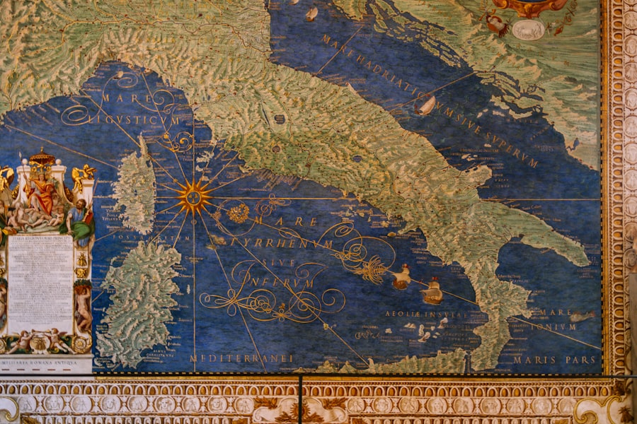
For millennia, humanity has relied on maps to navigate, conquer, and understand its world. From the earliest rudimentary depictions scratched onto cave walls to the sophisticated digital renditions of today, maps serve as windows into our collective knowledge and ambition. But what if some of the most profound cartographic secrets were not lost to time, but actively concealed, guarded by powerful entities for their own advantage? This article delves into the concept of “secret ancient maps” not as mystical artifacts of pure fantasy, but as information whose dissemination and control have been strategically managed, often by state monopolies, throughout history.
Imagine a vast library, not filled with books, but with the very essence of human exploration and territorial claims. This library’s contents, the knowledge contained within its maps, have historically been a source of immense power. Access to a comprehensive understanding of geography, resource locations, and strategic routes could bestow unparalleled advantages upon those who possessed it. It is within this historical context that the idea of state monopolies as guardians, and sometimes suppressors, of crucial cartographic knowledge begins to take shape. These entities, whether ancient empires, colonial powers, or even modern intelligence agencies, have understood that controlling the map is akin to controlling the territory itself.
The Genesis of Cartographic Control: From Royal Surveys to State Archives
The earliest forms of systematic mapmaking often originated with the direct patronage of rulers. As nascent states began to consolidate power and expand their influence, the need for accurate geographical data became paramount. This was not merely for administrative purposes, but for military strategy, economic development, and the assertion of sovereignty. Kings and emperors commissioned surveyors, cartographers, and explorers, not as independent scholars, but as agents of the state. The resulting maps, detailing borders, fortresses, navigable waterways, and agricultural lands, were considered invaluable assets, not to be shared with rival powers or even the general populace who might use such knowledge to circumvent authority or challenge existing power structures.
The Role of Royal Cartographers
Royal cartographers occupied a unique and often privileged position. They were privy to the innermost workings of the state and were entrusted with synthesizing vast amounts of information. Their output was not for public consumption; it was a strategic tool, a blueprint for expansion and control. Think of it like a chef guarding their signature spice blend – the essence of their culinary success is a closely held secret, and so too were the precise details on these early state-commissioned maps. The accuracy and completeness of these maps directly translated into an advantage in warfare, trade negotiations, and territorial claims.
The Emergence of State Archives
As mapmaking evolved, so too did the methods of its preservation and control. The establishment of dedicated state archives marked a crucial development. These repositories were designed to house and safeguard important documents, including maps, for posterity and for the exclusive use of government officials. Maps of contested frontiers, descriptions of newly acquired territories, and plans for infrastructure projects were all locked away, ensuring that only authorized personnel could access this sensitive information. The very act of cataloging and storing these maps within a controlled environment cemented their status as state property and, by extension, a form of intellectual property belonging to the ruling authority.
Colonial Expansion and the Strategic Secrecy of Maps
The age of exploration and colonial expansion is intrinsically linked to the strategic use and deliberate concealment of cartographic knowledge. European powers, driven by economic ambition and a thirst for geopolitical dominance, poured resources into mapping new territories. However, the maps they created were not neutral documents; they were tools of conquest and administration. The knowledge of a continent’s rivers, mountain passes, and indigenous settlements was a critical advantage in subjugating local populations and establishing colonial rule.
The Cartographic Arms Race
As different colonial powers vied for control of territories, a silent cartographic arms race ensued. Naval expeditions were dispatched not only to discover new lands but to chart them with unprecedented detail. These charts, often meticulously drawn and updated, were vital for safe navigation, resource exploitation, and establishing dominance over rival claims. Imagine two generals planning a battle, each with a detailed map of the battlefield. The one with the more accurate and comprehensive map holds a significant, even decisive, advantage. This was the reality for colonial powers; their maps were their battle plans for a global theater.
Encrypted and Classified Information
The secrecy surrounding colonial maps was often profound. To prevent rival nations from gaining an advantage, these maps were frequently classified, encrypted, or held under severe penalties for unauthorized disclosure. Surveyors and naval officers were sworn to secrecy, and the production of duplicates was strictly controlled. The very act of charting a territory could be considered an act of espionage if done by an agent of a rival power. Therefore, safeguarding the original maps and restricting their circulation was a matter of national security.
The Cold War and the Rise of Intelligence Cartography
The 20th century, particularly the Cold War era, witnessed a dramatic escalation in the strategic importance of maps and the efforts to control their dissemination. The ideological struggle between superpowers created a heightened need for intelligence, and cartography became a crucial component of this intelligence gathering and analysis. Satellites provided an unprecedented bird’s-eye view of the world, but interpreting this raw data and translating it into actionable intelligence required sophisticated mapping techniques and rigorous security protocols.
Satellite Imagery and Geospatial Intelligence
The advent of satellite technology revolutionized cartography. Suddenly, vast swathes of the globe could be mapped with a level of detail previously unimaginable. However, this sophisticated data was not made freely available. Governments established dedicated agencies to collect, process, and analyze satellite imagery. This geospatial intelligence, often heavily classified, provided critical insights into military installations, troop movements, resource deposits, and industrial capabilities. The ability to precisely identify and locate targets, or to understand the terrain of potential conflict zones, was a cornerstone of national security strategy.
The “Black” Maps of Espionage
During the Cold War, a distinct category of “secret ancient maps” emerged – not ancient in age, but secret in their creation and purpose. These were the intelligence maps, compiled by spies and analysts, that mapped out enemy infrastructure, vulnerabilities, and operational capabilities. These maps were the culmination of painstaking intelligence gathering, often involving human sources, signals interception, and aerial reconnaissance. Their creation was a clandestine operation, and their contents were guarded with extreme prejudice. The knowledge contained within these maps was the lifeblood of clandestine operations and deterrence strategies, and their unauthorized release could have had catastrophic consequences.
Modern State Monopolies of Geographic Data
Even in the digital age, the concept of state monopolies over geographic data persists, albeit in more sophisticated and often less overtly clandestine forms. While satellite imagery is more accessible than in the past, the highest resolution data, the most detailed topographical surveys, and the most comprehensive geopolitical databases remain under the purview of government agencies. These entities act as gatekeepers to crucial information that underpins national security, economic planning, and technological development.
National Geospatial-Intelligence Agency (NGA) and Equivalents
Organizations like the United States’ National Geospatial-Intelligence Agency (NGA), and their counterparts in other powerful nations, represent modern incarnations of state cartographic monopolies. These agencies are responsible for collecting, analyzing, and disseminating geospatial intelligence to support national defense, disaster relief, and other government functions. While they provide vital services, the very nature of their mandate necessitates a degree of control over the data they generate and manage. The raw, unadulterated datasets, the foundational layers upon which much of our understanding of the world is built, are often restricted.
The Geopolitics of Geographic Information Systems (GIS)
The widespread adoption of Geographic Information Systems (GIS) has further amplified the importance of accurate and comprehensive geographic data. GIS software allows for the sophisticated analysis and visualization of spatial information, making it an indispensable tool for urban planning, resource management, environmental monitoring, and even election analysis. However, the quality and completeness of the data fed into these systems are paramount. States often maintain exclusive rights to high-resolution data, proprietary algorithms, and curated datasets, creating a subtle but significant monopoly over the raw materials that fuel these powerful analytical tools. This is akin to owning the richest veins of ore in a vast mountain range – the potential for extraction and refinement is immense, but access to the ore itself is controlled.
The Future of Secret Maps: Open Source vs. State Control
The ongoing tension between the increasing accessibility of information and the enduring desire for strategic advantage shapes the future of “secret ancient maps.” On one hand, the open-source movement and the proliferation of publicly available satellite imagery and crowdsourced mapping projects are democratizing geographic knowledge. Platforms like Google Earth and OpenStreetMap have made detailed maps and imagery accessible to anyone with an internet connection, chipping away at traditional monopolies.
The Enduring Allure of Hidden Knowledge
However, the allure of hidden knowledge, and the power it confers, is unlikely to disappear entirely. State intelligence agencies will continue to develop advanced methods for data collection and analysis, and the most sensitive information will likely remain classified. The “secret ancient maps” of the future may not be etched on parchment, but exist as encrypted data streams, highly specialized algorithms, or proprietary databases guarded by sophisticated cyber defenses. The nature of secrecy may change, but the human impulse to control vital information, especially that which provides a strategic advantage, remains a constant. The ongoing challenge lies in balancing the legitimate needs of national security and economic development with the broader societal benefit of open access to information. The maps that guide our future, like those of the past, will continue to be shaped by these competing forces.
WATCH NOW ▶️ WARNING: The Giza Muon Scans Just Changed Everything
FAQs
What are secret ancient maps?
Secret ancient maps are historical cartographic documents that were often hidden or kept confidential due to their valuable geographic, political, or economic information. These maps sometimes reveal unknown territories, trade routes, or strategic locations from ancient times.
How do secret ancient maps relate to state monopolies?
Secret ancient maps could have been used by states to establish and maintain monopolies over certain resources, trade routes, or territories. By controlling knowledge of geography and access points, states could dominate economic activities and restrict competitors.
What kinds of monopolies were common in ancient states?
Ancient states often held monopolies over valuable commodities such as salt, spices, metals, and trade routes. These monopolies were enforced through legal, military, or economic means, sometimes supported by secret geographic knowledge from maps.
How were secret maps preserved and transmitted in ancient times?
Secret maps were typically preserved on durable materials like parchment, stone, or metal and were often kept in secure locations such as royal archives or temples. Transmission was limited to trusted officials or scribes to prevent the information from falling into rival hands.
Have any secret ancient maps been discovered in modern times?
Yes, several ancient maps once considered secret or lost have been discovered by archaeologists and historians. These maps provide valuable insights into ancient geography, trade, and political control, shedding light on how states managed their monopolies and territorial claims.