The Enigma of the Nazca Lines: A Geoglyphic Tapestry
The arid plains of the Nazca Desert in southern Peru hold one of the world’s most captivating and enduring mysteries: the Nazca Lines. These colossal geoglyphs, etched into the earth by an ancient civilization, depict an astonishing array of figures, from hummingbirds and monkeys to intricate geometric patterns and what appear to be stylized humanoids. Spanning an area of over 450 square kilometers, these massive earth drawings, some stretching for hundreds of meters, have puzzled archaeologists, scientists, and enthusiasts for decades. Their sheer scale, precise execution, and the sheer enigma of their purpose have cemented their status as a UNESCO World Heritage site and a global icon of ancient ingenuity.
The Nazca culture, which flourished in this region from roughly 100 BCE to 800 CE, is responsible for these monumental artworks. These people were skilled artisans, astronomers, and engineers, as evidenced by their sophisticated pottery, irrigation systems, and, of course, the geoglyphs themselves. The lines were created by removing the reddish-brown iron oxide-coated pebbles that cover the desert surface, exposing the lighter-colored soil beneath. The arid climate, with its lack of rain and wind, has remarkably preserved these delicate etchings for over fifteen centuries, allowing them to endure as silent testaments to a lost civilization. The sheer labor involved in their creation, without the benefit of aerial perspective, is a testament to their meticulous planning and communal effort. The question that inevitably arises is: what was the driving force behind such an immense undertaking?
The recent discovery of the Nazca figure groups trail has sparked significant interest in the study of ancient civilizations and their environmental impacts. This fascinating topic is further explored in a related article that discusses the implications of ancient climate changes on human societies. For more insights into how climate collapse may have influenced historical events, you can read the article here: Uncovering Ancient Climate Collapse Cover-Up.
Whispers from the Past: Theories on the Geoglyphs’ Purpose
The enduring allure of the Nazca Lines lies not only in their visual spectacle but also in the profound mystery surrounding their creation and meaning. Over the years, a multitude of theories have emerged, each attempting to decipher the intentions of the Nazca people. These interpretations range from the practical to the profoundly spiritual, reflecting the inherent complexity of understanding a culture so distant in time. While no single theory has achieved universal consensus, they collectively paint a picture of a society deeply connected to its environment and its cosmology.
Celestial Calendars and Astronomical Alignments
One of the most widely discussed theories posits that the Nazca Lines served as a vast astronomical calendar or observatory. Proponents of this idea, including prominent researchers like Maria Reiche, who dedicated much of her life to studying and preserving the lines, suggest that certain figures and lines align with celestial events. They argue that the Nazca people, keenly observant of the night sky, may have used the geoglyphs to track the movements of the sun, moon, and stars. For instance, specific lines might point to the sunrise or sunset on significant solstices or equinoxes, allowing the Nazca to mark agricultural seasons or religious festivals. The precision required for such alignments, especially without advanced tools, speaks to a sophisticated understanding of astronomy.
The geometric patterns, in particular, lend credence to this theory. Rectangles, trapezoids, and zigzags could represent star constellations or celestial pathways. The sheer number of lines radiating from certain points could indicate observation points for specific astronomical phenomena. The painstaking measurements and planning necessary to achieve these alignments suggest a deep reverence for the cosmos and a desire to integrate their lives with its predictable rhythms.
Ritualistic Pathways and Ceremonial Landscapes
Another prominent interpretation suggests that the Nazca Lines functioned as ritualistic pathways or sacred ceremonial landscapes. This perspective emphasizes the potential for the geoglyphs to have been part of elaborate religious ceremonies or processions. The Nazca people may have walked along these lines during specific rituals, imbuing the figures and pathways with spiritual significance. The sheer size of some of the figures would have made them invisible from ground level, suggesting that their purpose was not purely for the visual appreciation of those on the earth.
Theories abound regarding the specific nature of these ceremonies. Some suggest they were fertility rites, aiming to appease deities responsible for rain and agriculture in the harsh desert environment. Others propose they were related to shamanic practices or journeys into the spirit world. The animal figures, such as the spider, hummingbird, and monkey, might have represented totemic animals or deities associated with specific powers or domains. The act of walking these sacred paths could have been a form of prayer, meditation, or a means of connecting with the divine.
Water Worship and Agricultural Significance
Given the extreme aridity of the Nazca Desert, water was undoubtedly a precious and life-sustaining resource. A compelling theory connects the geoglyphs to the Nazca people’s deep concern for water and their sophisticated understanding of hydraulic engineering. Some researchers propose that the lines and figures are related to the worship of water deities or to rituals designed to ensure the flow of water, essential for their survival and agriculture.
The figures themselves may hold symbolic meaning in relation to water. For example, the hummingbird, often associated with water and rain in Andean cultures, appears frequently. The spider, another common motif, is sometimes linked to water sources or the ability to create something from nothing. Furthermore, the Nazca constructed intricate underground aqueducts, known as puquios, to channel water from the Andes to their settlements. It is possible that the geoglyphs served as a visual manifestation of their prayers or appeals for water, or perhaps as maps or indicators related to their water management systems. The act of creating these vast images might have been a communal offering or a way of honoring the forces that provided them with life.
The Mechanics of Creation: How Were They Made?
The sheer scale and precision of the Nazca Lines invariably lead to questions about the methods employed by their creators. Without modern technology, how did the Nazca people manage to design and execute such monumental artworks across such a vast expanse? Understanding the techniques involved offers valuable insights into their ingenuity and organizational capabilities.
Simple Tools, Profound Ingenuity
Contrary to some speculative theories involving advanced technology or extraterrestrial intervention, the creation of the Nazca Lines likely involved relatively simple tools and methods, albeit executed with remarkable skill and planning. The fundamental technique involved removing the dark, oxidized surface layer of pebbles, revealing the lighter, underlying soil. This was achieved by scraping and digging, likely using wooden or stone tools.
The Role of Templates and Observation Points
The precision of the figures suggests the use of some form of template or guiding system. Archaeologists hypothesize that the Nazca people may have used smaller-scale drawings or models to guide their work. These could have been made of wood, clay, or even drawn on the ground in a smaller area. They might have also used ropes and stakes to lay out the lines and curves.
Crucially, the Nazca people would have needed an elevated vantage point to oversee and guide the creation of such large-scale designs. While they wouldn’t have had airplanes, they could have utilized natural formations like hills or constructed simple scaffolding. The fact that many of the figures are only fully discernible from a distance or from above underscores the importance of planning and spatial reasoning. This suggests a well-organized society capable of coordinating labor and overseeing a project of immense complexity.
Preserving a Legacy: The Ongoing Efforts
The remarkable preservation of the Nazca Lines is a testament to the unique environmental conditions of the Nazca Desert. However, these ancient marvels are not immune to the threats of the modern world. Protecting this invaluable cultural heritage requires constant vigilance and dedicated efforts from various organizations and individuals.
Threats to the Geoglyphs
Despite their resilience, the Nazca Lines face several challenges. Foot traffic from tourists, particularly in areas where they are more accessible, can cause erosion and damage to the delicate lines. Vehicle traffic, including unauthorized off-road driving, poses a significant threat, as tires can crush and obliterate parts of the geoglyphs.
The changing climate also presents potential risks. While the desert is arid, shifts in weather patterns, increased rainfall, or more intense sandstorms could gradually degrade the lines. Furthermore, development and infrastructure projects in the surrounding areas, though often necessary, need to be carefully planned to avoid impacting the geoglyphic sites.
Conservation Initiatives and Research
Recognizing the fragility of this ancient art, numerous conservation efforts are underway. Organizations like UNESCO, in collaboration with the Peruvian government and local communities, work to monitor the condition of the lines, implement protective measures, and educate the public about their importance.
Ongoing archaeological research continues to shed light on the Nazca culture and the creation of the geoglyphs. New technologies, such as drone imagery and satellite mapping, are proving invaluable in documenting the lines, identifying previously undiscovered figures, and analyzing their spatial relationships. This research not only enhances our understanding of the geoglyphs themselves but also contributes to broader archaeological knowledge of ancient Andean civilizations.
The recent discovery of the Nazca figure groups trail has sparked significant interest in the study of ancient civilizations and their communication methods. This fascinating topic is further explored in an article that delves into the nuances of diplomatic language in ancient politics, shedding light on how these early societies may have interacted with one another. For those interested in understanding the complexities of ancient communication, you can read more about it in this insightful piece on the art of diplomatic language.
Experiencing the Lines: A Journey of Discovery
| Metric | Details |
|---|---|
| Discovery Year | 2018 |
| Location | Peru, Nazca Desert |
| Number of New Figures Discovered | 50+ |
| Types of Figures | Animals, geometric shapes, humanoid figures |
| Trail Length | Approximately 10 kilometers |
| Discovery Method | Drone surveys and aerial photography |
| Estimated Age of Figures | Between 500 and 2,000 years old |
| Significance | Expands understanding of Nazca culture and their geoglyphs |
For many, the opportunity to witness the Nazca Lines firsthand is a profound and unforgettable experience. While the mysteries surrounding their creation may endure, the sheer awe-inspiring nature of these geoglyphs transcends mere intellectual curiosity.
Flights Over the Ancient Canvas
The most common and arguably the most effective way to appreciate the full scale and artistry of the Nazca Lines is through aerial tours. Small aircraft offer flights over the Nazca plain, providing breathtaking perspectives of the most famous figures and intricate designs. From this vantage point, the patterns and alignments become strikingly clear, allowing visitors to grasp the immense planning and execution involved. The silence of the desert, broken only by the hum of the aircraft, amplifies the sense of wonder and contemplation.
Ground-Level Exploration and Observation Points
While aerial views are unparalleled, ground-level exploration also offers a unique perspective. Designated observation towers have been erected at strategic points, allowing visitors to view some of the larger figures from a higher elevation. Walking along marked paths in certain accessible areas can provide a more intimate connection with the earthworks, allowing one to appreciate the texture of the exposed soil and the careful craftsmanship. However, it is crucial for visitors to stay on designated paths to avoid damaging the fragile geoglyphs.
Recent discoveries regarding the Nazca figure groups have shed new light on the ancient geoglyphs of Peru, revealing intricate patterns and potential connections to the region’s cultural history. For those interested in exploring how historical narratives can shape our understanding of geography, a related article discusses the complexities of regional identities in Belgium, specifically focusing on Flanders and Wallonia. You can read more about this fascinating topic in the article here.
The Enduring Legacy of the Nazca Civilization
The Nazca Lines are far more than just ancient drawings etched into the desert floor. They are a profound testament to the ingenuity, artistic expression, and spiritual depth of a long-lost civilization. Their enduring presence continues to ignite our imaginations, prompting us to ponder the lives, beliefs, and aspirations of the people who created them.
The ongoing quest to understand the Nazca Lines reflects humanity’s deep-seated desire to connect with its past and unravel the enigmas that time leaves behind. Whether viewed as celestial calendars, sacred pathways, or expressions of their relationship with the natural world, the geoglyphs stand as a powerful reminder of the remarkable capabilities of human creativity and the enduring mysteries that lie buried beneath the sands of time. The Nazca Desert, with its silent figures, continues to whisper stories of a civilization that dared to leave its indelible mark on the very face of the earth, a legacy that continues to captivate and inspire generations.
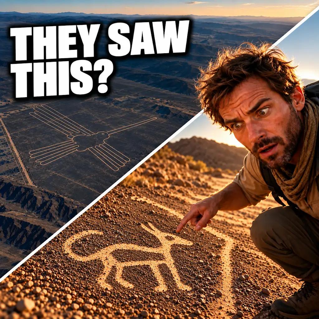
AI Found New Nazca Drawings—Could People See Them from the Ground?
FAQs
What are Nazca figure groups?
Nazca figure groups are a collection of geoglyphs created by the ancient Nazca civilization in southern Peru. These geoglyphs are large designs made on the ground by removing rocks and earth to create shapes visible from above.
What is the Nazca figure groups trail discovery?
The Nazca figure groups trail discovery refers to the recent finding of a new series of geoglyphs in the Nazca Desert. These newly discovered geoglyphs are believed to be part of a larger trail of figures that were previously unknown.
Who discovered the Nazca figure groups trail?
The Nazca figure groups trail was discovered by a team of archaeologists and researchers from a local university in Peru. They were conducting aerial surveys of the Nazca Desert when they spotted the previously unseen geoglyphs.
What do the Nazca figure groups depict?
The Nazca figure groups depict various animals, plants, and geometric shapes. Some of the most famous Nazca geoglyphs include the hummingbird, spider, and monkey figures. The newly discovered trail is expected to contain similar designs.
Why are the Nazca figure groups significant?
The Nazca figure groups are significant because they provide valuable insights into the culture and beliefs of the ancient Nazca civilization. The intricate designs and sheer size of the geoglyphs also showcase the advanced engineering and artistic skills of the Nazca people.