
The vast, arid plains of the Nazca Desert in southern Peru hold one of the world’s most enigmatic archaeological treasures: the Nazca geoglyphs. These colossal figures, etched into the earth by the ancient Nazca civilization over two millennia ago, have long captivated imaginations. While aerial photography has revealed their grandeur – the hummingbird, the monkey, the astronaut – a significant question lingers: what was their visibility from the ground? This exploration delves into the challenges and possibilities of experiencing these monumental artworks not from the heavens, but from the very earth that bears their outlines.
The Silent Giants: Scale and Perspective
The sheer scale of the Nazca geoglyphs is their most defining characteristic. Spanning hundreds of meters, some figures are so large that their complete forms are only discernible from a significant altitude. This immediately presents a fundamental challenge to understanding their ground-level visibility. The Nazca people, who created these designs between roughly 500 BCE and 500 CE, would have lived and worked within the landscape that hosts these geoglyphs. Their daily lives, their rituals, and their understanding of the world were intrinsically tied to this terrestrial plane. Therefore, contemplating ground-level visibility is not merely about whether the entire figure could be seen at once, but rather about how these designs might have been perceived and interacted with by people embedded within their environment.
Early Explorers and the Ground-Level Quandary
Before the advent of flight, the Nazca geoglyphs remained largely unknown to the wider world. Local communities were undoubtedly aware of their existence, perhaps incorporating them into their folklore or spiritual practices. However, it was through the pioneering aerial surveys of the 20th century that the true extent and complexity of the geoglyphs were revealed. Early explorers, such as pilots and archaeologists conducting surveys from low-flying aircraft, were the first to truly appreciate the scale. Yet, even their initial observations were from heights that provided a panoramic view, far exceeding typical ground-level vantage points. The very act of discovering these figures from above cemented the aerial perspective as the primary means of appreciating their full forms. This created a paradox: the geoglyphs were discovered from the sky, yet their creators were ground-dwelling humans. This disconnect fueled the debate about their original purpose and how they were meant to be experienced by the Nazca people themselves. Did they serve a terrestrial function that did not require a comprehensive aerial view? Or was the knowledge of their overall design a communal, perhaps even mystical, understanding passed down through generations, rather than a visual certainty for every individual?
The Illusion of the Horizon
The curvature of the Earth, though subtle over short distances, plays a crucial role in limiting ground-level visibility of large-scale features. Imagine standing in a vast, flat plain. While you can see for miles, your vision is ultimately constrained by the horizon. For a geoglyph to be fully visible from the ground, it would need to extend from your immediate vicinity all the way to the horizon, or a substantial portion of it would need to be visible as you approach. Many Nazca geoglyphs, particularly the more complex zoomorphic figures, are not designed in a way that lends itself to such a continuous visual sweep from a single ground-level viewpoint. Instead, sections of the figures would disappear behind the earth’s curvature or simply be too vast to encompass within the field of vision. This is not to say that the Nazca people saw nothing. Rather, their experience was likely fragmented, piecemeal, and perhaps understood through a different sensory or conceptual framework. The act of walking along the lines, or observing different sections from varying points, would have contributed to a more cumulative, rather than instantaneous, appreciation of the designs.
The Role of Terrain and Elevation
While the Nazca plateau is largely flat, there are subtle variations in terrain and the presence of low hills that could influence ground-level visibility. Moving to higher ground, even by a few meters, can significantly expand one’s visual range. It is plausible that the Nazca people utilized natural elevations or perhaps even constructed small viewing platforms or mounds to gain a better perspective on certain geoglyphs. These would not necessarily have offered a complete aerial view, but they could have allowed for the recognition of larger patterns or the connection of disparate parts of a design. The understanding of “visibility” from the ground must therefore be nuanced. It is not solely about a single, uninterrupted line of sight, but a combination of direct viewing, memory, communal knowledge, and perhaps even tactile engagement with the lines themselves. The very act of tracing the lines by foot could have provided a unique and intimate understanding of the geoglyphs’ forms and their relationship to the landscape.
The Nazca geoglyphs, renowned for their intricate designs etched into the Peruvian desert, have long captivated researchers and visitors alike, particularly regarding their visibility from ground level. While many believe these geoglyphs were created for aerial observation, recent studies suggest that their visibility may have been intended for ritualistic purposes or to be seen from nearby hills. For those interested in exploring other ancient marvels of engineering, a fascinating article on the ancient Persian qanat system, which showcases an innovative approach to water management, can be found here: The Ancient Persian Qanat System: A Water Management Marvel.
Experiencing the Lines: Beyond the Aerial Gaze

The persistent focus on aerial visibility has, perhaps, overshadowed the more nuanced and tangible ways in which the Nazca people might have experienced their geoglyphs. The sheer effort involved in creating these massive etchings suggests a profound significance that transcended mere visual representation. Exploring ground-level experiences requires shifting our perspective from that of a distant observer to that of an active participant within the landscape. This involves considering how the geoglyphs might have been perceived through movement, sound, and even ritualistic interaction.
Walking the Pathways of Giants
One of the most intuitive ways to experience the Nazca geoglyphs from ground level is by walking along their very lines. The Nazca people likely used these lines as pathways for ceremonies, processions, or as routes for accessing different parts of the Nazca plateau. As one walks, the immense scale becomes apparent not as a complete image, but as a series of expansive, directional lines stretching into the distance. The texture of the disturbed earth, the clarity of the packed ground, and the subtle changes in the desert floor all contribute to an embodied understanding of the geoglyphs. While the complete form of a hummingbird might be lost to the horizon, the feeling of following its outstretched beak or the curve of its wing as it recedes into the distance offers a powerful connection to the creators and their intentions. This experience is less about a static visual appreciation and more about a dynamic, kinetic engagement with the artwork. The repetitive nature of walking along these lines could have induced a meditative state, further enhancing the spiritual or ritualistic aspect of their use.
The Art of Approximation and Association
Even without seeing the entire geoglyph, the Nazca people could have recognized recognizable elements and associations from ground level. For example, a long, straight line might be interpreted as the body of a snake or the edge of a bird’s wing. The repetition of certain patterns or motifs across different geoglyphs could have reinforced their meaning and aided in their identification. Furthermore, the surrounding landscape might have played a role in associating specific geoglyphs with particular features. A geoglyph situated near a hill or a dry riverbed might have been understood in relation to that geographical marker. This implies a form of “recognition by parts” or “recognition by association,” where a complete visual gestalt was not always necessary for identification or comprehension. The Nazca people likely possessed an intimate knowledge of their territory, and the geoglyphs were integrated into this lived experience, not imposed upon it as abstract aerial art. Their understanding would have been built over time, through repeated exposure and communal transmission of knowledge.
The Whispers of the Wind and the Shifting Sands
The desert environment is not static. The wind constantly reshapes the sands, and the sun’s position changes throughout the day, casting shadows that can subtly alter the appearance of the geoglyphs. From the ground, these subtle shifts could have been more apparent than from high above. The Nazca people, living in constant proximity to these forces, would have been attuned to such changes. A geoglyph might have appeared more prominent at certain times of the day, or its features might have been emphasized by the angle of the sun. The wind, blowing across the lines, could have created subtle auditory cues, a soft rustling sound that, in the quiet of the desert, might have been associated with the presence of the geoglyphs. These are sensory experiences that are largely lost to the aerial observer. The ground-level experience is one of constant interaction with the environment, where the geoglyphs are not just static drawings but dynamic elements within a living landscape.
Theories of Purpose: Grounded Interpretations
The question of ground-level visibility is inextricably linked to the ongoing debate about the purpose of the Nazca geoglyphs. If they were primarily intended for aerial viewing, their purpose might be linked to deities or celestial beings. However, if they were meant to be understood and utilized by the Nazca people on the ground, their functions could be more terrestrial, relating to ritual, agriculture, or astronomical observation. Exploring these grounded interpretations offers a different lens through which to understand the geoglyphs.
Ritual Landscapes and Ceremonial Pathways
One prominent theory suggests that the geoglyphs served as a vast ceremonial landscape. The lines themselves may have been walked during rituals, processions, or pilgrimages. Different figures could have represented deities, ancestors, or cosmological concepts, and specific events or ceremonies might have been enacted at or around particular geoglyphs. From the ground, the experience of walking these lines would have been profoundly immersive and spiritual. Imagine a group of Nazca people, chanting and moving along the lines, their focus on the immediate path and the collective experience. The lack of full aerial visibility from any single point would not diminish the spiritual significance; rather, it would encourage a deeper engagement with the process and the journey. The geoglyphs could have acted as a form of communal prayer etched into the earth, visible in its entirety only to the gods or spirits they were meant to appease. This perspective emphasizes the performative and participatory nature of their creation and use.
Astronomical Alignments and Calendrical Markers
Another compelling theory proposes that some geoglyphs are aligned with celestial events, serving as a giant astronomical calendar or observatory. While many of these alignments are best confirmed from aerial views, the possibility of ground-level observation of specific celestial phenomena in relation to the geoglyphs exists. For instance, the rising or setting of a particular star or the sun at specific points along the horizon might have been observed by individuals standing on or near the geoglyphs. These observations would not require the entire geoglyph to be visible, but rather a specific alignment between a point on the ground and a celestial body. The Nazca people were keen observers of the natural world, and their understanding of seasons and agricultural cycles would have been crucial for survival. The geoglyphs, from a ground-level perspective, could have served as a tangible system for tracking time and predicting important agricultural events. The careful placement of certain lines might have indicated solstices or equinoxes, providing crucial cues for planting and harvesting.
Water Management and Fertility Cults
In the arid Nazca region, water was and remains a precious resource. Some researchers propose that the geoglyphs are connected to ancient water management systems or fertility cults. The lines might have been used to channel water, or their forms might have represented rain gods or symbols of fertility. From the ground, the geoglyphs would have been integrated into the practical concerns of daily life. A long, straight line might have served as a marker for an underground aqueduct, or a particular animal figure could have been associated with rituals to ensure rainfall. This interpretation grounds the geoglyphs in the immediate needs and beliefs of the Nazca people, suggesting that their creation was not purely an artistic or spiritual endeavor but a practical one with vital implications for their survival and prosperity. The act of walking along these lines, perhaps during ceremonies to appease deities for water, would have been a direct interaction with the forces that governed their lives.
The Challenge of Interpretation: Modern Eyes on Ancient Art
Understanding the ground-level visibility of the Nazca geoglyphs is a complex archaeological and anthropological endeavor. It requires us to shed our modern, often aerial-centric, perspective and attempt to reconstruct how people living within that landscape would have perceived and interacted with these monumental artworks. Modern methods of investigation are crucial in this process, combining meticulous fieldwork with cutting-edge technology.
Archaeological Excavation and Ground-Level Evidence
Archaeological excavations have provided invaluable insights into the Nazca culture, revealing their daily lives, their tools, and their beliefs. While excavations rarely uncover the geoglyphs themselves in their entirety, they can reveal evidence of human activity around and within the lines. The discovery of pottery shards, tools, or ceremonial offerings along the geoglyph lines can indicate their use as pathways or ritual sites. The careful analysis of soil disturbance and the patterns of erosion can also provide clues about how the lines were maintained and used over time. By meticulously documenting the archaeological context, researchers can build a more comprehensive picture of how the Nazca people interacted with these designs from the ground up. This process is akin to assembling a giant, intricate puzzle, where each unearthed artifact provides a small but significant piece of the larger narrative.
Geolocation and Micro-Visibility Studies
Modern technology, particularly GPS and advanced geolocation techniques, allows for precise mapping of the geoglyphs. This enables researchers to conduct “micro-visibility” studies, analyzing which parts of a geoglyph are visible from specific ground-level points. By systematically surveying different locations and elevations, researchers can create detailed maps of potential lines of sight. These studies can reveal patterns that might have been exploited by the Nazca people, such as specific vantage points that offered partial views of larger figures or alignments with distant landmarks. While these technologies cannot fully replicate the sensory experience of the Nazca people, they can provide a scientific basis for understanding the limitations and possibilities of ground-level perception. The data generated can then be correlated with archaeological findings to create a more robust interpretation of the geoglyphs’ intended use and visibility.
Reconstructing the Nazca Worldview
Ultimately, understanding ground-level visibility is about reconstructing the worldview of the Nazca people. It requires considering their sensory perceptions, their understanding of space and time, and their relationship with the divine and the natural world. It is a multidisciplinary challenge that draws upon archaeology, anthropology, astronomy, geography, and even cognitive science. The geoglyphs are not simply pictures etched in the desert; they are a manifestation of a complex belief system and a sophisticated understanding of their environment. By focusing on ground-level visibility, we are not diminishing the wonder of the aerial perspective but rather enriching it, adding a layer of human experience that is often overlooked. It is about recognizing that while the full artistic vision might have been an aspiration for the heavens, the lived experience and practical application were firmly rooted on the earth.
The Nazca geoglyphs, often admired for their intricate designs and vast scale, present a fascinating challenge when it comes to visibility from ground level. While many people believe that these ancient figures can only be fully appreciated from the air, recent studies suggest that certain vantage points on the ground may reveal unique perspectives of the geoglyphs. For those interested in exploring the broader implications of ancient technologies and their mysteries, a related article discusses various lost technologies and their significance in understanding human history. You can read more about this intriguing topic in the article found here.
The Enduring Mystery: A Legacy of Wonder
| Metric | Value | Unit | Notes |
|---|---|---|---|
| Average Line Width | 30 | cm | Width of geoglyph lines at ground level |
| Average Line Length | 200 | m | Typical length of major geoglyph lines |
| Visibility Range from Ground | 50-100 | m | Estimated distance at which geoglyphs are recognizable on foot |
| Elevation Difference | 0-10 | m | Variation in ground elevation within geoglyph area |
| Contrast Ratio (Line vs Surrounding Soil) | 1.5 | Unitless | Reflectance difference aiding visibility |
| Average Viewing Angle | 5-15 | Degrees | Typical angle from ground to view entire figure |
| Time of Day for Optimal Visibility | Early Morning / Late Afternoon | Time | When shadows enhance line visibility |
The Nazca geoglyphs continue to be a source of profound mystery and wonder, and the question of their ground-level visibility is an integral part of that enigma. While aerial views reveal their breathtaking scale and intricate designs, exploring their terrestrial perception offers a deeper connection to the ancient civilization that created them. It suggests a world where meaning was found not just in grand panoramas, but in the intimate experience of walking, observing, and interacting with the earth itself.
The Complementary Nature of Perspectives
It is increasingly understood that ground-level and aerial perspectives are not mutually exclusive but rather complementary. The Nazca people likely possessed both a grounded understanding of the lines and an accumulated, perhaps even conceptual, awareness of their overall forms. This duality is not a contradiction but a testament to the complexity of their culture. The geoglyphs might have served multiple purposes, catering to different audiences and different levels of understanding. A shaman walking the lines might have experienced a profound spiritual connection, while a farmer might have used them as markers for seasonal changes. The aerial view, while not necessarily the primary mode of creation or daily use, could have served as a powerful reinforcement of the geoglyphs’ significance, perhaps through myth, storytelling, or ritualistic reenactments that invoked the celestial realm.
The Human Element: Intent and Interaction
The human element is paramount when considering ground-level visibility. The Nazca people were not passive observers; they were active creators and users of these designs. Their intent, their daily lives, and their cultural practices shaped how these geoglyphs were perceived and utilized. The ongoing research into ground-level visibility seeks to re-center the human experience, moving beyond the purely visual spectacle to understand the practical, spiritual, and social dimensions of these ancient artworks. It is about acknowledging that while the lines are vast, the hands that created them were human, and the feet that walked them were also human. This anthropocentric approach is crucial for unlocking the deeper meaning and legacy of the Nazca geoglyphs.
A Living Legacy in the Desert
The Nazca geoglyphs, even after millennia, remain a vibrant and compelling testament to human ingenuity and spiritual depth. The exploration of their ground-level visibility underscores that their significance lies not solely in their photographic grandeur but in their integration into the lives and beliefs of the people who created them. As we continue to study these silent giants, we are reminded that understanding ancient wonders often requires us to walk in their footsteps, to feel the earth beneath our feet, and to appreciate the profound connections that can be forged between humanity, the landscape, and the mysteries of the universe. The desert, in its vastness and silence, still whispers tales of the Nazca people, and by looking at their creations from the ground, we can begin to hear those whispers more clearly.
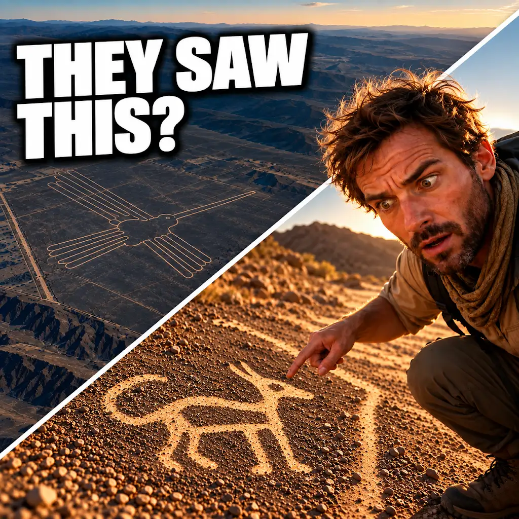
AI Found New Nazca Drawings—Could People See Them from the Ground?
FAQs
What are Nazca geoglyphs?
Nazca geoglyphs are large designs created on the ground in the Nazca Desert in southern Peru. They are believed to have been made by the ancient Nazca people between 500 BC and 500 AD.
How are Nazca geoglyphs best viewed?
Nazca geoglyphs are best viewed from the air, as they are large and intricate designs that can only be fully appreciated from above. However, some geoglyphs are also visible from certain elevated viewpoints on the ground.
Can Nazca geoglyphs be seen from ground level?
Yes, some Nazca geoglyphs can be seen from ground level, particularly those located on hillsides or elevated areas. However, the full extent and intricacy of the designs are best appreciated from the air.
Are there any restrictions on visiting Nazca geoglyphs?
Yes, there are restrictions on visiting Nazca geoglyphs to protect them from damage. Visitors are not allowed to walk on or touch the geoglyphs, and drone flights over the area are also prohibited.
What is the significance of Nazca geoglyphs?
The purpose of Nazca geoglyphs is still a subject of debate among archaeologists and historians. Some theories suggest they were used for religious or astronomical purposes, while others believe they served as markers for water sources or pathways.