Understanding Stratigraphy: Unveiling Earth’s Layers
The Earth’s crust is a vast, intricate record, a colossal archive meticulously documenting billions of years of geological history. To decipher this profound narrative, geologists turn to stratigraphy, a fundamental branch of geology that studies rock layers, or strata, and their sequential relationships. Stratigraphy is not merely about observing patterns in the ground; it is a powerful analytical tool that allows scientists to unravel the Earth’s past, understand its geological evolution, and even predict future geological events. By meticulously examining the superposition, lithology, and fossil content of rock layers, geologists can reconstruct ancient environments, track the movement of continents, and witness the ebb and flow of life on our planet. It is a detective story written in stone, where each layer offers a clue to the events that transpired during its formation.
At the heart of stratigraphy lie a set of guiding principles that form the bedrock of its analytical methods. These principles, established over centuries of geological observation, provide the framework for interpreting the sequence and age of rock layers. Without these fundamental laws, the complex geological history preserved within the Earth’s crust would remain inscrutable.
The Law of Superposition: The Unwavering Order of Time
Perhaps the most intuitive and universally applied principle in stratigraphy is the Law of Superposition. This law states that in an undisturbed sequence of sedimentary rocks, the oldest layers are at the bottom, and the youngest layers are at the top. Imagine baking a cake; each layer of batter and filling is added one on top of the other. The first layer you pour is at the very bottom of the finished cake, while the last layer you sprinkle on top is the highest. Similarly, in geological formations, sediments are deposited layer by layer over vast stretches of time. The first sediments to settle in a basin will form the lowest strata, and subsequent deposition will build upwards, with newer layers accumulating on top of older ones. This principle is crucial for establishing a relative chronological order of rock units. It allows geologists to determine which layer is older than another without needing to know their absolute age. While faulting, folding, and erosion can disrupt this pristine layering, understanding the original depositional sequence is the starting point for any stratigraphic investigation.
The Principle of Original Horizontality: The Natural Pose of Sediments
Another cornerstone principle, the Principle of Original Horizontality, posits that sedimentary rocks were originally deposited in horizontal or near-horizontal layers. This is a natural consequence of deposition by gravity, whether from water, wind, or ice. Sediments tend to settle evenly across a surface, forming planar sheets. If sedimentary rock layers are found tilted, folded, or even overturned, it indicates that subsequent geological forces, such as tectonic movements, have acted upon them after their deposition. Recognizing these deformations is key to interpreting the geological history of a region, as it reveals episodes of mountain building, faulting, or volcanic activity that have altered the original sedimentary pancake.
The Principle of Lateral Continuity: The Extended Reach of Layers
The Principle of Lateral Continuity suggests that sedimentary layers extend laterally in all directions until they thin out, encounter a barrier, or grade into a different rock type. This principle is vital for correlating rock layers across different locations. If a specific sedimentary layer is observed in one outcrop, it is reasonable to assume that it continues to extend, even if it is not continuously exposed. Erosion can then reveal parts of this layer in valleys or canyons, allowing geologists to trace it across a landscape and understand its distribution. This principle is particularly useful when trying to match rock units between geographically separated areas, aiding in the reconstruction of ancient depositional basins and the mapping of geological formations.
Stratigraphy, the study of rock layers and layering, plays a crucial role in understanding geological history and the processes that shape our planet. For those interested in exploring how geological factors can influence various industries, including supply chains, a related article can provide valuable insights. You can read more about this topic in the article titled “Understanding the Risks of Mexico’s Supply Chain” available at this link.
Lithostratigraphy: The Language of Rock Types
Lithostratigraphy focuses on the physical characteristics of rock layers, classifying and correlating them based on their lithology – their composition, texture, color, and other inherent physical properties. This approach is akin to identifying different types of building materials in a structure to understand its construction history. By examining the rock types, geologists can infer the depositional environments and the processes that formed them.
Defining Lithostratigraphic Units: Formations and Beyond
The fundamental unit in lithostratigraphy is the formation. A formation is a body of rock with distinct lithological characteristics that distinguish it from overlying and underlying strata. Formations are typically named after geographic features near where they are first identified, such as the “Navajo Sandstone” or the “Dakota Sandstone.” A group is a collection of two or more adjacent or related formations that share a common lithological theme. Conversely, a formation can be subdivided into members, which are smaller lithologically distinct units within a formation. These hierarchical classifications allow for a detailed cataloging of the Earth’s rock record.
Lithofacies: Windows into Ancient Environments
Within lithostratigraphy, the concept of lithofacies is paramount. A lithofacies is a body of rock characterized by a particular set of physical, chemical, and biological properties that reflect the depositional environment in which it formed. For example, a shoreline environment might produce well-sorted, rounded sandstone, while a deep-sea environment might yield fine-grained mudstone. By identifying and mapping different lithofacies, geologists can reconstruct past landscapes and seascapes, understanding whether an area was once a sandy beach, a muddy river delta, a coral reef, or a deep oceanic trench. This, in turn, provides invaluable context for interpreting the fossil assemblages found within these rocks.
The Role of Well Logs and Geophysical Data
In subsurface exploration, particularly in the oil and gas industry, lithostratigraphy relies heavily on well logs and geophysical data. Well logs are records of physical properties, such as resistivity, radioactivity, and density, obtained by lowering instruments into boreholes. These logs, when correlated with core samples, provide detailed lithological information, allowing geologists to map formations and identify potential hydrocarbon reservoirs even in areas where rock outcrops are absent. Geophysical methods, such as seismic surveys, use sound waves to infer subsurface rock structures and lithologies, complementing borehole data.
Biostratigraphy: The Chronicle of Life
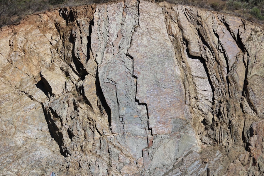
Biostratigraphy is a subdiscipline of stratigraphy that uses the fossilized remains of ancient organisms to determine the relative ages of rock layers and to correlate them across different regions. Life itself has evolved and changed over geological time, leaving an unmistakable imprint within the rock record. The presence and sequence of specific fossil types act as chronological markers, allowing us to date and link rock units that might otherwise appear disconnected.
Index Fossils: The Geologist’s Timekeepers
The success of biostratigraphy hinges on the concept of index fossils, also known as guide fossils. These are organisms that possessed specific characteristics making them ideal for dating and correlation. Ideally, an index fossil should be:
- Abundant: Found in large numbers, increasing the likelihood of encountering it.
- Widespread: Distributed geographically across a broad area, enabling correlation between distant locations.
- Short-lived Stratigraphically: Existed for a relatively brief period of geological time, making its presence indicative of a narrow age range.
- Easily Recognizable: Possesses distinct morphological features that are unambiguous.
Examples of successful index fossils include various species of ammonites, conodonts, and foraminifera. The presence of a specific ammonite species, for instance, might pinpoint a rock layer to the Late Jurassic period.
Fossil Assemblages and Biozones
Rather than relying on a single index fossil, biostratigraphers often analyze entire fossil assemblages – the collection of all fossil types found within a particular rock layer. Certain combinations of fossils, or the ranges of different fossil groups, define specific biozones. These zones are intervals of rock defined by the first or last appearance (or both) of specific fossil taxa. By identifying the sequence and boundaries of these biozones, geologists can establish a detailed biostratigraphic framework for a region. This allows for highly precise relative dating and correlation.
Evolution and Extinction as Markers
The fundamental evolutionary history of life provides the underlying framework for biostratigraphy. As life evolves, new species emerge, diversify, and eventually go extinct. Each geological period is characterized by a unique biota. The evolutionary “firsts” and “lasts” of species are like milestones on the timeline of life on Earth, providing invaluable markers for dating rocks. Likewise, mass extinction events serve as dramatic punctuation marks in the geological record, clearly demarcating boundaries between major geological time units.
Chronostratigraphy and Geochronology: The Absolute Clock of Earth

While lithostratigraphy and biostratigraphy provide relative ages, chronostratigraphy and geochronology aim to establish absolute ages for rock layers. This involves dating rocks by measuring the decay of radioactive isotopes. These methods provide a concrete numerical timeline, allowing us to assign specific ages in millions or billions of years to geological events and rock formations.
Radiometric Dating: The Unyielding Hands of Time
Radiometric dating is the cornerstone of geochronology. It relies on the principle that certain radioactive isotopes of elements decay into stable isotopes at a constant, predictable rate. This rate is called the half-life, the time it takes for half of the radioactive atoms in a sample to decay. By measuring the ratio of parent radioactive isotopes to daughter stable isotopes in a rock sample, scientists can calculate the time elapsed since the rock formed. Key radiometric dating methods include:
- Uranium-Lead (U-Pb) dating: Particularly useful for dating very old rocks, as uranium isotopes have long half-lives.
- Potassium-Argon (K-Ar) dating: Widely used for dating volcanic rocks and minerals.
- Radiocarbon (Carbon-14) dating: Effective for dating relatively young organic materials (up to about 50,000 years old).
The Geological Time Scale: A Comprehensive Timeline
The data from radiometric dating, combined with biostratigraphic correlations, have allowed scientists to construct the Geological Time Scale. This timescale divides Earth’s history into a hierarchical series of intervals: Eons, Eras, Periods, Epochs, and Ages. Each division is defined by specific geological events, changes in fossil content, or absolute age boundaries. The Geological Time Scale is a dynamic document, constantly refined and updated as new data become available. It is the overarching framework within which all stratigraphic information is placed.
Deconstructing Unconformities: Gaps in the Record
Chronostratigraphy also plays a crucial role in identifying and interpreting unconformities. Unconformities represent significant gaps in the geological record, periods of time during which deposition ceased, erosion occurred, and then deposition resumed. These gaps can be caused by uplift and erosion, sea-level changes, or tectonic events. Recognizing unconformities and their ages is vital for a complete understanding of a region’s geological history, as they represent periods of missing time and significant geological activity.
Stratigraphy, the study of rock layers and layering, plays a crucial role in understanding Earth’s history and the processes that have shaped our planet. For those interested in exploring how ancient civilizations utilized natural resources, a fascinating article discusses the innovative techniques of wind harvesting and their significance in historical contexts. You can read more about this topic in the article titled “Uncovering Ancient Secrets of Wind Harvesting” available at this link. This connection between stratigraphy and ancient practices highlights the importance of geological studies in revealing the stories of our past.
Applications of Stratigraphy: Beyond Pure Science
| Stratigraphic Unit | Description |
|---|---|
| Formation | A mappable unit of rock that is distinctive enough in lithology, color, and other characteristics to differentiate it from adjacent rock. |
| Member | A subdivision of a formation, often based on lithology, fossil content, or other characteristics. |
| Bed | A distinct layer of rock, often with a consistent thickness and composition. |
| Stratum | A single layer of sedimentary rock, often used interchangeably with “bed”. |
Stratigraphy is not merely an academic pursuit; it has profound practical applications that impact numerous industries and scientific fields. Its ability to reconstruct past environments and predict subsurface conditions makes it invaluable for resource exploration, hazard assessment, and understanding global climate change.
Resource Exploration: Unearthing Earth’s Riches
The oil and gas industry is heavily reliant on stratigraphy. Understanding the sequence and types of sedimentary rocks is crucial for identifying potential reservoir rocks (porous and permeable layers that can hold hydrocarbons) and source rocks (rocks that contain organic matter from which hydrocarbons can be generated). Stratigraphic principles are used to map subsurface structures, predict the distribution of potential reserves, and guide drilling operations. Similarly, stratigraphy is essential for exploring for other resources like coal, metal ores, and groundwater. The layering of minerals and fossil fuels often reflects specific depositional conditions and geological histories that stratigraphy can unravel.
Paleoclimatology and Environmental Reconstruction: Reading Earth’s Climate History
Stratigraphy provides an unparalleled archive of Earth’s past climate. Sedimentary rocks often contain proxies for past climatic conditions. For example, the type of rock (e.g., glacial till, desert sandstone, coal seams), the presence of certain fossils (e.g., tropical reef corals, polar marine organisms), and geochemical signatures trapped within minerals can reveal information about past temperatures, precipitation patterns, atmospheric composition, and sea levels. By studying these stratigraphic records, scientists can reconstruct long-term climate trends, understand the drivers of past climate change, and gain crucial insights for predicting future climate scenarios.
Geohazards and Engineering Geology: Building on a Solid Foundation (or Not)
Understanding the stratigraphy of an area is critical for assessing and mitigating geohazards. The stability of slopes, the potential for landslides, and the risk of earthquakes are all influenced by the nature and arrangement of underlying rock layers. In civil engineering, stratigraphy informs decisions about where to build foundations for bridges, dams, and buildings, ensuring structural integrity. For example, building on unconsolidated sediment layers carries different risks than building on solid bedrock. Moreover, understanding the stratigraphy of active fault zones is crucial for earthquake hazard assessment.
Archaeology and Paleoanthropology: Unearthing Humanity’s Past
Stratigraphy also plays a vital role in archaeology and paleoanthropology. Artifacts and fossilized remains of early humans are often found buried within distinct layers of soil and sediment. By applying stratigraphic principles, archaeologists can determine the relative ages of these finds, reconstruct the sequence of human occupation at a site, and understand the environmental context in which ancient humans lived. The principle of superposition is fundamental to establishing the chronological order of human activity and technological development.
In conclusion, stratigraphy is a multifaceted and indispensable field of geology. It offers a window into the deep past, allowing us to understand the planet’s immense journey through time. From the fundamental laws governing the deposition of rock layers to the sophisticated techniques of radiometric dating, stratigraphy provides the framework for deciphering Earth’s intricate geological narrative. Its applications extend far beyond academic curiosity, influencing our understanding of the resources we depend on, the environment we inhabit, and the very history of life itself. Each rock layer is a page in Earth’s autobiography, and stratigraphy is the key to reading its profound and compelling story.

Scientists Found Earth’s Hidden Timestamp
FAQs
What is stratigraphy?
Stratigraphy is the study of rock layers (strata) and the way in which they are formed. It involves analyzing the sequence of layers, their composition, and the fossils contained within them to understand the geological history of an area.
What are the principles of stratigraphy?
The principles of stratigraphy include the law of superposition, which states that in any sequence of undisturbed strata, the youngest layer is at the top and the oldest is at the bottom. Other principles include the principle of original horizontality, the principle of lateral continuity, and the principle of faunal succession.
How is stratigraphy used in geology?
Stratigraphy is used in geology to determine the relative ages of rock layers and the events that formed them. It helps geologists understand the Earth’s history, including past environments, climate changes, and the evolution of life.
What are the practical applications of stratigraphy?
Stratigraphy is used in various fields such as archaeology, paleontology, and petroleum exploration. It helps archaeologists date and interpret the layers of soil and debris at an archaeological site, while paleontologists use it to study the evolution of life. In petroleum exploration, stratigraphy is used to locate potential oil and gas reservoirs.
How is stratigraphy important for understanding Earth’s history?
Stratigraphy provides a record of the Earth’s history, including the timing and nature of past geological events, changes in climate, and the evolution of life. By studying the layers of rock and the fossils within them, scientists can reconstruct the Earth’s history over millions of years.