The earth, a silent witness to millennia of profound transformations, holds within its stony embrace the echoes of cataclysmic events that shaped its surface and, in turn, influenced the trajectory of life. For eons, these geological disasters – erupting volcanoes, colossal earthquakes, and devastating tsunamis – have periodically reshaped landscapes, triggered mass extinctions, and presented immense challenges to burgeoning civilizations. While the immediate impact of these events was often destructive, their long-term consequences have been instrumental in creating the very world we inhabit today, leaving behind a rich geological record for scientists to meticulously unearth and decipher.
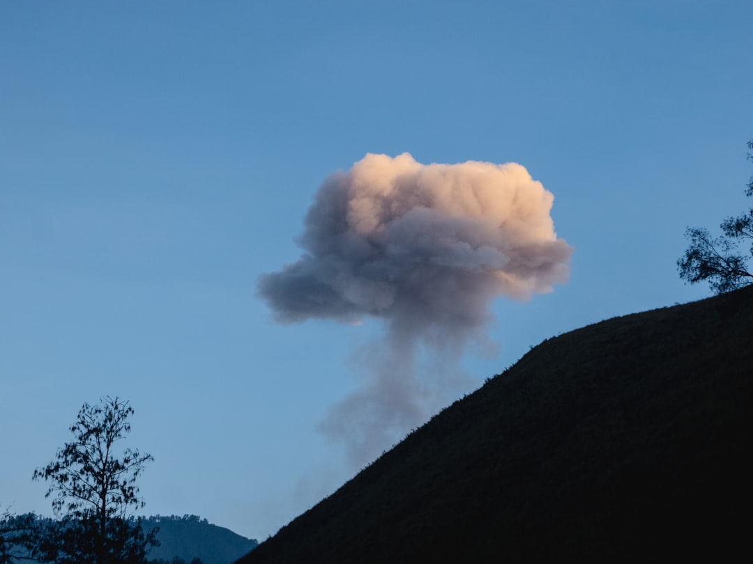
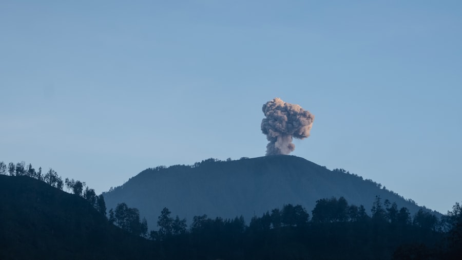
Volcanic eruptions, powerful expressions of the earth’s internal heat and pressure, stand as some of the most dramatic geological phenomena. From the fiery incandescent flows to the suffocating ash clouds, these events have punctuated history with moments of awe-inspiring destruction. Scientists, through careful geological analysis, are increasingly able to reconstruct ancient volcanic episodes, gleaning vital information about their magnitude, frequency, and the devastating impacts they wrought.
Ignimbrite Deposits: Ghosts of Pyroclastic Flows
One of the most compelling pieces of evidence for ancient volcanic cataclysms comes in the form of ignimbrites. These are distinctive rock layers formed by the rapid deposition of superheated ash, pumice, and rock fragments carried by pyroclastic flows – fast-moving currents of gas and volcanic debris that race down the slopes of volcanoes at hundreds of kilometers per hour. When these incandescent avalanches engulf an area, they can incinerate everything in their path, burying landscapes under meters of volcanic material.
The geological signature of an ignimbrite is its welded texture, where the immense heat fuses the volcanic particles together. Examining the composition and thickness of these deposits allows geologists to estimate the volume of erupted material and the extent of the pyroclastic flow. In regions like the Campanian Ignimbrite in southern Italy, scientists have identified a massive eruption that occurred approximately 39,000 years ago, potentially contributing to significant climatic shifts and impacting early human populations. The sheer scale of such ignimbrites underscores the devastating potential of even a single volcanic event.
Ash Layers as Chronometers: The Tephra Record
Beyond ignimbrites, the fine ash ejected from volcanoes – known as tephra – provides an invaluable chronological marker. Volcanic ash particles are chemically unique, reflecting the specific magma composition of the volcano that produced them. When a volcano erupts, this ash is dispersed by wind currents, often traveling thousands of kilometers. These distinct ash layers, when preserved in sedimentary sequences, act like bar codes, allowing geologists to correlate rock layers across vast distances and establish precise timelines for geological and archaeological events.
The analysis of tephra layers has been crucial in understanding periods of increased volcanic activity and their potential impact. For instance, studies of ice cores from Greenland and Antarctica have revealed distinct ash layers that coincide with major volcanic eruptions throughout history. By analyzing the chemical fingerprint of these ash layers, scientists can identify the source volcano and the approximate date of the eruption. This interdisciplinary approach, combining volcanology with paleoclimatology, paints a vivid picture of how ancient eruptions influenced global climate, leading to periods of cooling or warming that could have dramatically affected ecosystems and human societies.
Ancient Lava Flows: Sculpting the Land and Documenting Time
While pyroclastic flows and ash are fleeting but destructive consequences, ancient lava flows represent a more enduring geological legacy. When molten rock, or magma, erupts onto the Earth’s surface as lava, it cools and solidifies, forming distinctive igneous rock formations. The type of lava, its viscosity, and the duration of the flow all leave their unique imprint on the landscape.
Geologists analyze the chemical composition of ancient lavas to understand the type of magma involved and its origin deep within the Earth’s mantle. The texture and structure of solidified lava, such as the ropey pahoehoe or the sharp, blocky a’a flows, provide clues about the cooling process and the speed at which the lava moved. Furthermore, radiometric dating of volcanic rocks allows scientists to establish precise ages for these ancient flows, helping to reconstruct the geological history of a region and identify periods of heightened volcanic activity. The vast basalt plateaus found in regions like the Deccan Traps in India, formed by countless ancient lava flows spanning millions of years, are a testament to the immense scale of past volcanic processes. These immense volcanic provinces not only reshaped continents but also played a significant role in the mass extinction event that wiped out the non-avian dinosaurs.
Ancient geological disasters have significantly shaped the Earth’s landscape and influenced human history. For a deeper understanding of how ancient cartography reflects these geological events, you can explore the article on the Piri Reis map, which highlights the intersection of ancient navigation and modern scientific discoveries. This fascinating piece delves into how early maps can provide insights into past geological occurrences. To read more, visit this article.
The Tremors That Reshape: Understanding Ancient Seismic Events
The earth’s crust is a fractured and dynamic entity, constantly undergoing stresses and strains. When these forces build up to immense proportions, they are released in sudden, violent ruptures, generating seismic waves that travel through the planet. These earthquakes, ranging from imperceptible tremors to devastating ground-shaking events, have left their mark on geological formations and the archaeological records of ancient settlements.
Paleoseismology: Reading the Earth’s Scars
The scientific discipline of paleoseismology is dedicated to studying ancient earthquakes. Unlike historical records that provide a limited window into the past, paleoseismological techniques allow scientists to investigate seismic events that occurred long before human documentation. This involves meticulously examining geological formations for evidence of ground rupture, fault displacement, and liquefaction.
Fault scarps, which are abrupt changes in elevation along a fault line, are often the most visible evidence of past earthquakes. By carefully excavating and studying these scarps, geologists can determine the amount of displacement that occurred during individual seismic events. Sediment studies also play a crucial role. Liquefaction, a process where water-saturated soil temporarily loses strength and behaves like a liquid during an earthquake, can leave distinct layers of disturbed sediment. The presence of these disturbed layers, coupled with dating techniques, allows for the reconstruction of the timing and magnitude of past earthquakes. The San Andreas Fault in California, for instance, has been the subject of extensive paleoseismological research, revealing a history of large, recurring earthquakes that shaped the landscape and continue to pose a significant hazard.
Tsunami Deposits: Whispers from the Sea’s Wrath
Earthquakes occurring beneath the ocean floor are often the progenitors of tsunamis – colossal waves that can travel across entire ocean basins, inundating coastal areas with devastating force. The geological evidence of ancient tsunamis lies in distinct sediment layers deposited inland, far from the typical shoreline.
These tsunami deposits are characterized by their unusual composition and depositional structures, often containing a mixture of marine and terrestrial material. Thick layers of sand, gravel, and debris, including transported boulders and seaweed, found in coastal plains or even inland valleys, are strong indicators of past tsunami inundation. Scientists analyze the grain size distribution, the presence of marine fossils, and the overall sedimentary architecture to distinguish tsunami deposits from normal storm surge deposits or riverine sedimentation. The identification of ancient tsunami deposits along the coasts of Japan and the Pacific Northwest has provided crucial insights into the recurring threat of these oceanic cataclysms, helping to inform modern-day hazard assessments and coastal planning.
Evidence in Coastal Sediments: Beyond the Immediate Impact
The influence of ancient seismic activity extends beyond the immediate damage caused by fault rupture and tsunamis. Repeated seismic events can lead to gradual deformation of coastal landscapes, influencing sedimentary patterns and the distribution of ancient habitats. Uplift and subsidence caused by tectonic movements, often linked to seismic cycles, can alter sea levels and create or drown coastal environments over geological timescales.
By analyzing sedimentary cores from coastal regions, geologists can identify subtle changes in sediment type, fossil content, and depositional environments that are indicative of gradual land-level changes induced by seismic activity. This long-term geological record provides a crucial context for understanding how ancient ecosystems responded to recurring earthquakes and the associated changes in elevation. For example, the study of ancient reef systems that have been uplifted or submerged can reveal a history of repeated seismic uplift or subsidence, painting a picture of a geologically active coastline over millennia.
The Submerged World: Unearthing Cataclysmic Floods and Sea Level Changes

Throughout Earth’s history, significant shifts in global sea levels and colossal inundation events have dramatically altered coastlines and inland regions. These hydrological catastrophes, often driven by glacial melt or tectonic activity, have left behind indelible marks on the geological record, revealing the planet’s dynamic relationship with water.
Glacial Lake Outburst Floods (GLOFs): Unleashing Ice-Dammed Waters
During the Quaternary period, vast ice sheets covered much of the Northern Hemisphere. As these glaciers advanced and retreated, they often dammed rivers, creating enormous proglacial lakes. When the ice dams failed, either due to melting or structural collapse, these lakes would catastrophically empty, unleashing torrents of water and sediment that carved out dramatic landscapes. These events are known as Glacial Lake Outburst Floods (GLOFs).
The geological evidence of GLOFs is often impressive, characterized by massive erosional features such as immense canyons, deeply scoured bedrock, and extensive deposits of rounded cobbles and boulders. The Channeled Scablands in eastern Washington State, carved by a series of colossal GLOFs from the melting Cordilleran Ice Sheet, are a prime example. The sheer scale of erosion and the distinctive landforms in this region provide compelling evidence of the immense power of these ancient floods. Studying the stratigraphy of the sediments deposited by these floods allows geologists to reconstruct the frequency and magnitude of past GLOFs, providing insights into the dynamics of glacial retreat and its potential for abrupt hydrological hazards.
Megatsunamis: Waves Beyond Imagination
While triggered by earthquakes, some tsunamis of the ancient past were on a scale that dwarfs anything witnessed in recorded history. These megatsunamis, often caused by massive underwater landslides or meteorite impacts, possessed an incredible destructive potential, capable of inundating continents.
The geological evidence for these ancient megatsunamis is found in widespread deposits of coarse-grained sediments, often containing large marine boulders, debris, and marine fossils that are found far inland from present-day coastlines. The presence of distinctive sedimentary structures, such as imbricated boulders (rocks tilted in the direction of flow) and hummocky cross-stratification, further supports their interpretation as tsunami deposits. The Lituya Bay megatsunami in Alaska, recorded in 1958, reached a staggering height of over 500 meters, demonstrating the potential for such enormous waves. The geological record suggests that events of this magnitude have occurred throughout Earth’s history, with evidence found in various coastal regions worldwide, impacting ancient ecosystems and potentially influencing early human migrations.
Evidence of Sea-Level Fluctuations: Shorelines in Flux
Beyond sudden inundation events, gradual but significant sea-level changes have also been monumental geological disasters for coastal ecosystems and human settlements. Periods of rapid sea-level rise, often driven by melting ice sheets, can inundate vast coastal areas, submerging ancient shorelines and terrestrial environments. Conversely, periods of sea-level fall can expose new lands, but also dramatically alter existing ecosystems.
Geologists study ancient shorelines, preserved in coastal landforms and sedimentary sequences, to reconstruct past sea levels. Raised beaches, submerged coastal features, and cliff erosion patterns all provide clues about historical sea-level fluctuations. The analysis of marine fossils within these deposits helps to date the marine incursions and regressions. For instance, the study of ancient mangrove forests or coral reefs that are now found far inland or submerged can reveal evidence of past sea-level transgression. These records are crucial for understanding how coastal environments adapted to these changes and the potential impact on ancient human populations who relied on these regions for resources.
The Impact on Life: Mass Extinctions and Evolutionary Bottlenecks
The geological record is not merely a chronicle of physical forces; it is also a testament to the profound impact these forces have had on the evolution and survival of life on Earth. Ancient geological disasters have repeatedly acted as powerful selective pressures, leading to periods of mass extinction and paving the way for the emergence of new species.
The Great Dying: The Permian-Triassic Extinction Event
One of the most catastrophic events in Earth’s history was the Permian-Triassic extinction event, often referred to as “The Great Dying.” This mass extinction, occurring approximately 252 million years ago, wiped out an estimated 96% of marine species and 70% of terrestrial vertebrate species. While the exact causes are still debated, a significant contributor is believed to be the immense volcanic activity associated with the Siberian Traps.
The eruption of vast basalt provinces like the Siberian Traps released colossal amounts of greenhouse gases, such as carbon dioxide and methane, into the atmosphere. This likely triggered a runaway greenhouse effect, leading to extreme global warming, ocean acidification, and widespread anoxia (lack of oxygen) in the oceans. The geological evidence for this event is found in widespread sedimentary layers characterized by the dramatic decline in fossil diversity, the presence of distinctive geochemical anomalies, and the widespread presence of coal and other carbon-rich deposits indicative of massive organic matter decomposition. Understanding this event provides crucial insights into the vulnerability of life to rapid and extreme environmental change driven by geological processes.
The K-Pg Extinction: The Dinosaur’s Demise
Perhaps the most famous mass extinction event is the Cretaceous-Paleogene (K-Pg) extinction, which occurred approximately 66 million years ago and is famously linked to the demise of the non-avian dinosaurs. While the impact of the Chicxulub asteroid is the primary culprit, evidence suggests that preceding and concurrent volcanic activity played a significant contributing role.
The Deccan Traps in India, another vast volcanic province, were undergoing massive eruptions around the time of the K-Pg extinction. The immense amounts of ash, sulfur dioxide, and greenhouse gases released by these eruptions would have caused significant climate disruption, including temporary cooling followed by global warming, and acid rain. The geological evidence for the K-Pg extinction is globally distributed, with the iridium anomaly – a layer of iridium, a rare element on Earth but common in asteroids, found in rock strata worldwide – serving as a key marker. Studies of fossil assemblages in K-Pg boundary layers reveal a dramatic and abrupt decline in biodiversity. The interplay between asteroid impact and massive volcanism in this event highlights the complex and multifaceted nature of geological catastrophes and their devastating impact on the biosphere.
Evolutionary Innovations in the Wake of Catastrophe
While mass extinctions represent periods of immense loss, they also serve as evolutionary crucibles. The removal of dominant species often creates ecological vacuums, allowing previously marginal groups to diversify and evolve into new niches. The fossil record reveals a remarkable pattern of evolutionary recovery and innovation following major extinction events, driven by the very geological forces that caused the extinctions.
For example, the extinction of the non-avian dinosaurs opened up opportunities for mammals to rapidly diversify and eventually dominate terrestrial ecosystems. Similarly, the recovery from the Permian-Triassic extinction saw the rise of new reptilian groups that would eventually lead to the dinosaurs and, much later, to the evolution of mammals. By carefully studying the fossil record and correlating it with the geological evidence of past disasters, scientists can trace these evolutionary trajectories, understanding how life has adapted and persisted in the face of relentless geological change.
Ancient geological disasters have significantly shaped the Earth’s landscape and influenced the course of human history. For those interested in how geological events can impact modern strategies, a fascinating article discusses China’s lunar resource extraction strategy and its implications for future exploration. You can read more about it in this insightful piece that highlights the connection between ancient geological processes and contemporary technological advancements. The article can be found here.
Forensics of the Earth: Modern Techniques and Future Discoveries
“`html
| Disaster | Location | Year | Impact |
|---|---|---|---|
| Mount Vesuvius eruption | Pompeii, Italy | 79 AD | Destroyed Pompeii and Herculaneum |
| Toba supereruption | Sumatra, Indonesia | ~74,000 years ago | Caused a volcanic winter and population bottleneck |
| The Great Flood | Various locations | Estimated 2,500-2,000 BC | Caused widespread flooding and destruction |
“`
The quest to unearth ancient geological disasters is an ongoing scientific endeavor, continuously advanced by new technologies and innovative analytical methods. These modern tools allow scientists to probe deeper into the Earth’s past with unprecedented accuracy and detail, piecing together the complex narratives of ancient cataclysms.
Isotope Geochemistry: Unlocking Past Climates and Processes
Isotope geochemistry plays a pivotal role in understanding ancient geological events. By analyzing the ratios of different isotopes of elements within rocks and fossils, scientists can reconstruct past environmental conditions, trace the movement of materials, and date geological events with remarkable precision.
For instance, the ratio of oxygen isotopes in ancient marine shells can reveal information about past ocean temperatures and the extent of ice sheets. Similarly, the ratios of carbon isotopes can provide clues about the amount of carbon dioxide in the atmosphere, helping to pinpoint periods of volcanic degassing or biological productivity collapse. The analysis of isotopes of radioactive elements, such as Uranium-Lead or Potassium-Argon, is fundamental to radiometric dating, allowing geologists to assign absolute ages to volcanic rocks and sedimentary layers, thereby establishing a precise timeline for geological events.
High-Resolution Imaging and Geophysics: Peering Beneath the Surface
Advancements in imaging technologies and geophysical methods have revolutionized our ability to study subsurface geological structures and reconstruct past events. Techniques like seismic reflection and refraction allow scientists to map underground fault lines, lava flows, and sedimentary layers, providing a detailed three-dimensional view of the Earth’s crust.
Ground-penetrating radar (GPR) and lidar (light detection and ranging) are particularly useful for identifying subtle geological features at the surface and in shallow subsurface environments, such as buried fault scarps and ancient shorelines. High-resolution satellite imagery and drone-based surveying provide detailed topographical maps that can reveal large-scale geological formations related to past disasters. These techniques allow for the non-destructive mapping and characterization of geological evidence, enabling scientists to identify new sites of interest and refine their understanding of past geological processes.
Computational Modeling and Simulation: Recreating the Cataclysm
Modern computational power has enabled scientists to develop sophisticated numerical models and simulations that can recreate the dynamics of ancient geological disasters. By inputting geological and environmental data, these models can simulate the behavior of volcanoes, the propagation of seismic waves, the inundation patterns of tsunamis, and the climatic consequences of massive eruptions.
These simulations are invaluable for testing hypotheses, exploring the range of possible outcomes of past events, and understanding the complex interactions between different geological processes. For example, modeling the dispersal of ash from ancient volcanic eruptions can help predict the extent of their climatic impact. Simulating the mechanics of large-scale landslides can provide insights into the generation of megatsunamis. These computational tools not only enhance our understanding of past events but also contribute to our ability to predict and mitigate the risks associated with future geological hazards.
In conclusion, the Earth’s crust is a living testament to countless geological dramas. By meticulously unearthing and interpreting the evidence left behind, scientists are continuously illuminating the profound and often devastating impact of ancient volcanic eruptions, earthquakes, floods, and sea-level changes. These events, far from being mere footnotes in Earth’s history, are integral to its evolution, shaping its landscapes, influencing the trajectory of life, and reminding humanity of the immense power and dynamism of the planet it calls home. The ongoing study of these ancient geological disasters not only deepens our understanding of Earth’s past but also provides crucial insights for navigating the geological challenges of the future.

The Lost City That Was Never Really Lost
FAQs
What are ancient geological disasters?
Ancient geological disasters refer to catastrophic events that occurred in the distant past, such as earthquakes, volcanic eruptions, tsunamis, and landslides, which had significant impacts on the Earth’s surface and ecosystems.
What evidence do scientists use to study ancient geological disasters?
Scientists use various forms of evidence to study ancient geological disasters, including geological formations, sedimentary layers, fossil records, and isotopic dating techniques. These provide insights into the timing, magnitude, and effects of past geological events.
What were some of the most significant ancient geological disasters?
Some of the most significant ancient geological disasters include the eruption of Mount Vesuvius in 79 AD, which buried the Roman city of Pompeii, the 1755 Lisbon earthquake and tsunami, and the eruption of Mount Tambora in 1815, which led to the “Year Without a Summer” in 1816.
How do ancient geological disasters compare to modern ones?
Ancient geological disasters often had similar destructive impacts to modern ones, but the lack of advanced technology and infrastructure meant that their effects were often more devastating. However, modern disasters can affect larger populations due to increased urbanization and population density.
What can we learn from studying ancient geological disasters?
Studying ancient geological disasters can provide valuable insights into the Earth’s history, the processes that drive geological events, and the potential impacts of future disasters. This knowledge can help inform disaster preparedness and mitigation efforts.