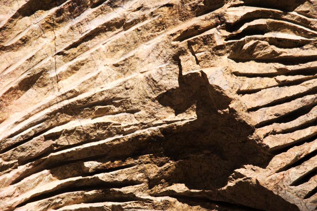
The whispers of the past are not confined to crumbling pottery shards or faint hieroglyphs; they are also etched into the very fabric of the Earth. Archaeology, the meticulous excavation of human history, and geology, the study of our planet’s physical structure and substance, are not disparate disciplines but rather intrinsically intertwined. Unearthing the interplay of geology and archaeology reveals a profound symbiosis, where the geological landscape shapes human settlement patterns, resource availability, and even the preservation of cultural remains, while archaeological discoveries, in turn, can inform and refine our understanding of geological processes and timelines. This article delves into the multifaceted relationship between these two scientific giants, exploring how a deeper understanding of one can illuminate the other, leading to richer and more comprehensive interpretations of both the human past and the Earth’s dynamic history.
The earliest cradles of human civilization were not chosen by chance. They were, in large part, dictated by the geological characteristics of the environment. The availability of fertile soil, water sources, and essential raw materials were all direct consequences of geological formations and processes. Understanding these geological underpinnings is crucial for archaeologists seeking to reconstruct the lifeways and migratory patterns of ancient peoples.
Rivers and Alluvial Plains: The Lifeblood of Agriculture
The emergence of agriculture, a transformative shift in human history, is inextricably linked to the geological properties of river valleys and their surrounding alluvial plains. These areas, formed by the deposition of sediment carried by flowing water, are characterized by exceptionally fertile soils. The rich silt and clay deposited by annual floods replenished the nutrients in the soil, creating ideal conditions for crop cultivation.
The Nile Valley: A Paradigm of Geological Influence
The Nile River in Egypt stands as a prime example. The predictable annual inundation of the Nile brought nutrient-rich silt from the Ethiopian highlands, creating a vast, fertile ribbon of land that sustained one of the world’s earliest complex civilizations. Archaeologists studying ancient Egypt must consider the geological history of the Nile’s flooding patterns, the composition of its sediment, and the resulting fertility of the land to understand the agricultural basis of pharaonic society. The geological ebb and flow of the river directly influenced the rise and fall of settlements, the intensity of agricultural production, and the development of sophisticated irrigation systems.
Mesopotamian Fertile Crescent: The Dawn of Urbanism
Similarly, the land between the Tigris and Euphrates rivers in Mesopotamia, often referred to as the Fertile Crescent, owes its immense archaeological significance to its alluvial plains. The geological processes of these powerful rivers created fertile land that allowed for surplus food production, a prerequisite for the development of early cities, organized labor, and specialized craftsmanship. Archaeological investigations in this region cannot ignore the geological context, including the river dynamics, sediment accumulation, and the impact of salinization, a geological phenomenon that can render land infertile over time and contribute to societal decline.
Access to Resources: Stone, Ore, and Water
Beyond fertile soil, geological formations provided humans with the raw materials necessary for survival and technological advancement. The availability of stone for tools and construction, metal ores for crafting weapons and implements, and reliable sources of fresh water were all dictated by the underlying geology.
Lithic Technologies: Quarries and Flint Deposits
The development of lithic technologies, from the earliest stone tools to more refined implements, was directly dependent on the availability of suitable stone. Archaeologists meticulously study the geological sources of flint, chert, obsidian, and other workable stones used by prehistoric peoples. Identifying the geological origin of these materials through geochemical analysis can reveal trade networks and migratory routes. For instance, the discovery of obsidian tools far from their volcanic source points to established trade or travel patterns, all facilitated by geological knowledge of obsidian deposits.
Metallurgy and Mineral Wealth
The advent of metallurgy opened up a new era of human technological capability. The discovery and exploitation of copper, tin, iron, and other metal ores were entirely dependent on geological occurrences. Identifying the geological formations that host these mineral deposits is crucial for understanding the distribution of early metalworking sites. The proximity of ore deposits to human settlements often dictated where early mining and smelting operations took place, shaping settlement patterns and economic activity. Archaeological sites rich in metal artifacts can lead geologists to investigate nearby geological formations for potential ore sources, creating a reciprocal relationship.
Water Management: Springs, Aquifers, and Drainage Basins
Water, the most fundamental resource for life, is also a geological product. The presence and accessibility of springs, the nature of underlying aquifers, and the overall drainage patterns of a region are all geological phenomena. Archaeological settlements are invariably found in proximity to reliable water sources. Understanding the local hydrogeology – the study of groundwater – is essential for archaeologists to explain settlement locations, the development of water management systems like wells and cisterns, and even the potential for drought or water scarcity to impact ancient societies.
The intersection of geology and archaeology offers fascinating insights into human history and the natural world. A related article that explores the economic implications of geological resources is available at this link: The Economic Value of Lunar Helium-3. This piece delves into the potential of lunar resources, such as helium-3, and how they could impact future exploration and technological advancements, drawing parallels to how geological findings can influence archaeological interpretations and our understanding of past civilizations.
The Landscape as a Tool: Shaping Human Behavior and Strategy
Geological features are not merely passive backdrops; they actively shape human behavior, influencing everything from defensive strategies to preferred routes of travel. Mountains, rivers, coastlines, and caves, all products of geological forces, have played significant roles in human history.
Defensive Strongholds: Hills, Caves, and Natural Barriers
The raw power of geological formations has frequently served as natural fortifications. Elevated terrain, such as hills and mountains, provided strategic advantages for defense, offering commanding views and making assaults more difficult. Caves and rock shelters offered natural protection from the elements and predators, becoming early human habitations or temporary refuges.
Hillforts and Fortified Settlements
The presence of prominent hills or escarpments often led to the development of hillforts or fortified settlements by prehistoric and ancient peoples. Archaeologists examining these sites can analyze the geological characteristics of the terrain to understand why a particular location was chosen for defense. The geology dictates the natural ramparts and the ease of access, informing defensive strategies employed. The stability of the underlying rock and soil also influences the longevity and structural integrity of such fortifications.
The Strategic Use of Caves and Rock Shelters
Caves and rock shelters have been crucial sites throughout human prehistory, providing shelter, storage, and potentially sacred spaces. Archaeological excavations within these geological formations offer unique insights into early human life. The geological composition of the cave walls, the presence of mineral deposits, and the ongoing processes of sedimentation within the cave can provide chronological markers and clues about the environment in which early humans lived. The preservation of artifacts within these protected geological environments is often exceptionally good.
Routes of Travel and Trade: Valleys, Passes, and Coastlines
The geological landscape has always dictated the most efficient and practical routes for human movement. Rivers have served as natural highways, valleys have provided sheltered corridors, and mountain passes have offered crucial links between otherwise isolated regions.
Riverine Routes and Coastal Networks
Rivers have been instrumental in the development of trade and communication networks for millennia. Archaeological evidence of ancient settlements clustering along riverbanks speaks to their importance as transport corridors. Similarly, coastlines, shaped by geological processes of erosion and deposition, have facilitated maritime trade and interaction between distant communities. The study of port cities and shipwrecks, often influenced by geological factors like sediment buildup and water depth, relies heavily on geological understanding.
Mountain Passes and Desert Crossings
The crossing of formidable mountain ranges or vast deserts often relied on specific geological features – mountain passes, occasional oases formed by geological conditions, or stable geological platforms for overland travel. Archaeologists seeking to reconstruct ancient trade routes often consult geological maps to identify these natural corridors. The discovery of artifacts or settlements in remote or unexpected locations can be explained by the existence of a previously unacknowledged geological pathway.
The Earth as a Chronicle: Geological Time and Archaeological Dating

The Earth itself is a vast repository of time, with its rock layers and fossilized remains providing a chronological framework far exceeding the scope of human history. Geology offers crucial tools and perspectives for dating archaeological finds and understanding the temporal context of human activities.
Stratigraphy: Layers of Time
The fundamental geological principle of stratigraphy – the study of rock layers and their order of deposition – is a cornerstone of archaeological dating. The law of superposition states that in an undisturbed sequence of rock layers, the oldest layers are at the bottom, and the youngest are at the top. Archaeologists directly apply this principle to excavation, understanding that artifacts found in deeper layers are generally older than those found in shallower layers.
Relative Dating and Chronological Sequences
By meticulously documenting the stratigraphic layers at an archaeological site, archaeologists can establish a relative chronology of events. They can determine that one artifact or cultural phase is older or younger than another based on its position within the geological strata. This relative dating, often combined with the analysis of faunal remains or pottery styles, helps build a picture of the site’s occupation history over time.
Absolute Dating Techniques Inspired by Geology
Geological principles have also spurred the development of absolute dating techniques that provide numerical ages for artifacts and sites. Radiocarbon dating, a widely used technique, relies on the decay rate of carbon-14, an isotope found in organic materials, a process understood through radioactive decay principles rooted in physics and geology.
Paleoclimatology and Environmental Reconstruction
The geological record provides invaluable insights into past climate changes, allowing archaeologists to correlate human settlement patterns and societal developments with significant environmental shifts. Ice cores, ocean sediment cores, and tree rings, all studied through geological and paleoclimatological methods, offer detailed records of past temperatures, precipitation patterns, and atmospheric composition.
Evidence of Droughts and Glacial Periods
The evidence of past droughts, floods, and glacial periods documented by geologists can help explain population movements, resource scarcity, and the adoption of new technologies or subsistence strategies by ancient peoples. For example, understanding a period of prolonged drought through geological proxies can illuminate why a particular settlement was abandoned or why a society developed more efficient water management systems.
The Impact of Sea-Level Changes
Geological processes like tectonic uplift and subsidence, as well as the melting and formation of glaciers, have led to significant sea-level changes throughout Earth’s history. These changes have directly impacted coastal settlements, influencing trade routes, resource availability, and the very geography of ancient habitable zones. Archaeologists working in coastal regions must collaborate with geologists to understand the paleo-coastlines and the impact of past sea-level fluctuations on human occupation.
Preservation and Degradation: The Geological Factors Affecting Archaeological Sites
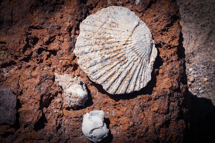
The very forces that shape the Earth can either preserve or destroy archaeological remains, making geological understanding critical for site management and conservation efforts.
Natural Preservation Environments: Bogs, Deserts, and Permafrost
Certain geological environments offer exceptional conditions for the preservation of organic materials, providing unparalleled glimpses into the past.
Bog Bodies and Waterlogged Sites
Peat bogs, formed by the anaerobic and acidic conditions of waterlogged environments, are remarkable natural mummifying agents. The geological composition of these bogs, with their slow decomposition rates, has preserved human bodies, textiles, and wooden artifacts for thousands of years, offering archaeologists incredibly detailed insights into past diets, clothing, and daily life.
Desert Environments and Dry Storage
Conversely, arid desert environments, with their low humidity and stable temperatures, can also contribute to excellent preservation. The geological characteristics of these regions, which limit moisture and biological activity, can preserve organic materials like papyrus scrolls or textiles for extended periods.
Permafrost and Frozen Treasures
In polar regions, permafrost acts as a natural freezer, preserving organic materials with astonishing fidelity. The geological conditions of these frozen landscapes have yielded remarkably intact archaeological finds, from ancient tents to well-preserved food caches.
Site Degradation: Erosion, Sedimentation, and Tectonic Activity
Unfortunately, geological processes can also be destructive forces, leading to the erosion, burial, or even complete obliteration of archaeological sites.
Erosion by Wind and Water
Soil erosion by wind and water can strip away protective layers of soil, exposing delicate artifacts to the elements and eventual destruction. Conversely, rapid sedimentation, often triggered by geological events like floods or landslides, can bury sites, protecting them from immediate destruction but making their discovery more challenging. Understanding the geological processes of erosion and sedimentation in a region is crucial for predicting potential threats to archaeological sites and implementing appropriate conservation measures.
Tectonic Activity and Landscape Change
Earthquakes, volcanic eruptions, and other forms of tectonic activity can dramatically alter landscapes and lead to the destruction or burial of archaeological sites. The eruption of Mount Vesuvius, for instance, preserved the Roman cities of Pompeii and Herculaneum under layers of volcanic ash, offering an extraordinary snapshot of Roman life. However, such events are inherently destructive to existing structures and human populations. Archaeologists working in tectonically active regions must be aware of the geological hazards and the potential for dramatic landscape changes to impact the archaeological record. Furthermore, geological surveys can help identify areas prone to such events, guiding archaeological survey and preservation efforts.
The fascinating intersection of geology and archaeology reveals how ancient civilizations utilized natural resources, a topic explored in depth in a related article. This piece discusses China’s lunar resource extraction strategy, highlighting the geological implications of such endeavors and their potential impact on our understanding of historical resource management. For more insights into how these fields converge, you can read the article here.
The Future of Discovery: Advancing Interdisciplinary Research
| Geological Feature | Archaeological Significance |
|---|---|
| Fossils | Provide evidence of past life forms and environments |
| Stratigraphy | Helps archaeologists understand the age and sequence of archaeological layers |
| Mineral Deposits | May have been exploited by ancient civilizations for tools, pigments, or trade |
| Volcanic Activity | Can preserve ancient settlements and artifacts under layers of ash |
The ongoing collaboration between geologists and archaeologists promises to unlock even deeper secrets of our shared past. Advances in technology and analytical techniques are increasingly blurring the lines between these disciplines, fostering more sophisticated and nuanced understandings.
Geochemical Analysis and Provenance Studies
Sophisticated geochemical analysis techniques, borrowed from geology, are revolutionizing provenance studies – the identification of the origin of materials. By analyzing the elemental composition of pottery, stone tools, or metal artifacts, archaeologists can pinpoint the geological source of the raw materials, revealing ancient trade networks, migration routes, and cultural interactions with unprecedented detail.
Geophysics and Non-Invasive Survey Methods
Geophysical techniques, such as ground-penetrating radar, magnetometry, and electrical resistivity, are invaluable non-invasive tools for surveying archaeological sites. These methods can detect buried features, structures, and even changes in soil composition without disturbing the ground, allowing archaeologists to precisely target excavation areas and identify potential archaeological remains based on their geological signatures.
Integrated Landscape Archaeology
The emergence of integrated landscape archaeology emphasizes the holistic study of past human interaction with their natural environment. This approach recognizes that human societies were not isolated entities but were deeply embedded within their geological and ecological contexts. By combining geological mapping, paleoenvironmental reconstructions, and detailed archaeological surveys, researchers can gain a more comprehensive understanding of how geological factors shaped human land use, resource management, and societal development over millennia.
Geoarchaeological Signatures of Past Human Impact
Geologists are increasingly recognizing the subtle, yet significant, “geoarchaeological signatures” of past human activity. These can include changes in soil composition due to agriculture, the alteration of drainage patterns for irrigation, or the deposition of anthropogenic sediments from early settlements. By identifying these tell-tale geological markers, geologists can help archaeologists pinpoint potential settlement locations that might otherwise be overlooked and understand the long-term impact of human societies on the landscape.
In conclusion, the relationship between geology and archaeology is a profound and dynamic one. The Earth’s geological history provides the literal foundation upon which human history unfolds, shaping where we settled, what resources we exploited, and how we interacted with our environment. In turn, the archaeological record offers unique insights into the human impact on geological processes and can even inform our understanding of Earth’s past, from climate change to the evolution of landscapes. As interdisciplinary research continues to flourish, the combined insights of geology and archaeology will undoubtedly continue to illuminate the intricate tapestry of our planet and its inhabitants, revealing a past that is as much carved into the Earth as it is written in the annals of human endeavor.

What Heated These Minerals? (The Abu Hureyra Mystery)
FAQs
What is the relationship between geology and archaeology?
Geology and archaeology are closely related because the study of the Earth’s materials and processes can provide valuable information for understanding past human civilizations. Geologists can help archaeologists identify potential sites for excavation, analyze the composition of artifacts, and determine the age of geological formations.
How does geology contribute to the field of archaeology?
Geology contributes to archaeology by providing information about the geological context of archaeological sites, such as the formation of landscapes, the distribution of natural resources, and the impact of natural disasters. This information can help archaeologists interpret human behavior and cultural development in relation to the surrounding environment.
What are some examples of how geology and archaeology intersect?
Examples of how geology and archaeology intersect include the use of geological mapping to locate potential archaeological sites, the analysis of sediment layers to date artifacts, and the study of ancient landscapes to understand how human societies adapted to environmental changes.
How do geologists and archaeologists work together?
Geologists and archaeologists work together by collaborating on field surveys, excavations, and laboratory analyses. Geologists can provide expertise in stratigraphy, mineralogy, and dating techniques, while archaeologists can offer insights into the cultural significance of geological features.
What are the benefits of integrating geology and archaeology in research and exploration?
The integration of geology and archaeology can lead to a more comprehensive understanding of past human societies and their interactions with the natural environment. This interdisciplinary approach can also help in the conservation and management of archaeological sites, as well as in the development of sustainable strategies for cultural heritage preservation.