
The Kola Superdeep Borehole stands as a monumental testament to human curiosity and scientific endeavor, a jagged scar on the Earth’s crust that plunged deeper than any other human-made hole. For over two decades, the Soviet Union and later Russia meticulously drilled into the lithosphere, driven by an insatiable desire to understand the planet’s inner workings. This ambitious project, located on the Kola Peninsula in northwestern Russia, wasn’t merely about drilling; it was an intricate geological investigation, a deep dive into the very foundations of our world. The data unearthed from its staggering 12,262-meter (7.6 miles) depth has fundamentally reshaped our understanding of continental crust, rock formation, and the extreme conditions that exist far beneath our feet.
The genesis of the Kola Superdeep Borehole project was rooted in a confluence of scientific ambition and geopolitical rivalry. The mid-20th century saw a burgeoning global interest in understanding the Earth’s structure, particularly its crust and upper mantle. Deep drilling was envisioned as the most direct method to achieve this.
Early Visions of Deep Exploration
The concept of “superdeep” drilling was not entirely new. Earlier, less ambitious projects had hinted at the potential for scientific returns from deep boreholes. However, the Soviet Union, with its vast resources and a strong commitment to scientific advancement, decided to push the boundaries far beyond anything previously attempted. The impetus was not just pure science; it was also a desire to demonstrate technological prowess on a global stage.
Strategic Motivations and Scientific Objectives
Beyond the scientific allure, the project also held strategic undertones. Understanding the Earth’s crust was seen as vital for resource exploration, particularly for mineral deposits and potentially even novel energy sources. However, the primary driver remained the pursuit of fundamental geological knowledge. Scientists yearned to answer questions about the composition of the continental crust, the nature of the Mohorovičić discontinuity (Moho), and the physical and chemical processes occurring at such depths. The Kola Peninsula was chosen for its location on an ancient and relatively stable segment of the Baltic Shield, an area of Archean and Proterozoic continental crust, making it an ideal site for a deep penetration of old, well-preserved geological formations.
The Kola Superdeep Borehole is a fascinating project that has provided invaluable insights into the Earth’s crust and its geological processes. For those interested in exploring more about the complexities of geological formations and human interactions with the Earth, the article on ancient city planning disasters offers a compelling perspective. It delves into how geological factors have influenced urban development throughout history, highlighting the importance of understanding geology in planning and construction. You can read more about this intriguing topic in the related article here: The Ancient City Planning Disaster.
The Monumental Engineering Challenge
Drilling to such unprecedented depths presented an engineering challenge of colossal proportions, pushing the limits of existing technology and demanding innovative solutions. The immense pressures, extreme temperatures, and the sheer volume of rock to be penetrated required a sustained and dedicated engineering effort.
Overcoming Technological Hurdles
The primary obstacle was the development of drill bits capable of withstanding the abrasive nature of the rocks at such depths. Traditional bits wore down rapidly, necessitating frequent and time-consuming replacements. New materials and designs were developed, including bits made from diamond and other superhard materials. Furthermore, the integrity of the drill string itself became a critical concern. The immense weight and torque applied at the bottom of the hole required the development of stronger and more resilient drill pipes, often made from specialized alloys.
The Evolution of Drilling Techniques
As the borehole deepened, the prevailing drilling techniques had to be adapted. Initially, standard rotary drilling methods were employed. However, as temperatures and pressures escalated, new approaches were needed. The Soviet engineers developed specialized muds – complex mixtures of water, clay, and chemical additives – designed to lubricate the drill bit, remove cuttings, and maintain borehole stability under extreme conditions. The management of these fluids and their temperature control became a significant engineering feat in itself.
Facing the Heat and Pressure
The increasing temperatures and pressures were perhaps the most formidable challenges. At depths exceeding 7 kilometers, temperatures surpassed 150°C, and by the deepest points, they approached 180°C. These temperatures significantly affected the performance of drilling equipment and the properties of the drilling mud. The pressure, reaching hundreds of megapascals, also posed a threat to the structural integrity of the borehole and the equipment. Sophisticated systems for cooling and managing the pressure within the borehole were continuously developed and refined.
Unveiling the Secrets of the Continental Crust
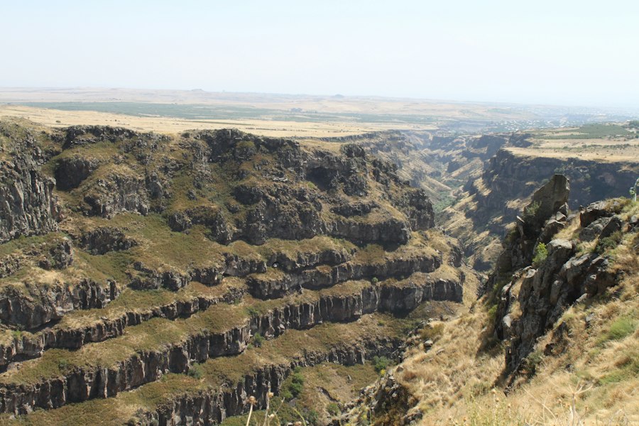
The samples and data retrieved from the Kola Superdeep Borehole offered an unparalleled glimpse into the composition and structure of the ancient continental crust, challenging long-held geological theories.
The Stratigraphy of the Baltic Shield
The borehole penetrated through a thick sequence of Archean and Proterozoic rocks, revealing the layered history of the Baltic Shield. The uppermost sections consisted of younger Proterozoic sedimentary rocks, followed by a vast expanse of metamorphic rocks, including gneisses and schists, indicative of intense pressure and heat during their formation. These were interspersed with significant intrusions of igneous rocks, such as granite and gabbro, providing evidence of ancient volcanic and plutonic activity.
The Surprising Nature of the Deeper Crust
One of the most striking discoveries was the composition of the lower crust. Geologists had long assumed that the lower continental crust would be dominated by denser, mafic rocks, similar to oceanic crust. However, the Kola Borehole revealed a surprisingly felsic composition, with a significant abundance of granite and related rocks, even at extreme depths. This suggested that the lower continental crust might be far more heterogeneous and less dense than previously theorized.
The Unforeseen Presence of Fluids
Another significant revelation was the pervasive presence of water and other fluids within the seemingly solid rock at such depths. Initially, it was believed that at these extreme pressures and temperatures, water would be squeezed out of the rock. However, the borehole encountered numerous zones with significant fluid inclusions and even pressurized pockets of water and methane gas trapped within mineral grains. These fluids were found to play a crucial role in the chemical and physical processes occurring within the crust, including rock deformation and mineral alteration.
Anomalies and Surprises from the Abyss
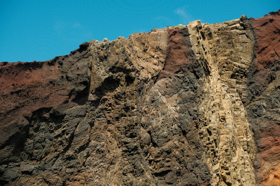
The Kola Superdeep Borehole consistently defied expectations, yielding a wealth of data that necessitated a re-evaluation of established geological models.
The “Granite Layer” Enigma
The persistent presence of granite, a relatively low-density rock, in the deeper sections of the crust, earning it the moniker the “granite layer,” was a significant deviation from the prevailing understanding of crustal structure. Traditional seismic models predicted a denser basaltic layer at these depths. The Kola data suggested that the process of continental crust formation and evolution might be far more complex, with extensive reworking and granitization of deeper crustal rocks.
Evidence of Extreme Metamorphism
The borehole samples provided irrefutable evidence of extreme metamorphism, indicating that the rocks at these depths had undergone immense pressures and temperatures over geological timescales. The mineral assemblages found, such as granulites and eclogites, are diagnostic of these high-grade metamorphic conditions. This provided a unique opportunity to study the phase transitions of minerals under pressure and temperature, contributing valuable data to experimental petrology.
Unexpected Geophysical Signatures
The seismic data collected during the drilling also revealed anomalies. Seismic waves traveled at unexpectedly slow speeds through certain zones, hinting at the presence of fractures, fluids, or different rock compositions than anticipated. These geophysical signatures, when correlated with the rock samples, helped to build a more nuanced picture of the subsurface structure and the processes occurring within it.
The Kola Superdeep Borehole is a fascinating project that has provided invaluable insights into the Earth’s crust and its geological processes. For those interested in the implications of deep geological research beyond our planet, a related article explores how private sector investment is paving the way for building lunar infrastructure. This initiative could significantly enhance our understanding of extraterrestrial geology and resources. You can read more about this exciting development in the article here.
The Enduring Legacy and Future Implications
| Metric | Value | Description |
|---|---|---|
| Location | Kola Peninsula, Russia | Geographical site of the borehole |
| Maximum Depth | 12,262 meters (40,230 feet) | Deepest point reached by the borehole |
| Drilling Period | 1970 – 1994 | Years during which drilling was conducted |
| Rock Types Encountered | Granite, Gneiss, Amphibolite | Main geological formations penetrated |
| Temperature at Bottom | Approximately 180 °C | Measured temperature at maximum depth |
| Geological Findings | Presence of metamorphic rocks, unexpected porosity | Key geological insights from drilling |
| Purpose | Study Earth’s crust composition and structure | Scientific objective of the project |
| Core Sample Length | Approximately 7 km | Length of rock core extracted for analysis |
| Crust Thickness at Site | About 35 km | Estimated thickness of continental crust in the area |
Though the drilling operations at the Kola Superdeep Borehole concluded in the early 1990s, its scientific legacy continues to resonate within the geological community and beyond. The data collected has fueled countless research projects and inspired new avenues of inquiry.
Impact on Plate Tectonics and Crustal Evolution Models
The findings from Kola have had a profound impact on our understanding of plate tectonics and the evolution of continental crust. The unexpected composition of the lower crust and the presence of fluids have led to revised models of crustal formation, differentiation, and isostatic adjustment. It has highlighted the dynamic and complex nature of Earth’s crust, suggesting that processes of recycling and alteration may be more prevalent than previously thought.
Advancements in Geophysics and Geochemistry
The borehole served as a unique natural laboratory for geophysicists and geochemists. The ability to directly sample rocks from significant depths allowed for precise calibration of geophysical instruments and methods. Geochemical analyses of the fluids and minerals provided crucial insights into the chemical cycles operating deep within the Earth, including the cycling of carbon and the origin of hydrocarbons.
Inspiring Future Deep Exploration Projects
The Kola Superdeep Borehole stands as a beacon of inspiration for future deep exploration endeavors. While the cost and complexity of such projects are substantial, the scientific rewards are immense. The lessons learned in engineering, drilling technology, and data acquisition from Kola provide a crucial foundation for planning and executing future deep drilling projects, whether for scientific understanding or for resource exploration. The quest to understand our planet’s interior is far from over, and the Kola Superdeep Borehole has provided an invaluable stepping stone in that ongoing journey.

They Drilled 12 KM Into Earth — Then Everything Changed
FAQs
What is the Kola Superdeep Borehole?
The Kola Superdeep Borehole is the deepest man-made hole on Earth, reaching a depth of over 7.5 miles (12 kilometers) into the Earth’s crust.
Why was the Kola Superdeep Borehole drilled?
The Kola Superdeep Borehole was drilled in order to study the Earth’s crust and mantle, as well as to explore the possibility of drilling to even greater depths.
What did scientists discover from the Kola Superdeep Borehole?
Scientists discovered that the Earth’s crust is much hotter than previously thought, with temperatures reaching up to 356 degrees Fahrenheit (180 degrees Celsius) at the bottom of the borehole.
What geological formations were encountered during the drilling of the Kola Superdeep Borehole?
During the drilling of the Kola Superdeep Borehole, scientists encountered various geological formations, including granite, basalt, and gneiss, providing valuable insights into the composition of the Earth’s crust.
What is the significance of the Kola Superdeep Borehole in the field of geology?
The Kola Superdeep Borehole has provided valuable data and insights into the Earth’s crust and mantle, helping scientists better understand the processes that shape our planet and contributing to advancements in the field of geology.